
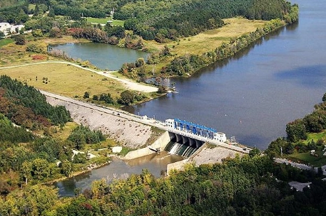
The Thames River dominates London’s geography.
The North and South branches meet at the centre of the city, a location known as “The Forks of the Thames.” This isn’t just a scenic curiosity. It’s why London has faced some of the most dramatic flood events in Canadian history, and why a massive concrete structure now stands guard at the city’s northeast edge.
The Tree-Like Shape of the Thames Basin
The Upper Thames watershed spans roughly 1,320 to 1,350 square miles. Think of it as a giant tree with two main branches. The North Thames branch covers about 676 square miles, while the South and Middle Thames branches cover about 525 square miles upstream. These branches stretch far to the north and east, reaching toward Stratford, Woodstock, and Tavistock.
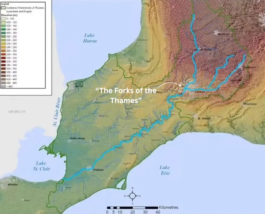
(Photo credit: City of London).
When heavy rain falls across the entire region, or when spring snowmelt rushes through the countryside, both branches funnel immense volumes of water toward the city at the same time. In London, the two branches of the river merge into one downtown channel that flows westward towards Lake St. Clair.
The Funnel Effect at “The Forks”
When both branches of the Thames River peak around the same time, the sudden restriction and the combined volumes of the two branches overwhelm the single downstream channel. Water has nowhere to go but over the riverbanks and into low-lying neighbourhoods like London West and Broughdale.
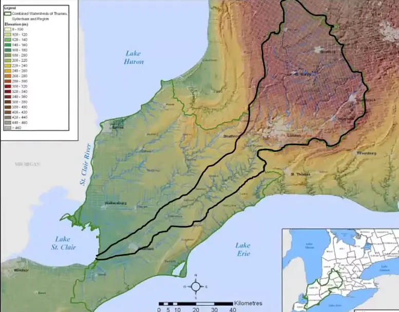
Notice how the river funnels towards London, where it bottlenecks at the “Forks of the Thames.”
(Photo credit: City of London).
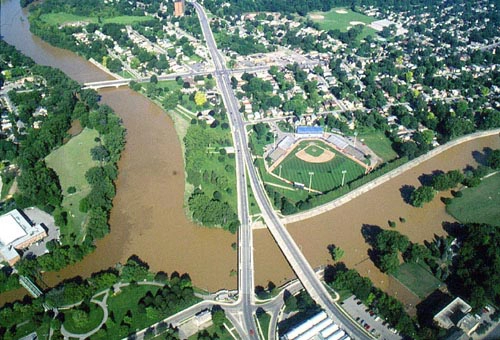
(Photo credit: UTRCA).
It’s not so much how much rain falls on London itself that poses the main flood risk to the city. For example, a snowmelt or rainfall event in the northern part of the watershed can cause flooding in London even if the city stays dry. London is, in a very real sense, at the mercy of the entire upstream watershed.
The Flood That Changed Everything
The Flood of 1937
In late April 1937, Southwestern Ontario was hit by an unprecedented deluge. Six to seven inches of torrential rain fell across the region, and the Thames River responded with terrifying speed. The river crested at an astonishing 23 feet above its normal level, transforming London’s waterways into a raging torrent.
April 26, 1937 became known as “Black Monday” by those who survived one of the worst floods to strike Southwestern Ontario. The 1937 flood overtopped the West London dikes and spread over a wider area than any other flood in the city’s history. Five lives were lost, an estimated 1,100 homes were ruined, and property damage ran to $3 million. At least 6,000 people were left homeless.

(Photo credit: UTRCA).
The Danger From Beneath the Streets
But the devastation wasn’t just about water flooding entire neighbourhoods. It was also about water coming up from below.
Because the river rose so high, the outlets where storm sewers drained into the Thames became completely submerged. The water had nowhere to go. This created immense hydraulic backpressure, pushing a toxic mix of river water and trapped sewage backward up residential lines. It erupted out of newly installed indoor toilets and basement drains in over 1,100 homes.
The Solution
A New Kind of Organization
The disaster forced London to shift from simply managing wastewater to managing the environment itself. In 1947, the Upper Thames River Conservation Authority (UTRCA) was created, charged with preventing a catastrophe like this from ever happening again.
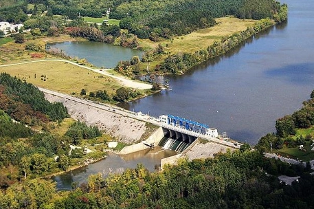
The first major project the UTRCA took on was the construction of the Fanshawe Dam, strategically located upstream from London on the North Thames River. This dam was just one of a series of eight dams recommended by the Upper Thames Valley Report as essential for complete flood control on the Thames River system.
Building the Dam
Construction began in 1950 and was completed by December 1952, at a cost of $5 million. It was funded by the federal government at 37.5%, the provincial government at 37.5%, and the UTRCA at 25%, with 95% of that UTRCA share coming from the City of London.
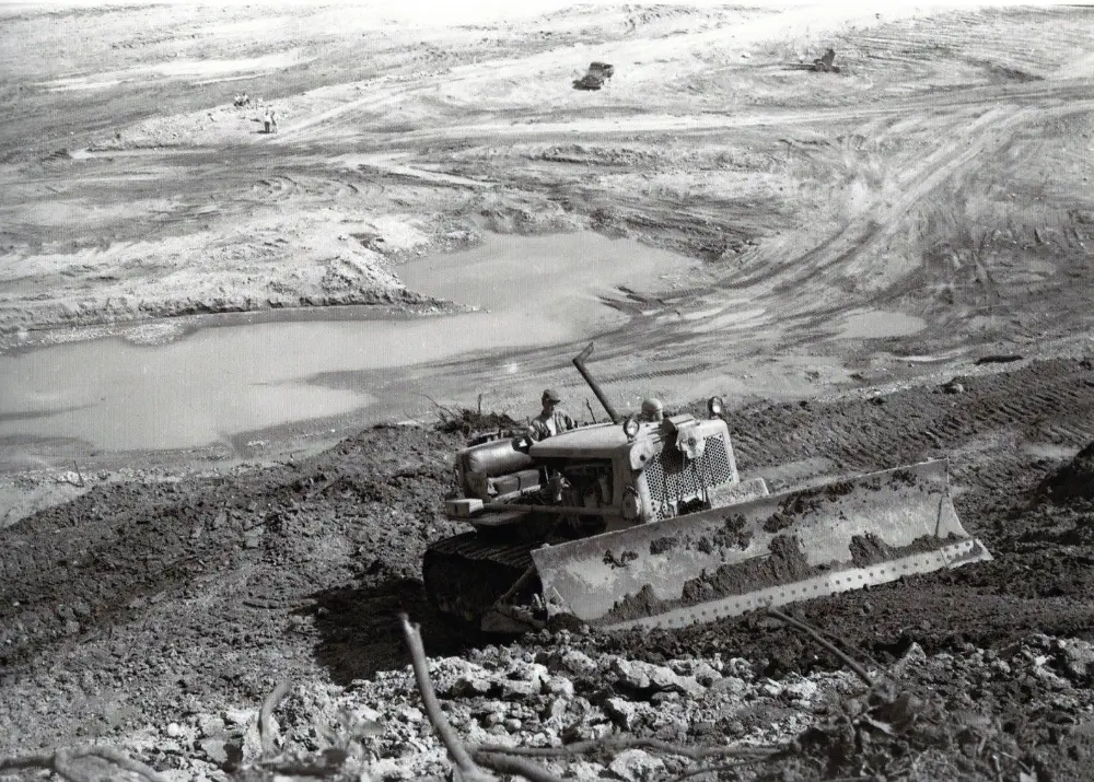
(Photo credit: Fred Weyerman).
How the Fanshawe Dam Protects London Today
The Reservoir
The dam created a 4.0-mile-long lake capable of holding 2.6 billion gallons of water under normal conditions. During extreme flood events, its capacity can expand dramatically to 11 billion gallons.
The reservoir, when full, has a water surface area of 1,322 acres, with a maximum depth of 71 feet at the dam. A tremendous volume of water can be held back to protect the city whenever the river threatens to rise too high.
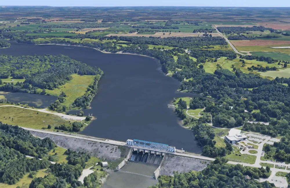
(Photo credit: London Environmental Network).
The Massive Sluice Gates
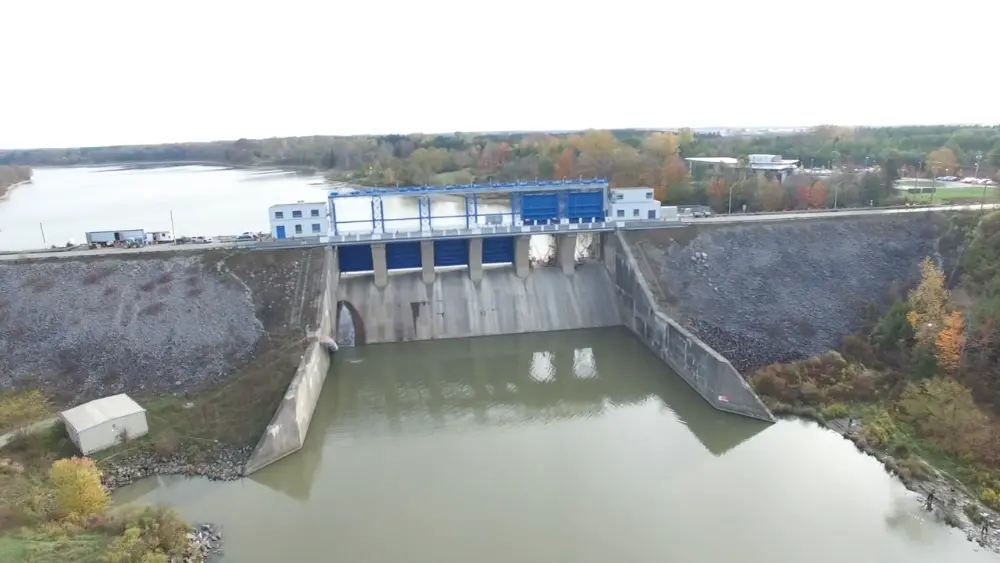
The dam is outfitted with six massive steel sluice gates.
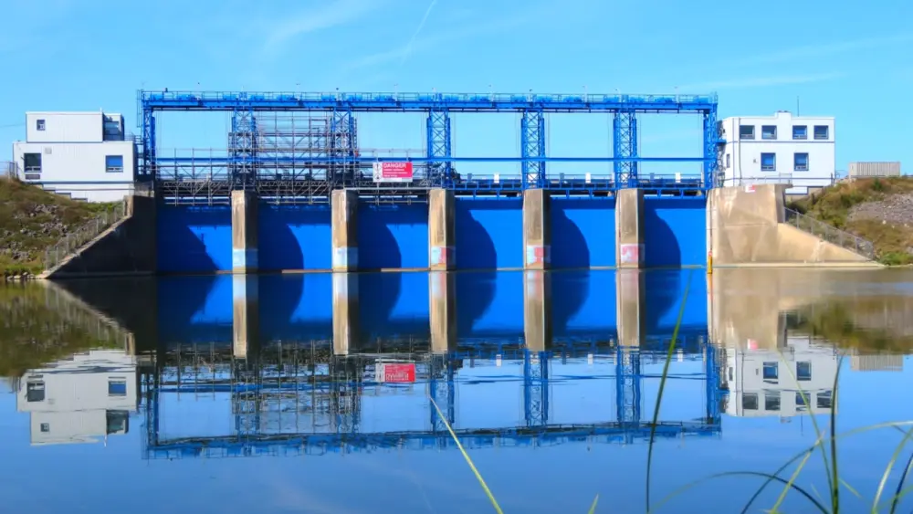
(Photo credit: UTRCA).
The Operation
During heavy spring melts or severe rainstorms, engineers close or restrict these gates. This forces the raging North Thames River to back up into the designated, uninhabited reservoir basin instead of rushing toward downtown London.
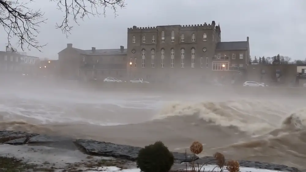
(Photo credit: UTRCA).
When large amounts of rain fall in parts of the watershed, operations at Fanshawe Dam and its reservoir can reduce flows on the North Thames River into London by up to 50 percent.
Engineering To Withstand the Worst the River Can Deliver
Structural Keying to Bedrock
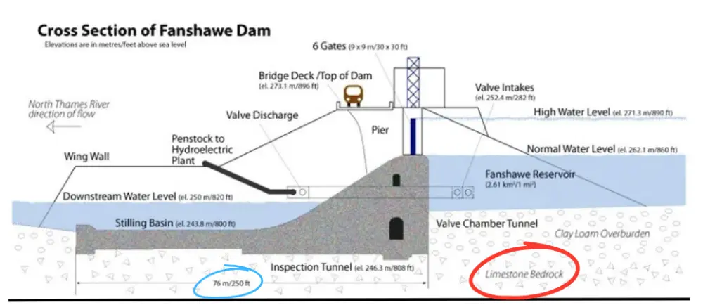
A flood control dam cannot protect municipal infrastructure downstream if it washes away. That’s why the main concrete section of the Fanshawe Dam was built using 775,023 bags of Portland cement and is physically anchored and locked directly into the solid limestone bedrock 100 feet below the crest of the dam.
(Photo credit: UTRCA).
(Photo credit: UTRCA).
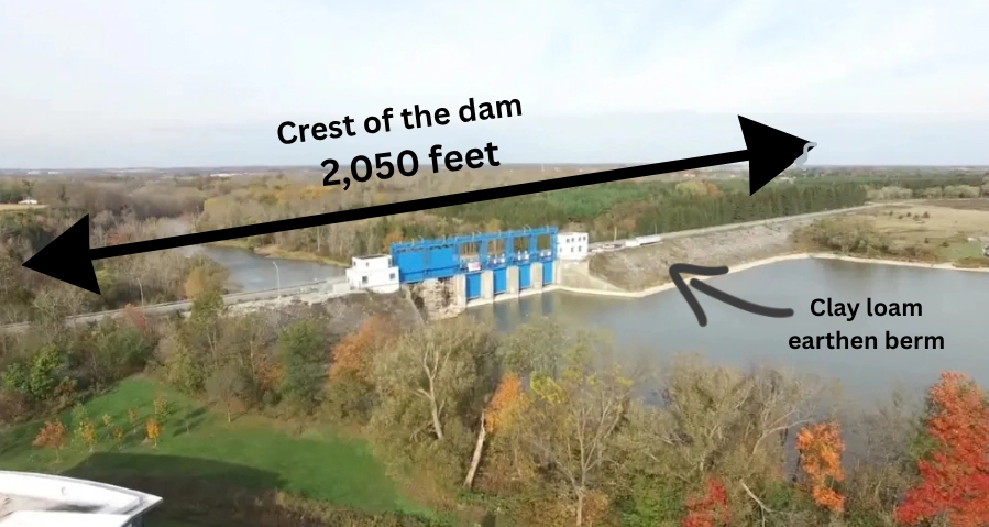
Flanked by massive clay loam earthen berms, the dam is engineered to withstand a maximum discharge capacity of 113,000 cubic feet of rushing water per second.
(Photo credit: UTRCA).
The Fanshawe Dam Today
The Fanshawe Dam has become more than just a piece of infrastructure. It is now a destination. The Fanshawe Conservation Area that surrounds the dam in northeast London is a 3,000-acre outdoor playground that offers many recreational activities to the people of southwestern Ontario.
Fanshawe Lake is 4 miles long and offers boating, fishing, and sailing opportunities, along with canoe and kayak rentals. The lake is also a popular rowing venue, hosting several regattas throughout the year and serving as home to the Western Mustangs Rowing Team.

(Photo credit: London Free Press).
Circling Fanshawe Lake is the Fanshawe Lake Trail, a 13-mile path open to both hikers and cyclists.

(Photo credit: Ontario Bike Trails).
Hidden Wonders Inside the Dam
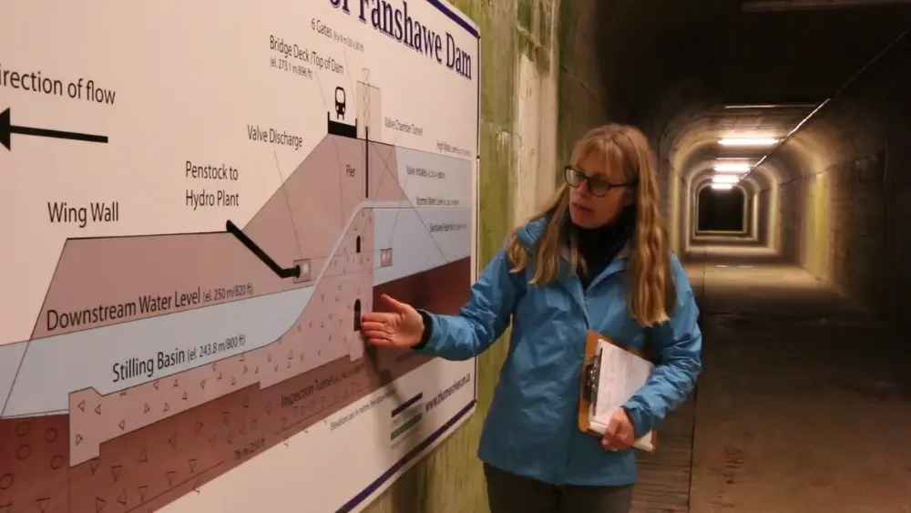
The dam itself generates enough hydroelectric power to run 400 households. And if you’re curious about its inner workings, a stairway with 139 steps descends 30 stories down to an inspection tunnel.
(Photo credit: UTRCA).
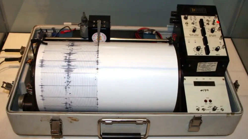
And to top it off, in the 1960s, the University of Western Ontario geology department placed a seismograph deep inside the dam, roughly 88 feet below the roadway, to monitor the structure’s stability. It is one of the rare regional monitoring sites positioned directly on solid bedrock, which helps provide exceptionally clear seismic readings.
(Photo credit: UTRCA).
Why This Dam Matters
The next time you cycle along the Thames River valley, or paddle across Fanshawe Lake, or simply enjoy a picnic in one of London’s many riverside parks, you’re experiencing the benefits of a decision made over seventy years ago by city officials who refused to let the city repeat its worst flooding disaster.

(Photo credit: Lawrence Durham).
Hi. I’m Lawrence – bicycle tour guide, storyteller, and history nerd. I help curious folks like you discover the best parts of London, from a bicycle seat, of course. If you want to experience some of London’s hidden gems, come on a bicycle tour with me. Small groups and lots of laughs. Your next adventure awaits.
Credit for featured cover photo: Tourism London.