At one time, if you asked a Londoner for directions in the city’s north end, you’d likely hear a name, “Calamity Corners,” that sounds more like a wild west outpost than a modern intersection.
In the late 1800s, there were lots of stagecoach wrecks at the corner of Fanshawe Park Road and Richmond Street.
Way more trees. A narrow dirt road coming down a fairly steep hill. The stagecoach picks up speed. If the brakes overheat and fail, you’ve got a runaway stagecoach. If the stagecoach (or sleigh) overtakes the ability of the team of horses to hold it back, well, there you have it… a calamity.
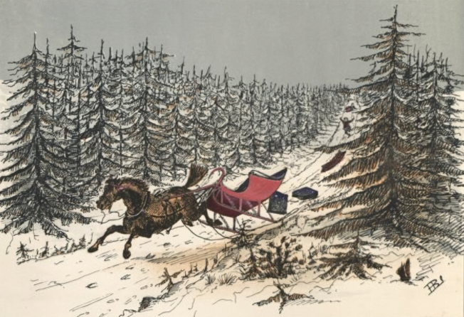
(Illustration credit: Canadiana)
By 1935, the London Free Press was calling it the most dangerous intersection in western Ontario.
In 1936, shortly after the new Masonville School was built near Calamity Corners, the principal reported that, “he had no other choice than to let students go briefly to the windows to assess the damage whenever they heard the unmistakable sounds of colliding vehicles.”
The Boom Years: When the Name Stuck
(Photo credit: Archives & Special Collections, Western University, London Free Press collection of photographic negatives)
(Photo credit: Archives & Special Collections, Western University, London Free Press collection of photographic negatives)
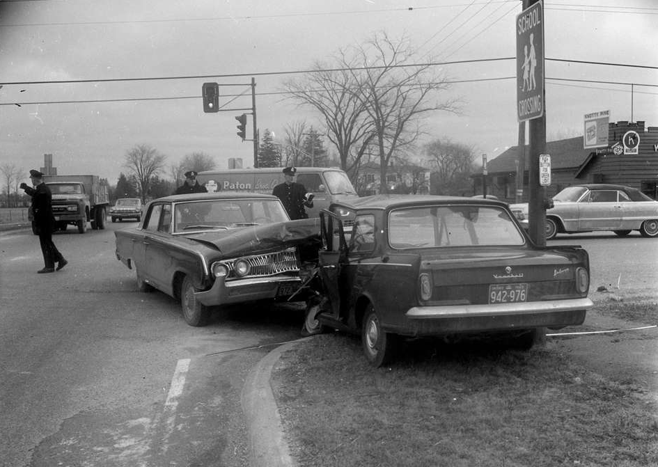
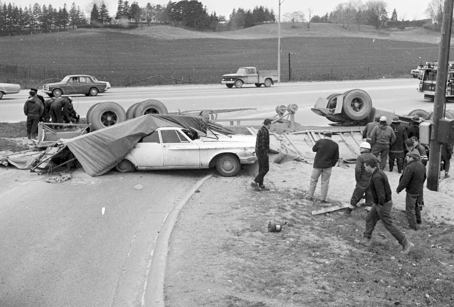
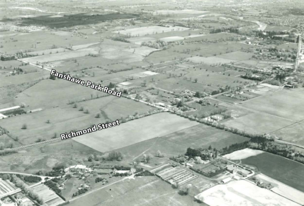
As London expanded aggressively northward in the post-war era, so did Richmond Street. The road was widened, and what was once a rural route became a major arterial corridor.
(Photo credit: Archives & Special Collections, Western University, London Free Press collection of photographic negatives)
The intersection became a notorious hotspot for fender-benders and traffic snarls.
Even back then, the pace of development was outstripping the infrastructure needed to support it.
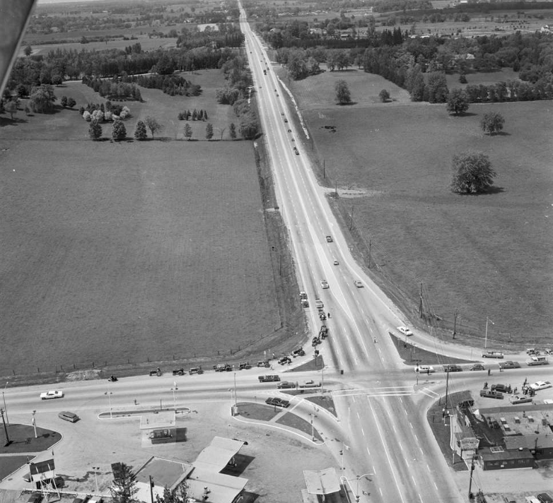
The Pressure Cooker: A Busy Intersection in a Growing City
(Photo credit: Masonville Secondary Plan, City of London)
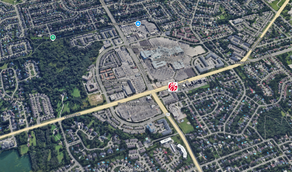
(To explore the area shown, click here on Google Maps)
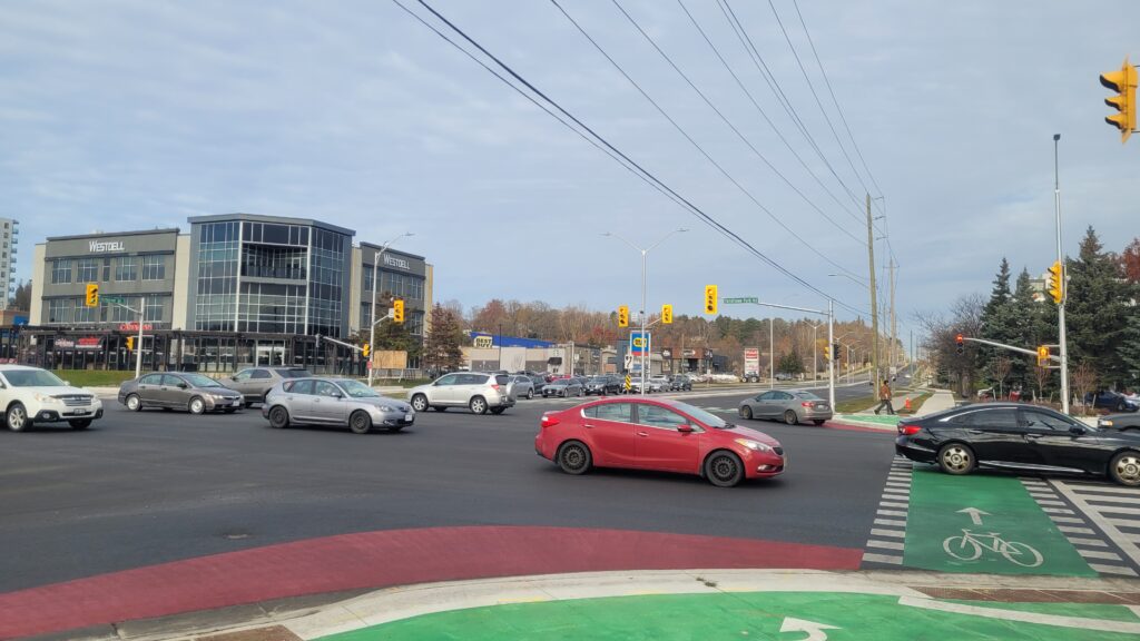
The intersection is currently surrounded by big-box retailers, restaurants, and services that draw traffic from all corners of the city. It’s a place of constant motion, a symbol of a city that is actively outgrowing its old skin.
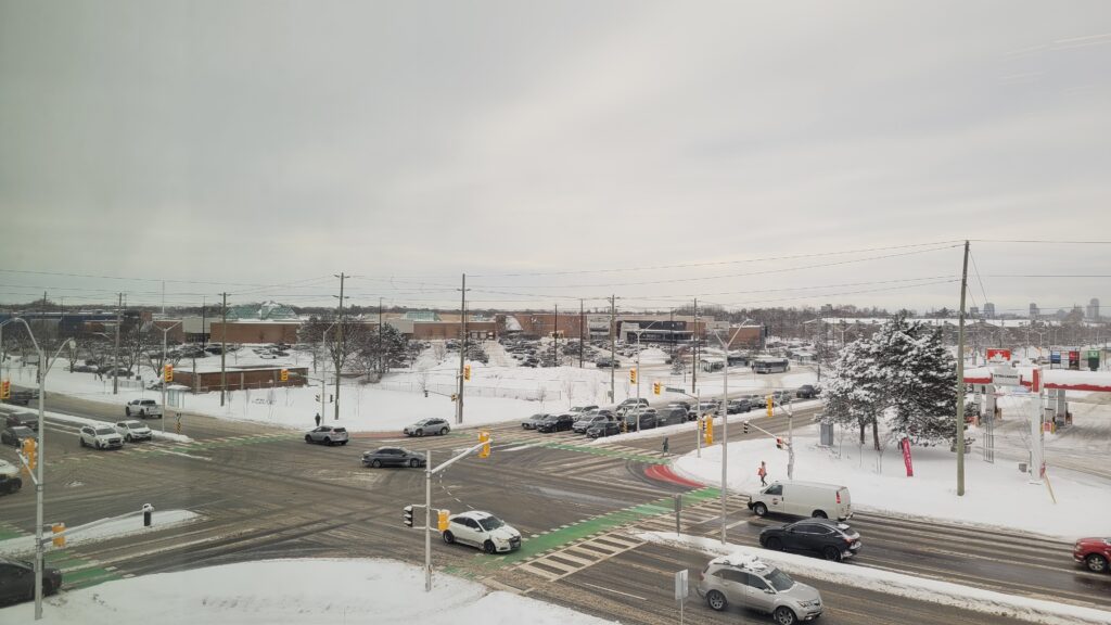
(Photo credit: Lawrence Durham)
(Photo credit: City of London)
By 2021, London was ranked the fastest-growing city in Ontario and the fourth fastest-growing city in all of Canada.
Of course, with growth comes traffic.
By 2025, traffic data giant TomTom ranked London as the 12th most congested city in North America and 142nd in the world.
(Photo credit: Lawrence Durham)
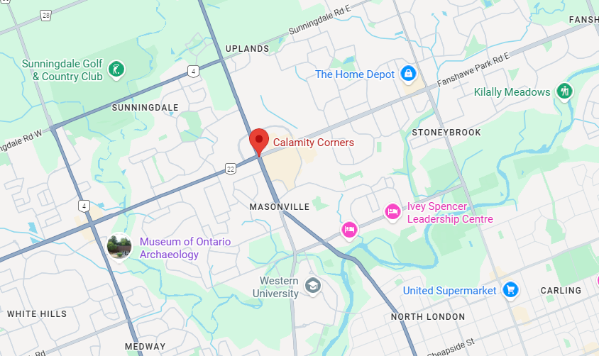
(To explore the area shown, click here on Google Maps)
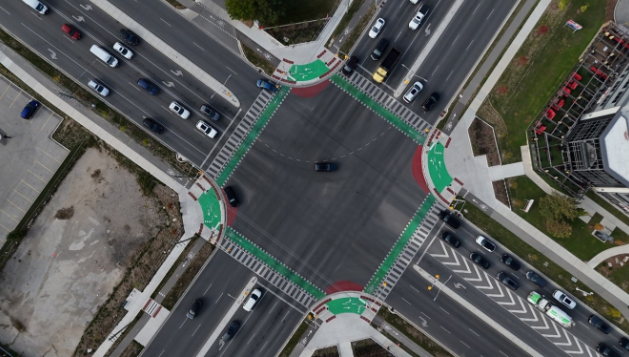
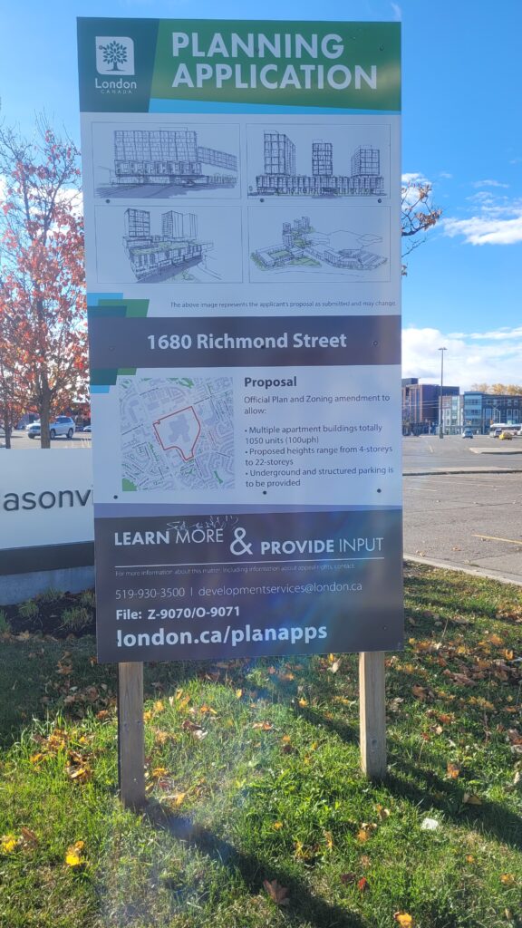
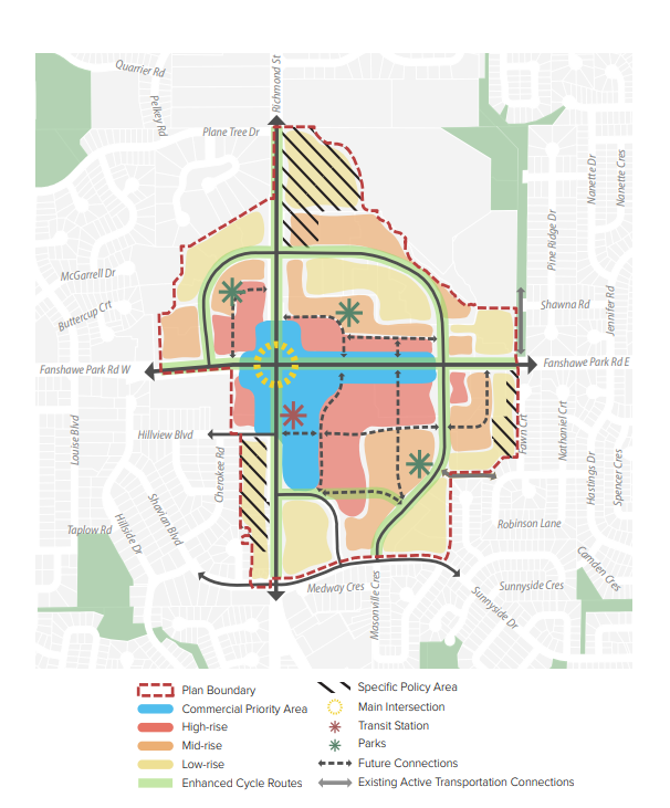
The Future: Densification and a Transit Village
Just when you might think the story peaks, a new chapter is being written.
This whole area, including nearby Masonville Mall, is slated for a monumental transformation into a “Transit Village.” This isn’t just a simple expansion; it’s a vision for a denser, more walkable, and transit-oriented urban hub, with high-density residential towers, commercial space, and improved public transit, all integrated into a single site.
(Photo credit: Lawrence Durham)
(Photo credit: Masonville Secondary Plan, City of London)
This exciting development promises to densify the entire area, bringing more people, more life, and undoubtedly, more pressure to the already-busy intersection, which now stands at a new crossroads – not of streets, but of eras, between London’s car-centric 20th century and its denser, more sustainable 21st-century future.
(Photo credit: Masonville Secondary Plan, City of London)
The challenge for our city will be to manage this growth, to re-engineer this legendary corner not as a point of calamity, but as a model of efficient, modern urban flow.
So, is Calamity Corners STILL the worst intersection in southwestern Ontario?
I’d say “No.”
Even though it’s still busy, the traffic engineers have gotten rid of most of the design flaws that made it so dangerous in the past.
(Photo credit: Lawrence Durham)
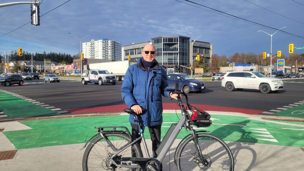
Hi, I’m Lawrence—storyteller, unofficial London cheerleader, and a guy who believes the best stories are found when you’re not behind a windshield.
I started this blog as a way to share the wonderful, quirky, and hidden-in-plain-sight gems that make our city special. Uncovering the true tales behind places like Calamity Corners is exactly what I love to do.
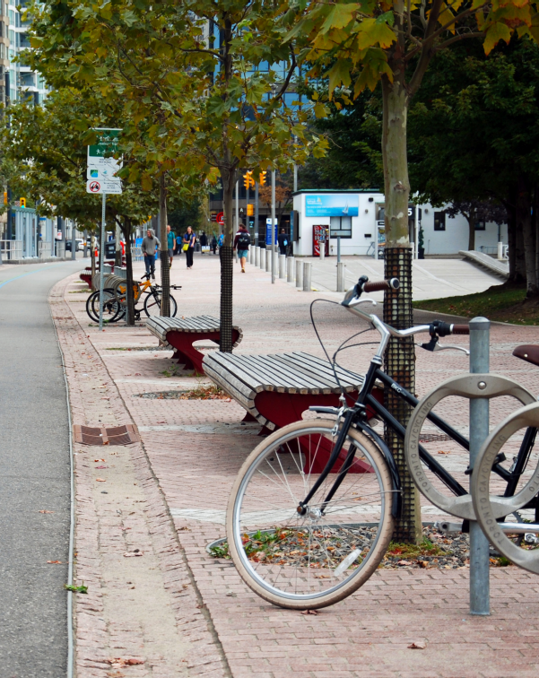
If reading about all this busyness makes you want to experience the charm of London’s quiet pathways instead, I’d be thrilled to have you along on one of my relaxing bicycle tours.
Leave a Reply