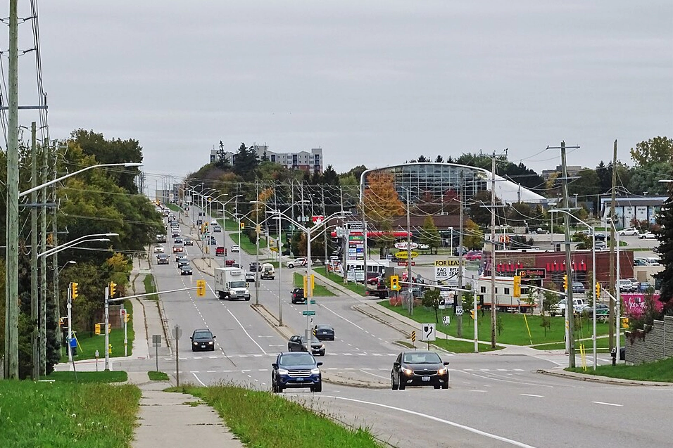
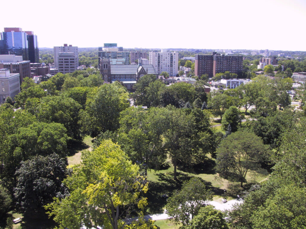
When you think of Canada’s top cities for nature and sustainability, you might picture Vancouver’s coastal rainforests or Banff’s mountain majesty. But did you know that a quiet achiever in Southwestern Ontario has quietly claimed the top spot in the nation?
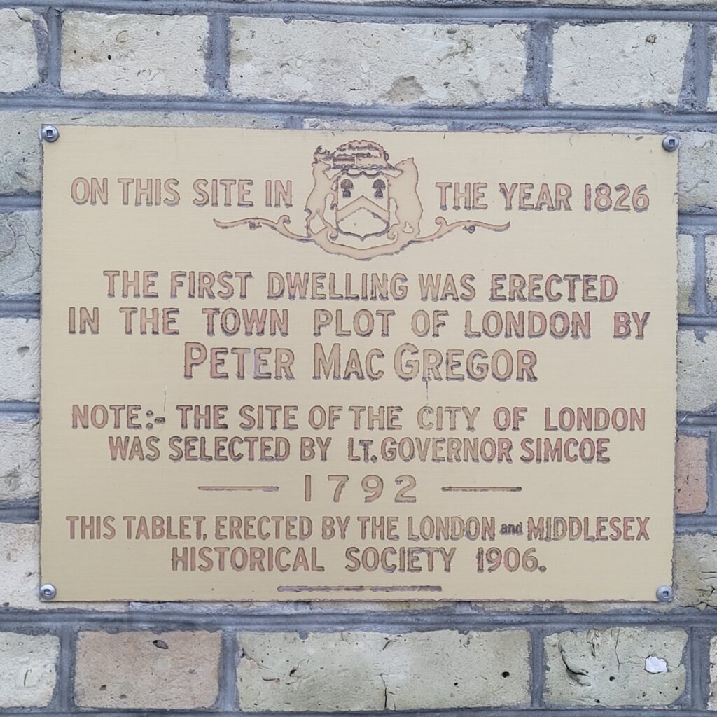
That’s right. In 2022, London, Ontario, was officially ranked #1 in Canada for its environmental conditions. This isn’t just a local opinion; it’s the result of a comprehensive national study that put London at the forefront of urban environmental quality.
For visitors and culture seekers who appreciate a city where urban life and nature coexist in perfect harmony, this ranking is your invitation to explore a destination that is as green as it is welcoming.
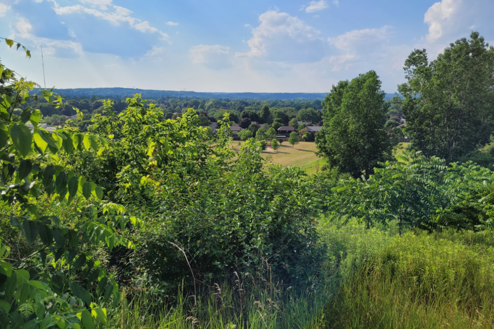
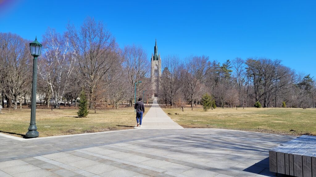
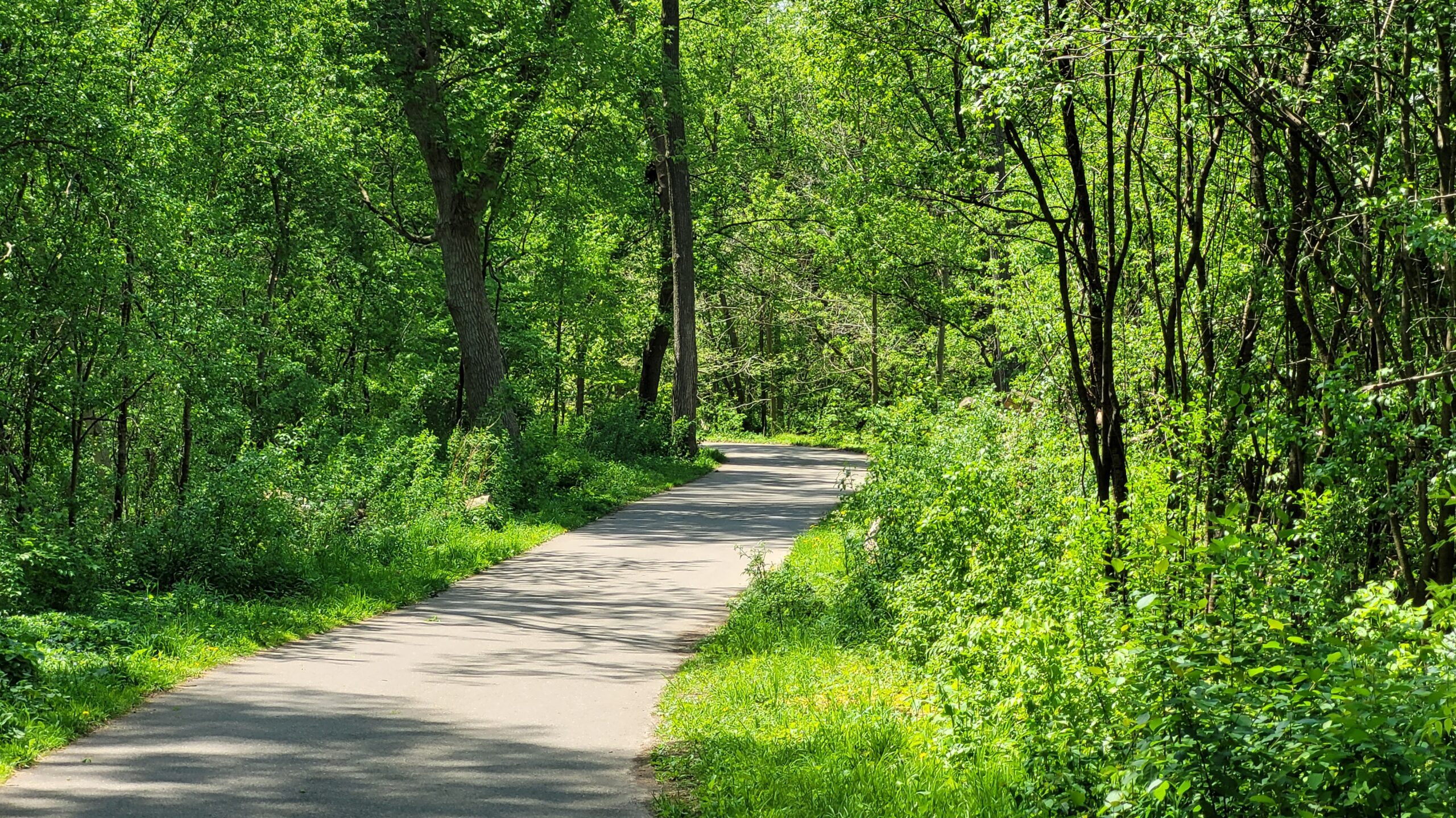
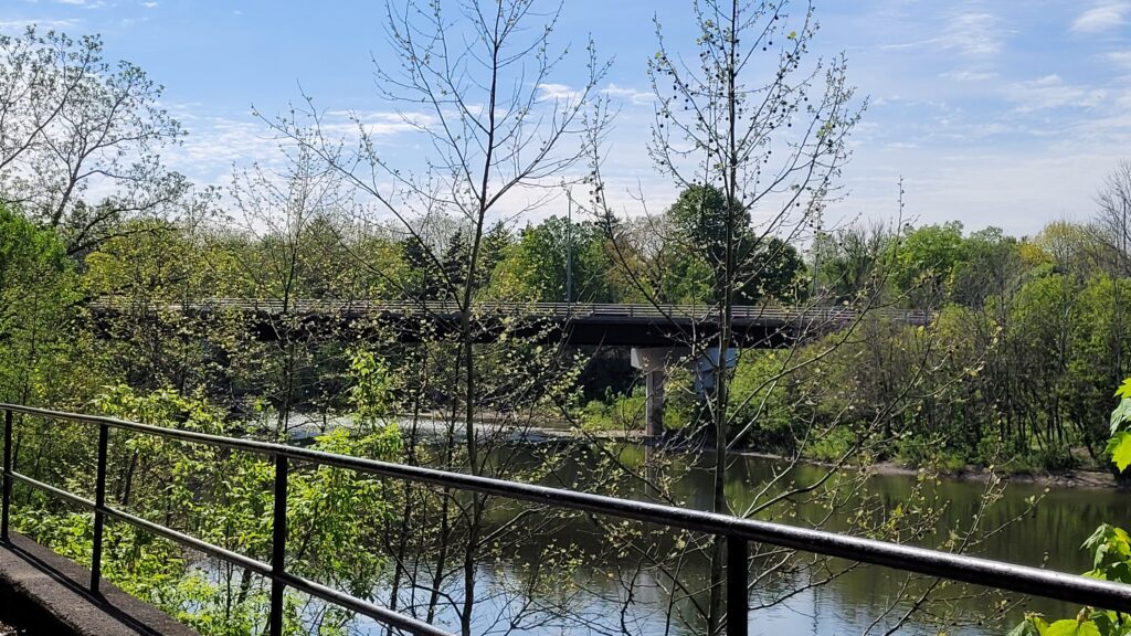
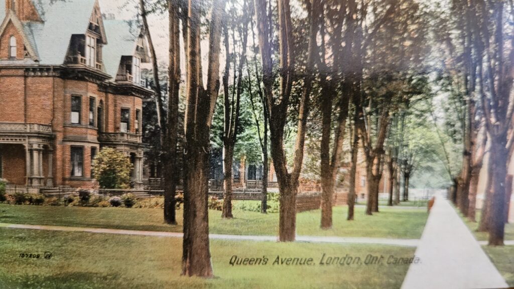
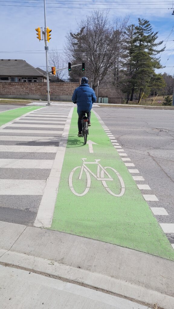
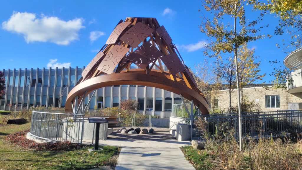
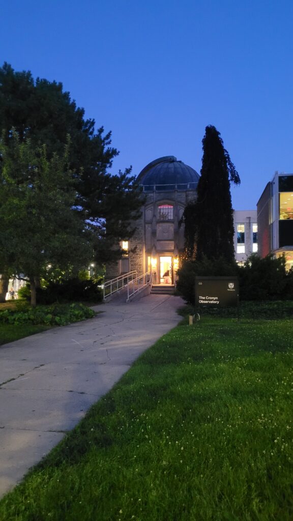
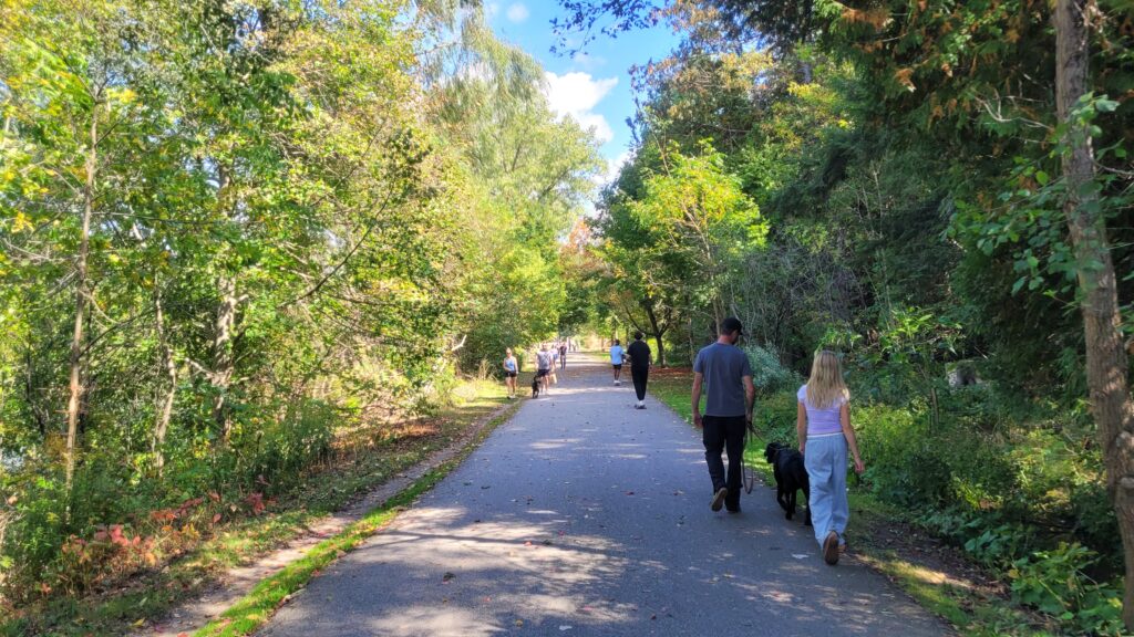
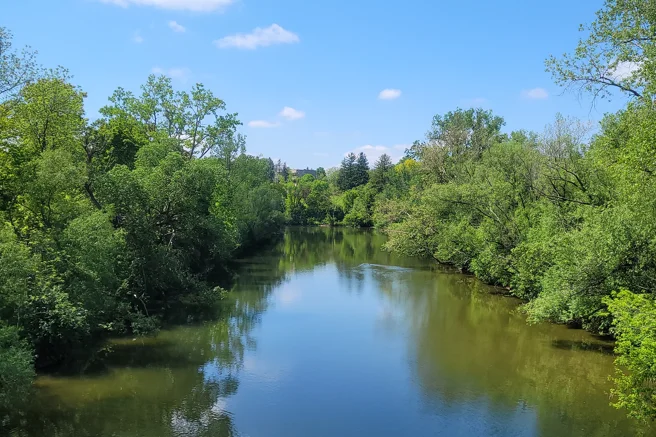
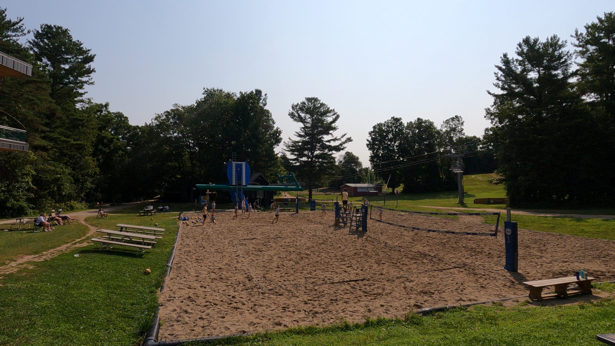
The Thames Valley Parkway winds its way along the three branches of the Thames River, offering a 43 km journey along shaded pathways and scenic views. (Photo credit: Lawrence Durham).
What Makes a City #1?
This impressive accolade comes from a study by Dalhousie University, which looked beyond just pretty parks. Researchers developed an Environmental Quality Index (EQI) to measure the “total environment” of 30 major cities across Canada.
London didn’t just place well; it excelled with a median EQI score of 70, the highest in the country. What’s even more remarkable is the consistency of this quality. Unlike some cities where green spaces are a luxury of the wealthy, London’s high environmental scores are balanced and accessible across all its neighbourhoods. This means that whether you’re strolling through the historic downtown or the leafy suburbs, you are never far from a breath of fresh air.
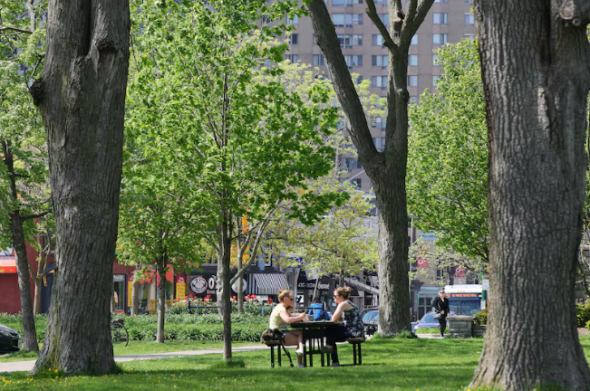
Londoners having lunch in Victoria Park. (Photo credit: Dave Chidley/CBC)
The Forest City Legacy: More Than Just a Nickname
London’s identity is deeply rooted in its canopy. The nickname “Forest City” dates back to the 19th century, and today, it’s a title the city actively earns. With over 7 million trees, the city is a living, breathing arboretum.
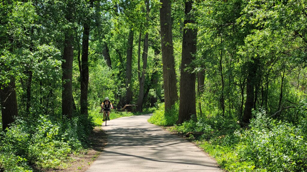
In addition, London is home to 21 designated Environmentally Significant Areas (ESAs), covering more than 750 hectares of protected land. These are pockets of wilderness within the city limits, where you can find rare species of plants and animals, meandering creeks, and ancient forests. For a culture seeker, this means your itinerary can easily blend a visit to a gallery in the morning with a hike through a Carolinian Forest in the afternoon.
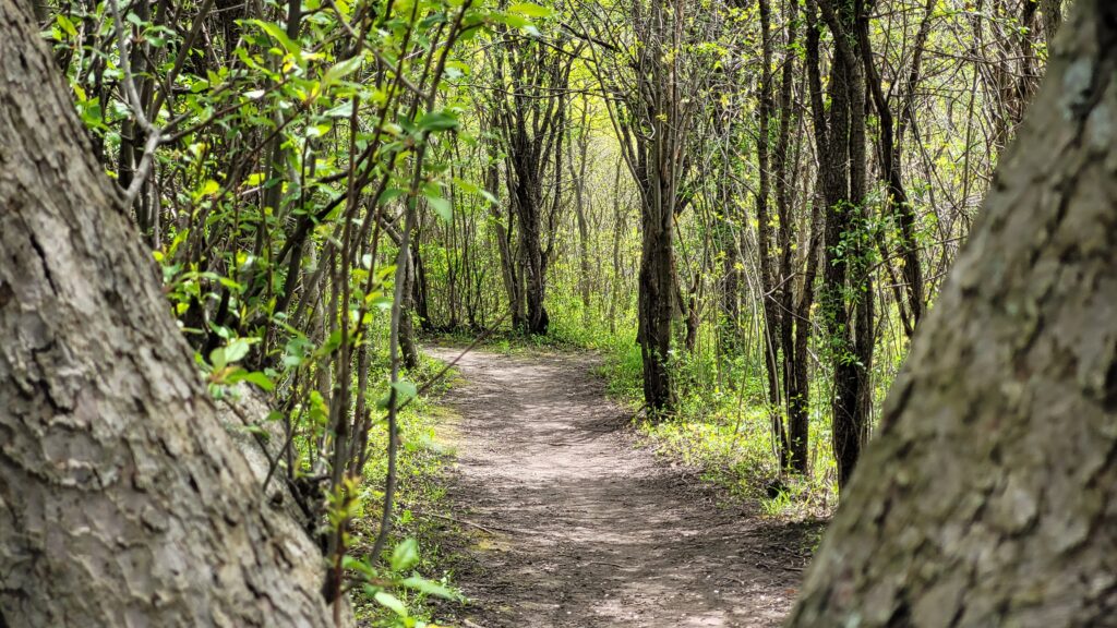
A hiking path weaving its way through the Carolinian Forest. (Photo credit: Lawrence Durham).
Sheltered by Geography: A Natural Advantage
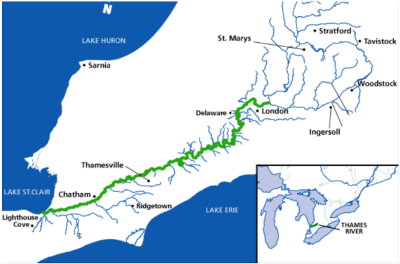
Part of London’s top ranking comes down to a bit of geological good fortune. Situated in the heart of the Great Lakes, London enjoys a position that protects it from the most severe climate events that challenge other parts of the country. We are largely free from the threat of major hurricanes, wildfires, and coastal erosion that other regions face. This geographic stability provides a safe and secure foundation for a thriving urban ecosystem, allowing nature and the city to grow together peacefully.
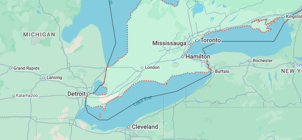
London is surrounded by three of the five Great Lakes. (Source: Google Maps).
A City that Cares: Proactive Protection for Future Generations
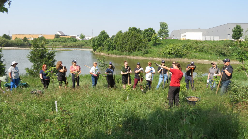
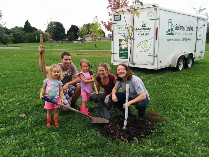
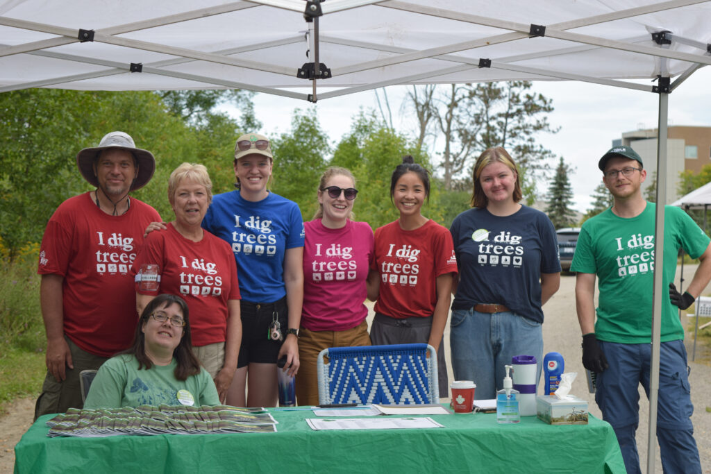
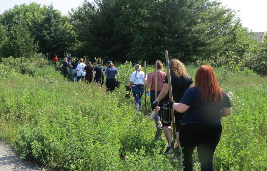
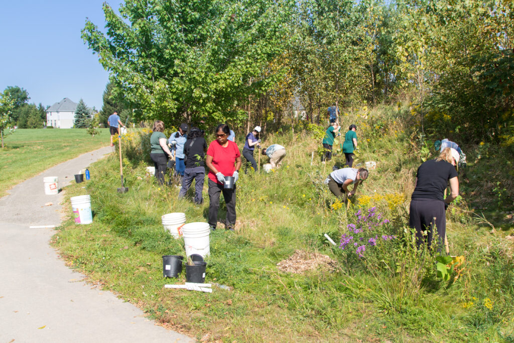
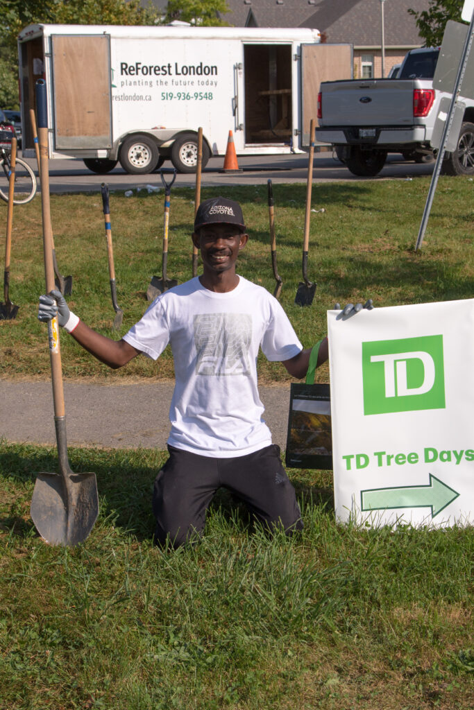
This #1 ranking isn’t just a happy accident of history; it’s a promise the city is actively keeping. London isn’t resting on its laurels. Through programs like ReForest London, the community is continuously involved in planting and nurturing its urban canopy.
Tree planting efforts led by ReForest London. (Photo credit: ReForest London).
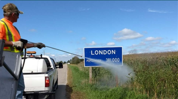
Spraying to remove Phragmites. (Photo credit: City of London).Manually removing Phragmites when spraying over water is not possible. (Photo credit: City of London).
Furthermore, the city’s commitment is enshrined in its Climate Emergency Action Plan, a forward-thinking strategy to reduce emissions and build a sustainable, resilient community for the future. This dedication ensures that the clean air and green spaces we enjoy today will be here for generations to come.
This Surface Temperature Map, produced by researchers at Western University, shows the cooling effect of the tree canopy in green. Note in particular the dark green ribbons showing where the three branches of the Thames River run through the centre of the city. (Photo credit: Karlos Lao/Western University)
Experience the Green Heart of Southwestern Ontario
For the discerning traveller, a city’s environmental health is a key ingredient to a great trip. It means cleaner air for your morning run, beautiful backdrops for your photos, and a sense of peace and well-being as you explore. In London, the environment isn’t a separate attraction; it’s the fabric of the city itself.
From the winding paths of the Thames Valley Parkway to the serene beauty of our ESAs, London invites you to breathe easy and explore deeply. The city’s #1 ranking is more than a statistic. It’s a warm welcome to come and experience the lush, sustainable, and naturally beautiful heart of Southwestern Ontario for yourself.
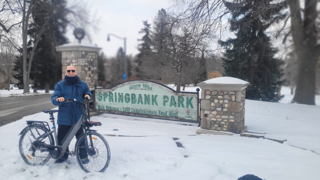
The author, standing at the viewing platform at one of the many picturesque kettle lakes in the Westminster Ponds ESA. (Photo credit: Lawrence Durham).
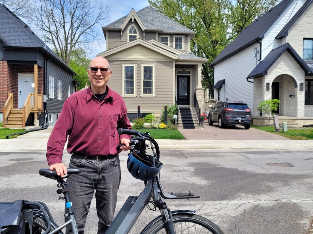
Hi. I’m Lawrence – bicycle tour guide, storyteller, and your personal cheerleader for all things London.
I’m on a mission to show curious folks like you just how green, vibrant, and wonderful this city really is. If you want to experience our award-winning environmental conditions up close, feeling the breeze through our 7 million trees and exploring those beautiful ESAs, I know the perfect way to do it. Come join me on a bicycle tour! We’ll cover more ground, share some big laughs, and discover the hidden natural gems that make London Canada’s #1 city for environmental quality.
When you picture London, Ontario today, you likely see farm-to-table dining, festival crowds in Victoria Park, and cyclists cruising along the Thames Valley Parkway. But take a ride through our downtown core, and you’re actually passing through what was once one of the most powerful industrial streetscapes in the country.
Believe it or not, in the years leading up to 1915, London was the second-largest cigar manufacturing city in Canada, trailing only Montreal.
At its peak, this city of modest size was producing nearly 80 million cigars a year, with over 20 active factories humming along streets you probably know by heart. Let’s roll back the clock and explore how London became an unlikely tobacco titan, and where those stories still linger today.
How London lit up Canada’s cigar industry
In the late 19th century, most cigars sold in Canada weren’t Canadian at all. They were imported from Germany. But that changed dramatically with Prime Minister John A. Macdonald’s National Policy of 1879, which imposed heavy duties on finished manufactured goods, such as imported cigars, while leaving raw materials, such as Cuban and American tobacco, tax-free.
Suddenly, a high-quality, locally made cigar became the smarter, cheaper option for Canadian smokers.
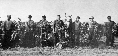
London was perfectly positioned to capitalize. The city had already grown into a railway hub, with lines fanning out in every direction. Raw tobacco rolled in by boxcar. Finished cigars rolled out to markets across the country. And the sandy soils of southwestern Ontario, already earning the region its “tobacco belt” nickname, didn’t hurt either, even if much of the finest cigar leaf still came from the Caribbean.
London’s cigar heyday burned brightest in the years just before the First World War. Historians estimate that between 1910 and 1912 alone, the city’s factories were churning out a staggering eighty million cigars annually.
To put that in perspective: Canada’s national population at the time was only about seven million people. London was keeping a significant portion of the country stocked with smokes.
The factories weren’t tucked away in some remote industrial park. They were clustered right downtown, particularly along Clarence, Horton, and Dundas Streets. These were bustling, working-class neighbourhoods where you could smell tobacco curing before you saw the factory signs.
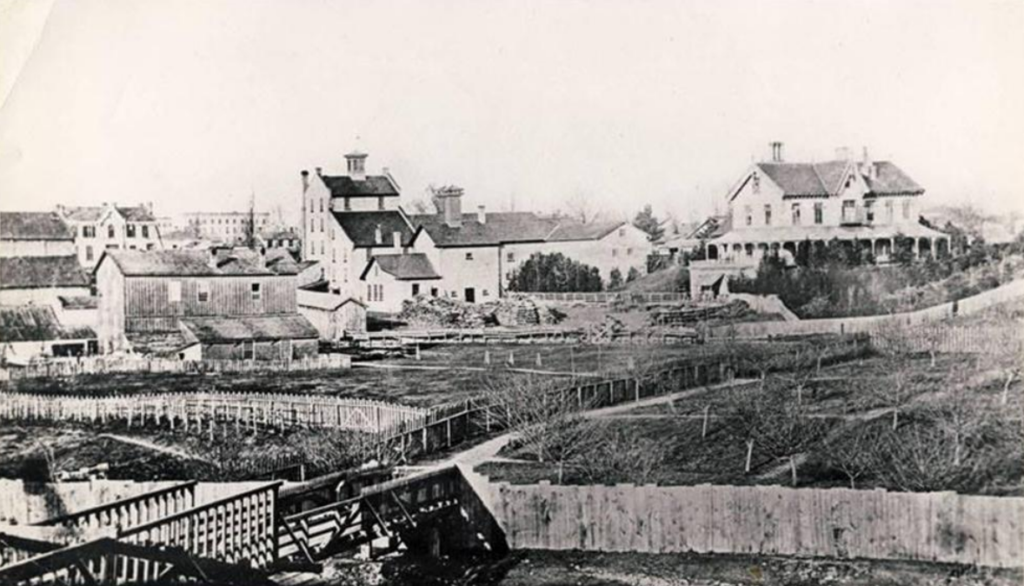
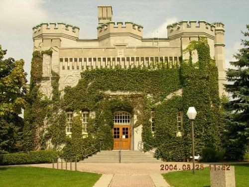
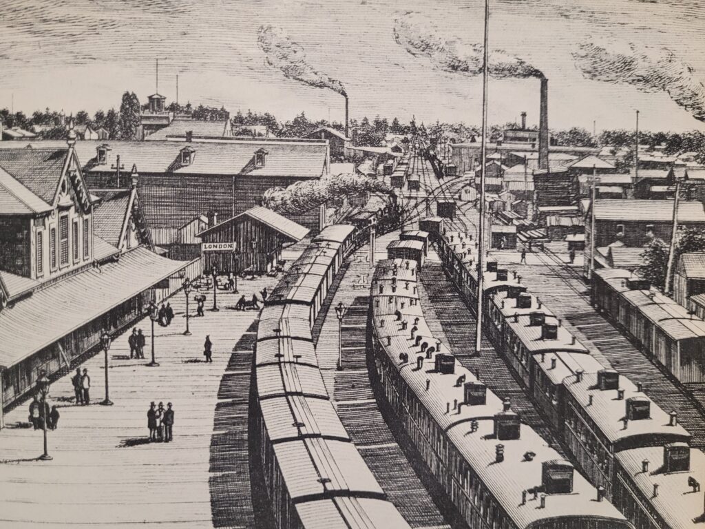
Downtown London in 1907. (Photo credit: Vintage London).
Meet the cigar kings of London
Several major players built this industry, and their names still echo through local landmarks.
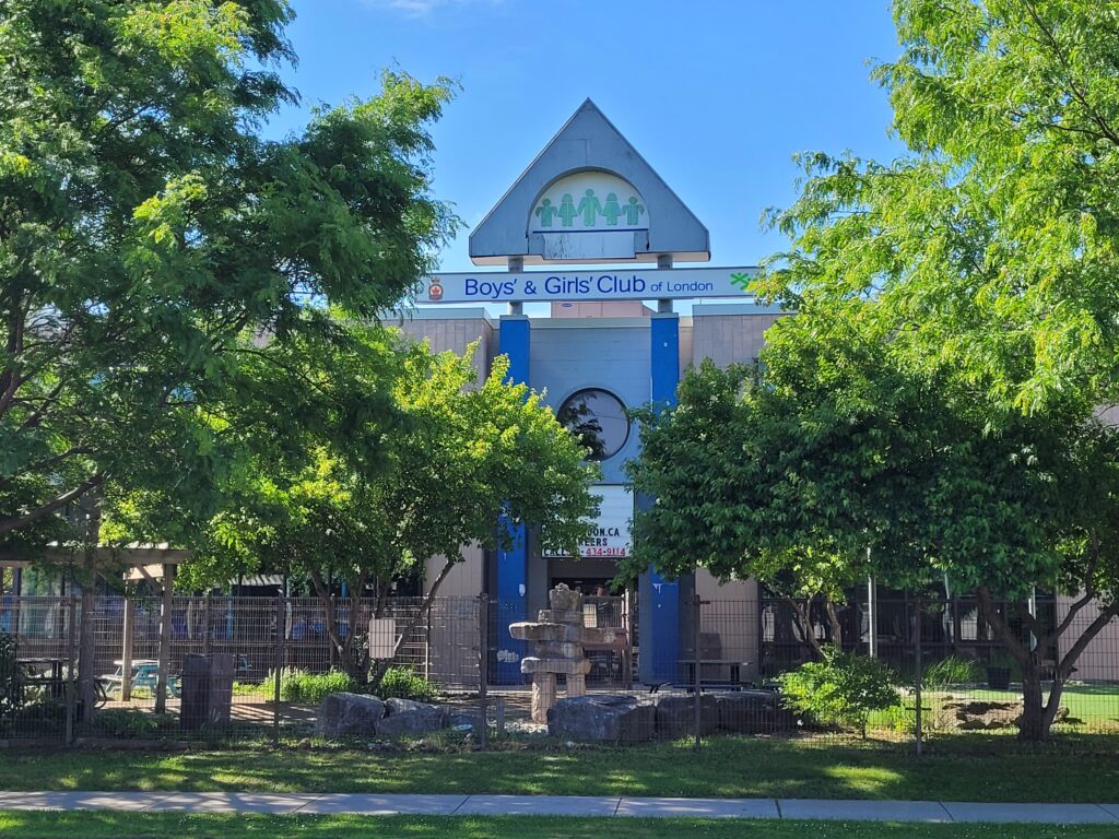
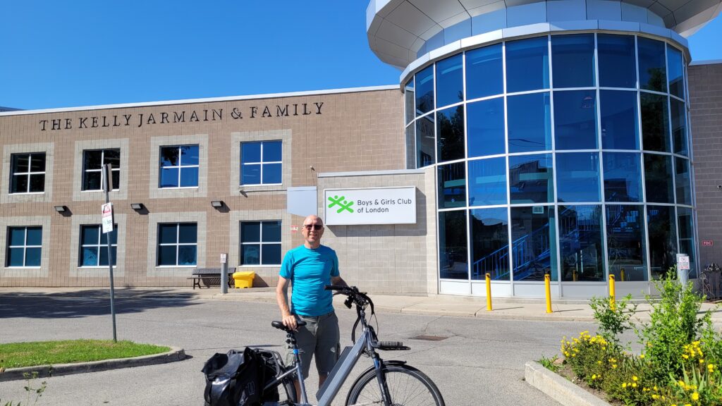
The Brener Brothers were arguably the biggest. Otto E. Brener, a German immigrant, began making cigars as early as 1881. By 1912, his sons had joined the business, and their factory at 184 Horton Street East (now the home of the Boys and Girls Club) employed roughly 200 people and produced 10 million cigars a year.
Early Brener cigar factory on Ridout Street, east side, north of King Street, c. 1890. (Photo credit: London Public Library).
Brener Brothers became known for hiring Jewish immigrants arriving in the city, and their factory sat just down the road from the synagogue that would open in 1924 (today the N’Amerind Friendship Centre).
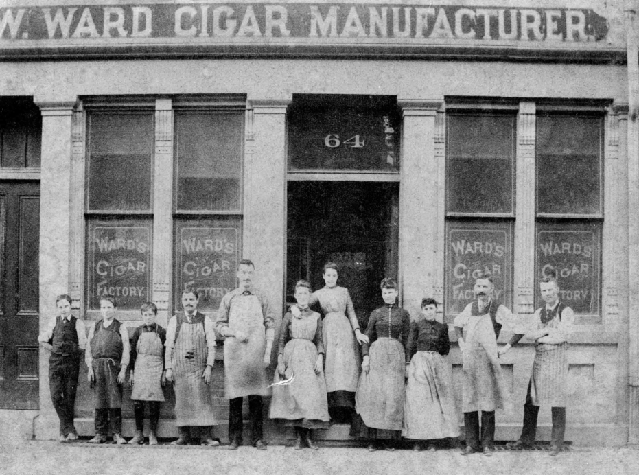
William Ward & Sons was another titan. Established in 1875 at 64 Dundas Street, Ward’s operation outlasted every single competitor. While other factories flickered out after the First World War, William Ward & Sons kept rolling until 1952, the last cigar maker standing in London.
Employees of the Ward Cigar factory pose outside the premises on Dundas Street, c. 1905. (Photo credit: Robert B. Ward/ Museum London)
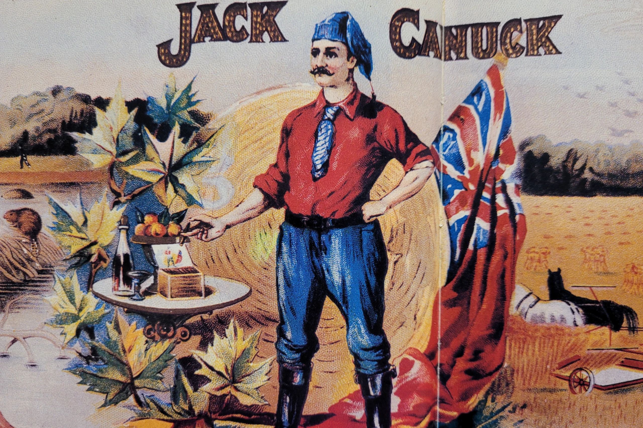
Other major names included H. Simon Cigar, John McNee & Sons, and the London Cigar Company. Together, they turned London into a national powerhouse.
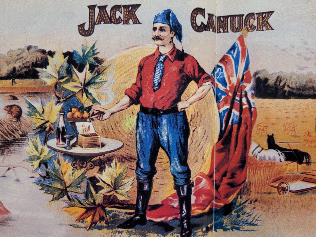
Cigar box label, c. 1900. Combining the romance of the expanding Canadian West with a young nation’s rising sense of patriotism, the London Cigar Company marketed the “Jack Canuck” brand to the smoking public. (Photo credit: J.M. Waters)
Why did men (and it was mostly men) smoke so many cigars?
Cigars in Victorian and Edwardian Canada weren’t just about nicotine. They were about status.
Cigar poster, c. 1910. This colourful poster advertised cigars made from high-grade, imported Cuban and American tobacco, “obviously ” only smoked by discriminating gentlemen of wealth and importance. (Photo credit: Archives and Special Collections, Western University).
As manufacturing efficiencies brought prices down, cigars stopped being an upper-class indulgence and became accessible to working men. Puffing on a good cigar suggested sophistication, success, and a certain worldly confidence. You’ll see this reflected in the elaborate, colourful cigar box art of the era, though it’s also true that some of that artwork featured troubling racist stereotypes of Japanese, Arab, and Indigenous peoples, reflecting the prejudiced attitudes of the time.
The imagery on the cigar boxes often depicted certain groups as foreign and exotic “others.” This packaging aligned with and reinforced the stereotypes and racist ideas that permeated Canadian culture at the time. (Photo credit: Museum London)
What snuffed out London’s cigar empire?
Every good story has a turning point. For London’s cigar industry, the ashes began to cool during the First World War.
Prohibition (1916) dealt a serious blow to the cigar industry. Taverns and bars had been a primary sales channel for cigars. When Ontario banned alcohol sales, those outlets evaporated overnight.
But the real knockout punch came from a smaller, more convenient rival: the cigarette.
During the war, soldiers’ rations included cigarettes. The Princess Mary Gift Box of 1914, given to troops, contained tobacco, a pipe, a lighter, and twenty cigarettes. When those men came home, they didn’t switch back. Cigarettes felt modern, sociable, and middle-class. Cigars suddenly seemed old-fashioned.
The Princess Mary Brass Box Christmas Gift of 1914. (Photo credit: Museum London).
By 1922, Brener Brothers had closed its doors. William Ward & Sons hung on for another three decades, but when it finally shut down in 1952, an era ended. London’s run as Ontario’s cigar capital was over.
You can still see the legacy today
Here’s the good news for curious travellers: some of the buildings are still standing.
That Brener Brothers factory at 184 Horton Street? It’s now the Boys and Girls Club of London, and you can ride right past it. Many of those downtown factories along Clarence and Dundas have been repurposed into shops, lofts, and offices, but their bones are pure 19th-century industrial London.
184 Horton Street today, repurposed as the Boys and Girls Club of London. (Photo Credit: Lawrence Durham).
For a deeper dive, the London Room at the London Public Library holds photographs, cigar box labels, and local history files. And the Canadian Museum of History in Ottawa also displays some of London’s vintage cigar box art.
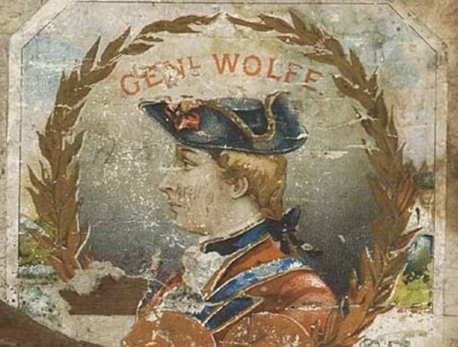
The Canadian Museum of History in Ottawa says many 19th-century London, Ont., cigar makers revered the city’s British roots. This particular cigar maker memorialized ‘Gen’l Wolfe,’ whose British army took Quebec in 1759. (Photo credit: Canadian Museum of History).
See London’s hidden history from the best seat in the house
Stories like these are everywhere in London, if you know where to look. The old cigar factories don’t have plaques on every door. The neighbourhoods where workers rolled ten million cigars a year are now some of the most charming, walkable (and bikeable) districts in the city.
That’s exactly what we love to share.
The author, in front of the Boys and Girls Club of London. (Photo Credit: Lawrence Durham).
Hi. I’m Lawrence. I’m a bicycle tour guide, storyteller, and unabashed London booster. I started London Bicycle Tours because I believe the best way to fall in love with a city is to explore it at human speed, with fresh air in your lungs and a few good laughs along the way.
We ride past buildings you’ve driven by a hundred times without noticing. We uncover the weird, wonderful, and forgotten chapters of London’s past. And we do it in small groups, because big crowds ruin the magic.
If you’d like to see where London made millions of cigars, meet the ghost of William Ward, and discover why this city has always been tougher and more surprising than anyone gives it credit for, come on a bicycle tour with me.
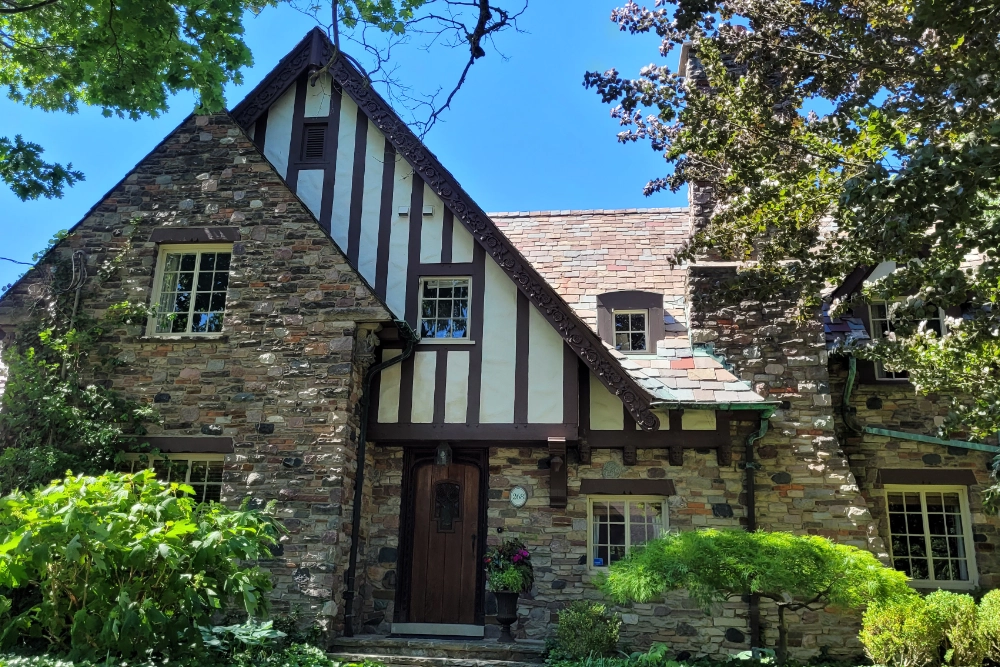
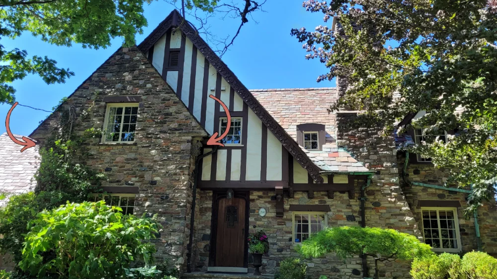
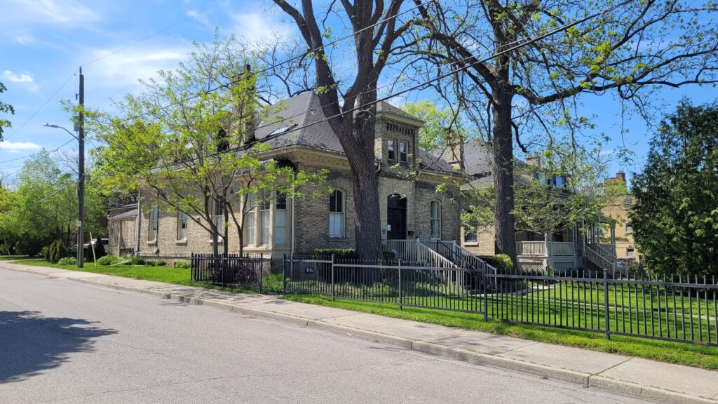
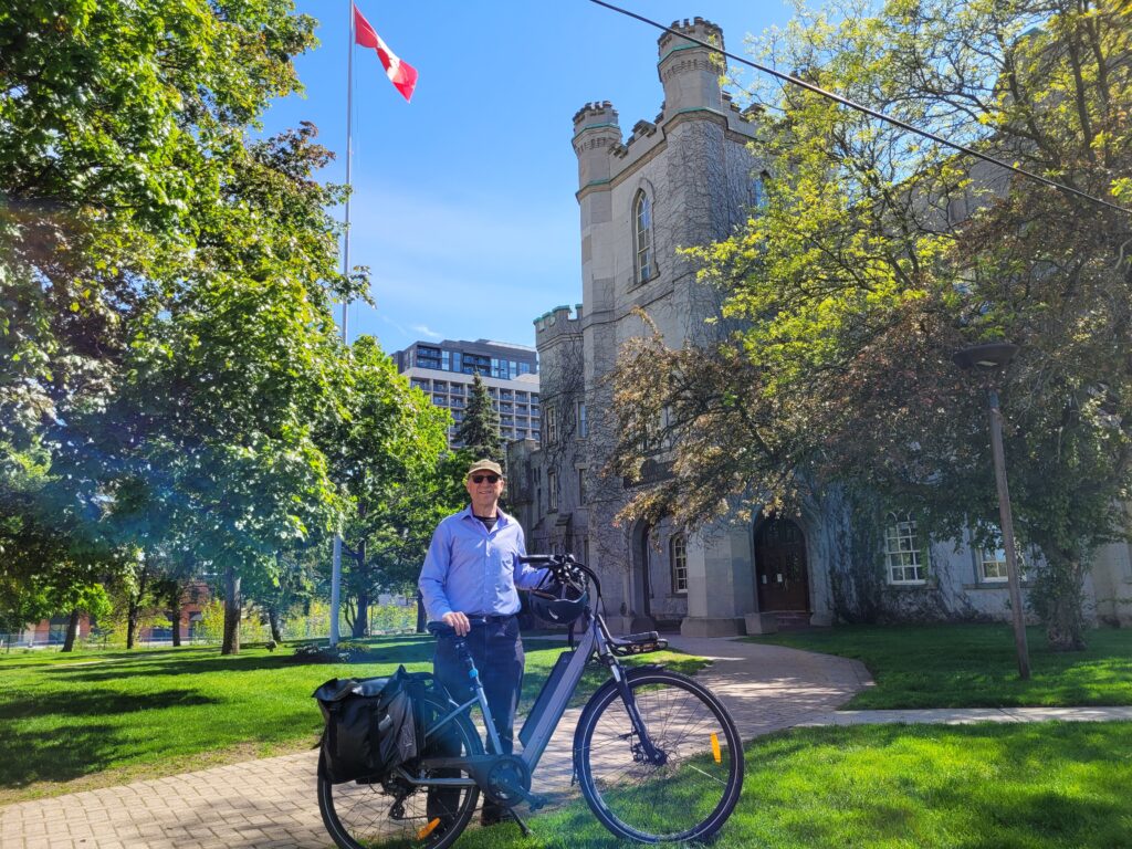
There’s something magical about turning a corner and discovering a building that seems to be straight out of a fairy tale. At the intersection of Regent and Wellington Streets in London, Ontario, you’ll find the place I affectionately call the “Gingerbread House.”
It isn’t just another heritage property. It’s a playful architectural confection that invites you to stop, stare, and smile. When I look at this house with its uneven roofline, mismatched windows, stone gargoyles, and hand-carved wooden details, it always seems to be winking back at me.
Let me take you on a tour of this whimsical treasure and explain why it should be on your itinerary when you visit London.
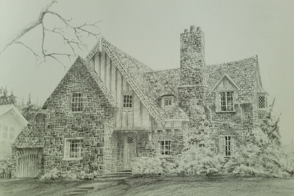
A sketch by Louis Taylor
A Brief History: The Men Behind the Magic
Albert M. Masuret: A Grocer with Grand Vision
In 1935, as the world slowly emerged from the Great Depression, a successful wholesale grocer named Albert M. Masuret decided to build something extraordinary. Masuret had made his mark in London’s business community. Still, he wanted his home to make an entirely different kind of statement, one that celebrated craftsmanship, whimsy, and the enduring charm of Old World design.
He commissioned the project during an era when many homes were being built with practical efficiency in mind. Masuret, however, had other plans. He wanted a residence that would stand as a testament to artistry and imagination, a place where every stone, every shingle, and every carved detail told a story.
Herbert E. Murton: The Architect
Masuret found his creative partner in Herbert E. Murton, one of London’s most prominent architects of the period. Murton was known for his appreciation of fine materials and his ability to blend architectural traditions in unexpected ways.
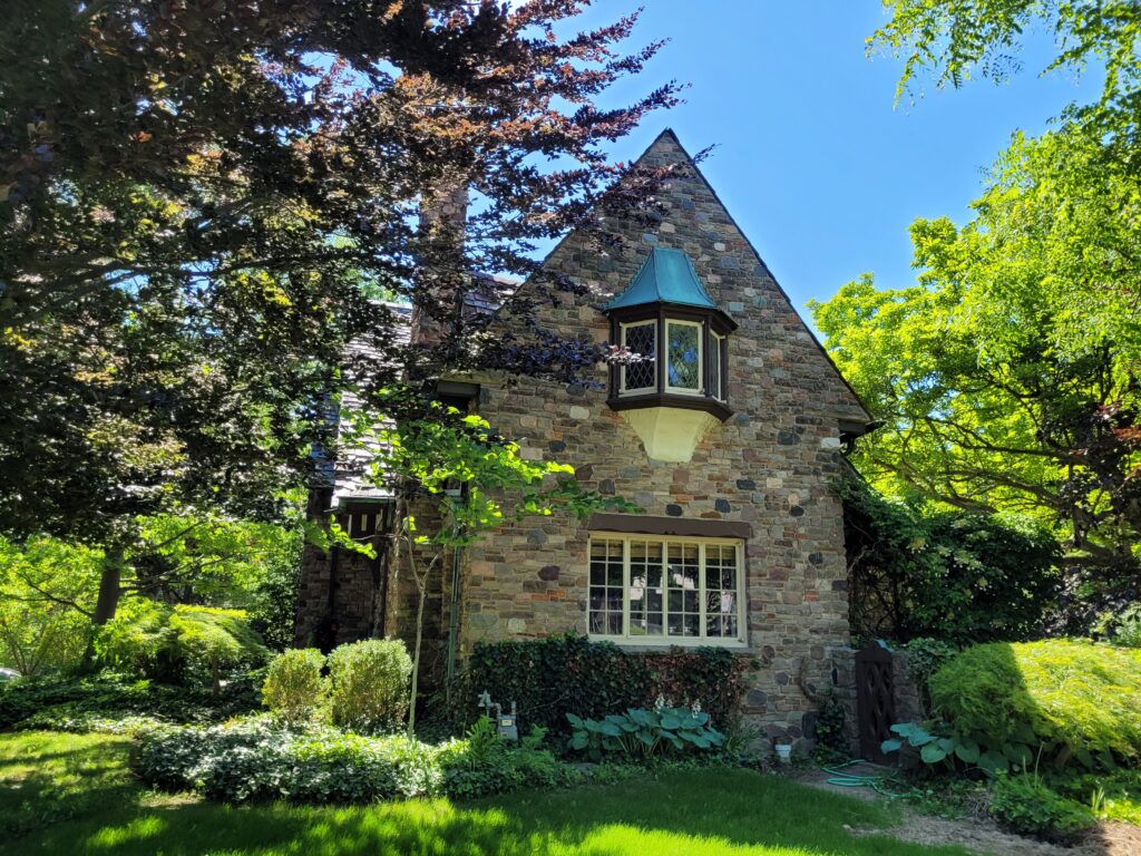
For the Masuret House, Murton drew inspiration from the Arts and Crafts movement and the English Cottage style, architectural traditions that celebrated handcraftsmanship and a connection to nature. The result? A building that the City of London Heritage Register officially classifies as “Tudor Revival,” though that label hardly captures its full personality.
Today, 268 Regent Street is a heritage-designated property on the City of London Heritage Register, ensuring that this remarkable piece of London’s architectural history will be preserved for future generations to enjoy.
Architectural Wonders: A Feast for the Eyes
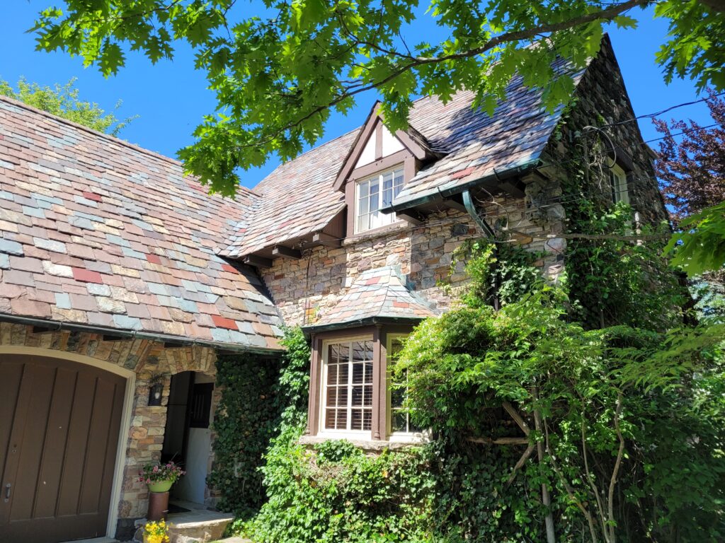
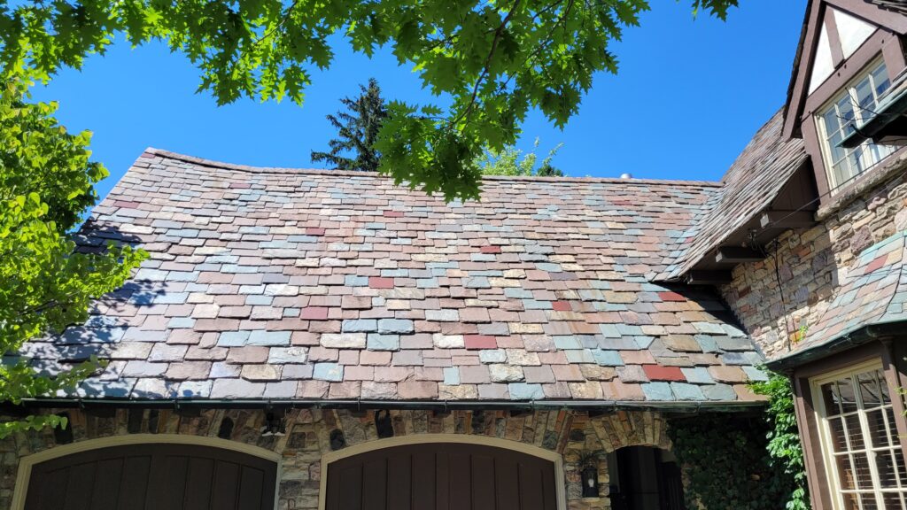
The 22-Ton Roof
Let’s start at the top, because this is where the Masuret House truly defies expectations. The roof is composed of massive, variegated stone slates, reputed to weigh an astonishing 22 tons. That’s the weight of approximately 14 cars resting on the top of a single-family home!
Note the delicate Tudor Arch over the doorway, and multicoloured slate roof.
But it’s not just the weight that captivates; it’s the colour. Murton selected slates in a remarkable variety; shades of blue, green, red, and purple mingle with more sober greys and browns. The effect is almost painterly, like a palette of earth tones splashed with unexpected jewel tones.
No, the roof isn’t sagging from the weight of the slate. It was designed that way.
The slates are also graduated in size and thickness, becoming smallest at the ridge, a technical detail that speaks to Murton’s obsessive attention to craftsmanship. The roofline itself slopes up at the ridge end, creating the illusion that the centre has sagged with time, as if this house has stood for centuries rather than decades.
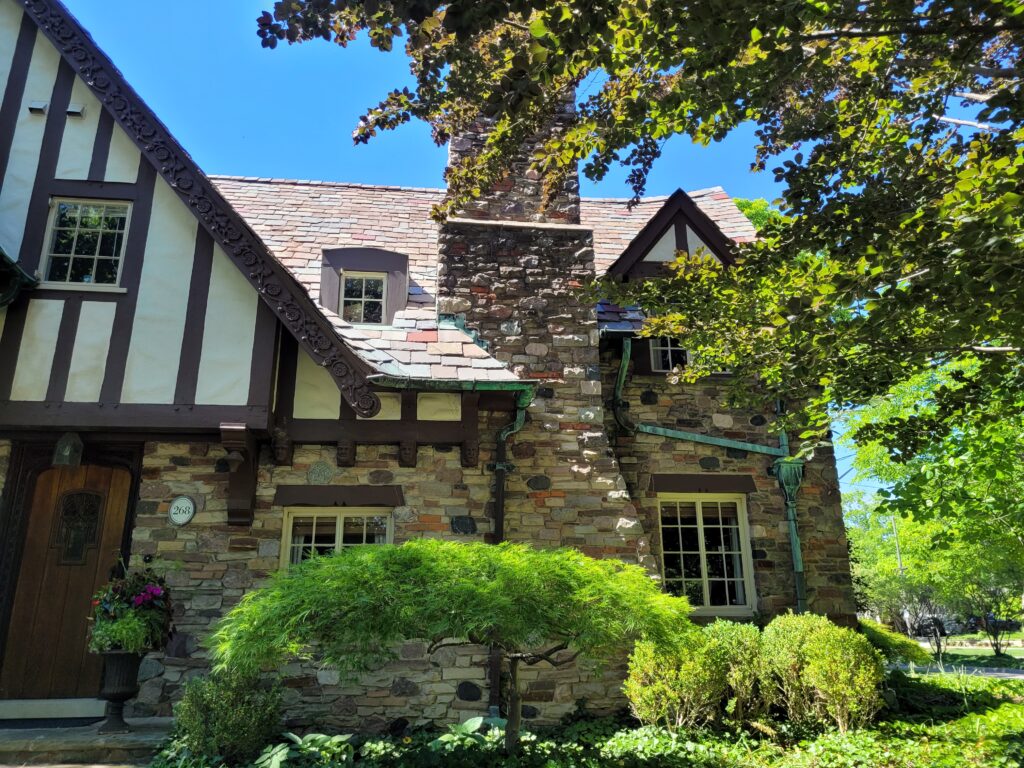
The Stone Walls
The exterior walls are composed of a rich mixture of Credit Valley stone and local fieldstone, creating a rugged texture that complements the playful roofline. The rusticated stonework gives the house an ancient, almost castle-like feel, as though it has been standing on this corner for hundreds of years, weathering seasons and centuries with quiet dignity.
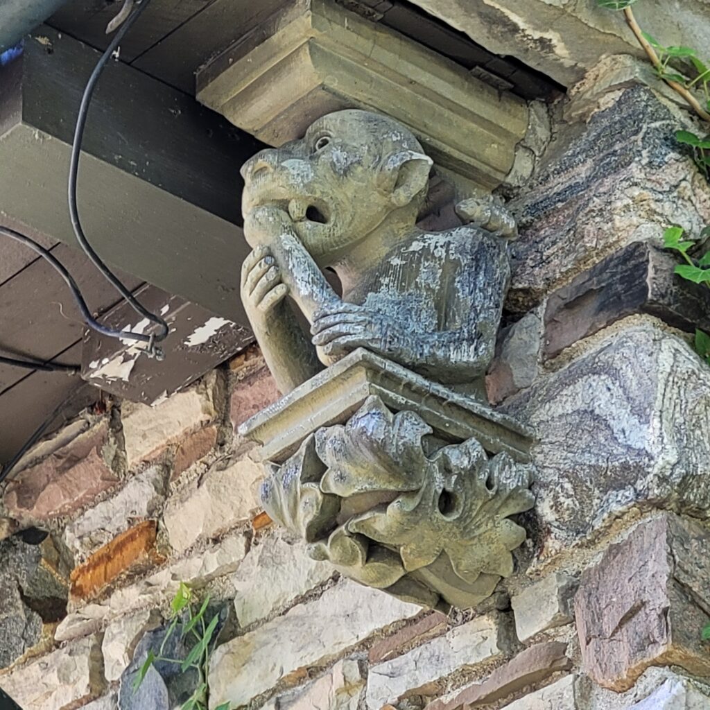
The Whimsical Details
Half-timbers with whitewashed walls in between, steeply pitched roofs, and elaborate chimneys are all defining characteristics of Tudor Revival homes.
Here’s where the Masuret House truly shines. Murton and his craftsmen let their imaginations run wild, creating details that reward close inspection:
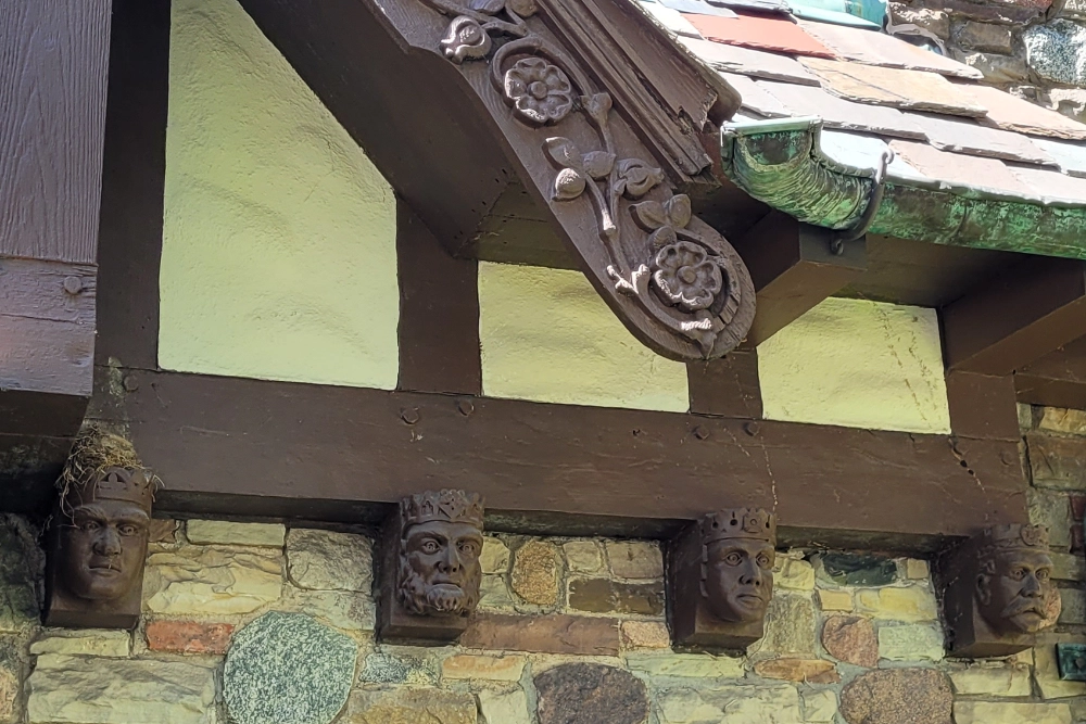
Carved Bargeboard: The decorative wooden boards that hang beneath the roofline are carved with intricate patterns, including wooden Tudor roses that seem to grow organically from the wood.
Tudor Heads: A series of hand-carved brackets features the faces of Tudor figures, each one unique, each one watching over the house with expressions that range from stern to bemused.
This close-up photo shows the four distinct Tudor Heads (below) and the decorative bargeboards with carved roses (above).
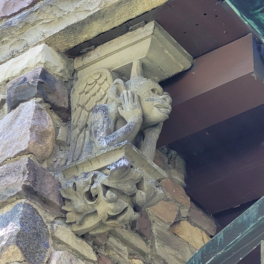
The Gargoyles: Yes, actual stone gargoyles guard the structure, playful, mischievous, and entirely unexpected on an Ontario street corner.
Casement Windows: Multi-pane windows in varying styles pierce the roof at different angles, as if added at different times in the house’s long (fictional) history.
Hansel and Gretel Vibes: The overall effect has been compared to a fairy-tale cottage, a Hansel and Gretel house whose “candy roofs” are varicoloured slates and whose “gingerbread” is skillfully hand-carved oak.
Gargoyles under the eaves (left photo and centre photo).
Solid oak door with hand-carved wooden frame (right photo).
The Arts and Crafts Influence
Murton’s work on the Masuret House clearly shows the influence of the Arts and Crafts tradition, a movement that emerged in Britain in the late 19th century as a reaction against industrialization and mass production.
The Arts and Crafts movement celebrated:
Handcraftsmanship over machine production
Natural materials and honest construction
The integration of art into everyday life
A connection to historical styles and traditions
At 268 Regent Street, these principles come alive. The hand-adzed timbers, the careful selection of local stone, the hand-carved details; every element speaks to the joy of making, the value of a skilled tradesperson, and the belief that houses should nourish the spirit as well as shelter the body.
If you look closely, you’ll see the gargoyles hiding under the eaves.
The Interior
While the exterior captivates from the street, the interior of the Masuret House is equally impressive in its craftsmanship:
The interior features rich black walnut trim, a wood prized for its dark, warm tones and durability.
The floors are composed of 8-inch oak planks, cut on a quarter turn, a method that enhances the wood’s stability and showcases its beautiful grain pattern.
Every material was chosen with care, reflecting Murton’s emphasis on working with only the finest materials available.
A House That “Plays at Being Old”
Perhaps the most charming aspect of the Masuret House is what architectural historians describe as its playful pretence. With all its eccentricities, the house seems to “play at being old.”
It’s like a child dressed up in old-fashioned finery. The delight comes not from fooling anyone, but from the obvious joy in pretending.
This isn’t a house that takes itself too seriously. It’s a house that invites you to share in its joke, to appreciate the artistry behind the whimsy, and to remember that architecture can be both substantial and fanciful.
The east side of the house, as viewed from Wellington Street.
Why This House Matters
The Architectural Conservancy of Ontario (ACO) regularly features the Masuret House on its walking tours, recognizing it as one of London’s most significant residential buildings. It’s also a highlight of my “Old North” Bicycle Tour.
But beyond its official heritage status, the house matters because it represents something valuable: the belief that our built environment can inspire joy, spark imagination, and connect us to history in meaningful ways. In a world of cookie-cutter subdivisions and identical condominium towers, buildings like the Masuret House remind us that our homes can be expressions of personality and artistry.
A Final Thought
There’s something special about stumbling upon a place like the “Gingerbread House.” It’s the kind of discovery that makes you feel like you’ve found a secret, a treasure tucked away on a quiet corner, waiting for someone to notice and appreciate it.
In a world that often prioritizes speed and efficiency over beauty and craftsmanship, the Masuret House stands as a lovely reminder that taking time to create something beautiful is never wasted. And taking time to seek out those beautiful things, whether on foot, by car, or by bicycle, is how we find the magic hidden in our own cities.
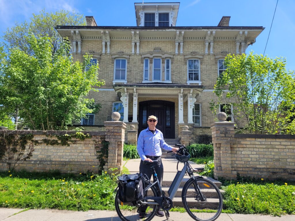
The author, in front of the heritage home.
Hi, I’m Lawrence, bicycle tour guide, storyteller, and proud Londoner. I believe the best way to discover a city’s hidden gems is at a pace that allows you to stop, look, and appreciate the details. The Masuret House is exactly the kind of treasure I love sharing with visitors, a place that embodies the charm, craftsmanship, and playful spirit that make London such a wonderful city to explore.
If you’d like to see the Gingerbread House and many other architectural delights up close, I’d love to show you around. My tours are designed for curious folks who want to experience the best parts of London, from a bicycle seat, of course. Click here to learn more! Your next adventure awaits!
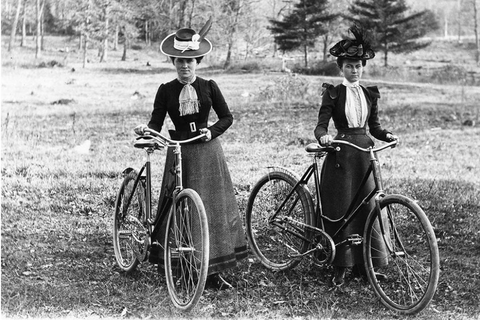
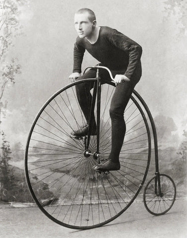
Before the 1890s, the bicycle was a death-defying contraption known as the “penny-farthing,” a towering machine with a giant front wheel that required a running leap to mount and a great deal of courage to ride. Unsurprisingly, women were largely excluded from this early, unwieldy craze.
A man atop the “penny farthing.” Its name came from the comparison of its wheel sizes to the British penny and farthing coins, with the larger penny representing the front wheel and the smaller farthing representing the rear. (Photo credit: Historical Pix).
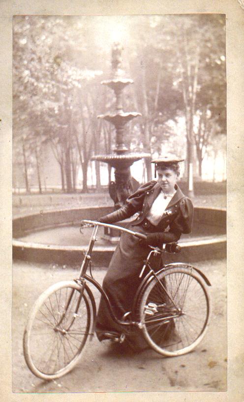
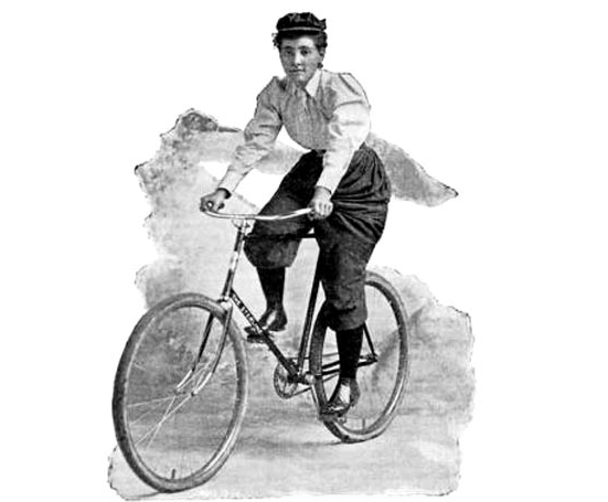
But everything changed when English inventor John Kemp Starley introduced the “safety bicycle” in 1885. With two wheels of equal size, a chain drive, and pneumatic tires, the safety bicycle was stable, easy to mount, and, crucially, with the downward sloping top bar, accessible to riders of all genders.
Woman with a safety bicycle, 1890s. (Photo credit: Wikimedia Commons).
In London, Canada, this technological breakthrough ignited a social revolution.
London’s Early Cycling Scene
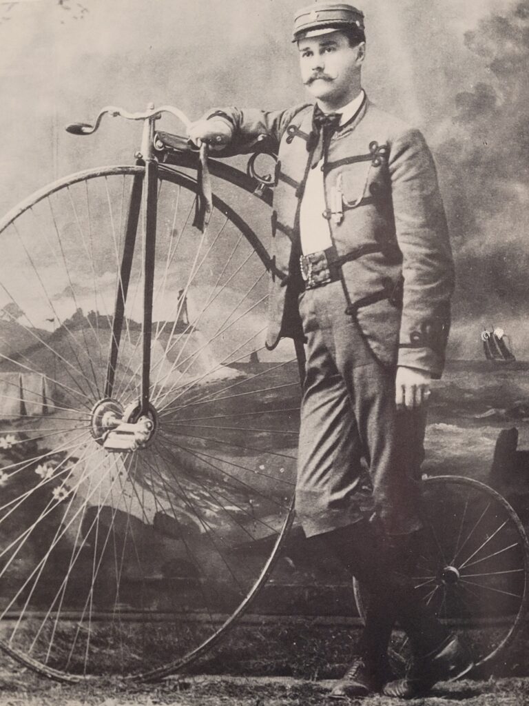
London’s cycling history runs deep. The Forest City Bicycle Club, one of the first cycling clubs to be organized in Canada, was founded on September 18, 1882, when a group of young men from London’s elite merchant and manufacturing classes gathered to legitimize this new and controversial pastime.
Here we see J.A. “Nip” Tune of the Forest City Bicycle Club posing with his favourite high-wheeler. (Photo credit: Archives and Special Collections, Western University)
Initially, cycling was an expensive and exclusive hobby. A single high-wheel bicycle could cost the equivalent of several months’ wages for a worker at a local furniture factory. But as bicycle manufacturing expanded and prices dropped, the sport became accessible to a much wider cross‑section of Londoners, including middle‑class women.
Women Join the Forest City Bicycle Club
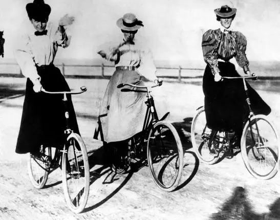
By the early 1890s, a small number of women began joining London’s premier cycling club, a change similar to that occurring in clubs across Canada. These pioneering women weren’t just passive participants.
An 1890 account in the London Free Press described the Forest City Bicycle Club’s annual 150‑mile tour between London and Goderich. Leading the party was Mr. and Mrs. Lamb on their tandem bicycle. The reporter noted that “the lady’s perseverance and strength surprised the male ‘cyclers.”
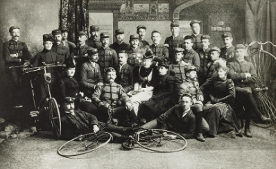
A group photograph of the Forest City Bicycle Club, taken around 1900 and now held in the collection of Museum London, shows female members posing proudly alongside their male counterparts, a visual testament to the club’s growing inclusivity.
Men and women alike pose for this Forest City Bicycle Club photo, circa 1900. (Photo credit: Museum London).
“Bicycle Face,” Bloomers, and the Battle for Rational Dress
Of course, progress was not without resistance. When women took to the streets of London on two wheels, they challenged deeply held Victorian gender norms. Learning to ride required middle‑class women to carefully navigate “a set of highly conservative and rigid gender norms.”
Physicians warned of a mythical ailment called “bicycle face,” a supposedly permanent expression of strain and exhaustion caused by cycling. Meanwhile, the most visible controversy surrounded clothing. Women cyclists abandoned heavy bustles and corsets for split skirts, bloomers, and “rational dress,” shorter skirts worn over voluminous trousers. The style was as practical as it was provocative. Women who adopted it reported being insulted and even pelted with rocks.
Annie “Londonderry” Kopchovsky, the first woman to cycle around the world in 1884-85, was an advocate of rational dress. (Photo credit: Cycling History).
In London, as elsewhere, the bicycle became a flashpoint in the broader debate over women’s rights. But for every newspaper column mocking the “New Woman,” there was a Mrs. Lamb pedalling steadily from London to Goderich, proving that perseverance and strength were not gendered traits.
Freedom, Mobility, and the “New Woman”
What the bicycle truly gave women was independence. For the first time, a woman could leave her home alone, travel freely through the city, and join mixed‑sex social excursions without a male chaperone. The bicycle provided “a freedom, mobility, and sense of adventure previously denied to them.”
Historian Glen Norcliffe notes that women first became active in Canadian cycling in 1890 and 1891, a direct result of the safety bicycle’s introduction. By the middle of the decade, cycling was being enthusiastically embraced by middle‑class women across the country, from young professionals in Toronto to trailblazers in small‑town Ontario.
Women riding bicycles, circa 1900. (Photo credit: Cycling History).
The figure of the “New Woman,” educated, independent, and free‑wheeling, became a cultural icon, celebrated by suffragists and satirized by conservative commentators. But the underlying message was undeniable: women on bicycles were here to stay.
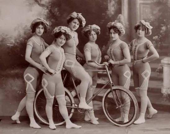
The Kaufmann Troupe of trick cyclists, looking very modern in their one-piece uniforms, circa 1900. (Photo credit: Cycling History).
From Victorian Riders to a Cycling Mayor: The Jane Bigelow Legacy
Fast‑forward to 1972. London elects its first female mayor, Jane Bigelow, a woman who embodied everything the 1890s “New Woman” movement had fought for. Bigelow, who served as mayor from 1972 to 1978, was an avid cyclist and a fierce advocate for active transportation. She often traveled by bike, sometimes with the family poodle Figgy riding in the carrier. She was also instrumental in the introduction of bicycle paths in London, promoting them as a way to protect the environment.
Mayor Jane Bigelow rode her bicycle everywhere, even to City Council and events where people expected her to arrive by car. (Photo credit: London Free Press).
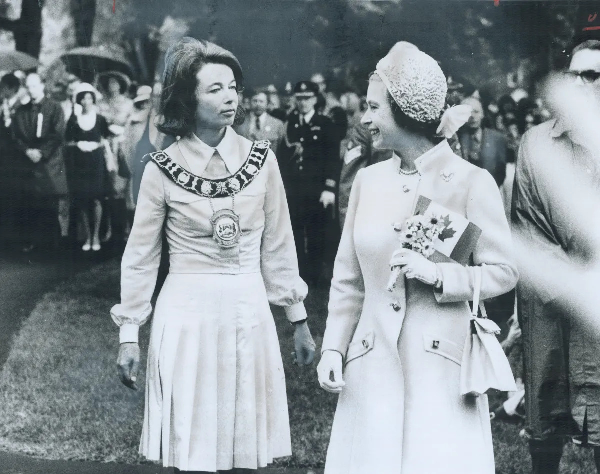
Bigelow was a trailblazer in every sense of the word. She didn’t just break the glass ceiling; she shattered it, becoming a mentor to the women who followed her into municipal politics, including Dianne Haskett, Anne Marie DeCicco-Best, and Joni Baechler. On a rainy June day in 1973, she famously bucked protocol by declining to wear a hat while greeting Queen Elizabeth II in Victoria Park, simply stating, “I never wear a hat”. It was a small act of defiance that perfectly captured her character.
Mayor Bigelow (minus a hat) with Queen Elizabeth II in 1973. (Photo credit: Reg Innell/Toronto Star)
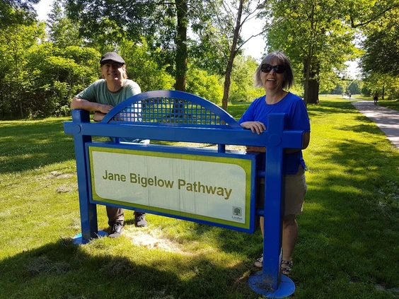
In 2018, on the occasion of her 90th birthday, the City of London officially named a section of its trail system the Jane Bigelow Pathway (located between Adelaide Street North and Wellington Road).
When the former mayor passed away in 2021, her children invited the community to walk the path in her memory, with an ice cream truck on hand, a nod to her sweet tooth. Her daughter Ann put it simply: “This is the passing of a dynamo”.
David and Ann Bigelow, adult children of London’s first female mayor, stand at the entrance to the trail that bears their mother’s name. (Photo credit: London Free Press).
London’s Legacy on Two Wheels
The next time you glide along the Thames Valley Parkway or join a group ride through downtown, spare a thought for Mrs. Lamb, the women of the Forest City Bicycle Club, and Mayor Jane Bigelow. They pedalled through insults, scepticism, and heavy Victorian skirts (and, in Jane’s case, the weight of protocol) to prove that a bicycle seat could be a seat of liberation.
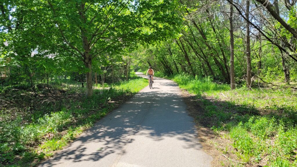
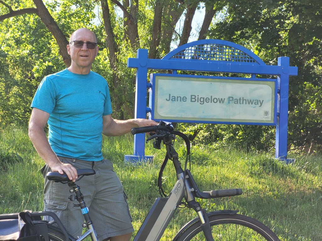
The author on the Jane Bigelow Pathway, which is now part of the 43-km-long Thames Valley Parkway. (Photo credit: Lawrence Durham).
Hi, I’m Lawrence, bicycle tour guide, storyteller, and proud chronicler of London’s two‑wheeled history. I believe every pedal stroke connects us to the past. From the cobblestone streets where the Forest City Bicycle Club once rolled, to the modern pathways that crisscross our beautiful city, London is a place where cycling has always meant freedom.
On my guided bicycle tours, we explore the hidden corners of the Forest City: the architecture, the nature, and the stories that make this place special.
Ready to ride into history? Small groups, big laughs, and a century of stories await you. Click here to learn more.
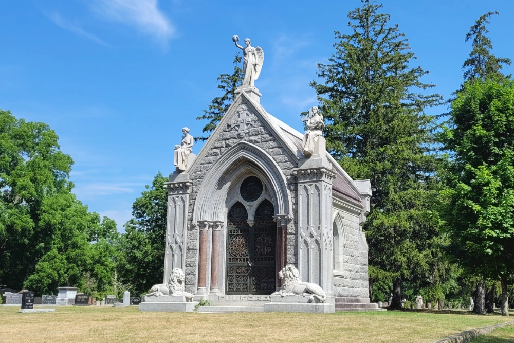
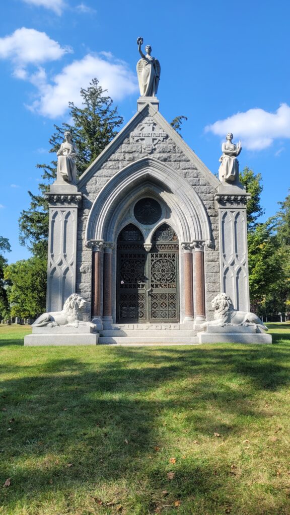
Did you know that one of the finest funeral monuments in Canada can be found right here in London?
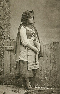
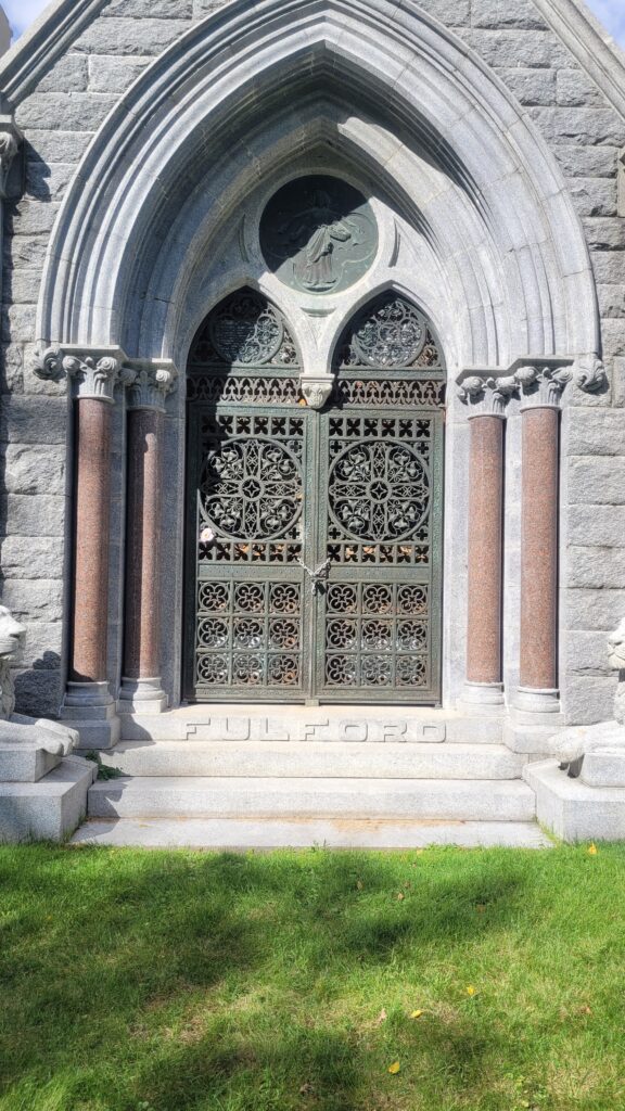
Known as the Fulford-Pixley Mausoleum, this ornate structure, made of granite and marble, contains the remains of Annie Pixley, a celebrated stage actress who captivated audiences across North America in the late 1800s.
Author’s Note: Unless otherwise indicated, all photos are by the author.
The mausoleum stands alone on a hill, separated from the remaining headstones in the cemetery.
But how did a world-famous actress who was born in New York and died in London, UK, come to be buried in London, Canada?
First, Who was Annie Pixley?
In her day, Annie Pixley was a bona fide star.
She began her career as a dancer but found her greatest fame in the title role of M’liss, Child of the Sierras, a theatrical adaptation of a Bret Harte story about a wild-hearted girl in a California mining camp.
The play was a blockbuster hit, and she performed it over two thousand times, touring from New York to San Francisco and becoming one of the highest-paid actresses of her era.
Her Connection to London, Ontario
Annie Pixley was married to Robert Fulford, who also acted as her manager. They had one son, Thomas.
Annie and her family frequently visited the London area, staying in Port Stanley, where they vacationed each summer for ten years.
Tragedy Strikes
Tragically, their son Thomas died while staying with relatives in Port Stanley in 1886. He was 12 years old. Unfortunately, Annie and Robert were away on tour at the time.
Devastated, they rushed back to Ontario and shortly thereafter laid him to rest at Woodland Cemetery in London.
While Annie tried to remain effervescent on stage, she never fully recovered. Seven years later, she died of “brain fever” in England while visiting relatives.
A Tribute to His Wife
Robert thought it only fitting that Annie, in death, should join her son in Woodland Cemetery.
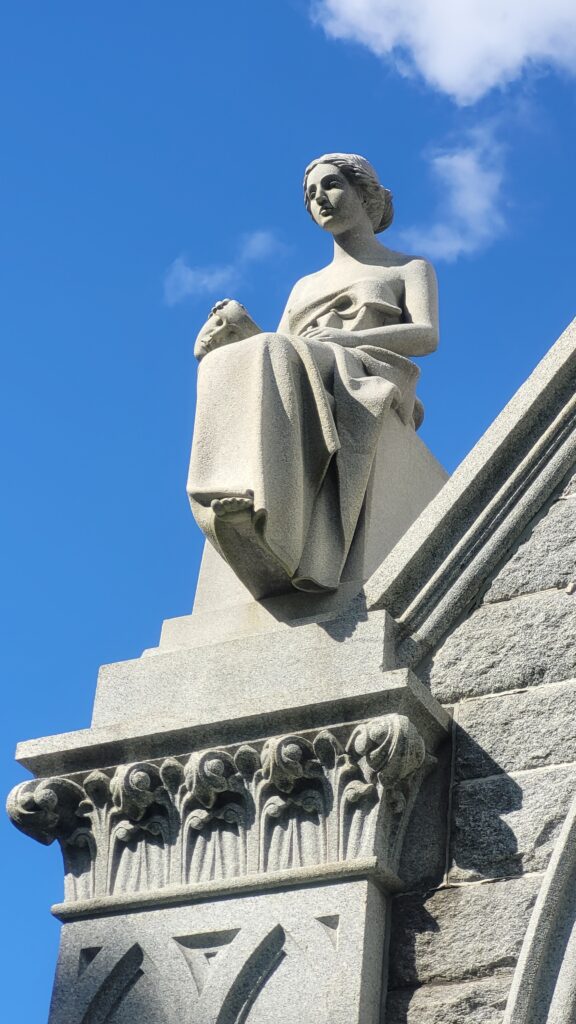
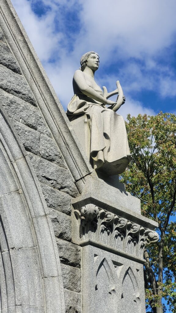
So he commissioned the construction of the elaborate Fulford-Pixley Mausoleum, which is considered one of Canada’s finest funerary monuments.
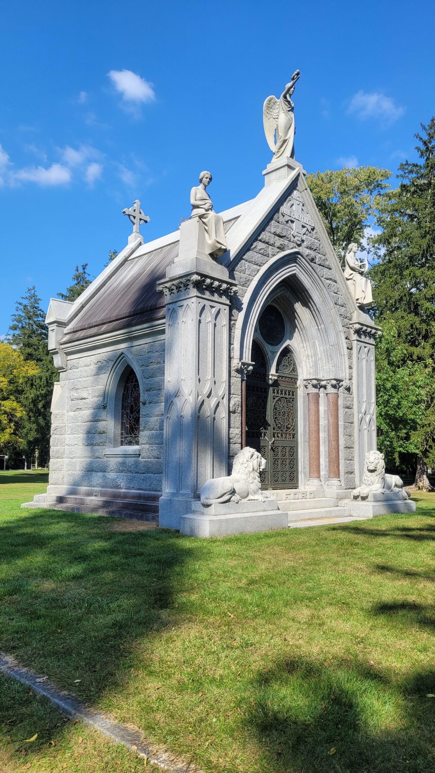
Solemn stone lions guard the entranceway. If this mausoleum were built with the same materials today, it would easily cost over a million dollars.
Annie’s husband commissioned celebrated Toronto sculptor, Walter S. Allward, to produce granite sculptures of Drama (left photo), Victory (top photo), and Music (right photo).
Left photo: Constructed from Barre granite and adorned with Italian marble, the building is a masterpiece of Victorian funerary art.
Photo on the right: Peeking through the ornate, solid bronze gates and delicate floral motifs, one can view the richly decorated interior, which holds a marble bust of Tommy and the reliquaries with his parents’ remains.
So, the next time you find yourself exploring London’s history, remember the name, Annie Pixley. She was an international star who, through a story of love and loss, became an everlasting part of the fabric of London, Ontario.
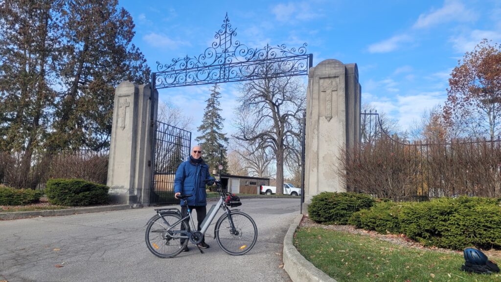
The author, just outside the gates to Woodland Cemetery.
Hi. I’m Lawrence – bicycle tour guide, storyteller, and proud Londoner.
I love shining a light on the hidden gems and interesting stories like Annie’s that make our city special. I can’t always promise a million-dollar mausoleum, but I can guarantee small groups, big laughs, and a fresh perspective on this wonderful city.
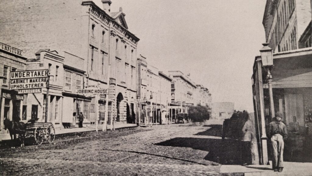
If you stroll down King Street in downtown London, Ontario, you’ll pass a bustling mall, coffee shops, and office towers. What you won’t see, unless you know where to look, is the birthplace of an industrial empire.
In 1852, on the very spot where shoppers now browse for shoes and smartphones, two brothers opened a modest tin smith shop. Within a generation, that tiny venture would grow into the largest stove manufacturer in the British Empire, a brand so trusted that the name “McClary” became shorthand for quality in kitchens everywhere.
Here is the tale of humble beginnings, clever risk-taking, and a legacy that still echoes through London’s streets.
From Tin to Iron: The McClary Brothers’ Gamble
John McClary’s start in life could not have been more ordinary, or more modest. Born on a farm south of London in 1829, the 11th of 12 children, John learned the tinsmith trade as a young apprentice from his older brother.
In 1852, at just 23 years old, he and his brother Oliver formalized their partnership as J. and O. McClary. Their first shop sat at the corner of King and Wellington Streets, at the very heart of the city. But John had bigger dreams than repairing pots and pans in a small tin shop.
He noticed that settlers streaming into Canada West (now Ontario) needed durable, efficient cooking stoves. Imported stoves were expensive and often delayed. So the McClary brothers added a small foundry to their operation, pouring their first cast-iron stoves by hand. It was a gamble, but one that would pay off spectacularly.
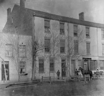
The original McClary tin shop was located at the corner of King and Wellington Streets. (Photo credit: Museum London)
Seizing the “Tariff of Bad Roads” and the Iron Horse
Two forces outside the McClarys’ control unexpectedly became their greatest allies.
First, there was what historians call the “tariff of bad roads.” In the mid-19th century, Canada’s muddy, rutted wagon trails made shipping heavy goods from the United States or Britain painfully slow and costly. Local manufacturers like the McClarys suddenly had a massive advantage: they could deliver a cast-iron stove to a farmhouse in a week, while an imported rival might take months.
Early pioneer roads were treacherous, bumpy, and muddy. (Photo credit: Wikimedia Commons)
Second, the Great Western Railway arrived in London in 1853, one year after the company opened its doors. The timing was perfect. McClary stoves could now be loaded onto boxcars and sent out west as fast as the railway companies could lay down tracks.
By the 1870s, a McClary wood-burner was warming kitchens from rural Ontario to the western prairie frontier.
In 1871, the company incorporated as the McClary Manufacturing Company… and never looked back.
The Famous McClary Stove
What made McClary stoves so beloved?
Reliability and variety.
The company produced everything from compact wood-burning ranges for small cabins to ornate, nickel-trimmed cookstoves for Victorian townhouses. As technology evolved, so did the McClarys: they added oil-fueled models, and later, electric ranges that were the envy of modern homemakers.
The McClary “Ladies Aid” wood stove, c. 1916. (Photo credit: Paul Feltz)
But stoves weren’t the whole story. McClary also became a leading producer of enamelware, tinware, copper pots, and pressed metal kitchen accessories.
And for cast-iron enthusiasts, McClary frying pans and skillets are still sought-after antiques today. Pick up a vintage McClary skillet at a flea market today, and you’ll feel the heft of 19th-century craftsmanship, a label that meant “guaranteed” long before modern warranties existed.
Top left: McClary No 9 Drip Top Spider. (Photo credit: Rick Beach)
Top right: Very rare (and heavy) McClary Sad Iron. (Photo credit: Worth Point)
Two Factories, One City
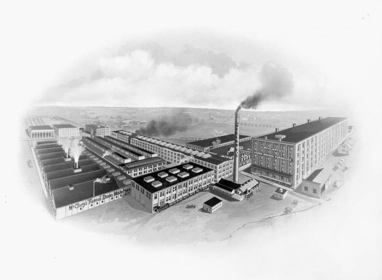
The original factory at the corner of King and Wellington Street soon expanded to take up more than one city block. (Photo credit: Dictionary of Canadian Biography)
After five decades, the exploding demand for stoves required that the company expand even further.
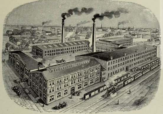
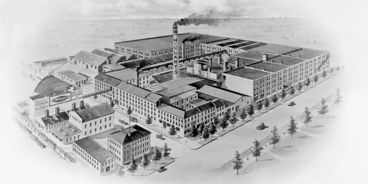
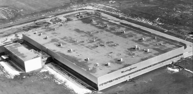
In 1903, McClary opened a sprawling new factory on Adelaide Street, just north of the Thames River. That red-brick complex soon rang with the clang of cast-iron moulds and the hiss of steam engines.
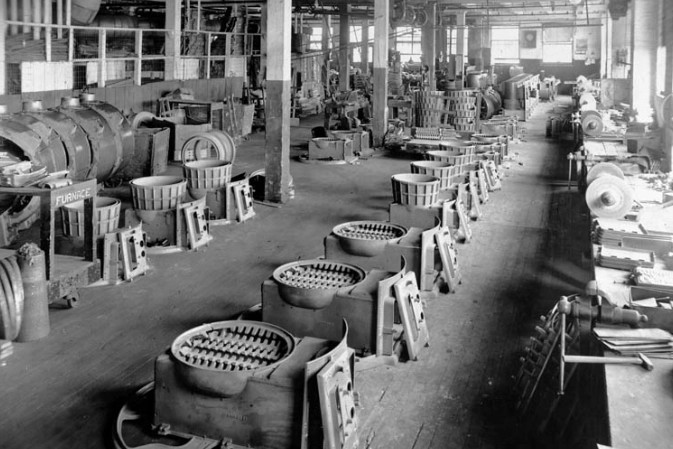
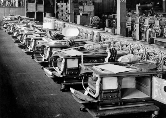
McClary wood-burning stoves, in the process of being manufactured, 1914-1918. (Photo credit: Library and Archives)The stove and furnace factory was located on Adelaide Street. (Photo credit: Dictionary of Canadian Biography)
At its peak in 1915, the McClary Manufacturing Company employed 1,500 Londoners. McClary’s was now the largest employer in the city and shipped stoves across the British Empire.
The GSW Merger and a Quiet Sunset
In 1927, facing increasing competition, McClary Manufacturing merged with four other companies to form General Steel Wares (GSW).
The McClary brand lived on for a time, but gradually the name faded from memory. GSW continued operating the McClary factories until the mid-1970s, when the last cast-iron stove rolled off the line.
But remnants of the McClary era still stand.
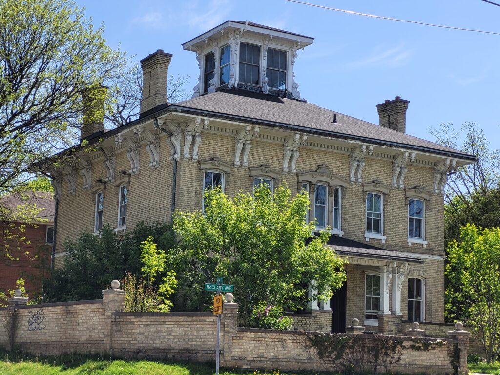
The McClary House at the corner of McClary and High Streets. (Photo credit: Lawrence Durham).
McClary House, a handsome yellow-brick home built around 1882 at 53 McClary Avenue, remains as a quiet monument to John McClary’s success.
And the McClary name itself lives on in street signs, antique shops, and in the memories of London’s old-timers.
Across McClary Ave are the two houses John McClary built for his daughters. (Photo credit: Lawrence Durham).
Why McClary’s Story Matters for Visitors Today
For the culture seeker, the traveller who loves industrial heritage, rags-to-riches stories, and the smell of cast iron in the morning, McClary’s legacy is a hidden gem.
And here’s the secret that bicycle tour guides know: history feels different when you move through it at the speed of a pedal stroke. Fast enough to cover ground, slow enough to notice the faded ghost signs on old brick buildings.
The author, in front of the old McClary mansion. (Photo credit: Lawrence Durham).
Hi, I’m Lawrence – bicycle tour guide, storyteller, and proud London history nerd. I help curious folks like you discover the hidden layers of our city, from the seat of a bicycle (the best seat in the house). On my tours, we roll past the echoes of McClary’s foundries, share a laugh or two, and connect the dots between 1852 and today. Small groups, big stories, and a whole lot of fun.
You don’t need Train Platform 9 ¾ to find magic in Southwestern Ontario.
Here’s the secret that even many Londoners don’t know: the architectural makeup of Western isn’t an accident. It is one of the most visually cohesive Collegiate Gothic campuses in Canada, a deliberate, decades-long architectural love letter to medieval Europe, hiding in plain sight on the banks of the Thames River.
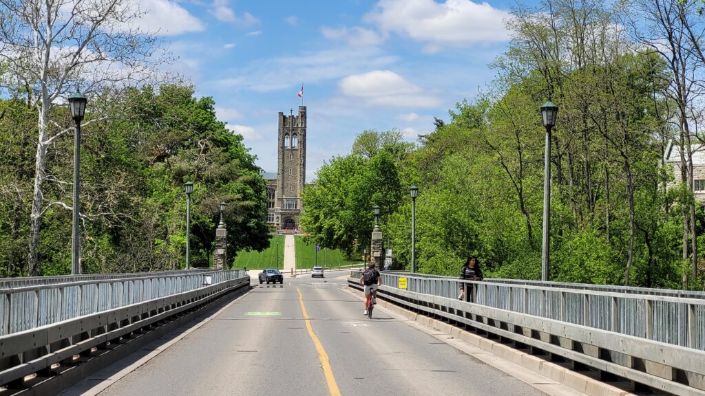
This historic stone bridge on University Drive is the gateway to the main campus. (Photo credit: Ben Durham).
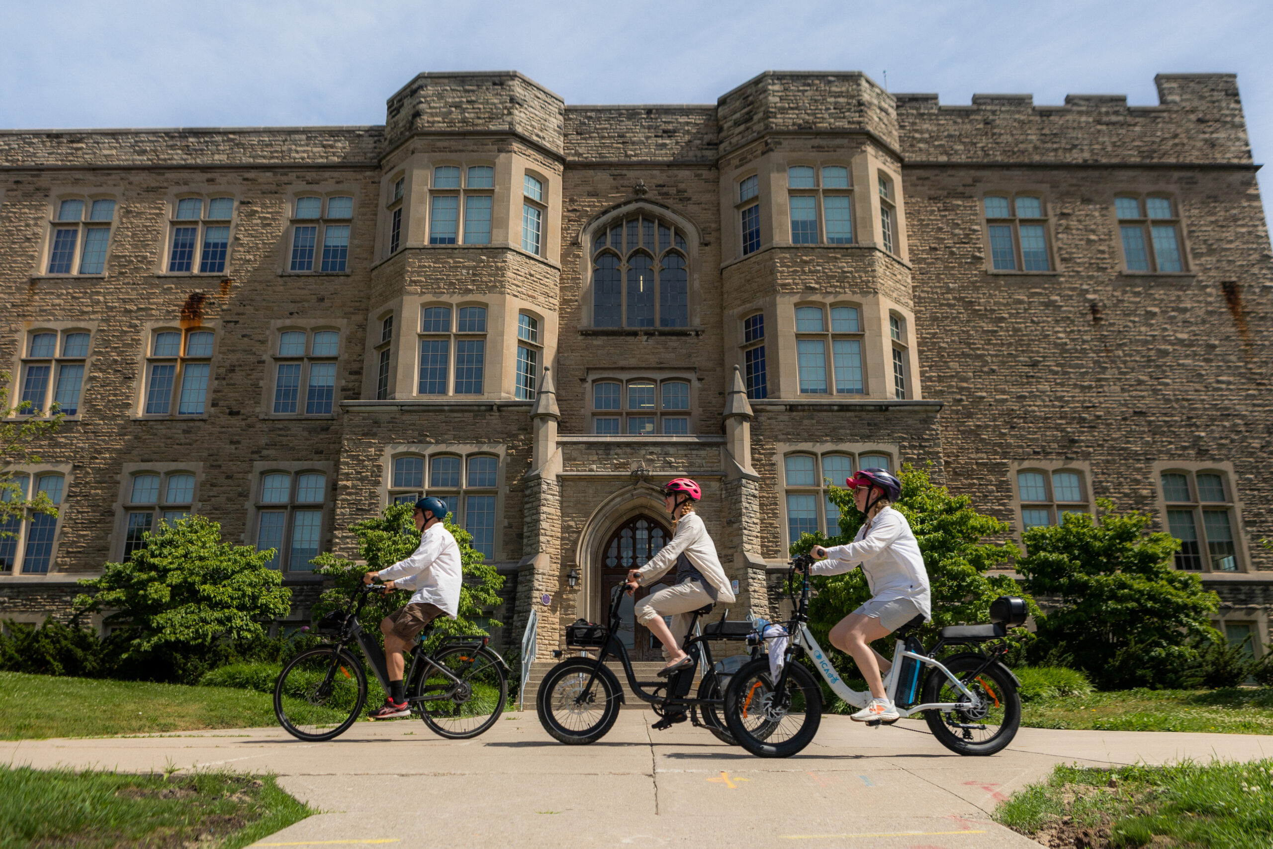
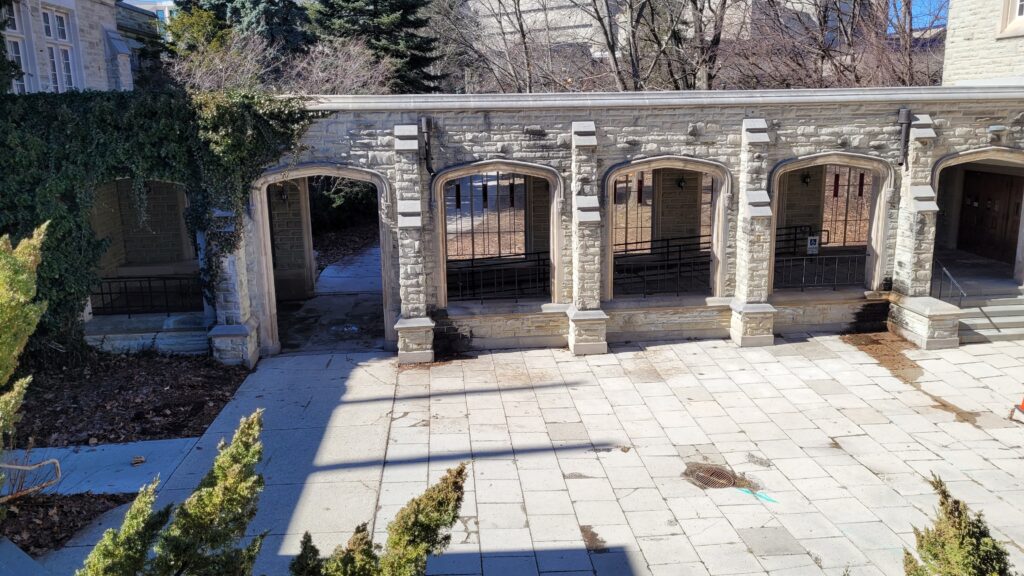
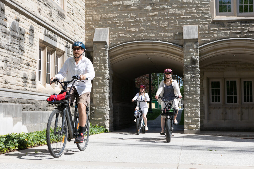
All you need to do is pedal your bicycle up the gentle hill toward Western University in London. Suddenly, the modern city falls away. Limestone towers rise against the sky. Stone arches cover quiet walkways. And if you squint just a little, you could be forgiven for thinking you’ve stumbled onto the set of a Harry Potter film.
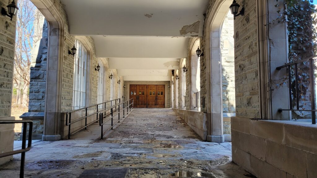
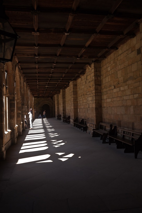
A quiet covered walkway, known as a cloister, connects two buildings on campus. (Photo credit: Lawrence Durham).Interior view of the same cloister. Notice the similarity in how it looks and feels compared to the example in the UK, shown below. (Photo credit: Lawrence Durham).This cloister at Durham Cathedral was used in filming scenes for the first two Harry Potter films. (Photo credit: Les Bessant).
Hogwarts vs. Western: The Architectural Kinship
Let’s start with the obvious question: What style is Hogwarts?
The Harry Potter films borrowed heavily from real-world history. The filmmakers blended Medieval, Gothic, and Gothic Revival architecture, mixing the pointed arches of Gothic cathedrals with the heavy, circular forms of Norman Romanesque and the turreted charm of Scottish Baronial castles.
Real-life inspirations included Durham Cathedral, Gloucester Cathedral, and, most relevant to us, the ancient colleges of Oxford and Cambridge.
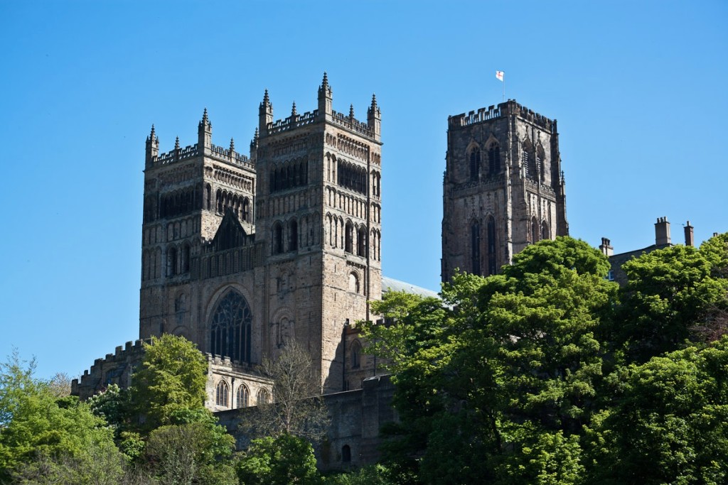
Hogwarts’ twin square towers (minus the spires) were almost exact replicas of the twin square towers of Durham Cathedral, shown above. (Photo credit: Les Bessant).The Middlesex County Memorial Tower is similar in design to the square towers of Hogwarts and Durham Cathedral. (Photo credit: Lawrence Durham).
Western University’s architects were doing the exact same thing as rivalist architects elsewhere, at the exact same time, for the exact same reason: to make a young institution feel ancient, wise, and worthy of respect.
Author’s Note: The remaining photos were all taken by the author, unless otherwise indicated.
How Western Compares Nationally
Canada has several beautiful university campuses, but Western sits in the top tier for a trio of reasons that go beyond a single pretty building.
1. Consistency of Style
Many Canadian universities have a “Gothic quad” surrounded by later architectural chaos. Not Western. From the 1920s through to 1960, the university used Collegiate Gothic as its baseline architectural identity. Across 1,100 acres, the core campus speaks one visual language: stone, tower, arch, tradition.
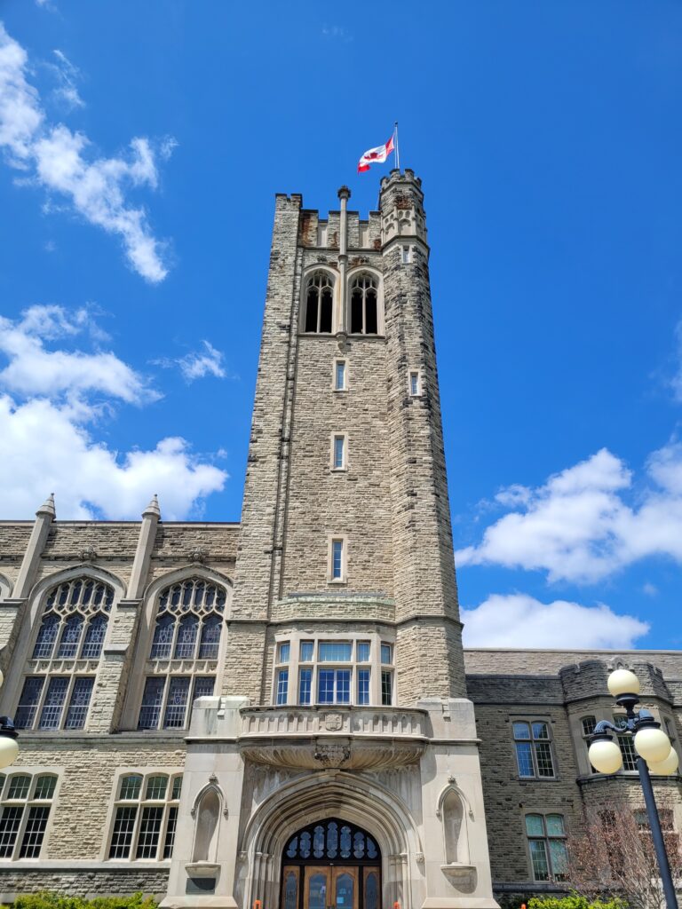
Notice the pointed arches, massive presence, and detailed stone work at the entrance to University College, built in 1922. Riding among these buildings, you could be forgiven for thinking you had been transported to another time and place.
2. The Power of the Signature Landmark
Every great campus needs a defining exclamation point. For the University of Toronto, it might be Hart House. For the University of Saskatchewan, the iconic College Building.
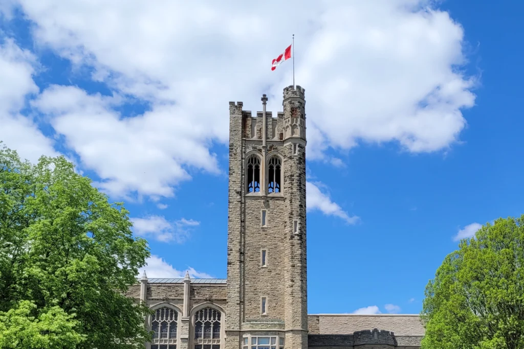
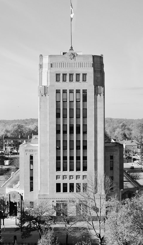
For Western? The Middlesex County Memorial Tower at University College. At 126 feet, it is one of the most recognizable academic landmarks in Canada, a stone exclamation mark that has welcomed students for nearly a century.
This view of the Middlesex County Memorial Tower greets everyone crossing the Thames River.Although the belfry was explicitly designed to accommodate a carillon when the building was constructed in the 1920s, it was ultimately never installed.
3. Longevity of the Era
Here is where Western truly surprises architecture buffs. Most of North America abandoned Gothic stonework immediately after World War II, rushing headlong into modernist concrete.
Western said, not so fast.
The university continued building true stone Collegiate Gothic structures well into the modern era, culminating in Middlesex College in 1959. That is remarkably late for this style, and it gives Western a seamless, timeless feel that other campuses can only envy.
A student walking to Middlesex College, seen in the distance.The spire on the tower of Middlesex College was a regular feature of Gothic architecture and fits in perfectly with the fictional world of Hogwarts.The clock tower at Middlesex College has a five-bell carillon; however, it was decommissioned in 2007 and is no longer functional due to the high cost of refurbishment.Notice the use of multiple spires in this rendering of the fictional Hogwarts Castle by Hendricks Architecture.
The Architect and His Palette
The man responsible for much of Western University’s vision was architect John M. Moore. He didn’t just copy Europe; he adapted it for Southwestern Ontario.
Moore’s architecture at Western leans heavily on:
Indiana limestone trim (that creamy, warm stone you see around windows and doorways)
Grey cut stone for the main wall surfaces
Heavy buttresses that look structural but often serve a decorative purpose
Crenellated rooflines (those castle-like notches that make you feel safely fortified)
Notice the pointed arches over the doorway and centre window, as well as the crenulated roofline to the upper right.
Walk or bike through the campus core, and you’ll see these elements repeated with loving consistency. It’s architecture as a unified symphony, not a chaotic collage.
Architectural Highlights & Hidden Quirks
Beyond the broad strokes, Western rewards the curious visitor with delightful surprises.
The Carved Grotesques
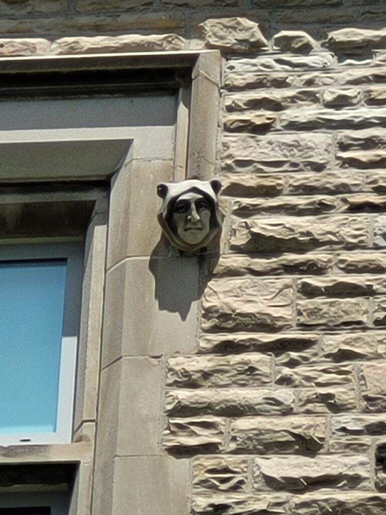
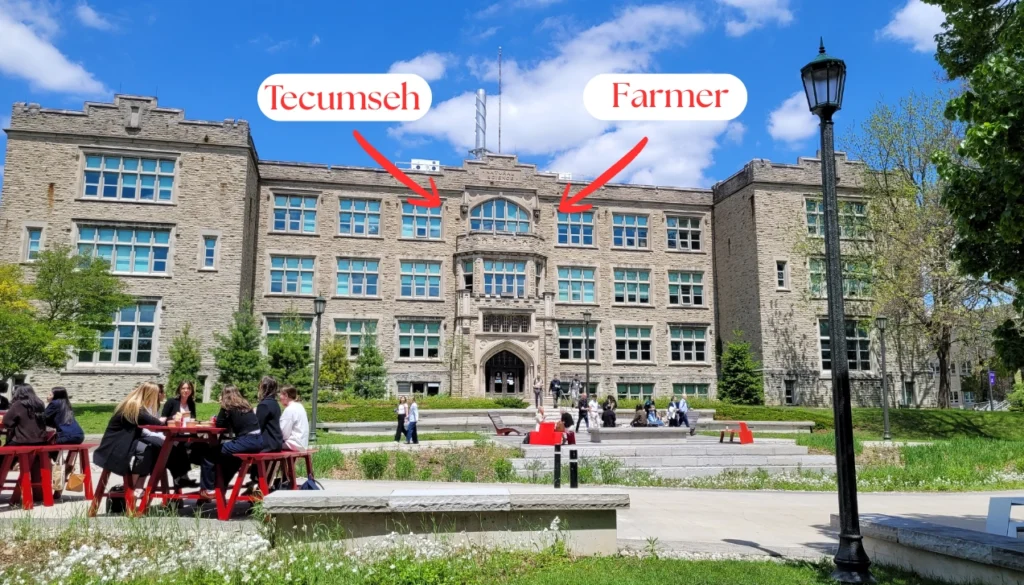
On the Physics and Astronomy Building (completed in 1924), look up.
Waaaay up!
The original stone carvers had a sense of humour, and a sense of place. Hidden among the Gothic tracery are playful carved faces and figures, including a Yorkshire farmer (a nod to the masons’ origins) and an image of the Indigenous leader Tecumseh. It’s a small, stone-cold reminder that even medieval-inspired architecture can tell a very Canadian story.
Left photo above: Tecumseh.
Right photo above: Yorkshire farmer.
The Physics and Astronomy Building.
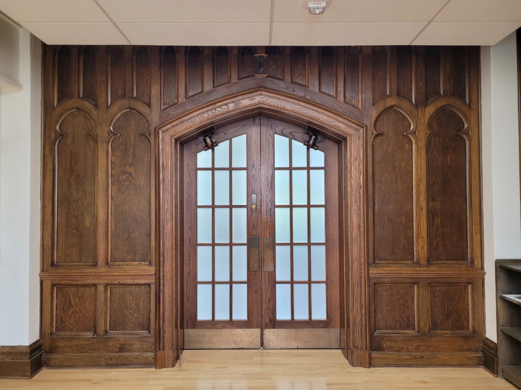
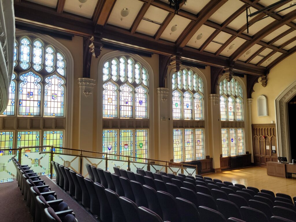
Global Heraldry Inside Conron Hall
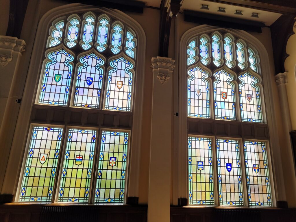
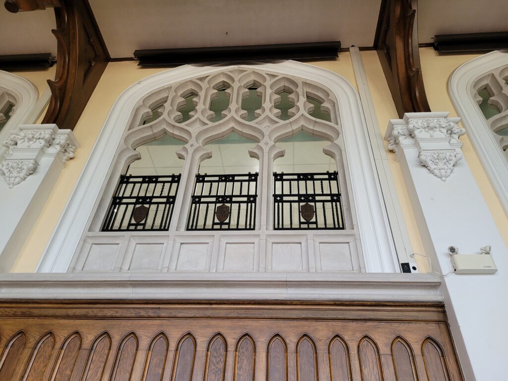
Step inside Conron Hall (part of University College) and you’ll find something that feels ripped from a wizarding library. Intricate stained glass windows display coats of arms and shields from the world’s great historic universities. Oxford, Cambridge, Harvard, and others are represented, physically anchoring this London, Ontario campus to the global academic tradition. It’s a quiet, glorious room on the third floor that many busy students rush past.
Heavy oak doors leading into Conron Hall.Inside Conron Hall.Close-up of heraldic shields on stained glass windows.Elegant carved woodwork and stonework adorn the walls.
The Modern Compromise
No architectural story is without tension.
In the late 1960s, Western, like almost every North American university, experienced an enrollment boom that demanded quick, affordable space. The result? A sharp, temporary break from tradition.
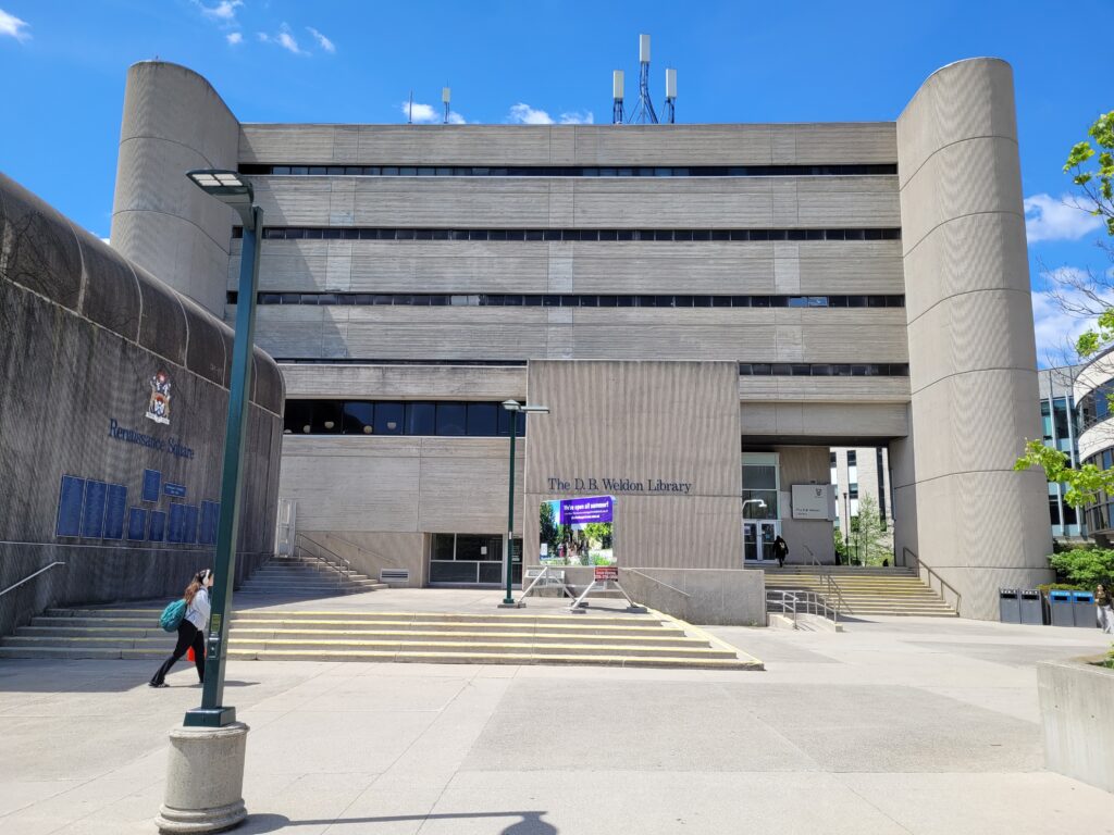
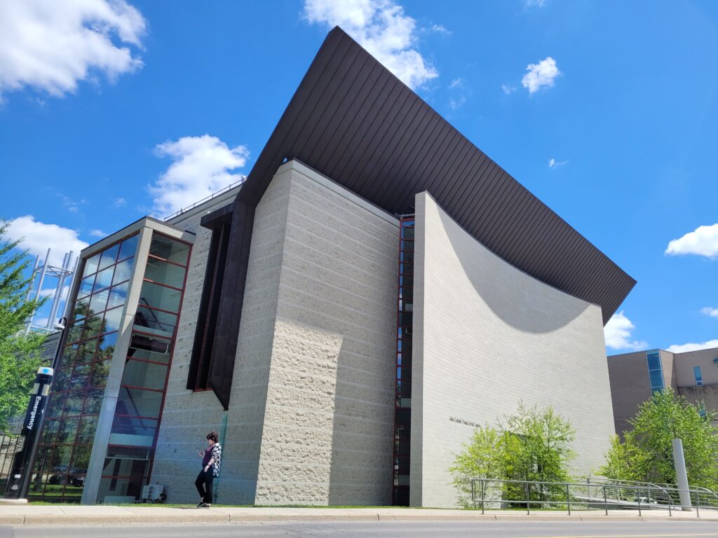
Suddenly, sharply-planed Brutalist concrete structures appeared alongside the limestone. The D.B. Weldon Library and the John Labatt Visual Arts Centre are prime examples: heavy, geometric, functional. They are not ugly, but they are certainly different.
The D.B. Weldon Library. The John Labatt Visual Arts Centre.
Protecting the Gothic Horizon
Here is the uplifting conclusion to that tension. Western’s Campus Master Plan now enforces strict protections for the historic core. Any new building must respect the visual weight and focal point of University College Hill. The tower remains dominant. The stone remains honoured. And the Gothic horizon is protected for future generations of students and curious bicycle tourists.
Everywhere you look, the architecture has a consistent look and feel.
Why This Matters
You are not a casual traveller. You are the kind of person who reads plaque texts, looks up at grotesques, and wants to know why a place looks the way it does.
Western University offers a rare thing: a complete, walkable (or bikeable) lesson in early 20th-century academic ambition. The founders of this school did not want a frontier college. They wanted a “university on the Thames” that could stand beside Oxford and Harvard. They built their dream in stone, and it worked.
Come See It for Yourself
The best part? You don’t need permission. Western’s campus is public, welcoming, and free to explore. The university is proud of its heritage, and Londoners love sharing it.
Secret pathways wind quietly between massive stone buildings.
So grab a coffee, hop on a bike, and spend an afternoon wandering the courtyards, spotting Tecumseh in stone, and standing at the base of that 126-foot tower. It’s not Hogwarts, but for one afternoon, it might feel just as magical.
The author, standing in front of University College.
Hi. I’m Lawrence. Bicycle guide, storyteller, and lover of historical architecture.
I guide people through the quiet pathways of Western’s Collegiate Gothic campus, truly the highlight of one of our signature tours.
On a bicycle, you can cover the entire architectural arc of the university in one relaxed afternoon: from the 1920s limestone of University College to the 1959 stone of Middlesex College, past the Brutalist concrete of the 1960s, and back to the protected Gothic horizon.
Ready to discover London’s hidden wizarding world? Click here to learn more about my tours. Small groups, big laughs, and absolutely zero required magic skills, just a love for good stories and great architecture.
London’s nickname as ‘The Forest City’ just became more official after the Canadian Institute of Forestry named it the Forest Capital of Canada for 2026.
However, being known for its forests didn’t start as an honour.
Originally, it was an insult.
The Joke That Stuck
In the late 18th century, Governor John Graves Simcoe had grand visions for this area. He dreamed of a prosperous capital in Upper Canada, a place he would name London after the great metropolis back home in England. But when early surveyors and visitors arrived at the designated site, they found not a city, but a dense, almost impenetrable wilderness.
The British government was likely amused by the disconnect between Simcoe’s grand ambition and the very modest reality. They began to mockingly refer to the settlement as “The Forest City.” It was a sarcastic jab at a town that was little more than a remote clearing in the middle of nowhere. Other names of the era, like “London-in-the-Bush,” reinforced the idea that this was an isolated outpost where visitors had to clamber through thick woods just to reach the village.
For decades, the nickname was a gentle slap in the face, a reminder of how far the city was from its intended glory.
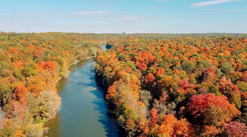
Aerial view of the Thames River in the autumn. (Photo credit: Travis Dolynny/CBC)
Growing Into the Name
By 1871, much of the original forest had been cleared for development, and London had lost its defining feature: its forest.
Looking north from the Thames River, you get a view of Labatt Brewery and City Mills (before 1874). Notice the lack of forest canopy, as clear-cutting forests to make way for industry was standard practice at that time. (Photo credit: Western Archives, Labatt Brewing Company Collection, AFC 101)
In a visionary move, the London city council at the time launched a massive campaign to buy and plant 15,000 trees (at 25 cents each) along city streets and in Victoria Park. It was one of Canada’s first large-scale municipal tree-planting initiatives, and it marked the moment London began to embrace its identity.
What was once an insult slowly became a promise. Londoners took stewardship of their urban forest seriously, and over the following century, the city was transformed into the lush, green landscape we see today.
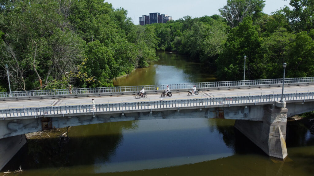
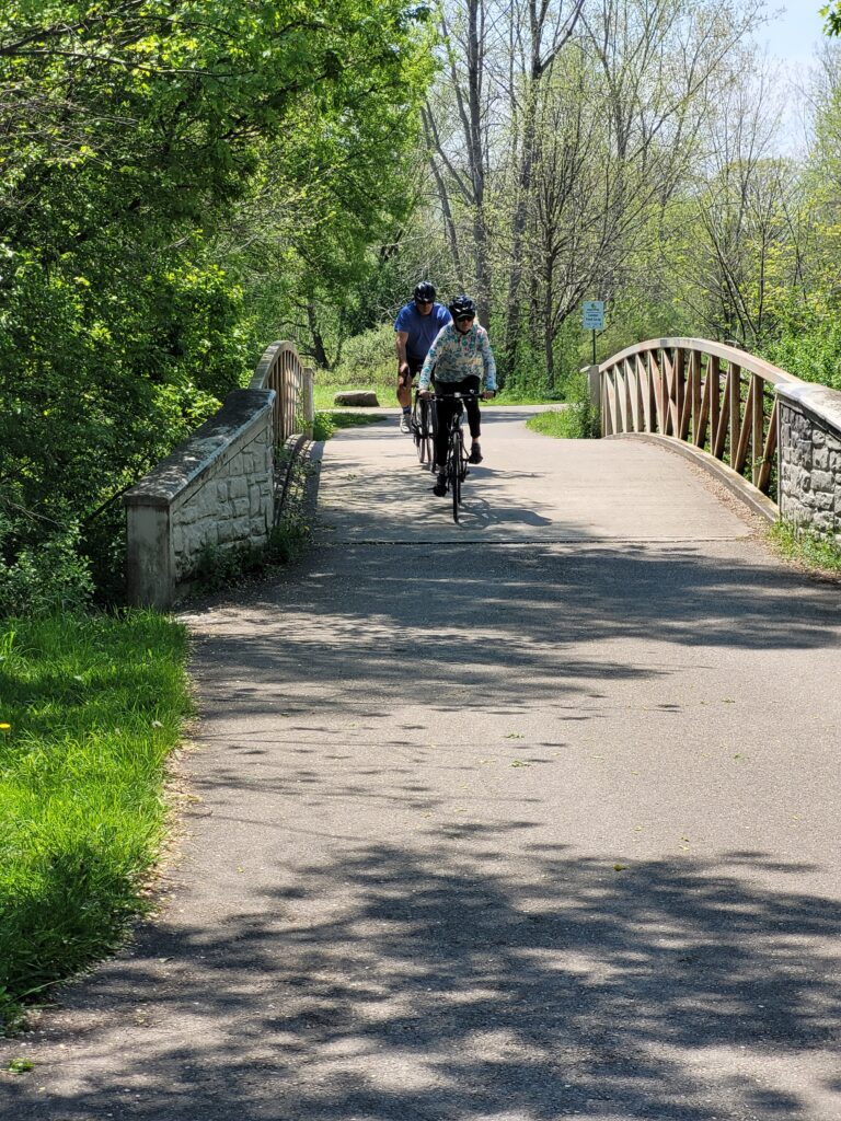
The Thames Valley Parkway, a multi-use pathway that began in the 1970s, now runs for 43 km along all three branches of the Thames River. (Photo credit: Lawrence Durham).
The Forest Capital of Canada 2026
Fast forward to 2026, and the narrative has come full circle. Being named the Forest Capital of Canada celebrates London’s leadership in forest conservation and urban forestry.
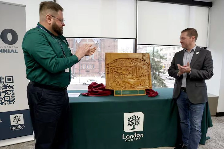
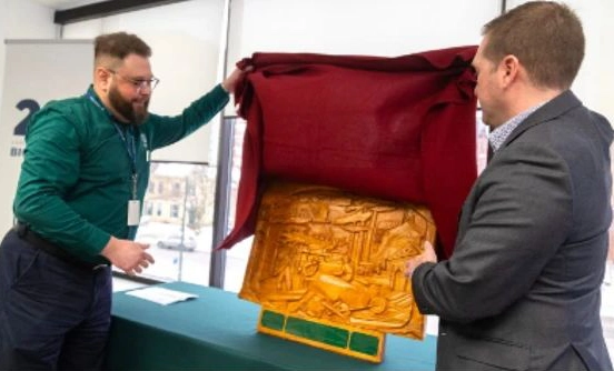
Paul Yeoman, London’s director of parks and forestry, and Mayor Josh Morgan unveil a commemorative Forest Capital of Canada plaque at London City Hall. (Photo credit: Mike Hensen/The London Free Press)
This isn’t just a ceremonial title. It reflects decades of deliberate strategy and community commitment. The city currently boasts an extensive urban forest of roughly 8.4 million trees, covering 27% of its urban area. But we’re not stopping there. The long-term goal is to increase that canopy cover to 34% by 2065, ensuring that London remains a verdant sanctuary for generations to come.
A London resident showing a tree some love. (Photo credit: ReForest London).
For visitors, this means that whether you’re strolling through downtown or exploring a residential neighbourhood, you’re never far from the calming presence of a mature tree.
One of the scenic bridges crossing over the many streams and creeks along the Thames River Parkway (Photo credit: Lawrence Durham).
A City of Strategies and Protections
London’s modern reputation as a forest leader isn’t accidental. It is supported by a robust framework designed to protect, manage, and expand our green infrastructure. People who appreciate thoughtful urban planning will find much to admire here.
Key initiatives include:
The Urban Forest Strategy: A guiding document that shapes how we protect and enhance our green spaces.
Tree Protection By-law: Consolidated tree protection laws ensure that mature trees are preserved, even as the city grows.
These policies work together to safeguard the forest that defines London’s character.
As the 2026 Forest Capital of Canada, London will now play host to a year-long series of tree-themed events, from tree giveaways to educational talks. (Photo credit: ReForest London).
The Heart of the Effort: Community and Collaboration
One of the most compelling aspects of London’s forest story is the degree of community involvement. Because a significant percentage of the city’s trees are on private property, the success of the urban forest depends on residents, non-profits, and businesses working together.
ReForest London is a cornerstone of this effort. This passionate organization runs planting and growing programs, hosts the Million Tree Challenge, and operates a community tree nursery at the Westminster Ponds Centre. Through events, volunteers, donors, and sponsors, they are putting trees in the ground and cultivating a culture of environmental stewardship.
A young family helps plant a tree in a park as part of the Million Tree Challenge. (Photo credit: ReForest London).
Similarly, the London Environmental Network has a vision that aligns perfectly with the city’s official goals: to see London known as one of the greenest and most resilient cities in Canada.
Facing the Future: Challenges and Resilience
Of course, maintaining a healthy urban forest is not without some obstacles. Understanding these challenges adds a layer of appreciation for the green spaces we enjoy.
London’s trees face threats from:
Climate Change: Shifting weather patterns and extreme events put stress on tree populations.
Urban Growth: Balancing development with preservation requires careful planning.
Invasive Pests: Species like the Emerald Ash Borer and Gypsy Moth have posed significant risks to the city’s tree diversity.
Despite these obstacles, the city remains resilient.
Located in the Carolinian Forest region, one of the most biodiverse zones in Canada, London benefits from a rich natural inheritance. A focus on diversity means planting native species to ensure that the forest can adapt and thrive even as new challenges emerge.
London sits at the northern edge of the Carolinian Forest, a vast deciduous forest that extends southward, all the way to the Carolinas. (Photo credit: Lawrence Durham).
Experience the Forest Up Close
For Londoners, the forest isn’t just a backdrop; it’s an experience.
Whether you want to explore more than 290 woodlands or 21 Environmentally Significant Areas located within our urban growth boundary, wander through Victoria Park, or simply enjoy a coffee beneath a century-old maple, the forest is waiting to be discovered.
The author, riding on a rail trail in a virtual tunnel of trees. (Photo credit: Lawrence Durham).
Hi. I’m Lawrence, bicycle tour guide, storyteller, and proud Londoner. I’m on a mission to share the surprising stories and hidden green spaces that make this city special. If you’d like to experience the Forest City from the best seat in the house (a bicycle seat, obviously), I’d love to show you around. Click here to learn more! Small groups, big laughs, and plenty of tree-lined routes await.
Photo credit for the featured cover photo: City of London.
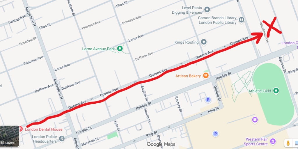
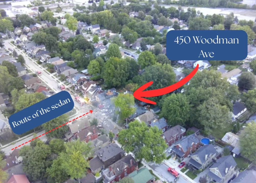
At 9:30 pm on a warm summer evening in 2019, a sedan came barrelling down Queens, going the wrong way on a one-way street.
When it got to a T-intersection, it had nowhere else to go. It slammed into the front of a small brick house at full speed.
The driver was a 23-year-old woman who was later found to have a blood alcohol level nearly three times the legal limit.
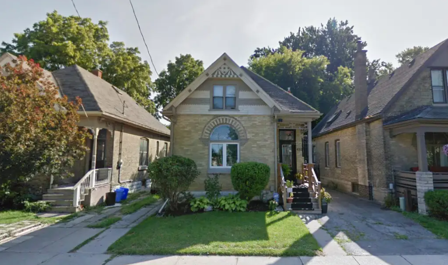
The fateful route taken up Queens Ave. (Created with Google Maps) 450 Woodman Ave, before the explosion. (Google Maps street view).
The impact was so violent that witnesses said the rear of the car lifted into the air. The crash severed the home’s natural gas line, creating a ticking time bomb.
A 15-Minute Race Against the Clock
First responders flooded the scene immediately. Neighbours didn’t wait for instructions. Seeing the driver unconscious behind the car’s locked doors, local residents grabbed some bricks and smashed the windows to try to pull her to safety.
When firefighters arrived on the scene, they knew that they had less than 15 minutes before their worst fears were realized.
Evacuations began instantly. Within minutes, crews were knocking on doors, pulling sleeping families from their beds, and rushing them to safety. But gas had already filled the void beneath the home.
Then came the blast.
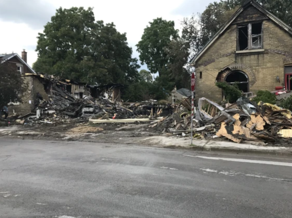
The explosion levelled 450 Woodman Avenue, completely wiping it off the map. The shockwave knocked nearby emergency personnel off their feet. It shook homes blocks away. The blast was so powerful that it registered on infrasound sensors 23 kilometres north of the city, near Elginfield, Ontario.
Author’s note: The following photos are all from news coverage by the London Free Press, unless otherwise stated.
Firefighters from across the city rushed to contain the flames.Concerned residents and curious bystanders alike quickly gathered to watch the blaze.
The Immediate Aftermath
In the hours that followed, the true scale of the response became clear.
100 homes were evacuated.
Natural gas was shut off to more than 50 properties.
12 homes were damaged, 3 beyond repair.
4 first responders (2 police officers and 2 firefighters) were injured but survived.
Over the first 15 hours, 12 of London’s 14 fire halls were involved.
23 of the department’s 27 fire apparatuses attended Woodman Avenue.
60 firefighters came and went, extinguishing hot spots and sifting through the rubble.
Dozens of displaced residents spent the early morning hours at an emergency centre, before the city moved them to hotels.
Early estimates put the cost of the destruction in the tens of millions of dollars. It was, by any measure, a catastrophic event.
Aerial shot of the path the car took prior to striking 450 Woodman Ave.Aerial view showing fire hoses still spraying the roofs of nearby houses the next morning. Fire officials survey the damage, while police officers keep people back.Concerned residents, watching from behind police caution tape.450 Woodman Ave was no more. The homes on both sides were later slated for demolition.
Justice and Accountability
The driver was arrested the night of the incident. She later pleaded guilty to four counts of impaired driving causing bodily harm. In February 2021, she was sentenced to three years in prison, a sobering reminder of the real-world consequences of impaired driving.
But for the residents of Old East Village, the court case was a footnote. The main story was always about going home.
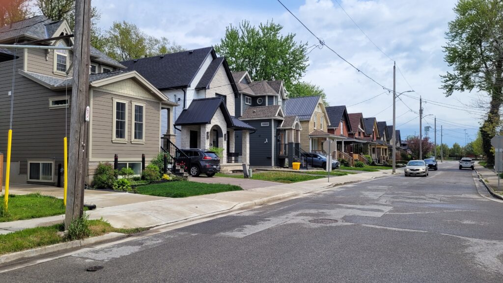
The Rebuild
If you visit Woodman Avenue today, you won’t see a scarred wasteland. You’ll see new buildings standing proudly beside restored heritage homes. You’ll see front porches with flower baskets, kids playing on driveways, and neighbours waving at each other.
The explosion didn’t destroy the spirit of Old East Village – it proved its durability.
In the months following the blast, the city and local developers worked closely with displaced homeowners. Fundraisers popped up at local pubs. The neighbouring community centre (just a short walk away) became a hub for recovery meetings. Strangers donated furniture. Volunteers gutted smoke-damaged basements.
Woodman Avenue today. (Photo credit: Lawrence Durham)
Why This Matters for Your Visit to London
If you’re reading this from Toronto, Vancouver, or even abroad, you might wonder: Why would a bicycle tour company write about a gas explosion?
Because history isn’t just about the pretty parts. Great cities are defined by how they react to the ugly parts.
London has a deep history of resilience.
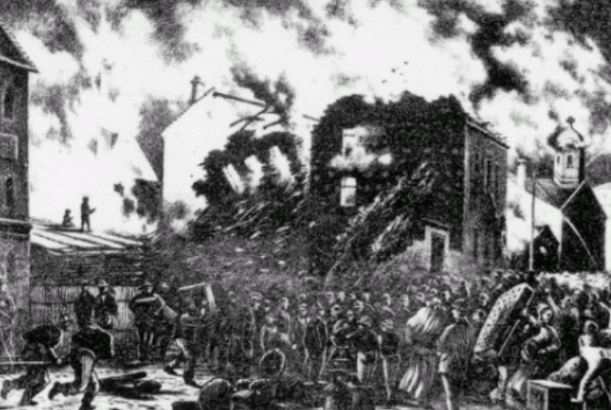
Did you know that in 1845, after the Great Fire of London burned much of the original town to the ground, citizens rebuilt it so quickly that within two years, London was named the district capital? The same energy was on display following the gas explosion of 2019.
When you cycle through Old East Village today, you’ll pass through a neighbourhood that has survived deindustrialization, economic shifts, and yes, a literal explosion.
And yet, the coffee shops are busy. The Western Fair Farmers’ & Artisans’ Market (just a block away from Woodman) is a weekend institution. The murals on Dundas Street tell stories of hope.
That survival instinct is part of London’s charm.
Author, in front of 450 Woodman Ave in 2026. (Photo credit: Lawrence Durham).
Hi. I’m Lawrence—bicycle tour guide, local history nerd, and proud Londoner.
I tell you this story not to scare you, but to impress you. London isn’t a city that breaks easily. It’s a city that buckles, takes a deep breath, and then rebuilds with better windows and a stronger foundation.
When you join me on a tour, we don’t just ride past buildings. We ride past stories.
We keep our groups small, our laughs big, and our pedals steady.
So come see the real London. The one with scars, smiles, and spectacular bike lanes. Your next adventure is waiting. Click here to book a tour. Let’s roll through history together.
Why would the United Nations Educational, Scientific and Cultural Organization, the same body that designates World Heritage sites like the Pyramids of Giza, choose a mid-sized city in Southwestern Ontario over Canada’s biggest metropolises?
The “Super Power” of Being Smaller
It’s tempting to assume that a UNESCO music title would naturally go to Toronto, with its massive concert venues and international star power, or Montreal, with its legendary jazz festival and vibrant indie scene. But UNESCO’s Creative Cities Network isn’t just about size, it’s about integration. It’s about how deeply music is woven into a city’s identity, its education system, its economy, and its daily life.
Here, London’s smaller size becomes its superpower.
Unlike sprawling metropolises where culture can feel fragmented, London offers something increasingly rare: a walkable, connected music ecosystem where venues, educators, and artists actually know each other.
The Perfect Step Up For Artists
What makes London truly special for musicians and fans alike is our ecosystem of venues. Unlike massive metropolitan centers with a few impersonal arenas, London boasts what industry insiders call a perfect “venue ladder.”
As of 2019, the city supported a diverse mix of 53 live music venues, including taverns, concert halls, and a 9,100-capacity arena.
Musicians playing in front of a live crowd on Dundas Street on a warm summer night. (Photo credit: London City of Music).
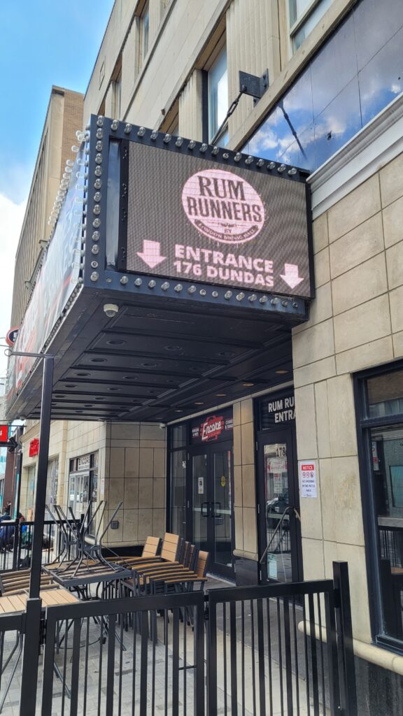
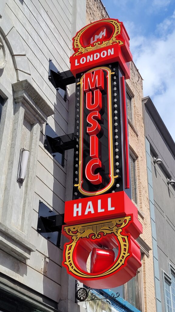
An artist could get their start at a local bar, then advance to a club like Rum Runners (capacity 350), recognized as Small Club of the Year by the Canadian Live Music Association in 2024. Next, they could move up to the London Music Hall (capacity 1,600) or Centennial Hall (capacity 1,637 ), and eventually headline Canada Life Place (capacity 9,100).
Top left photo: Rumrunners. (Photo credit: Lawrence Durham).
Top right photo: London Music Hall. (Photo credit: Lawrence Durham).
Performers on stage at the Sunfest Festival, held each summer in Victoria Park. (Photo credit: TD Sunfest Canada).
This venue ladder allows artists to literally grow within the city, building fanbases over years or even decades.
A Factory of Talent
But UNESCO didn’t just look at our venues. They looked at our classrooms. London is a bona fide hub for music education, thanks to three internationally recognized post-secondary institutions: Western University, Fanshawe College, and the Ontario Institute of Audio Recording Technology (OIART).
Together, these schools educate over 1,000 music students annually, creating a pipeline of talent that feeds the industry at every level, from performers to producers.
The numbers back this up. In 2017, three out of five JUNO-nominated sound engineers were London-educated, a statistic that speaks to the caliber of training happening in our classrooms and studios.
Craig Mann, Oscar winner for Best Sound Mixing for the movie Whiplash, speaking before students at the Ontario Institute of Audio Recording Technology (OIART). (Photo credit: London City of Music)
This isn’t just about producing graduates; it’s about retaining talent. UNESCO’s designation recognized that London isn’t just consuming music, we’re creating it, at an internationally competitive level. This makes sense when you consider that Canada is the third-largest exporter of music globally, trailing only the U.S. and the U.K.
The Geographic Sweet Spot (and the Challenges)
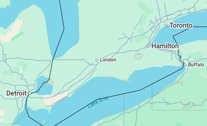
Nestled almost exactly halfway between the musical titans of Toronto and Detroit, London occupies a unique position in the touring world. This proximity is both a blessing and a curse.
Some major artists skip London: it often comes down to “radius clauses” that prevent artists from playing nearby cities when they perform in Toronto. If an artist is playing the Rogers Centre (capacity 55,000), they’re often contractually prohibited from also playing London’s 10,000-seat Canada Life Place.
Still, large-scale concerts can come to London with the right infrastructure and investment. And London has proven it can compete: we’ve hosted Metallica, Prince, and in 2024, Nickelback at Rock the Park.
Approximately 12,000 fans still came out to see Nickelback on July 10, 2024, at London’s Rock the Park despite a dousing of 70 mm of rain from Hurricane Beryl. (Photo credit: Rock the Park / Facebook)
A Commitment Baked Into Policy
What truly set London apart for UNESCO wasn’t just our talent or our venues. It was our intentionality. In 2014, London became only the second municipality in Canada to approve a dedicated Music Strategy, and in 2015, we hired a Music Industry Development Officer.
The city has intentionally put music into its strategic direction, supporting over 290 special events annually, including major festivals like Sunfest, Rock the Park, and the Canadian Country Music Awards (CCMA).
London hosted the JUNOS in 2019 and the CCMA in both 2016 and 2021.
The UNESCO designation wasn’t accidental. It was the result of decades of sweat equity.
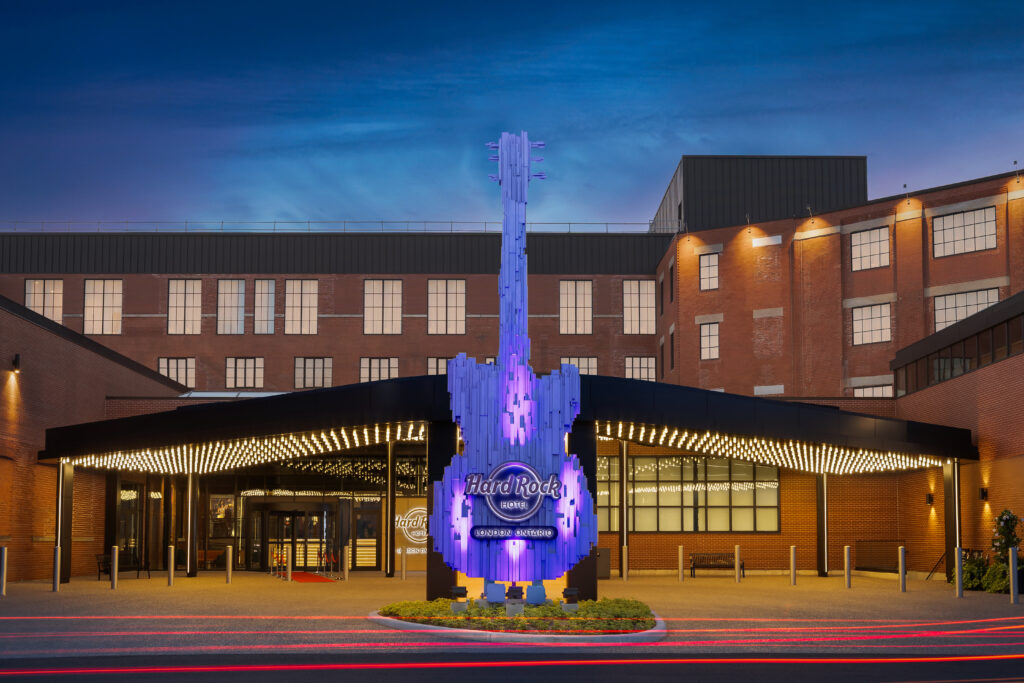
In 2025, Canada’s very first Hard Rock Hotel opened its doors in London, offering guests curated in-room vinyl collections, a guitar and amp menu available for delivery to your suite, and a speakeasy tucked away for post-show debriefs.
Illuminated electric guitar in front of the Hard Rock Hotel London, the first hotel of its kind in Canada. (Photo credit: Hard Rock Hotel London)
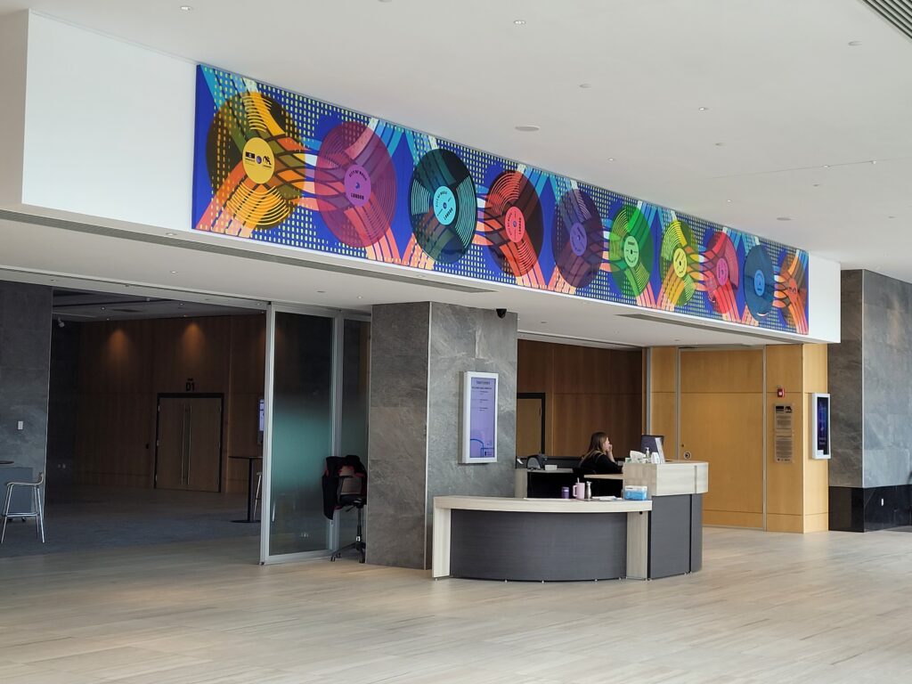
In 2023, the city unveiled a UNESCO City of Music Mural by London artist Tova Hasiwar in the lobby of RBC Place London.
UNESCO City of Music Mural in the front lobby at RBC Place. (Photo credit: Lawrence Durham).
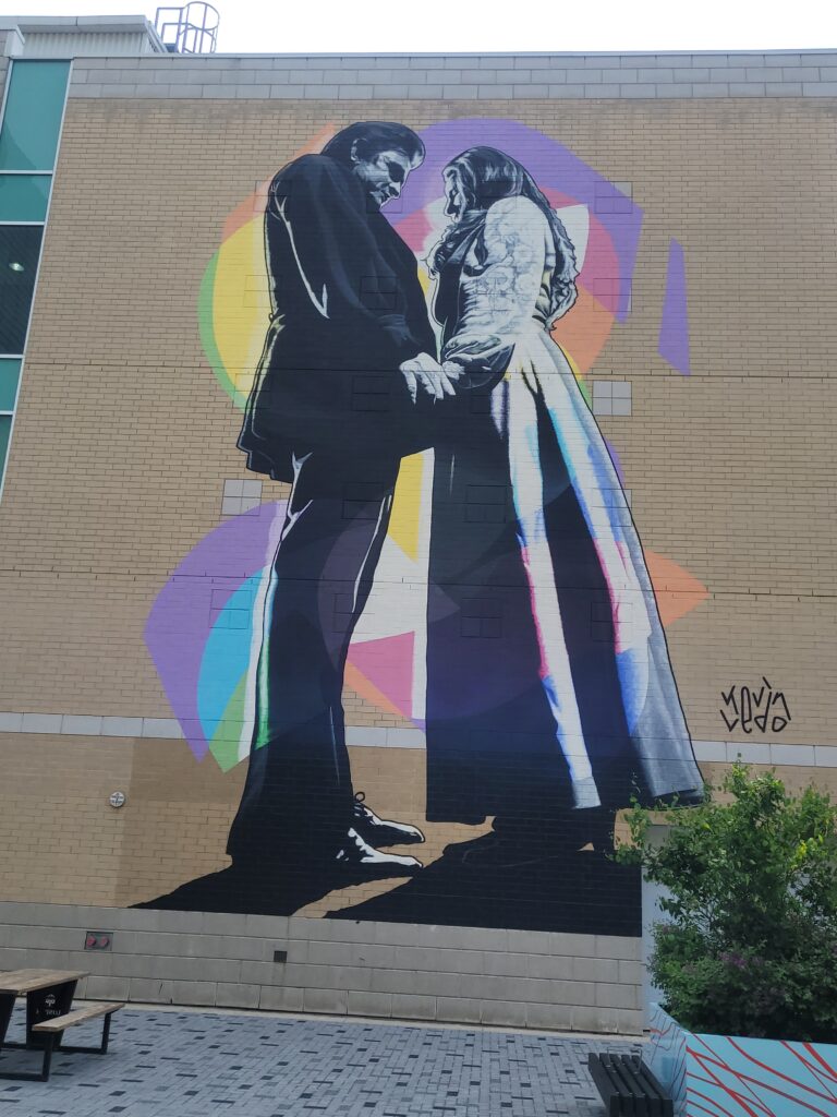
Also in 2023, artist Kevin Ledo created the three-story-tall “Johnny & June” mural on the north side of Canada Life Place on Dundas Street, commemorating Johnny Cash’s famous 1968 on-stage proposal to June Carter at the former London Gardens arena.
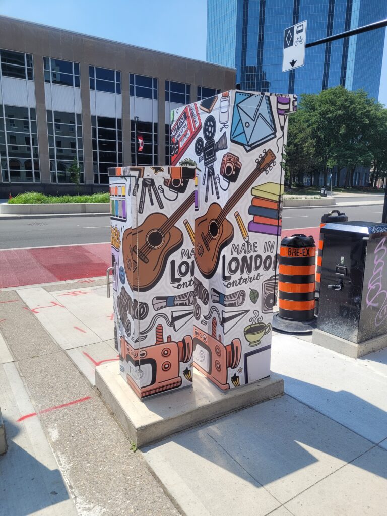
Capturing an iconic Johnny Cash moment, the “Johnny & June” mural at Canada Life Place. (Photo credit: Lawrence Durham).Celebrating music in London: traffic signal boxes at the Corner of Dundas & Wellington. (Photo credit: Lawrence Durham).
The Economic Impact
The effect of London’s music scene extends far beyond the stage. The music sector supports nearly a thousand full-time equivalent jobs and hosts thousands of events annually. Before the pandemic, the 2019 London Music Census found that London hosted 4,740 live music events in 2018 (that’s an average of 13 per day), with five major music events drawing hundreds of thousands of visitors and generating a $25.9 million economic impact.
In 2023, Tourism London announced a staggering $1 billion in tourism revenue, with the music sector playing a significant role in attracting visitors from across the province, country, and world.
Looking Ahead
London continues to leverage its UNESCO designation actively. In 2024, the London Music Office hosted the international UNESCO Cities of Music meetings, welcoming guests from as far away as New Zealand and Mauritius. Plans are underway for a physical “incubation facility” that would market London’s studios to producers, engineers, and artists from around the globe.
The city was even recognized as ‘Music City of the Year’ by the Canadian live music industry during the 2024 Canadian Live Music Awards.
Why London?
So why was London chosen over Toronto or Montreal? Because UNESCO wasn’t just looking for big cities with big concerts. They were looking for cities where music is a way of life, where it’s taught in schools, supported by policy, celebrated in streets, and accessible to everyone.
London’s size means our music community is connected, not siloed. It means artists actually talk to each other in hotel lobbies, can walk to dinner without entourages, and feel right at home.
London may be small, but our sound is anything but. From the classrooms of Western to the stages of Rock the Park, London is proving that world-class music can thrive far from big cities, right here in Southwestern Ontario.
The author, standing in front of the London Music Hall of Fame. (Photo credit: Lawrence Durham).
Hi. I’m Lawrence – bicycle tour guide, storyteller, and lover of puns. I also enjoy listening to live music… even though I can’t carry a tune.
I hope you enjoyed this quick look at why our LITTLE city earned such a BIG title. If you want to experience London’s hidden gems, come along for a bicycle tour with me. We’ll pass historic venues, talk about the artists who got their start here, and see the London that only the locals know.
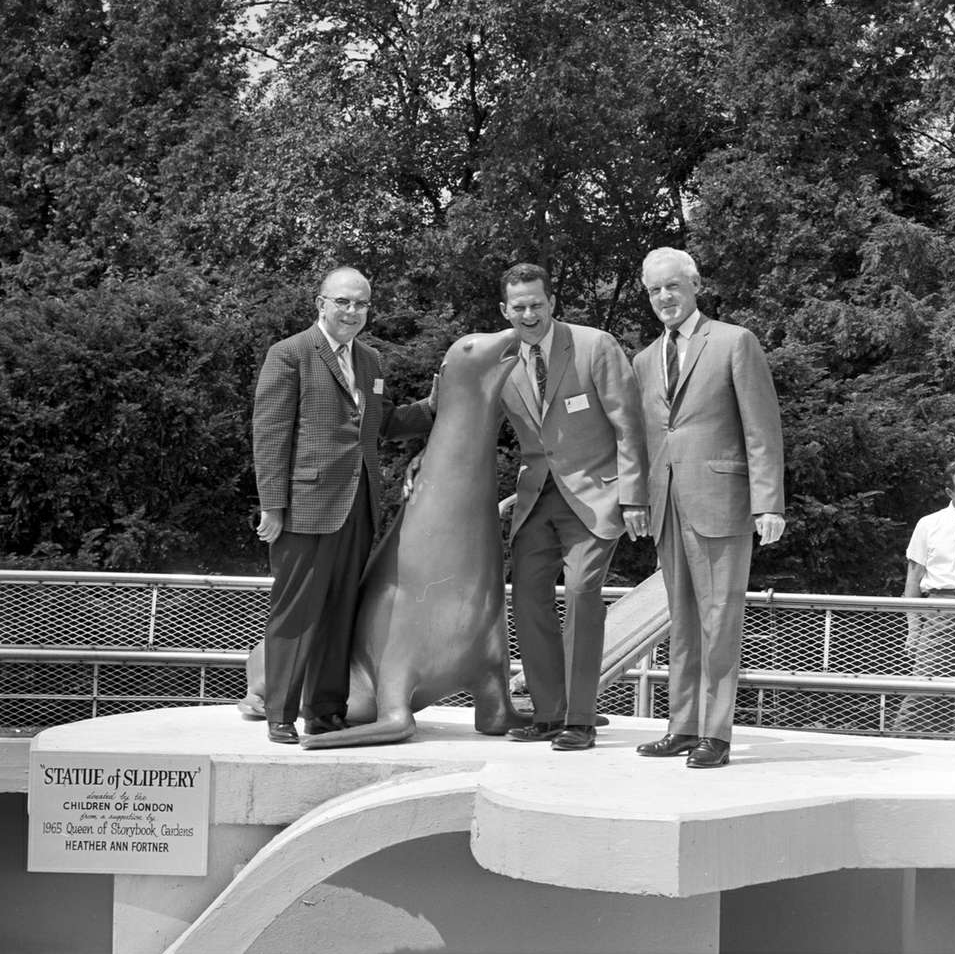
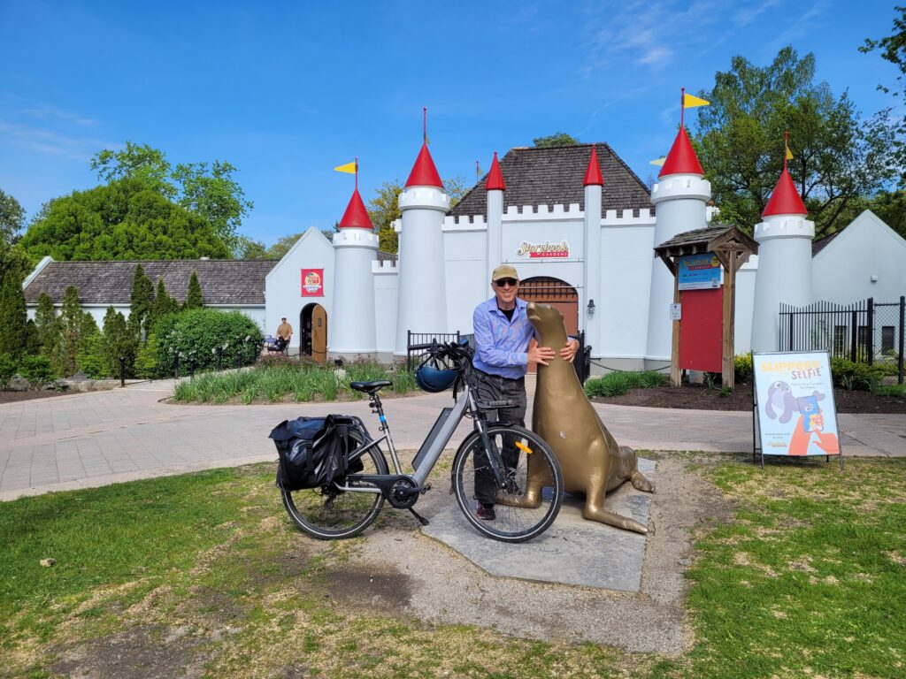
A young sea lion breaks out of a brand-new theme park, slips into a river, and leads bounty hunters, zookeepers, and politicians on a ten-day, cross-border chase that makes international headlines. By the time he’s done, half a city is waiting on the curb to cheer him home.
This is the story of Slippery, the sea lion, London’s unlikeliest hero.
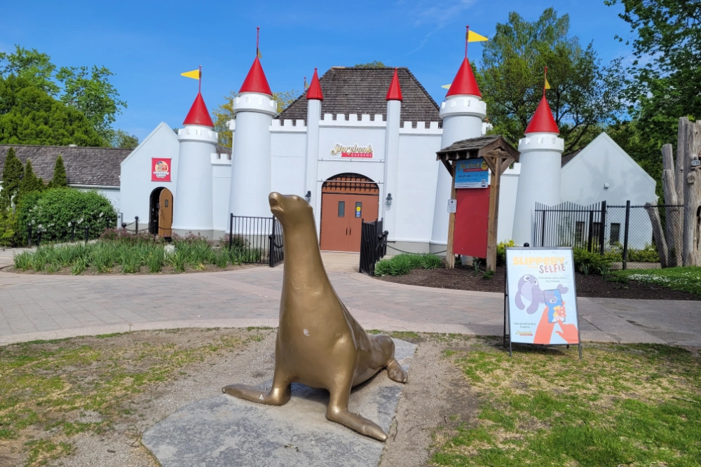
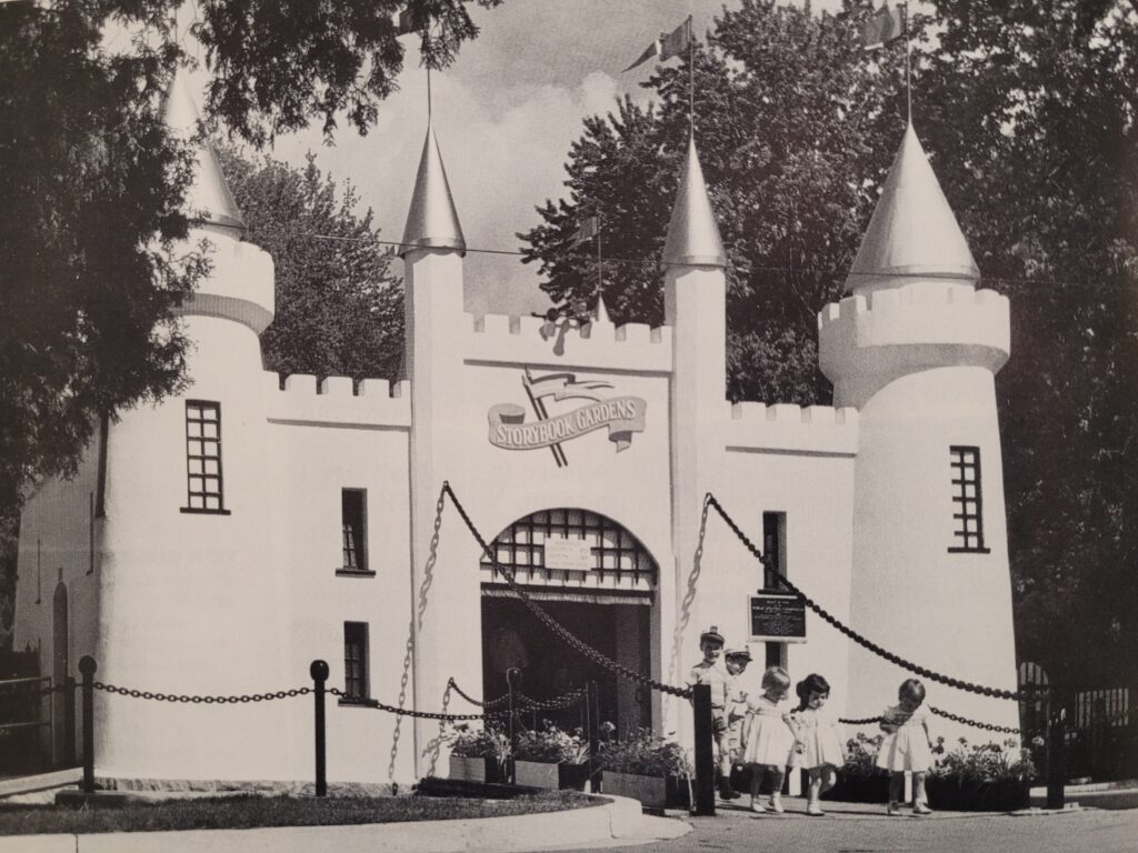
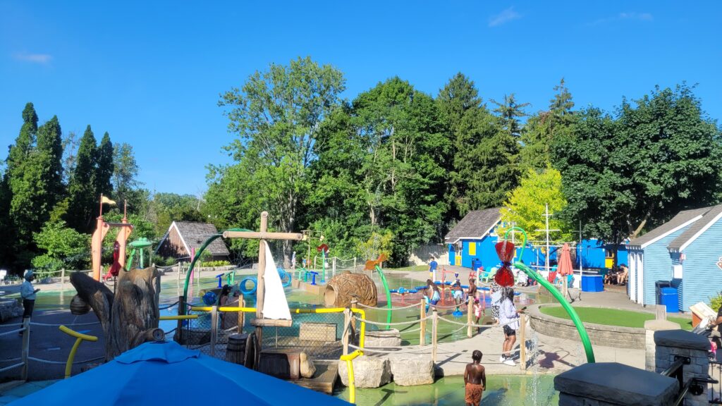
A New Park
In June 1958, the city of London opened the gates to Storybook Gardens, a family-friendly theme park built around fairy-tale characters and nursery rhymes. But in the 1950s, no children’s park was complete without live animal exhibits. And so Storybook Gardens started its own exhibit. Among its most ambitious attractions were two California sea lions.
Children at the gate to the newly opened Storybook Gardens. (Photo credit: London Free Press)
The Breakout
Just days after the park opened, novice zookeepers made a rookie mistake: they overfilled the sea lion pool. The higher water level gave Slippery a chance, and he seized the moment. He slipped through a gap in the fence and dropped into the Thames River, free, curious, and heading south.
The London Free Press quickly posted a $200 reward for his safe capture. That might not sound like much today, but in 1958, that was serious money. Amateur bounty hunters, animal lovers, and curious locals all joined the chase.
The Thames River Highway
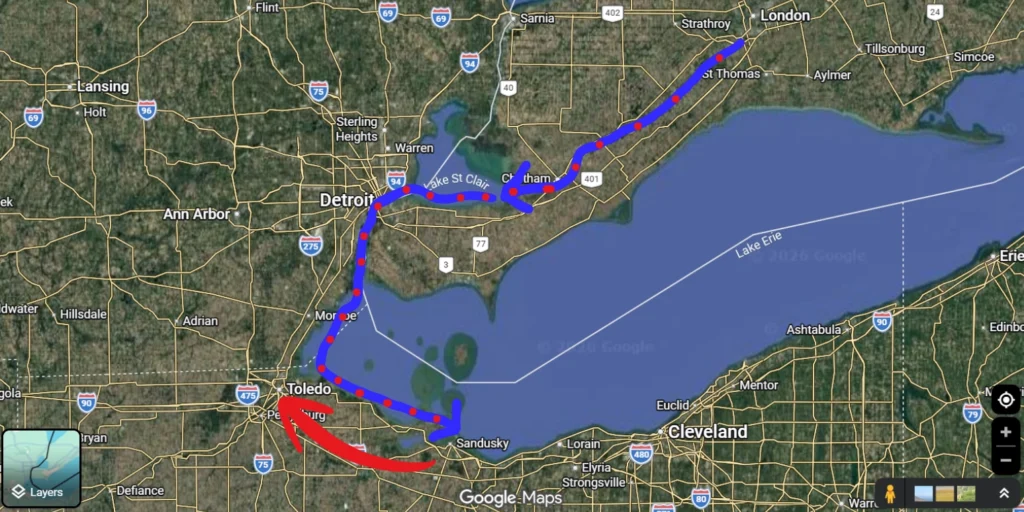
Over the next ten days, Slippery did what sea lions do: he kept swimming.
Down the Thames River – past the factories and farms of southwestern Ontario.
Into Lake St. Clair – a major body of water that could have swallowed him forever.
All the way to western Lake Erie – crossing an international border without a passport.
Sightings poured in. Every few hours, someone would spot a sleek, dark head bobbing in the water. But Slippery was always just ahead of his pursuers.
Over 10 days, Slippery traveled approximately 300 km. (Map by Lawrence Durham)
The Capture That Made Headlines
The chase finally ended not in Canada, but in Sandusky, Ohio, near the famous Cedar Point amusement park. The director of the Toledo Zoo successfully hit Slippery with a tranquilizer dart and then found him asleep in an empty boathouse.
His capture was just in time for the Fourth of July.
The Toledo Zoo put Slippery on display, and curious crowds who had been following the saga in newspapers for days lined up to see the fugitive sea lion. Then came the twist: the Toledo director announced he might keep Slippery for good.
“Slippery Come Home”
Londoners were not having it.
Petitions circulated. One of the most charming messages sent to Toledo read:
“Slippery, come home. London needs you. 100,000 Londoners await your arrival at Storybook Gardens.
P.S. Don’t swim; transportation has been arranged.”
Politicians protested. The press ate it up. But just as tensions peaked, the Toledo zookeeper relented. Slippery would return to London after some well-deserved rest. As a parting gesture of goodwill (and brilliant showmanship), Toledo gave Slippery the keys to the city before he headed north.
A Hero’s Homecoming
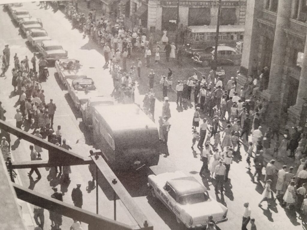
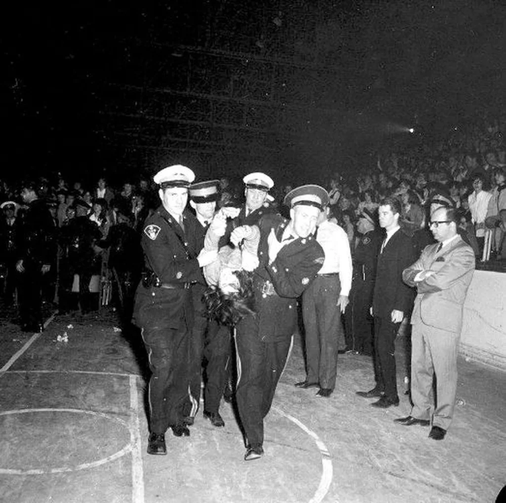
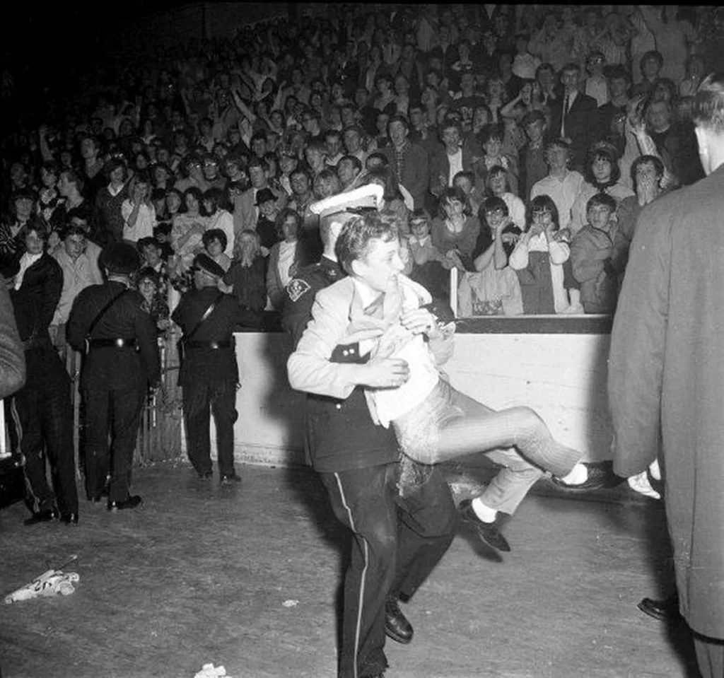
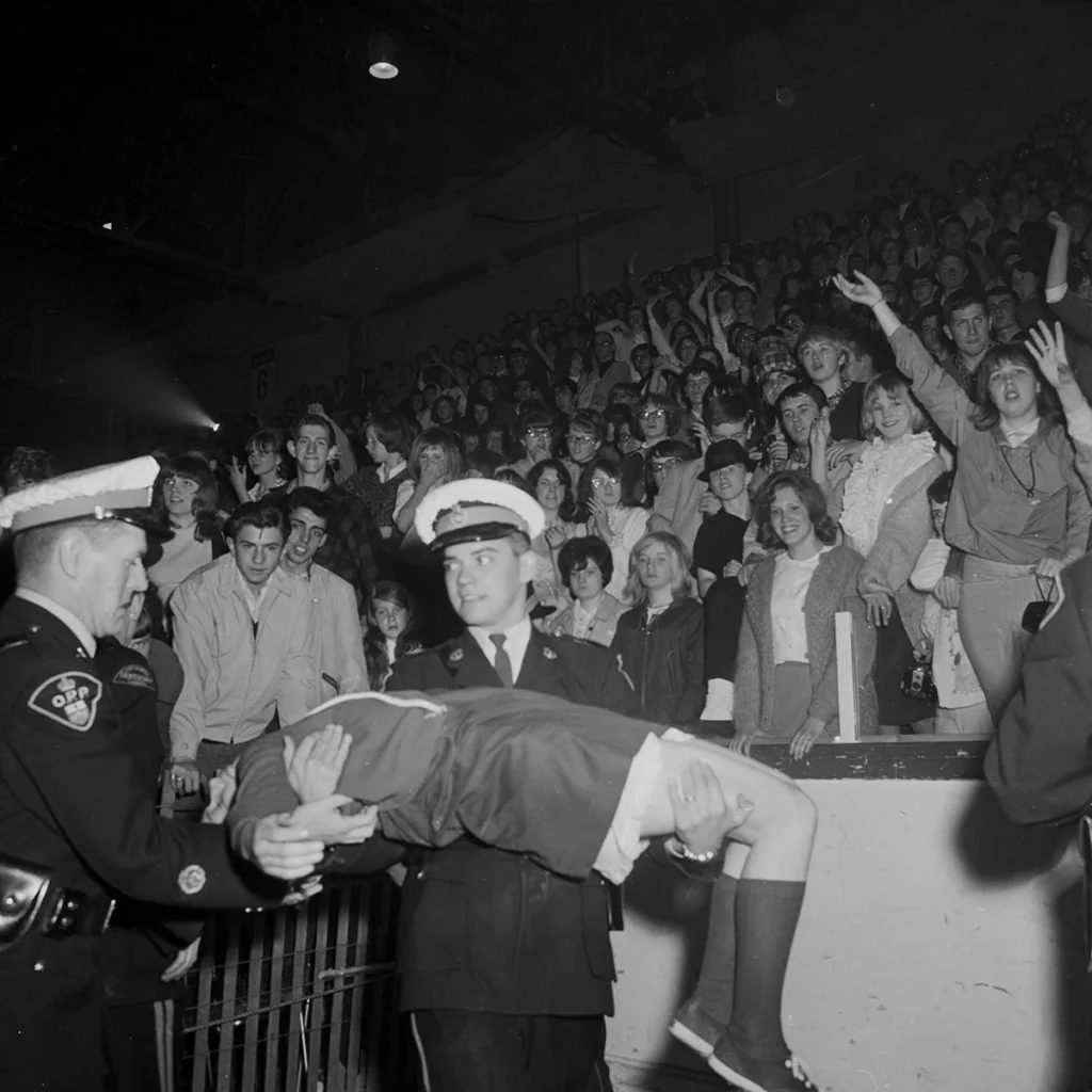
On July 6, 1958, Slippery returned to London.
And here’s where the story becomes legendary: roughly half the city’s population, tens of thousands of people, lined the streets to welcome him home. It was a parade, a party, and a civic celebration all at once.
Parade down Dundas Street following Slippery’s return. (Photo credit: Archives and Special Collections, Western Libraries, Western University)
Slippery’s reaction? Total indifference. He was far more interested in reuniting with his mate, Lonesome, back at the sea lion pool.
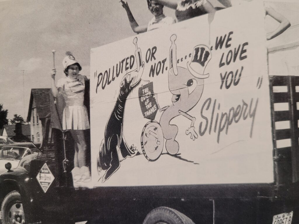
Londoners joked that they welcomed Slippery back home, even though he swam in the Thames River (which was quite polluted at the time). (Photo credit: Ron Nelson Photography Ltd)
The Secret Joke
Here’s the detail that makes this whole story even better.
Years later, the Toledo zookeeper admitted that his threat to keep Slippery was a joke, one he’d cooked up with an official from London to drum up publicity. The whole cross-border “feud” was a friendly stunt.
And it worked brilliantly. International coverage put Storybook Gardens on the map just as it was opening its doors.
Slippery the sea lion, 1966. (Photo credit: Archives and Special Collections, Western Libraries, Western University)
An Official Mascot, a Splash Pad, and a Goodbye
Slippery lived out his years as the unofficial, and later official, mascot of Storybook Gardens. He died in 1967, but his legend never faded.
Unveiling the Slippery statue in 1967. (Photo credit: Archives and Special Collections, Western University).Even officials from Toledo, Ohio, showed up for the unveiling. (Photo credit: Archives and Special Collections, Western University).
In 2003, the park named a brand-new splash pad after his great escape, ensuring that kids could escape their day-to-day worries as they ran through water in honour of his journey.
The splash pad, filled with happy children. (Photo credit: Lawrence Durham)
But times change.
In 2008, London City Council voted to phase out live animal exhibitions. The final harbour seal exhibit closed in 2012, ending a 54-year love affair with Slippery and his sea lion successors.
Why This Story Still Matters to London
You won’t see live sea lions at Storybook Gardens today. But his escape reminds us that London has always been a city of quiet surprises. It’s where a children’s theme park can make global news, where a sea lion can become a civic icon, and where half the people in the city will cheer for a creature who couldn’t care less about the applause.
For culture seekers, that’s the real magic of London. It’s not Toronto. It’s not Vancouver. It’s a city with a small-town heart, big ambition, and at least one international fugitive sea lion.
The author, saying “hello” to Slippery in front of the entrance to Storybook Gardens. (Photo credit: Lawrence Durham)
Hi, I’m Lawrence. bicycle tour guide and storyteller. Slippery’s great escape is one of my favourite stories: part adventure, part comedy, and all heart. If you’d like to pedal through the very river valleys that Slippery swam through (on dry land, I promise), I’d love to show you around. Small groups, big laughs, and stories you won’t hear anywhere else. Click here to book a tour with London Bicycle Tours. Your next adventure is just a pedal away.
When visitors to London see the old courthouse on Ridout Street, they often ask the same question: “Is that a castle?”
It’s a fair question.
Overlooking the Thames River is a structure that looks as if it were plucked straight from the Irish countryside, complete with octagonal towers, crenellated parapets, and imposing stone walls. But it’s not a medieval fortress. Instead, it’s the oldest surviving building in the region, the Middlesex County Courthouse.
The south view of the Middlesex County Courthouse, as seen from King Street in 2004. (Photo credit: Canada’s Historic Places)Malahide Castle in Ireland, built in the 12th century. (Photo credit: William Murphy)
An Irish Vision in the Canadian Wilderness
To understand why the London courthouse of today looks like a castle from the past, we need to go back to a time when a certain eccentric Irishman had authority over this part of Ontario.
Born in Ireland in 1771 at Malahide Castle, Colonel Thomas Talbot was an Anglo-Irish aristocrat who, after a promising military career, did the unexpected. He sold his commission and immigrated to Canada, where he became a colonial administrator of a large tract of land in southwestern Ontario, known as the Talbot Settlement.
For the next 40 years, Talbot ruled his domain like a feudal lord, granting land to loyal British and Irish immigrants and building roads along the Lake Erie shore. He was powerful, controversial, and deeply nostalgic for his Irish homeland. So, when the time came to build a new district courthouse in the fledgling town of London in 1827, Talbot, who sat on the building committee, ensured it would remind him of his old castle home near Dublin.
Despite his difficult personality, Colonel Thomas Talbot played a prominent role in the establishment and development of London and the surrounding region. (Photo credit: Western University Archives, London Free Press Negative Collection)
Built to Exude Power
Construction of the courthouse began in 1827 and was completed in 1829.
The three-and-a-half-storey building was designed in the Gothic Revival style by Toronto architect John Ewart and was built with locally quarried stone.
It had the look of a castle, sitting as it was in this prominent location on a hill overlooking the Thames River. It featured a central pavilion flanked by two octagonal towers, complete with battlements (crenellations) that gave it that fortress-like silhouette. The bricks were covered in stucco and scored to look like stone masonry, a clever illusion to make the building look even more durable and ancient. Add in pointed arch windows and doors, label mouldings, and an exposed timber ceiling in the courtroom, and the effect was one of permanence and power.
Interestingly, when first built, the front door of the courthouse faced west, toward the Thames River. That’s because, in the early days of London, the river was the highway. So when visitors and prisoners arrived by water in 1829, the first thing they saw was this impressive structure dominating the skyline.
In contrast, most of the remaining buildings in this emerging frontier town were constructed of wood.
View of the Middlesex County Court House, as seen from the Thames River. This painting by George Russell Dartnell, c. 1841, shows the western view of the courthouse. (Photo credit: Toni Hafkenscheid, Museum London)
Where Justice was Served
For nearly 150 years, from 1829 until 1974, this building served as the judicial and administrative hub for the London District (later Middlesex County).
An extensive renovation in 1878 added more towers to the courthouse and changed the entrance to face east toward Ridout Street.
The Jail and its Yard
Behind the courthouse, on the west side nearest the river, a jail was added in 1846, enclosed by a high brick wall.
Public Hangings
In the 19th century, justice was a public spectacle. Crowds would gather on the grounds behind the courthouse to witness hangings.
In all, 19 people were hanged in London over 121 years.
By 1976, capital punishment was abolished nationwide.
The London Jail, or Gaol, as it was called until the 1930s, is shown above, surrounded by a high brick wall. (Photo credit: Ivey Family London Room, London Public Library, London, Ontario, Canada) South view of the Courthouse and Jail after inmates were transferred to a new jail on Exeter Road in 1977. Most of the high prison walls have since been removed. (Photo credit: London Post Card Collection, Box #98, Album #2, p. 82, pocket #1, Ivey Family London Room, London Public Library, London, Ontario, Canada)
Preservation, Recognition, and a New Chapter
Given its immense historical value, it’s no surprise that efforts to protect the courthouse began early.
In 1955, the building was designated a National Historic Site of Canada, recognized for its early Gothic Revival architecture and its association with the administrative organization of the province.
The courthouse is protected by an Ontario Heritage Trust easement and designated under Part IV of the Ontario Heritage Act.
A Modern Turning Point
In 2021, the site entered a new chapter when it was sold to a private developer, York Developments. While the county maintains some offices there for the time being, the future use of the historic structure is evolving.
Recent proposals for a high-rise development immediately to the south have sparked community conversations about how to balance modern growth with the protection of our irreplaceable heritage landmarks. It’s a reminder that the story of this building is not just in the past. It’s being written right now.
Above to the left: A cross-sectional drawing illustrates how close the 54-story tower would be to the 3-storey courthouse. (Zedd Architecture)
Above photo on the right: This rendering illustrates how the two-tower project proposed at 50 King St would dwarf the nearby courthouse to the north. (Photo credit: Jenifer Bieman)
The Surrounding Neighbourhood: London’s Founding Core
The courthouse does not stand alone. It is the jewel in the crown of London’s original administrative core. A short stroll from the front steps of the courthouse will take you to other heritage treasures.
Just up the street, you will find Banker’s Row: a collection of elegant 19th-century homes built by the city’s early banking and business elite.
Also along Ridout Street to the north is London’s oldest surviving residence, Eldon House. Built in 1834 by the Harris family, it is now a museum.
Bankers Row on Ridout Street, with Eldon House (the white one) in the distance. (Photo credit: Lawrence Durham)The author, standing in front of the old courthouse. (Photo credit: Lawrence Durham)Historical plaque outside the courthouse. (Photo credit: Lawrence Durham)
Hi! I’m Lawrence – bicycle tour guide, storyteller, and proud Londoner.
There is nothing I love more than riding my bike past the old courthouse and seeing its castle-like towers. Every building in this city has a story, and I love sharing them with others. If you want to experience London’s history up close, from the river valleys to the historic downtown, join me on a tour. We’ll laugh, we’ll learn, and we’ll see the city from the very best seat in the house, on a bicycle, of course.
You’d never know it now, but what is currently one of the city’s most essential north-south arteries began as a patchwork of country sideroads, gravel paths, and a bridge that locals famously called “the bridge to nowhere.”
Today, Wonderland Road tells a story about how cities grow, how communities connect, and how a little patience and a lot of planning can transform the way we move about our city.
A Name Born from Music and Merriment
Wonderland Road takes its name from Wonderland Gardens, a concert hall and entertainment complex built near Springbank Park in 1935 by the Jones family.
The original road to Wonderland Gardens was nothing more than a 3-kilometre gravel path leading north from Southdale Road up to the river’s edge.
Aerial photo of the gravel path leading to Wonderland Gardens. (Photo credit: Rachel Cree)
It was at Wonderland Gardens that a young Londoner named Guy Lombardo and his band, The Royal Canadians, first charmed audiences with what would become known as “the sweetest music this side of heaven”. Lombardo went on to become one of Canada’s most celebrated bandleaders, famous for his New Year’s Eve broadcasts and his signature rendition of Auld Lang Syne.
Shortly, we’ll see how Guy Lombardo’s name is connected to the Wonderland Road Bridge.
The Road Before It Was a Road
Here’s a fascinating piece of London trivia: the Wonderland Road we know today is actually a carefully stitched patchwork of six different historic roads (see map below).
North of the Thames River, the corridor consisted of:
Hutton Road, running north from Riverside Drive
A section of Sarnia Road that connected London on the east to Sarnia on the west, before being absorbed
Cameron Sideroad, continuing north toward Highway 7
South of the river, the original Wonderland Road served as the spine, later supplemented by sections of Airport Road and Bostwick Road.
(Map by Lawrence Durham)
For much of the mid-20th century, these roads had existed as separate entities, country lanes that served local farms and scattered homes rather than a unified city corridor.
The Bridge That Divided Opinion
The story of Wonderland Road’s transformation really began in 1977, with the opening of a new four-lane bridge spanning the Thames River. The bridge was dedicated to Guy Lombardo, who had passed away just months earlier, and it was meant to finally connect Wonderland Road south of the river with Hutton Road to the north.
But here’s where things got complicated.
When the Guy Lombardo Bridge opened, it was an impressive structure, four lanes wide, beautifully built, and seemingly poised to revolutionize north-south travel in London. There was just one problem: the roads on either side weren’t quite ready for it.
Aerial shot of the Guy Lombardo Bridge, looking west. In the centre of the photo, you can see the bicycle path hugging the south bank of the Thames River, leading to the Wonderland Gardens (just out of frame). The pathways of the Woodland Cemetery are visible in the lower left of the photo. (To explore the area shown on the map, click this link to Google Maps)Here we see the Guy Lombardo Bridge, spanning the Thames River, a distance of over 250 m (823 ft). (Photo credit: Lawrence Durham)The underside of the Guy Lombardo Bridge, viewed from the bicycle path below, shows the huge concrete pillars and massive girders that support the four-lane roadway above. (Photo credit: Lawrence Durham)
The Challenges
Disconnected Infrastructure
While the bridge itself was completed in 1977, the surrounding roadway network hadn’t caught up with the vision. The bridge was part of a long-term urban plan that wouldn’t be fully realized for years, leaving many Londoners scratching their heads at why such a substantial structure existed without a seamless corridor to support it.
Renaming Confusion
At the same time the bridge opened, Hutton Road was officially renamed Wonderland Road North. On paper, this unified the corridor.
In practice, however, many residents still thought of the two sides as separate entities. Old habits die hard, and for longtime Londoners, “Hutton” meant the north side, while “Wonderland” meant the south.
The original Hutton School on Hutton Road. The school property was purchased by The Association for Handicapped Adults in 1973. They promptly adopted the name Hutton House for themselves in honour of the school. (Photo credit: Vintage London, Ontario)
An Isolated Location
The bridge’s location near the Guy Lombardo Museum was beautiful, but it was also somewhat isolated. The surrounding areas hadn’t yet seen the residential and commercial development that would later make this corridor a commuter powerhouse. To some, the grand bridge seemed to lead to not much of anything.
Thus was born the nickname that stuck for years: “the bridge to nowhere.”
Wonderland Road Now
Today, Wonderland is one of the busiest roads in the city, carrying over 43,000 vehicles per day between Springbank Drive and Riverside Drive.
It is one of just two roads in London that traverse the city from north to south without any breaks or turnoffs, the other being Highbury Avenue to the east (see map below).
As envisioned in 1977, Wonderland Road has become a key north-south corridor. (Map by Lawrence Durham)By 2017, traffic congestion led the city to consider widening Wonderland Road, where it would have become “one of the largest road projects in city history.” But that’s not what happened. (Photo credit: Megan Stacey, London Free Press)
The Road Ahead
One of the most remarkable chapters in Wonderland Road’s story is still being written.
In 2021, the City of London made a decision that reflects changing priorities. After years of planning to widen Wonderland Road to six lanes from Sarnia Road to Southdale, city council voted 9-5 to halt the project due to environmental concerns.
Instead of pursuing a traditional road-widening approach, the city is now exploring alternative methods to improve traffic flow while accommodating pedestrians, cyclists, and transit. It’s a decision that signals a shift in how London thinks about its streets, not just as conduits for cars, but as spaces for people.
Wonderland Road, looking south towards Gainsborough Rd. (Photo credit: mosbo6)
A Story Worth Exploring
Wonderland Road’s journey from gravel sideroad to bustling corridor, from “bridge to nowhere” to essential artery, mirrors London’s own evolution. It’s a story of vision and patience, of growing pains and eventual payoff, of a city that kept building toward a future that took decades to arrive fully.
And like so many of London’s best stories, it’s one you can experience on two wheels. For example, just off Wonderland Road is the Thames Valley Parkway, a multi-use pathway that snakes along the Thames River for 43 km, opening up a whole city to explore.
The author, standing in front of the bandshell of the recently renovated Springbank Gardens. (Photo credit: Lawrence Durham)
Hi! I’m Lawrence, bicycle tour guide, storyteller, and unabashed London enthusiast.
I help curious visitors and locals alike discover the hidden stories woven into our city’s streets, parks, and neighbourhoods. From a bicycle seat, you see things differently: the way a bridge connects two halves of a city’s history, the quiet path that follows a river’s bend, the view that opens up when you slow down just a little.
If you’d like to experience the city from the best seat in the house, I’d love to show you around. Small groups, big laughs, and a whole lot of London, all waiting to be explored.
When you think of Canadian oil, your mind probably jumps to Calgary, Edmonton, or the oil sands of northern Alberta. But here’s a twist that might surprise you: more than 150 years ago, London briefly held the title of Canada’s oil capital.
Let me take you back to a time when the smell of sulphur hung in the air, Queens Avenue mansions were the talk of the town, and a little company called Imperial Oil was born.
The Discovery That Started It All
The Canadian oil story began in 1857, not in London, but about an hour’s drive west in Lambton County. When that first oil boom hit, you might expect the centre of processing to be somewhere closer to the wells. But the Board of Trade in London had other ideas. They negotiated favourable shipping rates via railroad to bring the crude oil to London for refining, and just like that, our city became the epicentre of Canada’s fledgling petrochemical industry.
Left photo: The town of Oil Springs, Ontario, circa 1867. (Photo credit: Canada’s History)
Right photo: Oil shoots out of a well in Petrolia, Ontario, in 1902. (Photo credit: Canada’s History).
It was a classic tale of entrepreneurial hustle: Londoners didn’t have the oil, but they had the brains, the infrastructure, and the ambition to process it.
A Smelly Situation
Oil refining in the 1860s wasn’t exactly a fragrance you’d want in a candle. It was pungent. It was unpleasant. And Londoners hated it.
So, the city council passed legislation requiring the refineries to relocate beyond the city limits. Out of sight, out of mind, right?
The logic seemed sound:
Move the smelly refineries downwind of their residents
Keep the peace with voters
Continue enjoying the economic benefits
The reality was far messier.
The smell didn’t magically stop at the city boundary. When winds blew from the east, sulphuric fumes wafted back over the city. And here is the ironic part. The newly constructed mansions of the oil barons on Queens Avenue, although safely within city limits, had their fresh paint eaten away by the very fumes their own industry produced.
Large homes were built on Queens Avenue, to the west of the oil refineries. (Photo credit: London Post Card Collection, Box #97 Album #3, p. 27, pocket 2, Ivey Family London Room, London Public Library, London, Ontario, Canada)
But the most shortsighted part? By pushing the refineries outside the city limits, London’s assessors lost the ability to tax them. The odour remained, but the tax base disappeared. The village of London East, on the other hand, was laughing all the way to the bank.
Boom Times in London East
While city councillors in London were left scratching their heads, London East was just getting started. Soon, it became the epicentre of Canadian oil refining.
By the 1860s, a dozen different oil refineries were operating in the area, soon joined by secondary industries.
For example, the Canada Chemical Manufacturing Company was established in 1867 to meet the growing demand for sulfuric acid, a chemical essential for removing the objectionable odour of raw petroleum.
The Canada Chemical Manufacturing Company was the first plant in Canada to produce sulfuric acid. (This sketch first appeared in City of London, Ontario, Canada: the Pioneer Period and the London of Today, published by London Printing & Lithographing Co. in October 1900)
By 1876, East London had over 50 small oil refineries, all processing crude from Lambton County. Workers flocked to London East. Supporting businesses sprouted up. For a brief, glorious period, London East was where the industrial action was.
However, the refining business was tough, even back then. Competition from American refineries was fierce, and the technical processes were changing faster than small operators could keep up. Survival meant consolidation.
So in 1880, a group of prominent oil refiners from London banded together to form a new company called Imperial Oil. They established their head office in London, with another office in Petrolia. It was a moment of tremendous pride for the city because, at that time, Imperial Oil controlled 85% of Canada’s oil refining capacity.
In 1883, lightning struck the London East refinery, and the facility burned to the ground.
Rather than rebuild in London East, Imperial Oil’s leadership made a strategic decision: they would build their new refineries closer to shipping facilities in Sarnia, where access to water transportation and an expanding railway network offered better long-term prospects.
And just like that, London’s reign as the oil capital of Canada was over. The head office eventually followed the refineries, first to Petrolia, then to Sarnia, later to Toronto, and finally, in 2005, to Calgary.
Our moment in the sun had passed.
What Remains Today
What became of that industrial stretch east of Adelaide? It evolved. The land gave way to other uses, other stories. The refineries are long gone today, and thankfully, the south branch of the Thames River no longer carries industrial waste. But traces of our oil legacy remain… if you know where to look.
From atop the Adelaide Street overpass, you can see the railway tracks that once moved shipments of oil into London East for refining. And if you look very closely, you can also spot an old Imperial Oil sign on the side of the brick building on York Street. See inset. (Photo credit: Lawrence Durham)
As for the mansions on Queens Avenue, those grand Victorian homes, once victimized by the very fumes their owners’ wealth created, are now part of our architectural heritage. Some have been restored. Others house businesses and professional offices. They stand as quiet monuments to the brief period when London’s oil barons built their dream homes in the shadow of their own industry.
Author, in front of one of the mansions on Queens Street, one block west of Adelaide Street. (Photo credit: Lawrence Durham)
Hi there. I’m Lawrence, bicycle tour guide, history enthusiast, and your friendly neighbourhood storyteller.
I started London Bicycle Tours because I genuinely believe this city is full of fascinating stories just waiting to be discovered. The oil boom might be long over, but the tales are still here, hiding in plain sight. If you’d like to explore London’s hidden history from the seat of a bicycle, I’d love to have you along. Small groups, big laughs, and the best views of the city you’ll ever get from two wheels.
When you think of London, Ontario, you might picture the serene forks of the Thames, the lush greenery of Victoria Park, or the vibrant arts scene.
But beneath our tree-lined streets and heritage storefronts runs a current of pure ambition, a story of one man’s relentless drive to bring the power of Niagara Falls to the people.
That man was Sir Adam Beck.
Mayor and MPP
Long before Sir Adam Beck became a household name across Ontario, he was a Londoner through and through. A successful manufacturer of cigar boxes and an outstanding athlete, Beck entered public life with the same vigor he brought to the racetrack. In January 1902, he became Mayor of London, serving for three one-year terms. But he didn’t stop there. Just months later, he was elected as the Conservative Member of Provincial Parliament (MPP).
Sir Adam Beck (1857–1925). (Photo credit: Archives and Special Collections, Western Libraries, Western University)
For two and a half years, Beck served simultaneously as both the Mayor of London and an MPP. It was an extraordinary concentration of local and provincial power, and it gave him the perfect platform for the vision that would define his legacy. He saw something others were slow to grasp: that the thundering waters of Niagara Falls, 200 kilometers away, could power the homes, farms, and factories of ordinary Ontarians.
The Fight for Public Power
In July 1905, Beck was appointed to head a hydroelectric commission of inquiry. What began as a fact-finding mission soon became a crusade. At the time, private power companies controlled the electricity generated at Niagara Falls, and they were charging rates that put this transformative technology out of reach for most citizens.
Beck believed deeply in a simple principle: dona naturae pro populo sunt – the gifts of nature are for the people. He envisioned a publicly owned system that would deliver power at cost, not for profit. But his own cabinet colleagues opposed him. Undeterred, Beck took his case directly to the public.
Using a mix of political showmanship, dramatic price cutting, and sheer force of personality, he built the Hydro-Electric Power Commission of Ontario, the precursor to today’s Ontario Hydro and Hydro One. By 1908, his vision proved so popular at the polls that he returned to the legislature with a dual mandate from both municipal and provincial electorates. He was no longer just a politician; he was an electrical messiah with a mandate.
London Connects to Niagara Falls
On October 11, 1910, the city of Berlin (now Kitchener) became the first municipality to receive power from Beck’s newly operational public grid. Just 50 days later, on November 30, 1910, London made history as the second city in Ontario to be wired into the Niagara Falls hydroelectric system.
For Londoners, the arrival of “hydro” wasn’t just a utility hookup; it was a civic celebration. Beck organized theatrical “turning-on” ceremonies in town after town, using each festival to champion the triumph of public power over private greed.
From that moment forward, London’s identity became deeply intertwined with the promise of clean, abundant, affordable electricity.
The Ontario Hydro-Electric Commission and its participating municipalities, including London, encouraged Ontarioans to use hydro. In this 1913 Labour Day Parade, the new way, a battery-powered truck, was contrasted with the old way, a horse-pulled delivery wagon. (Photo credit: Archives and Special Collections, Western Libraries, Western University)
The Hydro Shop: A Retail Revolution on Dundas Street
This is where London’s story takes a truly unique turn. Beck understood something that many early proponents of electricity overlooked: generating power was only half the battle. To make his public system sustainable, he needed people to use it.
Enter the Hydro Shop, one of the most innovative retail experiments in Canadian history.
Established in 1912 by London’s Board of Water Commissioners (later the Public Utilities Commission), the Hydro Shop was a retail store with a mission. Its purpose was to encourage the use of electrical appliances in the home, making life easier for homemakers while building a customer base for the power flowing all the way from Niagara Falls.
The Hydro Shop would become a hub of domestic innovation.
Marketing Strategies Ahead of Their Time
Long before modern retail tactics, the Hydro Shop was experimenting with:
Free home trials (so you could test a new electric range before buying)
Cooking demonstrations in its showroom
Installment payment plans to make appliances affordable for working families
It was the first store of its kind in Ontario, and its impact was staggering. The Hydro Shop helped attract and retain appliance manufacturers like McClary and Kelvinator to the region. It introduced the prototype for the Cascade 40 water heater, the first automobile block heater, and even a forerunner of the modern smart meter.
But perhaps its greatest claim to fame? London became the electric range capital of North America, with more electric stoves per capita than any other city on the continent. Thanks to the Hydro Shop, Londoners were cooking with electricity while much of the world still relied on wood and coal.
Interior of Hydro Shop, c. 1940. (Photo credit: Archives and Special Collections, Western Libraries, Western University).
Turning the Gifts of Nature Into Everyday Life
Beck’s motto, dona naturae pro populo sunt, wasn’t just a Latin phrase on a letterhead. Through the operation of the Hydro Shop and the municipal distribution system, he ensured that the benefits of affordable, reliable public power reached everyone: the farmer, the homemaker, and the small businessperson.
By 1956, the mission had been accomplished. Electrical appliances like kettles, stoves, refrigerators, air conditioners, mixers, and even curling irons had become commonplace. Private retailers had caught up with public demand, and the Hydro Shop closed its doors. But its legacy lived on in every London home that had been transformed by the convenience of electric living.
But to see how Beck got started with his most ambitious project, let’s go back in time to 1917.
The Queenston-Chippawa Project (1917-1921)
As the demand for electricity grew, especially to power wartime production during World War I, Beck set his sights on the natural power of Niagara Falls. He proposed diverting water from the upper Niagara River at Chippawa and channeling it around Niagara Falls through a massive canal to Queenston.
Chippewa is in the foreground, where the Welland River meets the Niagara River. Queenston is in the distance, at the top of the photo. (Photo credit: The Hydro-Electric Power Commission of Ontario)To direct water to the power plant, the Welland River was diverted, and a channel was dug through solid rock. The total diversion was 13.2 km long. (Photo credit: The Hydro-Electric Power Commission of Ontario)
The engineering was audacious. By bringing water to the top of the Niagara Gorge at Queenston, Beck could create a man-made waterfall with a drop of 97 metres, three times the head available at the existing private generating stations near the Falls. Every cubic foot of water flowing through this system would produce nearly 30 horsepower of energy.
When the Queenston-Chippawa Hydroelectric Plant first began producing power in 1922, it was the largest hydroelectric generating station in the world.
In 1950, on the 25th anniversary of Beck’s death, it was renamed Sir Adam Beck Hydroelectric Generating Station No. 1 in his honor.
In 1990, it was designated a National Historic Site.
The Next Power Station
Three decades after constructing Adam Beck I, Ontario Hydro began constructing its second Generation Station.
Even more ambitious this time around, the Sir Adam Beck Generating Station No 2 once again became the world’s largest hydroelectric plant when it opened in 1954
Sir Adam Beck Hydroelectric Generating Stations, as seen from the air; the northern dam (nearest) is Adam Beck I and the southern dam is Adam Beck II. (Photo credit: Ontario Power Generation)
Challenges and Controversies: The Price of Building an Empire
Adam Beck was knighted in 1914 for his contributions to society, specifically for pioneering public ownership of electricity and establishing the Hydro-Electric Power Commission of Ontario (now Ontario Hydro).
Beck was a visionary, but he was also a man who made enemies. Brusque and overbearing, he frequently rammed his projects forward over the objections of his own government colleagues. His ruthless determination to expand Hydro, with little regard for cost, eventually led to calls for accountability.
The Gregory Commission hearings in the 1920s questioned his management style, planning methods, and political accountability. Yet even his critics could not deny his accomplishments. By 1923, Hydro served 393 municipalities across Ontario. Beck had built a publicly owned integrated electric system on a scale the world had never seen.
When he died in 1925, monuments were erected in his memory. But as those who knew him understood, his greatest monument was Hydro itself, a crown corporation delivering power at cost to municipally owned utilities. It was an institution that would outlive governments, ideologies, and generations.
To that point, the following Canadian cities get most of their power from hydroelectric sources:
Montreal – 99%
Winnipeg – 97%
St. John’s, Nfld – 95-98%
Vancouver -90%
Whitehorse – 70%
While today’s grid includes nuclear, gas, and renewables, the legacy of public hydroelectric development, championed by Sir Adam Beck, remains embedded in the way we talk about power today.
Beck’s Legacy in London
Locally, London Hydro provides power to the city. As a wholly-owned subsidiary company, London Hydro operates much like a private entity under the Ontario Business Corporations Act, paying an annual dividend to its sole shareholder, the City of London.
In essence, all Londoners own London Hydro.
London Hydro offices at 111 Horton Street. (Photo credit: Lawrence Durham)
Come Discover London
Whether you’re strolling through our historic downtown, admiring the heritage architecture that once housed the Hydro Shop, or simply enjoying a coffee at a café powered by a grid Sir Adam Beck helped build, you’re walking in the footsteps of a man who believed that the gifts of nature belonged to everyone.
The author, at the site of the old London Hydro Shop at the corner of Dundas and Wellington, with the historical plaque in the background. (Photo credit: Lawrence Durham) (Photo credit: Lawrence Durham)
Hi. I’m Lawrence—bicycle tour guide, storyteller, and unabashed London booster.
I love nothing more than sharing the stories that make this city shine, from hidden architectural gems to the larger-than-life characters who shaped our streets. If you’re curious to see London from a different vantage point, and maybe learn a few more tales like Sir Adam Beck’s along the way, I’d be delighted to show you around. Small groups, big laughs, and plenty of local lore await.
Imagine being an early settler in the 1800s when roads were truly terrible.
Naturally, you’d ask the government to help make road improvements.
What you wouldn’t know at the time is that future drivers would later regret that YOU got what you asked for, because THEY would now have to pay a toll for using those same roads.
But we’re getting ahead of ourselves. Let’s start at the beginning.
The Original Roads Were Awful
The early settlers who had land claims north of London had to make their way along trail blazes and stakes laid out by land surveyors. Many roads were mere dirt trails through bogs and forests.
In swampy areas, it was necessary to lay down layers of logs to keep horses and carriages from sinking. Ruts from wagon wheels and tree stumps were further obstacles, and in wet weather, roads became rivers of mud.
Early pioneer roads were treacherous, bumpy, and muddy. (Photo credit: Wikimedia Commons)
In 1849, to deal with the problem of poor roads, the Ontario government passed legislation allowing private companies to build toll roads.
Immediately, a local group of London businessmen seized the opportunity, forming the “Proof Line Road Joint Stock Company” to grade, macadamize, and bridge the Proof Line Road north of London.
The road got its name from the early days when surveyors verified, or “proved,” the accuracy of the layout of the London District by comparing the various concession roads and lots they surveyed to the Proof Line Road running north.
The company completed a 10-mile stretch into the countryside, north from the V intersection at Richmond Street and Western Road, through Arva, Birr, and on to Elginfield (see map below). Later, they extended the Proof Line Road southwards to Huron Street, which at the time was the northern boundary of the City of London.
To pay for all these road improvements and to make a tidy profit for themselves, they put 5 toll booths along the route.
To explore this area of North London on Google Maps, click on this link.
At first, locals considered the Proof Line Road well worth the tolls and ranked it the best-maintained route in the district. They also liked the reliable stagecoach service. Several hotels and taverns opened along the road, an indication of its heavy use.
By 1882, roads everywhere had improved immensely. The province declared that all publicly owned county roads were toll-free, yet the Proof Line Road continued to collect its toll.
Resentful citizens would often take a detour for miles to avoid the toll gates on a road “run by profiteers,” as some of them put it.
25 Years After That…
Finally, in 1907, local councils and the province, spurred on by public petitions, bought the Proof Line Road for $11,000. The occasion was marked by a huge celebration in Arva, during which the toll gates were collected and burned in a large bonfire “as relics of barbarism.”
Today, people in the north end of the city are again asking for road improvements. And the city has responded… but with no tolls this time, of course.
For example, in 2025, the intersection at Richmond Street and Fanshawe Park Road was reconstructed and improved.
(Photo credits: Unless otherwise indicated, the following photos are by the author)
Looking north on Richmond Street at its intersection with Fanshawe Park Road.
Further north, reconstruction of the next major intersection, Richmond Street at Sunningdale Road, will be completed in 2026 (see below).
Ongoing road construction work at the intersection of Richmond Street and Sunningdale Road, March 2026.
The Difference in Road Design Now
The good thing about the road improvements nowadays is that the City of London is building road infrastructure that caters to all modes of transportation, not just cars.
Safer pedestrian crosswalks and crossrides for people on bicycles are being included whenever major roads and intersections are rebuilt.
Richmond Street at Plane Tree Drive. The new pedestrian crossover (PXO) design with bilateral bicycle crossrides and a crosswalk in between makes this crossing much safer for those using active transportation. Before this, there was no safe passage across Richmond Street for a 1 km stretch between North Centre Drive and Sunningdale Road.
New dedicated push buttons for people on bicycles (left photo), a dedicated crossride (centre photo), and dedicated bicycle crossing signals (right photo) complement the crosswalk infrastructure to make this crossing much safer and accessible for people of all ages and abilities.
A bird’s-eye view of the Fanshawe Park Road and Richmond Street intersection with mobility improvements. Notice the prominent painted crosswalks and crossrides in the intersection, and separate sidewalks and protected bicycle lanes leading to and from the intersection in all directions. (Photo credit: City of London)
The plan is for sidewalks and bicycle lanes to eventually take people safely all the way from the city centre in the south to the city limits in the north, along parts of the route previously known as the Proof Line Road, the toll road that drove London drivers crazy all those years ago.
Author, standing at the intersection of Fanshawe Park Road and Richmond Street.
Hi, I’m Lawrence, storyteller and unofficial London cheerleader.
I’m a guy who loves telling tales about the early history of London and the new bicycle infrastructure the city is building. If reading stories like this makes you want to experience London’s charm (on our quieter streets and pathways, of course), I’d be thrilled to have you along on one of our bicycle tours.
London is known for many things, but not usually for one of the most gripping manhunts in North American history.
Pull up a chair, because the story of Marion “Peg-leg” Brown is the kind of tale that makes you look at London a little differently. It’s a story of violence, a continent-wide manhunt, mistaken identities, a prophecy from the gallows, and a grave that refused to stay silent.
The Son of a Mexican Desperado Arrives in London
To understand this story, we need to travel back to June 24, 1898. London was a bustling railway hub. Trains rumbled through constantly, bringing goods, travellers, and sometimes, those who preferred to ride without a ticket.
On that summer evening, a young man hopped off a freight train into the London rail yards. His name was Marion Brown, though history would remember him by a different name: Peg-leg.
Drawing on the left above: The chaos of a busy rail yard in London at the turn of the century. (Source: Archives and Special Collections, Western Libraries, Western University, original source: Canadian Illustrated News).
Drawing on the right above: Marion “Peg Leg” Brown at age 25. (Find a Grave)
Born around 1873 in San Saba, Texas, Brown was the son of a Mexican desperado. With that background, he seemed predestined for a life on the wrong side of the law. At just 19 years old, he lost his left leg while attempting to hop a train, an injury that would define the rest of his short life. He now walked with a prosthetic limb crafted from elm wood, a detail that made him unforgettable.
By the spring of 1898, Brown found himself in a Texas jail for burglary. But in June, he managed to break out, taking with him a .44 caliber revolver loaded with six bullets. He would use every single one before the month was over.
After escaping in Texas, Brown hopped a series of freight trains and made his way north. His journey ended in London, Ontario, on the evening of June 24.
A Fatal Encounter at the Train Yards
What happened next unfolded rather quickly.
Brown confronted a railway guard, knocking him unconscious. When Constable Michael Toohey of the London Police Force arrived to arrest the suspect for assault, Brown raised his revolver and fired. The first shot struck Constable Toohey’s pocket watch, a timepiece that saved his life. But Brown’s second shot found its mark, ripping through the police officer’s abdomen. Constable Michael Toohey died at the scene, leaving behind three young children.
Constable Michael Toohey, an 11-year veteran of the London Police Force, was 39 years old at the time of his death. (Photo credit: Ontario Police Memorial Foundation)
In the chaos of the rail yards, the shooter vanished, disappearing into the night. And just like that, a three-month manhunt for Marion “Peg-leg” Brown began.
A Continent-Wide Dragnet
The challenge facing the London police was immense. They were searching for a needle in a haystack – a needle with one wooden leg, to be sure, but a needle that knew how to move quickly along the railway lines that crisscrossed the continent.
London Police Chief Williams wasted no time. His first instruction was decisive and sweeping: arrest every tramp in the county matching the suspect’s description. Within days, jail cells filled with drifters and transients, all questioned about the murder. But the real killer remained at large.
Next, authorities announced a reward: $500 for the capture and delivery of the suspect to any police station in Ontario. In 1898, this was a significant sum, enough to attract attention across the province and beyond.
Soon, a detailed description of the suspect was dispatched to every town and village with a population greater than 150 residents in both Canada and the United States.
Think about that for a moment. In an era before radio, television, or the internet, word of Marion Brown’s crime reached literally every hamlet and crossroads across two countries. The description was unmistakable: a one-legged man, probably travelling by rail, armed and extremely dangerous.
Unintended Consequences
The panic that gripped the nation had real human costs. Before Brown was finally captured, over forty other one-legged drifters were taken into custody across Canada and the United States based on nothing but their missing limbs. These innocent men were deprived of their freedom, some for weeks, simply because they shared a physical characteristic with a fugitive.
The Capture
For months, the trail went cold. Brown seemed to have vanished into the vastness of North America. He hopped trains through the Canadian wilderness, crossed back into the United States, and kept moving. Along the way, he reportedly engaged in a second gun battle near Watford, Ontario, though details of that encounter remain murky.
But London hadn’t forgotten Constable Toohey. Telegrams continued to fly across the continent, and police departments remained alert.
The break in the case came nearly three months later, nearly 4,000 kilometres from the scene of the crime. United States Marshal A.L. Dilley received a tip about a one-legged man in Washington State. Following up, Dilley tracked his quarry to an opera house and arrested him on Sept 24th without incident.
The international manhunt was over. Marshal Dilley had captured one of the most wanted men in North America.
The Return
Brown was extradited to Canada and transported back to London. When news of his arrival spread, a large crowd gathered, eager to catch a glimpse of the notorious killer. The man who had terrorized the continent was finally back in the city where his crime had occurred.
Brown’s preliminary hearing was held before a crowd of 400 spectators, with standing room only in the courthouse. From the very beginning, Brown insisted that the trial would not be fair or impartial. The public, he argued, was already prejudiced against him. The crowd in the gallery seemed to prove his point.
At the request of the defence, Brown’s trial was postponed to allow time to prepare their case. His attorney, a man named McPhillips, would need every moment.
The Trial: Justice or Prejudice?
By the time the trial finally commenced in March of 1899, it had already become one of the most expensive legal proceedings in the history of Middlesex County. The costs, estimated at around $4,500, were staggering for the time, reflecting the case’s notoriety and the resources devoted to the widespread manhunt.
But the evidence against Brown was substantial. His revolver, his presence at the scene, his flight from justice, all pointed toward guilt. The jury deliberated and returned a verdict of guilty. Marion “Peg-leg” Brown was sentenced to hang on May 17, 1899.
Coverage of the trial was nationwide. Here is a clipping from The Ottawa Journal, Mar 30, 1899. The attitude of the public toward Brown seems evident in the final comment, “not the least evidence of sympathy for the prisoner has been noticed.” Almost 100 years later, the sentiment still leaned towards Brown being a cold-blooded killer, not a folk hero.
An interesting footnote: Despite the massive effort to capture Brown and despite the $500 reward that had been promised, Marshal A.L. Dilley never received his payment. For reasons lost to history, the reward for the capture and delivery of one of the most notorious criminals of the era went unpaid.
A Deathbed Conversion and a Desperate Appeal
The cells in the London Gaol were impossible to move in when the bed was down. Prisoners often put them up against a wall during the day so they had somewhere to walk and even stand. Most often, there was no mattress for the bed. (Photo credit: Find a Grave)
In the months between his conviction and his execution, something remarkable happened to Marion Brown. Confined to his cell in the London jail, he underwent a deathbed conversion to Christianity. He read the Bible regularly, sang hymns, and struck up a friendship with Rev. Dr. Johnston, the pastor of St. Andrew’s Presbyterian Church.
Johnston, unlike many in London, believed Brown was innocent. Just days before the scheduled execution, he traveled to Ottawa in a desperate attempt to have the conviction appealed. He sought intervention from both the Governor General and Prime Minister Wilfrid Laurier himself. Over forty lawyers had already appealed to Laurier on Brown’s behalf, arguing that the trial had been biased and unfair.
The appeals went nowhere. Prime Minister Laurier and his government ignored the pleas, and the execution was allowed to proceed.
The Prophecy: “No Grass Shall Grow on My Grave”
As Brown was led away to the gallows on that stormy May morning, he spoke words that would echo through the decades:
Rev. Johnston and a small group of officials accompanied Brown to the scaffold at the appointed hour. Outside, a massive crowd had gathered around the London jail yard, though their view of the hanging had been deliberately blocked by wooden siding. London was determined to carry out justice, but not for it to be a spectacle.
Brown was hanged as scheduled. His body was buried in an unmarked grave within the prison yard, a common practice for executed criminals in that era, denying them proper burial in consecrated ground.
And for decades, the prophecy seemed to hold. The area became the walled-in exercise yard for prisoners, and later, when the jail evolved into other uses, it became part of the Middlesex County Courthouse parking lot. Grass never grew on his grave. Layer after layer of concrete and tarmac covered the spot where Brown’s body lay.
Then, in 1985…
Construction workers were excavating the courthouse parking lot for a new project. A backhoe operator dug into the earth and uncovered something unexpected: a human skeleton. The machine had severed the upper torso cleanly from the rest of the body.
A missing left leg made it immediately clear whose body had been found. Archaeologists were sent to comb through the earth that had already been removed and dumped as landfill, but they could only recover fragments of the upper skeleton.
Article from the London Free Press, May 4, 1985
As for his Wooden Leg…
One piece of Marion Brown never left public view. His wooden leg, that infamous prosthetic crafted from elm wood, survived. Today, it hangs on the wall of Museum London, just across the street from where Brown was hanged. Visitors can see it for themselves, this tangible connection to one of the most dramatic chapters in our city’s history.
Marion Brown’s prosthetic leg, at Museum London. (Photo credit: Lawrence Durham)
Questions Remain
The story of Marion “Peg-leg” Brown raises questions that still resonate today. Was he guilty, or was an innocent man executed? Were the appeals of forty lawyers and a Presbyterian minister simply ignored by a government unwilling to reconsider his plight? Does a prophecy fulfilled mean anything at all?
We may never know the truth. But we do know this: London’s history is richer, stranger, and more fascinating than most people realize. Every corner has a story. Every building has witnessed something. Every park has known laughter, and yes, sometimes tears.
As for Constable Michael Toohey, he was not forgotten. Nearly one hundred years after his death, two streets were named in his honour.
Author, at the corner of Toohey Lane and Toohey Court. (Photo credit: Lawrence Durham).
Hi. I’m Lawrence, bicycle tour guide, storyteller, and lover of tales that make you see our city in a whole new light. I help curious folks like you discover the best parts of London, and stories like this are just the beginning. On my tours, we don’t just ride through the city; we travel through time. We’ll explore the places where history happened, from the dramatic to the delightful, from the solemn to the surprising. Whether you’re a visitor seeing London for the first time or a local who thought you knew your hometown, I promise you’ll discover something new. Small groups and big laughs, your next adventure awaits.
or 14 minutes in total (if you also watch the three short videos that are included).
A city’s true spirit is often revealed through its art.
And thanks to the support of community partners and the vision of talented artists, Indigenous art in London is not confined to gallery walls. It’s a living, breathing part of the city you can discover as you explore our streets and byways.
It’s the story of the original inhabitants of this area, the Anishinaabek, Haudenosaunee, and Lünaapéewak peoples, whose vibrant artistic expressions are adding profound depth and voice to the urban landscape.
Below is my 2026 virtual tour of all the Indigenous Art on display throughout London.
Photo credits: All photos in this blog post were taken by the author, unless otherwise indicated.
Western University (North London)
At Western University, three locations display Indigenous design:
Social Science Centre
A long mural adorns the wall outside the Indigenous Studies office on the third floor of the Social Science Centre at Western University. Designed by Mike Cywink, an Ojibwe artist from Whitefish River First Nation, with input from the community, 2023. For a close-up shot of this mural, see the photo at the very beginning of this post.
2. Huron University
Symbolizing reconciliation between his community and the Anglican Church, “Eagle Tree of Peace” at Huron University, by Leroy Henry, a Haudenosaunee artist from Six Nations of the Grand River, 2022.
3. Wampum Learning Lodge
Ceremonial arbor constructed outside the Wampum Learning Lodge at Western University.
Market Lane (Downtown)
This Market Lane Mural is located in the heart of the city’s historic Covent Garden Market area.
There were many partners involved in bringing this project to life, including Andrew Gunn Consulting, Young & Free Press, Dundas Place, Downtown London, Museum London, WIL Employment Connections, and Tourism London.
Funding for the Market Lane mural project was provided by Tourism London and Downtown London, as well as a contribution from the Estate of Marianne Barrie.
Futuristic floral design by indigenous artist and beadworker, Hawlii Pichette of both Swampy Cree and French-Canadian ancestry, 2020.
Midtown
This series of murals is a joint project between the City of London, N’Amerind Friendship Centre, and the London Arts Council. It features many colourful panels on the south wall of the N’Amerind Friendship Centre and is best viewed from Horton Street. The series of panels aims to “honour the legacy of Residential School Survivors and the children who were lost through Canada’s Residential School System.”
“We Are Still Here” mural by Mike Cywink and youth Indigenous artists and residential school survivors, 2022.
A closer look at six of the woodland-style panels.
Carling Heights Optimist Community Centre (East London)
Here, visitors will find 19 works of art by 9 Indigenous artists in a wide variety of mediums, including glass, acrylic paint, canvas, leather, beads, deer, moose, and caribou hide, manipulated photography, wood, sand, clay, abalone shells, porcupine quills, gold, and silver.
East Lions Community Centre (East London)
Below are two of the first works to make up the City of London’s Permanent Indigenous Artwork Collection.
This was a collaboration between the City of London, in partnership with the London Arts Council, Indigenous London Arts, London Music Office, and the Rotary Club of London.
The stained glass-style mural “Firekeeper” by Ojibwe educator and visual artist Mike Cywink. (Photo credit: City of London)
Below is London’s first artistically interpreted Wampum Belt. Installed in 2024, it wraps around the interior fireplace at East Lions Community Centre.
The mural “Way of Life,” (Bimaadziwin), (Tsi’ niyóht tsi tyúnhe’), by Anishinaabe educator and visual artist Nancy Deleary.
Fanshawe College (East London)
Perhaps the most extensive use of indigenous design elements in a modern building in all of London can be found at the Innovation Village at Fanshawe College. Here, the artwork of Hawlii Pichette, Indigenous artist and Fanshawe College graduate, is featured prominently on the walls and windows throughout the facility.
Author’s Note: For your enjoyment, in the following gallery of photographs, you’ll find two short YouTube videos, one lasting 1:27 minutes and the second one lasting 3:30 minutes.
[Watch time: 1:27]All of the glass windows on the first and second floors of the Innovation Village are decorated with artwork by Hawlii Pichette.
Above left: Bear mural
Above right: Wolf mural
Above left: Turtle mural
Above right: Raven mural
Full-size window murals.
Above left: Buffalo mural
Above right: Ojibwe word, phonetic pronunciation, and mural description.
“Grandfather Teachings Mural” on an exterior wall of the courtyard, just outside of The Kalihwiyo Circle.Inside the Kalihwiyo Circle, with the “Grandfather Teachings Mural” visible outside in the courtyard.
[Watch time: 3:30]
Wellington Road Welcome Centre (South London)
At the Tourism London Welcome Centre at 696 Wellington Road South, visitors will find Indigenous art displayed on both the exterior and interior walls, showcasing a diverse range of Indigenous artists and styles.
[For a 3-minute video on Indigenous Art at the Welcome Centre, click here]
Two external mosaic murals (Medicine Wheel and Two Row Wampum) by Brenda Collins are located on the south wall of the Welcome Centre.
Below are 8 works of art displayed inside the Welcome Centre.
Above Right: Oscar Marroquin-Ponce, Huitzilopochtli (Hummingbird)
Above Left: Steve Maracle, It’s Summer, Let’s Dream
Above Right: Mike Cywink (Thunder Day), the Provider
Above Left: Annette Sullivan, Traditional Metis ceremonial smoking hat
Above Right: Steve Maracle, Ethan Bear
122 Baseline Road (West London)
Two tree trunk sculptures sit on either side of the entrance to this apartment building at 122 Baseline Road West, welcoming visitors and providing an encouraging message for families, parents, and children.
Plaque at 122 Baseline Street West. The artist is Garrett Nahdee, a self-taught member of the Walpole Island First Nation.
An Ongoing Story
These artworks are more than just decoration. They are a vital part of London’s journey toward reconciliation and a broader understanding of its own identity. They ensure that Indigenous voices and perspectives are seen, valued, and integrated into the shared story of the Forest City.
For visitors and residents alike, seeking out these pieces offers a richer, more meaningful experience of London – one that honours the past while celebrating a vibrant and continuing cultural presence.
The author, in front of the murals on the wall of N’Amerind Friendship Centre.
Hi, I’m Lawrence – bicycle tour guide, storyteller, and admirer of London’s hidden stories.
These are just some of the things I’ve discovered while riding around London on my bicycle. I get a real thrill from sharing this beautiful art and the powerful history that makes our city so unique.
Today, London, Ontario, is a vibrant, green city of nearly half a million people, known for its parks, trails, and welcoming neighbourhoods.
But its origins tell a different story, one of astonishing resilience. Before the skyscrapers, the universities, and the cycling paths, this was a place where survival was a daily conquest.
An Unforgiving Landscape: Mud, Stumps, and Quicksand
When surveyors arrived in 1826 to plot out the new site for the village of London, they weren’t met with gentle, farm-ready land. They faced an almost impenetrable forest. The nickname “Forest City” wasn’t a marketing slogan; it was a stark reality.
At that time, the downtown core was a challenging terrain of gravelly knolls and hidden quicksand. Streams and ravines cut through the area where buildings and streets now stand.
Stumps from chopped-down trees remained in the streets for years, making pedestrian travel an obstacle course. Directly east of the old courthouse on Ridout Street, where Canada Life Place now sits, lay a swamp so viscous it swallowed ox-carts and wagons whole.
Looking west along Dundas Street from Wellington Street in 1842. At the time, London was a frontier community of tree stumps and mainly wooden buildings. (From a painting by Lady Eveline-Marie Mitchell Alexander, courtesy of the 1999 Orr Collection at Museum London).
Law, Order, and Growing Pains
Despite the hardships they all faced, the city’s first resident, Peter MacGregor, typified the entrepreneurial spirit of those early pioneers. He reportedly opened his tavern by simply hanging a tin cup on a nail and placing a jug of whisky on a stump – a charmingly straightforward “open for business” sign.
Charming as MacGregor’s Tavern might have been, at the courthouse just across the road, justice meted out by the judges could be severe. Under the old British criminal code, judges handed down harsh, mandatory punishments where the death penalty applied to hundreds of crimes, often for minor property offenses. Fortunately, the judges regularly commuted such sentences.
View of the Middlesex County Court House, as seen from the Thames River. This painting by George Russell Dartnell, c. 1841, shows the western view of the courthouse. (Photo credit: Toni Hafkenscheid, Museum London)
Civic life in those days was rowdy; the first municipal elections were public affairs, not secret ballots, leaving room for intimidation and bullying at the polls. Gangs supporting one candidate often congregated outside polling stations, ready to beat up those who voted for their opponent.
The political tensions of the era hit home during the Rebellion of 1837, when groups of discontented citizens from both Toronto and London decided to stage an uprising against the government. Following the Battle of Montgomery’s Tavern in Toronto and a failed attempt at rebellion in London, Britain decided to station a garrison of troops in London to secure the region, shaping the city’s development for decades.
The Battle of Montgomery’s Tavern, Unknown artist, Canadian Military Heritage, Department of Defence. via Wikipedia.Barracks at London, Canada West, May 1842. The infusion of so many soldiers into the town gave London an economic boost and provided peace and security to the entire region. (Painting by Henry Ainslie, Library and Archives Canada)
While the military offered security, it didn’t stop the fires that regularly ravaged the town. With most buildings made of wood and no fire hydrants, fire was a constant threat. Londoners relied solely on bucket brigades, knowing a single spark could erase everything they had built.
Another fire. Another bucket brigade in action. (Photo credit: Wiktionary)
The Constant Shadow: Disease and Health Hazards
In early London, health was precarious for everyone, from the lowest labourer to the highest aristocrat. Consider the fate of Charles Lennox, the 4th Duke of Richmond, for whom Richmond Street is named.
Charles Lennox, 4th Duke of Richmond. (Painting by Henry Collen)
In 1819, while touring as Governor General in Upper Canada (as Ontario was then known), he was bitten by a fox and died in agony, in what is widely considered a case of rabies – a stark reminder that the wilderness held profound dangers for all, no matter one’s social status.
Then there were the epidemics that swept through London with terrifying regularity.
Asiatic Cholera arrived in 1832 and again in 1849, often brought by immigrants seeking a new life. During the first outbreak, a certain Reverend Boswell famously stood on Blackfriars Bridge warning away travellers from the disease-ridden city.
Ironically, the first victim of the 1832 epidemic was Eliza MacGregor, the sister of Peter MacGregor, the first resident of London. In all, three members of Peter’s family died of cholera. Later in the year, after these sad personal tragedies, he moved to a farm in Westminster Township, where he died at the relatively young age of 52 in 1846.
There is no known picture or painting of Peter MacGregor. He is buried in the Scottsville Cemetery, south of Lambeth on Highway 4, and you can still visit his gravesite today. A historic plaque marks the site.
In 1847, typhus ravaged London. The disease was carried by body lice from 100,000 emaciated Irish immigrants fleeing the potato famine in Ireland and arriving in Canada on crowded and unsanitary boats, known as “Coffin Ships.”
Offloading Irish immigrants in Toronto, some of whom were destined for London.
With limited medical knowledge and no modern infrastructure, these events in London were devastating tests of communal endurance.
From Frontier Settlement to Thriving City
Despite the immense challenges, the village of London persevered. By 1855, through sheer determination, these fiesty settlers transformed the village of London into a city with a population of 10,000.
Soon the stumps were cleared, the swamps were filled, and the foundations for the institutions, parks, and neighbourhoods we cherish today were firmly laid.
Looking north along Richmond Street in the late 1860s. Note the three-storey brick buildings, level dirt streets, and wooden boardwalks, all where a dense, impenetrable forest had stood just forty years earlier. (Photo credit: University of Western Ontario).
Conclusion: Seeing History Through a Modern Lens
The story of pioneer London isn’t just a tale of hardship; it’s a testament to human resilience.
Every time you walk down Richmond Street, cross Blackfriars Bridge, or enjoy a pub in the downtown core, you’re treading on ground made stable by the grit of those first Londoners. Their struggle against the forest, disease, and isolation forged the resilient, community-oriented character of the city we live in today.
To truly feel the depth of this transformation, there’s no better way than to explore it at the gentle pace of a bicycle. You can almost hear the echoes of ox carts on roads once full of stumps and feel the relief of modern, solid ground beneath your wheels.
The author, in front of the sign marking the original site of Peter MacGregor’s cabin. (Photo credit: Lawrence Durham)(Photo credit: Lawrence Durham)
Hi! I’m Lawrence – bicycle tour guide, storyteller, and proud Londoner.
I write these posts to share the incredible, layered history that makes our Forest City so unique. And if reading this makes you want to see these historic spots for yourself, well, I’d love to show you around from the best seat in the house: a bicycle!
Join me for a guided bicycle tour where we connect the dots between London’s tough pioneer past and its vibrant present. Small groups, big stories, and a whole lot of fun. Are you ready to pedal through history?
Today, we’re rolling back the clock to 1965 for a story that cemented London’s place in rock and roll history.
A History of Crazy
If you ask a music fan about the craziest moments in Rolling Stones history, they might mention the chaos that erupted at the Altamont Free Concert, or Keith Richards’ various onstage antics. But if you ask a Londoner of a certain age, they’ll likely tell you about the night the music died at a local hockey rink.
Setting the Stage
Picture London in the mid-60s. This was a staid, conservative city. The venue was Treasure Island Gardens, an arena just south of Highway 401 that has gone by many names over the decades (London Gardens, the Ice House), but on April 26, 1965, it was the night of the Rolling Stones concert with a packed house of 4,000 screaming fans.
Crowd shot at the Rolling Stones concert, April 26, 1965. (Photo credit: Bill Ross)
Even though this particular Monday was a school night, the teenagers of Southwestern Ontario didn’t care. The Rolling Stones were here on their first North American tour. They were considered the “bad boys” of rock and roll, the dangerous antidote to the clean-cut Beatles.
Immediate Chaos
The moment Mick Jagger, Keith Richards, Brian Jones, Bill Wyman, and Charlie Watts stepped onto the stage, the crowd lost its collective mind.
Excited teenagers climbed onto the stage, fans stood on chairs, and chaos erupted in the aisles. The band managed to get through maybe four or five songs in total. Some accounts say they played for only 15 minutes; others say 25.
The Police Step In
Fearing a full-blown riot and unable to control the mob of teenagers, local police decided to cut the power.
This group of sturdy Ontario Provincial Police (OPP) officers is seen carrying out a struggling teenager, while officials look on. (Photo credit: London Free Press)This young man wasn’t going without a fight. (Photo credit: London Free Press)This young lady decided to go limp. The crowd seems to be loving it. The Police, not so much. (Photo credit: London Free Press)
When the music stopped, Mick Jagger was visibly frustrated. The band was ushered off stage and out of the building for their own safety. The concert was over.
While the band had other Canadian stops in Montreal, Ottawa, and Toronto, which went off without a hitch, it was London that became the anomaly: the city where the Stones were unplugged.
The Aftermath
Remarkably, despite the flying debris and the “riot” atmosphere, there were no serious injuries.
Compared to today, where concerts are highly orchestrated and security is incredibly tight, the idea of a major band playing a local arena for just a few thousand dollars and having the plug pulled by cops feels like a relic of a wilder, more unpredictable time. To this day, it is often cited as one of the few times a Stones concert was stopped and never resumed.
And the kicker? Despite promises to come back to London, the Stones never rescheduled. Ever.
So, why does this matter today?
The Rolling Stones were at the precipice of becoming “The Greatest Rock and Roll Band in the World.” But for one chaotic night in 1965, they were stopped cold by a crowd of kids in London, Ontario.
This story is a perfect example of the city’s hidden depths. It’s a talking point. It’s a piece of music history that you can’t find in New York or Los Angeles.
Something New is Born
The good news is that the passion for music didn’t die with the power outage. In 2001, fifty-six years after that fateful concert, that same passion helped London earn the distinction of becoming Canada’s first and only UNESCO City of Music.
Joining other musical hotspots around the world, London’s UNESCO designation recognizes our rich musical heritage, our vibrant contemporary scene, and our deep love for live performance. And no story better captures the raw, untamed energy of that love than the infamous Rolling Stones concert of 1965.
Author, standing in front of The London Gardens in 2026, sixty-one years after the Rolling Stones came to town. (Photo credit: Lawrence Durham)
Want to discover more of London’s hidden history?
Stories like the 1965 Stones concert are what make London fascinating. They are the tales you don’t find in the standard guidebooks. If you want to experience some of these hidden gems, join me on a guided bicycle tour. We’ll pedal through the historic streets, see the sites where history unfolded, and share the stories that bring our city to life.
During the “Dirty Thirties,” many Canadians lost their jobs and couldn’t find work.
People were desperate.
Men lining up for food during the Great Depression, when unemployment was a national problem. (Photo credit: Newmarket Today)
Fortunately, the Canadian government stepped in to help.
The Public Works Construction Act (PWCA) of 1934
Under the Act, the Canadian government allocated 40 million dollars to cities and towns across the country for public works.
The money was used to construct buildings, highways, and other infrastructure projects and was aimed at boosting employment and reducing the cost of relief efforts.
The Federal Building in London: One of the Largest PWCA Projects in Canada
The Canadian government decided to construct a federal building in downtown London. In just over a year, from April 1935 to September 1936, hundreds of construction workers came together to build the Dominion Public Building at 457 Richmond Street.
(Photo credit for the following 6 photos in the construction series: Arthur Gleason, Murphy Moore Collection of Architectural Records, Western Archives, Western University)
April 2, 1935. Start of construction. Apr 15, 1935. Hundreds of unemployed workers were happy to have meaningful work. June 1, 1935. Getting ready to pour the foundation. August 24, 1935. Already up to the third floor. December 9, 1935. Exterior work progressed rapidly. January 24, 1936. Exterior work completed.
Of the 26 buildings erected across Canada under this Act, London’s was one of the more prominent ones. Local architects followed an offshoot of the neoclassical period called Classical Moderne to produce a design that was a bold departure for public buildings at the time.
The Dominion Public Building was the tallest in the city for 30 years, holding the title from its completion in 1936 until the construction boom of the mid-1960s.
View of the front of the building, looking west. (Photo credit: Diego Hernandez)
Features of the Building
The architects incorporated many Art Deco elements that complemented the smooth exterior shell. Some people consider this building to be one of the finest examples of Art Deco architecture in all of Canada.
(Photo credit for the following 7 photos: Lawrence Durham)
The maple leaf became a national symbol in 1921. Here we see a carved maple leaf at the top of the building. The decorative recessed carvings in the Art Deco style featured the maple leaf, rose, shamrock, thistle, and fleur-de-lis. The façade is a smooth ashlar limestone with polished black granite around the entry doors. Note both the coat of arms above the doorway and the original lamps on either side of the front doors. Inside the elegant front lobby are coffered ceiling panels, polished marble walls, and terrazzo floors. For over 50 years, the first level was allocated to the Post Office. It is now the home of Service Canada.
Note the black granite surrounding the doorway (in the photo to the left) and the elevator (on your right). Many bronze and brass fixtures were preserved during extensive renovations in 1983.
Its Role Today
One of the aims of the Act in 1935 was to establish a federal presence in communities across the country. And it has.
In 1990, it was declared a Classified Heritage Property on the registry of Canada’s Historic Places.
While things have obviously changed a lot over the years, and taller buildings now dwarf the six-storey Dominion Public Building, it continues to do today what it was designed to do ninety years ago. It helps people every day with necessary federal services.
The author, in front of the Dominion Public Building.
Hi. I’m Lawrence – bicycle tour guide, storyteller, and lover of heritage buildings.
This Depression Era federal building is just one of the many things I’ve discovered while exploring London on my bicycle. There’s sooo much more to see. Why not come along with me on a guided bicycle tour?
In 1829, a warrant was issued for the arrest of Cornelius Burley after he shot one of his neighbour’s cattle during a heated argument, and then fled to his uncle’s farm in Bayham Township near Aylmer.
When Constable Timothy Pomeroy arrived to bring Burley to justice, Pomeroy was shot and killed.
Burley, along with his uncle, Henry Ribble, and his cousins Anthony and David Ribble, was accused of shooting Officer Pomeroy.
The Ribbles had a lawyer, were established farmers in the area, and were well educated, whereas Burley was from out of the county and was described by some as “poor, ignorant, weak-minded, and almost an idiot”.
Nevertheless, the Ribbles and Burley were all put into the cells of the temporary wooden courthouse in London, which was the seat of the regional government.
A Non-Jail Break and a Dubious Confession
Interestingly, during a jailbreak that winter, all the prisoners escaped except Burley. He, being certain, he said, of his own innocence, remained behind to await his acquittal.
Later, however, he signed an eloquent written confession while in prison, though many believe he was coerced or “brainwashed” by a certain Reverend James Jackson into confessing to save his cousin from the gallows.
Burley was reportedly illiterate, which made the handwritten and eloquent confession that Jackson read for him from the gallows on the day of his execution all the more questionable.
Tellingly, Jackson printed and published a copy in a pamphlet titled “The Dying Confession of Cornelius Burley” two weeks after the execution (see below).
Below are the opening words of Burley’s confession, as reported by Reverend Jackson. As you read them, ask yourself: are these the words of an uneducated and illiterate man, or are they the words of the preacher himself?
The Trial
Records show the policeman was shot at night. There were no eyewitnesses.
Unfortunately, at the trial, even though the evidence given by the witnesses who did testify against him was circumstantial, Burley was found guilty and sentenced to hang.
The First Drop: A Broken Rope
Burley’s execution took place on August 19, 1830. Even though the population of the tiny village of London was only about 300 people at the time, a crowd of roughly 3,000 people, from the surrounding countryside, showed up for the hanging.
On the first attempt, the rope snapped, and Burley fell 20 feet to the ground. While someone was sent to fetch a new rope from the general store across the street, Burley regained consciousness and was forced to climb the scaffold a second time. This time, the rope held, and he was successfully hanged.
After he died on the gallows, his body was cut down and immediately set upon by medical doctors, who in those days would dissect corpses at the scene of a hanging as a kind of second show for those attending, and to practice their autopsy skills.
During this macabre show, Orson Squire Fowler, a famed phrenologist, decapitated the corpse and sawed off the top portion of his skull. After emptying the contents of Burley’s skull, Fowler inserted a lighted candle in the spinal hole at the base.
Sure enough, the geography of Burley’s cranium bore out Fowler’s predictions. Where he had said the skull walls were thin, the candlelight shone through; whereas in other areas, Fowler pointed out, Cornelius’ thickheadedness allowed no light to emerge.
Fowler used this demonstration to illustrate his pseudoscientific theory that the location of thin and thick sections of the wall of the skull indicated certain characteristics that could predict certain behaviours.
And so young Burley’s skull began a journey of decades and thousands of miles. Not his whole skull, mind you. You can see in the picture below where Fowler sawed the skull across, above the eyes, keeping the bowl-like top for his exhibitions.
Photo of Burley’s skull, minus the top portion. (Photo credit: Ivey Family London Room, London Public Library, London, Ontario, Canada)
So, off went the top of Burley’s head through the United States and Europe, to be touched and stroked and handled by anyone willing to pay the price of admission to one of Fowler’s exhibitions. He would hold out the skull cap to illustrate the theories he had borrowed from the European phrenologists to any paying customers who came to have their skulls read.
Fowler eventually became one of the most famous phrenologists in the world, having built a multi-millionaire business by using Burley’s skull to promote his theories.
Lingering Doubts and Final Rest
There is one more twist to Burely’s story.
Scholars now believe that he was innocent and that he was sacrificing himself to save his cousin. Although Burley did confess to the shooting death of Constable Pomeroy, there was, and remains, a great deal of skepticism over his guilt.
As for the skull remnant, it eventually found its way back to Eldon House, a local museum in London, where it was reportedly turned into an ashtray before being stored in the museum’s collections.
In 2001, after more than 170 years of display and displacement, Burley’s remains were finally given a proper burial when the skull fragment was returned to Burley’s distant relatives in Michigan and buried in a family plot.
And so ends the curious case of Cornelius Burley, the first (and second) man to be hanged in London.
The author, standing near the Courthouse where Cornelius Burley was hanged 197 years ago. The Courthouse is just down the road from Eldon House, where part of Burley’s skull eventually landed. (Photo credit: Lawrence Durham)
Hi. I’m Lawrence – bicycle tour guide, storyteller, and lover of London’s many fascinating quirks. This is just one of many interesting tales that are hidden in the fabric of London. If you’d like to discover more of the London that only locals know, I’d be delighted to have you come along with me on a guided bicycle tour.
Did you know that London is a launchpad for exploring the cosmos?
Tucked away on the campus of Western University is the Institute for Earth and Space Exploration, better known as Western Space.
On A Mission for Humanity
Western Space is the leading organization in Canada for Earth and Space Exploration, research, and training. Think of it as a mission control for brilliant minds, where astrophysicists, geologists, engineers, and even philosophers and artists come together to answer some of humanity’s biggest questions:
Founded on the principle that exploration is a fundamental human drive, the institute trains the next generation of explorers to tackle challenges from climate change monitoring to planning future missions to the Moon and Mars. They are, quite literally, building the future of space exploration right here in our city.
Western scientists are searching for ways for Canada, its cities, and its citizens to adapt to the recent record-high temperatures. (Photo credit:Julide Cakiroglu/Western Communications)A team of researchers at Western University studied which neighbourhoods in London were most at-risk during extreme heat events and, according to the creators, can be used by civic planners as an invaluable tool for building a cooler city in a warming world. (Photo credit: Karlos Lao/Western University)Researchers from Western Space are using drones, satellites, as well as stationary and hand-held devices to determine exactly how much methane is produced at London’s city landfill site on Manning Drive and whether any of it is escaping the collection system currently in place. The above photo shows where methane is collected and burned off. (Photo credit: City of London)A Western alumnus served as an engineer on the NASA science operations team that guided the Mars Rover once it landed on February 18, 2021. (Illustration by NASA/JPL-Caltech)Western space experts are currently field-testing new instruments that will eventually sit two metres above the Rover (as pictured above) when it is sent to Mars in 2028. (Photo credit: European Space Agency/Miabspace)Remarkable image near the heart of the Orion Nebula. As a partner, the CSA (Canadian Space Agency) receives a guaranteed share of the James Webb space telescope’s observation time, making Western scientists some of the first to study data collected by the most advanced space telescope ever built. (Photo credit: NASA/ESA/CSA, E. Dartois, E. Habart, PDRs4All ERS team)
Background
The Institute for Earth and Space Exploration (Western Space) was established in June 2019, building on the foundations of the former Centre for Planetary Science and Exploration.
Western Space hosts the only planetary science graduate collaborative specialization in Canada. Established in 2008, this program ranks among the top five worldwide in the number of students, many of whom are major scholarship recipients.
Western Space includes a Mission Control Facility, partners with international research collaborators, and regularly reaches out to the public to share its passion.
For instance, on public nights, you can view the stars through the 10-inch refractor telescope at the Hume Cronyn Memorial Observatory and pose your questions to the astronomers hosting the evening session.
(Photo credits: Lawrence Durham)
Your Next Adventure Awaits
London is a city of layers.
It’s a place where you can pedal along a serene river path in the morning and, by the afternoon, be contemplating the technology used to monitor our own changing Earth or the mysteries of a Martian landscape.
The story of Western Space is a powerful reminder that you don’t have to travel far to feel the thrill of exploration. Come see the hidden gems throughout London that showcase our unique blend of historical charm and bold, forward-thinking vision.
The author, in front of the Cronyn Observatory. (Photo credit: Lawrence Durham)
Hi. I’m Lawrence – bicycle tour guide, storyteller, and lover of London’s diversity.
I help curious folks like you discover the best parts of London, from its peaceful riverbanks to its sky-high ambitions. If you want to experience the energy of this great city, come along for a bicycle tour with me.
At one time, if you asked a Londoner for directions in the city’s north end, you’d likely hear a name, “Calamity Corners,” that sounds more like a wild west outpost than a modern intersection.
In the late 1800s, there were lots of stagecoach wrecks at the corner of Fanshawe Park Road and Richmond Street.
Way more trees. A narrow dirt road coming down a fairly steep hill. The stagecoach picks up speed. If the brakes overheat and fail, you’ve got a runaway stagecoach. If the stagecoach (or sleigh) overtakes the ability of the team of horses to hold it back, well, there you have it… a calamity.
The calamity begins with a steep hill and a narrow road. (Illustration credit: Canadiana)
By 1935, the London Free Press was calling it the most dangerous intersection in western Ontario.
In 1936, shortly after the new Masonville School was built near Calamity Corners, the principal reported that, “he had no other choice than to let students go briefly to the windows to assess the damage whenever they heard the unmistakable sounds of colliding vehicles.”
The Boom Years: When the Name Stuck
Car on car crash, 1965. Notice the “School Crossing” sign for the nearby school. (Photo credit: Archives & Special Collections, Western University, London Free Press collection of photographic negatives)Car and Truck crash, 1967. (Photo credit: Archives & Special Collections, Western University, London Free Press collection of photographic negatives)
As London expanded aggressively northward in the post-war era, so did Richmond Street. The road was widened, and what was once a rural route became a major arterial corridor.
Looking north along Richmond Street from the intersection with Fanshawe Park Road in 1966. (Photo credit: Archives & Special Collections, Western University, London Free Press collection of photographic negatives)
The intersection became a notorious hotspot for fender-benders and traffic snarls.
Even back then, the pace of development was outstripping the infrastructure needed to support it.
The Pressure Cooker: A Busy Intersection in a Growing City
Aerial view, looking southeast in 1950. The surrounding area was largely rural. (Photo credit: Masonville Secondary Plan, City of London)Aerial view, looking southeast in 2026 (76 years later). Notice the commercial and suburban buildup around the intersection. (To explore the area shown, click here on Google Maps)
The intersection is currently surrounded by big-box retailers, restaurants, and services that draw traffic from all corners of the city. It’s a place of constant motion, a symbol of a city that is actively outgrowing its old skin.
The view from a building’s 3rd floor, looking southeast. (Photo credit: Lawrence Durham)A bird’s-eye view of the Fanshawe Park Road and Richmond Street intersection with mobility improvements. (Photo credit: City of London)
By 2021, London was ranked the fastest-growing city in Ontario and the fourth fastest-growing city in all of Canada.
The intersection at Richmond and Fanshawe Park Road is the 5th busiest in London, as ranked by TomTom. (Photo credit: Lawrence Durham)Even today, when you type in “Calamity Corners,” look where Google sends you. (To explore the area shown, click here on Google Maps)
The Future: Densification and a Transit Village
Just when you might think the story peaks, a new chapter is being written.
This whole area, including nearby Masonville Mall, is slated for a monumental transformation into a “Transit Village.” This isn’t just a simple expansion; it’s a vision for a denser, more walkable, and transit-oriented urban hub, with high-density residential towers, commercial space, and improved public transit, all integrated into a single site.
Already, planning application signs are up. (Photo credit: Lawrence Durham)The map of the proposed Masonville Transit Village. (Photo credit: Masonville Secondary Plan, City of London)
This exciting development promises to densify the entire area, bringing more people, more life, and undoubtedly, more pressure to the already-busy intersection, which now stands at a new crossroads – not of streets, but of eras, between London’s car-centric 20th century and its denser, more sustainable 21st-century future.
The Masonville Secondary Plan includes “greenways,” active transportation routes for pedestrians and cyclists, as well as more shaded areas to rest. (Photo credit: Masonville Secondary Plan, City of London)
The challenge for our city will be to manage this growth, to re-engineer this legendary corner not as a point of calamity, but as a model of efficient, modern urban flow.
So, is Calamity Corners STILL the worst intersection in southwestern Ontario?
I’d say “No.”
Even though it’s still busy, the traffic engineers have gotten rid of most of the design flaws that made it so dangerous in the past.
The author, at the intersection of Fanshawe Park Road and Richmond Street. (Photo credit: Lawrence Durham)
Hi, I’m Lawrence—storyteller, unofficial London cheerleader, and a guy who believes the best stories are found when you’re not behind a windshield.
I started this blog as a way to share the wonderful, quirky, and hidden-in-plain-sight gems that make our city special. Uncovering the true tales behind places like Calamity Corners is exactly what I love to do.
If reading about all this busyness makes you want to experience the charm of London’s quiet pathways instead, I’d be thrilled to have you along on one of my relaxing bicycle tours.
PCBs (or Polychlorinated Biphenyls) were once viewed as a “miracle” substance. That’s because PCBs are non-flammable, chemically stable, and excellent insulators.
From the 1950s through the 1970s, the Westinghouse plant on Clarke Road in London manufactured essential electrical components like transformers and capacitors.
And the key to their success was PCBs.
Aerial Photo of the Westinghouse Plant on the south-east corner of Clark Road and Huron Street. c.1960s. (Photo credit: London Free Press, Collection of Photographic Negatives)
The Hidden Danger: Understanding the PCB Threat
In the early 70s, studies revealed the risks of using PCBs:
They are highly toxic and carcinogenic chemical compounds.
They bioaccumulate, traveling up the food chain, becoming more concentrated in animals (and humans) at the top.
They persist and can remain in the environment for decades.
An example of biomagnification of PCBs in the food chain. (Source: Enviroforensics)
By the late 1970s, production of PCBs was banned across North America.
PCB warning label on a power transformer known to contain PCBs. (Photo credit: Sturmovik)This transformer, dating from the 1930s, now has a warning label indicating that it contains PCBs. (Photo credit: Sturmovik)Labelling transformers containing PCBs (Photo credit: US Army Corps of Engineers)
Even though environmental agencies across North America enforced the 1970s ban, PCBs continue to pose health problems today due to their lingering presence in soil and sediment, and from products that were made before the ban.
Now back to Westinghouse
Like many sites across the continent, Westinghouse initially disposed of its PCB-laden materials (either knowingly or unknowingly) on the ground around its property.
Then PCBs from the contaminated soil leaked into the nearby Walker Drain and Pottersburg Creek, especially after heavy rains. From there, the PCBs found their way into the south branch of the Thames River.
In 1980, the discovery of elevated PCB concentrations in minnows collected from the Thames River near the mouth of Pottersburg Creek prompted an investigation, which eventually led to the Westinghouse Plant as the source of the contamination. (Photo credit: Bishnu Sarangi)You can trace the path the PCBs took as they made their way down Walker Drain and Pottersburg Creek to the South Branch of the Thames River. (Map by Nathalia Celeita).
How The Government Fixed the Problem (Temporarily)
The facility consisted of four containment cells lined with a non-permeable synthetic liner and about 24 inches of clay. The lined cells were surrounded by a sand/gravel leak detection zone contained within a secondary seal of clay.
The ministry monitored the site monthly, and thankfully, no leaks occurred.
In 1985, the MOE purchased the containment site to store MORE PCB-contaminated soil originating from OTHER industrial properties, as well as sediments cleaned up from Pottersburg Creek and Walker Drain.
And that’s how London came to have the LARGEST STOCKPILE OF TOXIC PCBs IN CANADA.
The Permanent Solution 24 Years Later (Excavation, Destruction, and Restoration)
In the 1980s, no technology or approved sites existed for the safe destruction of PCBs.
Secure storage was the only option available.
However, by the late 2000s, that all changed as cost-effective and safe methods for permanently destroying PCBs were developed.
Decommissioning of the Clarke Road site began in February 2009, and the first truckload of waste left the site in June. Numerous safety measures were in place to protect community health and safety throughout the project. Those precautions were backed up by constant monitoring of local air, dust, surface water, and groundwater.
Constant monitoring was done during the decommissioning of the Clarke Road site. (Photo credit: QM Environmental).
With the treated material gone, the site was backfilled with clean soil and re-vegetated for potential future use.
Total cost: $100 million.
A New Chapter: What This Cleanup Means for London
This story is more than an industrial report—it’s a narrative of renewal. It reveals a city that confronts its history with honesty and science, investing in a healthier future for its land and people.
The cleanup is an example of turning a challenge into a point of pride, demonstrating that environmental responsibility and community well-being are central to our identity.
The author, in front of the now vacant Westinghouse Plant. (Photo credit: Ben Durham)
Hi. I’m Lawrence, bicycle tour guide, storyteller, and lover of the environment.
This PCB story is just one example of the many unique things I’ve discovered while riding my bicycle around London.
It’s my personal mission to help curious folks like you discover all parts of London… from the pleasant to the not-so pleasant, all from the seat of my bicycle, of course. If you want to experience a city that’s actively shaping a brighter future for everyone, I invite you to come on a bicycle tour with me.
In 1885, an enthusiastic 80-member tobogganing club built the first engineered toboggan slide in London at the Military Grounds at the northeast corner of Wellington Street and Central Avenue.
It was wide enough to allow a couple of four-seater toboggans to descend the 45-degree slope at the same time, with a run of 200 to 250 feet on level ground.
A military band even serenaded the merrymakers who got refreshments at the nearby Gun Shed.
London’s initial toboggan slide was similar to this one built on Prince Edward Island, c. 1870. (Source: Canadiana)
1886
The next year, the starting platform was bigger and better, rising to a height of 38 feet. Its double chute was divided by foot-high boards and was 160 feet long. The course, which was lit by two rows of lanterns, went from the top of the ramp down to the end of the 279-foot-long run where a cushioning bank of snow was piled up against the street-side fence.
1887
The next season saw the construction of a 480-foot-long wooden slide starting on a vacant lot on Ridout Street near the west end of Albert Street.
Pairs of riders climbed sturdy wooden steps to the platform 15 feet above the river embankment, then launched themselves down the steep dual chutes, sliding a long distance before ending up down below on the river flats.
Three overhead electric lights, a novelty at the time, attracted crowds of people on a nightly basis.
1888
The next season saw two slides competing for patrons. The 800-member London Toboggan Club opened the new London North Slide further up the eastern bank of the Thames River.
The dual chute was higher and longer than the previous one, being 82 feet high and 780 feet long with a total run of 1,620 feet. It took 21 seconds for the descent, and then the riders faced a long walk back up the path, dragging their toboggans behind them. The contractors used nearly 60,000 feet of lumber in its construction.
Over 2,000 people watched the preliminary heats of the club’s first (and only) annual races on the evening of Tuesday, January 17th.
Not to be outdone, London South opened its own facility that January on Craig Street. From the brink of the hill overlooking what is now Thames Park, riders accelerated down the icy chutes, then flew through two dips on an open course across the flats, where they were challenged by a few trees for added excitement.
Sometimes toboggans ended their run by careening over the riverbank onto the ice. Since the Thames is quite shallow there, apparently drowning wasn’t a concern at the time.
1889
The next season saw the introduction of the London South Slide that started at the Hunt Dam and went straight down the frozen river, all while being lit by electric lights.
Another slide opened on what eventually became the campus of Western University.
In the rural areas outside London, people started setting up toboggan runs that took advantage of steep hillsides on their farms to get in on the action.
And of course, all of these sites charged admission to cover their costs at the very least, and to make a profit at best.
A two-lane tobogganing run in Montreal, c. 1890. (Photo credit: Canadiana)This ambitious toboggan slide in Montreal had 6 lanes, circa 1906. (Photo credit: Libraries and Archives Canada)
1890 & 1891 (Two Years of Bad Weather)
The winter of 1890 was unusually warm in London. No snow fell until the second week of February, making for a very short season.
In 1891, the season started early with lots of snow, but also ended early, closing by the middle of January, when the snow melted.
1892 (The End of an Era)
By 1892, the exciting but brief era of engineered toboggan slides in London was over. Did fickle weather play a role in their demise, or did people simply decide that natural hills provided them with enough excitement?
After all, toboggan runs on natural hills might be shorter and less steep than the engineered slides, but hey, THEY WERE FREE!
Tobogganing In London in Modern Times
With so many hills throughout the city, Londoners of all ages have continued the winter tradition of tobogganing.
As a tip of the hat to the toboggan craze of the late 1800s, a local craft brewery on Richmond Street opened its doors in 2014.
Called the Toboggan Brewing Co., it is decorated with toboggans hanging from its ceilings and has period photos on its walls.
A view inside the Toboggan Brewpub. Can you spot the two wooden toboggans hanging from the ceiling? (Photo credit: Lawrence Durham)
So whether you’re the active type who slides down hills on a toboggan or the type who prefers instead to sip a cold brew with friends in The Toboggan, there is a place for you here in London.
The author, outside the Toboggan Brewery in downtown London. (Photo credit: Lawrence Durham)
Hi, I’m Lawrence – bicycle tour guide, storyteller, and enthusiastic cheerleader of all things London.
I love sharing stories about what makes our city so special (in all four seasons). Perhaps, when the weather turns warmer, I can show you around London… on a bicycle, of course.
When you think of world-changing tech hubs, you probably picture some glass-and-steel metropolis where everyone wears black turtlenecks and drinks $12 cold brew.
Well, it’s time to update your mental map because London, Ontario, just ranked fourth on North America’s 2025 list of next-generation tech markets.
That’s right, little ol’ London has quietly outpaced a bunch of flashier cities to become one of the continent’s most explosive tech stories. And the best part? It’s a scene built not on hype, but on things that actually matter, like stability, diversity, and a refusal to take itself too seriously.
By the Numbers: Why London’s Tech Boom is No Accident
Let’s break down the stats that should make every other city a little jealous.
Metric
The Verdict
Why It Matters
Sector Growth (3 yrs)
54.5% growth
The highest growth rate on the list, more than 10% above its peers. This isn’t a slow burn; it’s a rocket launch.
North American Ranking
#4 (North America’s “Next 25 Markets”)
A notable jump from its previous position (#10 in 2021), officially putting London on the map as a top-tier contender.
Tech Employment
20,700 jobs and climbing
That’s over 4,000 new jobs compared to the previous year, proving the growth is creating real opportunities.
Average Tech Wage
$77,347 USD (2024)
A whopping 33.8% wage growth since 2021. Talent isn’t just coming; it’s being valued and paid well to stay.
More Than Just Code: A Tech Scene with an Identity Crisis (But In the Best Way)
So, what’s the secret sauce? London’s tech scene refuses to be pigeonholed. While other hubs specialize in one thing, London’s innovation comes in so many forms that it’s hard to keep track. This isn’t a one-trick pony; it’s a whole ecosystem.
London is home to Digital Extremes, the studio behind the massively popular game Warframe. The company has been operating in London for 30 years now and draws thousands of fans to the city for its conventions. This isn’t a fledgling industry; it’s a deeply rooted part of the culture.
Fans attend TennoCon, a video game convention for Warframe and other games by Digital Extremes, at RBC Place in London, Ont., in July 2023. (Photo credit: Jonathan Ore/CBC)
Then there is the health care industry. With a robust network of hospitals and research institutions, London is a natural leader in medical technology.
Opened in 1986, Robarts Research Institute at Western University is a medical research facility with more than 600 people working to investigate some of the most debilitating diseases of our time. (Photo credit: Robarts Research Institute)In 2023, it took workers at Robarts 11 hours to carefully offload and deliver Canada’s most powerful MRI system – only the second of its kind in North America and sixth in the world. (Photo credit: Christopher Kindratsky/Western Communications)
But it doesn’t stop there. Agricultural technology, food innovation, and artificial intelligence are all thriving here as well. The city’s strength is its diversity, making it resilient and endlessly interesting.
Photo credit for the following 7 photos: Lawrence Durham.
Founded in London in 2015, Northern Commerce is the fastest-growing eCommerce agency in Canada. Founded in London in 2003, Voices.com, has become the largest provider of voice actors in the world. Founded in London in 2004, Big Blue Bubble has developed over a hundred computer games.With its Canadian headquarters located in London, Carfax is Canada’s definitive source of automotive information, enabling used vehicle buyers and sellers to make informed decisions by accessing billions of records.
Stability & Soul: The Un-Glamorous Keys to Success
What truly makes London attractive, especially for culture seekers, is its vibe. The city offers a combination of stability and beauty that’s a welcome antidote to the breakneck pace of traditional tech hubs.
Companies like Info-Tech Research Group, a global firm with over 1,500 employees worldwide, still call London home, viewing it as a “launch pad, not a boundary.”
Founded in London in 1997, Info-Tech Research Group is the fastest-growing information technology research and advisory company in the world.
What makes London particularly special is how these technological developments integrate with the city’s historic fabric. You’ll find startups operating in restored heritage buildings, tech workers enjoying lunch in Victorian-era parks, and innovation districts that maintain human scale rather than overwhelming glass towers (although we do that too).
As indicated by this plaque, the Info-Tech Research Group building is located at a historically significant site in the downtown area.
London isn’t a transient boomtown. It’s a community where businesses put down roots for the long haul, supported by a network of incubators, academic institutions like Western University, and organizations like TechAlliance that actively fuel growth. As the city’s mayor, Josh Morgan, notes, this achievement is a milestone for the “innovators who build and invest here.”
Incorporated in 2000 and located in downtown London, TechAlliance provides support to startups and high-potential firms through a range of programs and initiatives and is an important stakeholder in the region’s innovation ecosystem.
London’s Next Chapter
The Forest City’s tech story continues to evolve. Recent developments include:
Major investments in artificial intelligence and machine learning research
Expansion of the city’s cybersecurity sector
Growth in clean tech and sustainable innovation
Continued strength in digital creative industries
This isn’t a transient boom but the latest chapter in a long story of adaptation and growth. From a strategic settlement at the Forks of the Thames 200 years ago to a 21st-century innovation hub, London has maintained its character while embracing change.
The author, in front of the Info-Tech Research Building in downtown London.
Hi. I’m Lawrence – bicycle tour guide, storyteller, and proud Londoner.
I love shining a light on the hidden gems and incredible stories that make our city special. If you want to experience the charm of London and get a more intimate look at why the city is attracting all these tech firms, why not join me on a bicycle tour?
In early December 2010, a weather event of historic proportions settled over southwestern Ontario, a storm so significant it earned the dramatic name “Snowmageddon.”
For 102 hours between December 4th and 8th, an astonishing 177 centimetres of snow blanketed the region, falling steadily for 98 of those hours.
The snow was almost six feet deep in places. (Photo credit: Yahoo! News)
Snowmageddon was caused by the “lake-effect,” which is a term that describes the streamers that blow in from the open waters of Lake Huron.
This effect is common in winter when winds from the west blow over the still-warm waters of Lake Huron and collide with the cold air over land, dumping all their moisture as snow.
What made “Snowmageddon” unique was its persistence; the winds were “caught in a rut” with no other weather system to push them along, resulting in an unrelenting, multi-day snowfall.
Schools closed across the city and throughout surrounding counties on December 6th and 7th.
London’s public transit system halted operations that did not resume until December 9th.
‘Snowmageddon’ dumped a record snowfall in Lucan, Ontario, just north of London. (Photo credit: Yahoo! News)
On the treacherous highways to the east of London, high winds created dangerous whiteout conditions and massive drifts. A multi-vehicle accident involving several tractor-trailers closed Highway 401 near Ingersoll.
In Lambton County to the west, a separate but equally intense pulse of the storm on December 12th led to the county declaring a State of Emergency.
Over 1,500 motorists were stranded in deep snow along Highway 402 and other roadways. The situation grew so dire that the county requested the deployment of Canadian military helicopters to undertake rescue flights for those trapped in their vehicles.
A Sarnia police officer checks on stranded motorists on London Line, East of Sarnia, Ont., on Tuesday, Dec. 14, 2010. (Photo credit: Glenn Ogilvie / The Canadian Press)
Where History Meets Heart: Stories of Community Resilience
In the midst of the chaos on Highway 402, incredible scenes of generosity unfolded. Individuals opened their homes to complete strangers.
John Prins, a local manufacturer, saw a stranded tanker truck near his driveway and invited the driver in to warm up. He then learned of another stranded driver, and then another. “The next thing you know,” Prins recalled, “we basically pulled that whole group, maybe there was like… 35, 40 people”. His home became an impromptu shelter, with neighbours contributing food and another using farm equipment to dig out vehicles.
Archivist Nicole Aszalos, who was home during the storm, remembers the surreal quiet that followed: “You heard nothing but the howling of the wind and the sound of the snowmobiles very faintly in the distance”. Those snowmobiles became the lifelines of the community, ferrying supplies and helping with rescues where cars could not go.
These stories of neighbours helping neighbours, of communities rallying without a second thought, form the warm, human heart at the centre of this cold historical event.
Discovering London’s True Character
The legacy of Snowmageddon isn’t about preparing for the next great storm. It’s about the character of the people in the area, a character built on resilience, kindness, and a quiet determination to look out for one another.
This is the same welcoming spirit you’ll find all year round in London’s vibrant neighbourhoods, its charming cafés, and along the scenic Thames River pathways.
The author, riding his bicycle in a relatively “mild” snowstorm in December 2025. (Photo credit: Ben Durham)
Hi. I’m Lawrence – bicycle tour guide, storyteller, and all-weather cyclist.
I love sharing stories about what makes our city so special, regardless of the season we find ourselves in. As an optimist, I like to say, “There isn’t bad weather, only poor clothing choices.”
But seriously, though, when the weather does turn warmer in the spring, perhaps you’d like to join me as I show you around London… on a bicycle, of course.
Every city has its monuments. But in London, Canada, one of our most magnificent monuments isn’t made of brick or mortar—it’s a living, breathing giant.
Tucked away in the charming Blackfriars district, a majestic white oak stands as a silent onlooker to two centuries of history.
The heritage oak tree at the end of Argyle Street, July 2009. (To view the neighbourhood, click here: Google Street View)
A Witness to London’s Earliest Days
This tree has seen the transformation of the landscape from dense forest to a thriving modern city. It’s a direct, living link to a precolonial London, a remnant of the vast Carolinian forests that once covered southwestern Ontario.
Looking south from Argyle Street, this photo from 1883 shows the oak tree (coloured green) was already two-storeys tall. (Photo credit: City of London)
The Dilemma
By 2025, the roots of the massive oak were growing into the foundation of the nearby house, with its five-foot-wide trunk being only inches away from the edge of the roof.
Notice just how close the tree trunk was to the house, Dec 2022. (To view the neighbourhood, click here: Google Street View)
A decision had to be made. Does the city save the building or the tree? One had to go.
The problem was that the heritage house was protected. But so was the tree because the Heritage Act specifically includes landscape features as important elements.
According to one consultant, “We have two heritage attributes [where] one has essentially been destroying the other. The root system of the tree has been growing into the (house) structure for several years.”
The Verdict
A few factors tipped the scales in favour of the tree:
The interior of the heritage house was destroyed by fire in 2022
An arborist’s report described the tree as “one of the nicest oak trees in the city,” and that, for “its age and structure, it is in impeccable condition.”
So it’s not surprising that city staff recommended permitting the house to be demolished while protecting the tree.
No mechanized equipment would be permitted near the tree during demolition or construction.
Part of the foundation must remain buried in the ground.
The new house had to be built near the centre of the property – a substantial distance from the oak tree.
The old house at 66 Blackfriars had to go, July 2023. (To view the neighbourhood, click here: Google Street View)The new house is set back from the large oak tree, Nov 2025. (Photo credit: Lawrence Durham)
The Best Part
So, the next time you’re wandering around London, remember that some of our most fascinating history isn’t confined to plaques and museums—it’s growing right beside us.
And the best part? You can go and see this incredible tree for yourself.
The author, standing beside the Heritage Tree. (Photo credit: Lawrence Durham)
Hi. I’m Lawrence – bicycle tour guide, storyteller, and proud Londoner.
I love shining a light on the hidden gems and incredible stories that make our city special, like this heritage oak. If reading this makes you want to experience the charm of Blackfriars and other hidden corners of London up close and personal, why not join me for a guided bicycle tour?
When we think of London, Ontario, we picture the Thames River, beautiful parks, and a vibrant city.
But what if I told you that the ground beneath our feet holds a secret history of London that stretches back over 13,000 years?
Long before London was founded, this very landscape was a stage for epic natural dramas, Ice Age giants, and the first human footsteps.
The Great Thaw: London’s Icy Beginning
Our story starts at the end of the last Ice Age.
For millennia, a colossal mass of ice, the Laurentide Ice Sheet, smothered most of Canada. As the climate slowly warmed, this mighty glacier began its grand retreat, melting northward from what is now Southwestern Ontario.
The meltwater unleashed torrential rivers and carved out the basins of our Great Lakes. The land, once crushed by billions of tons of ice, began to rebound.
It was into this new, wet, and fertile world that the first life returned—a world of spruce forests, marshes, and giant creatures that now seem the stuff of legend.
The Giants of the Thames Watershed
Imagine cycling along the Thames River Parkway today, but instead of squirrels and geese, you spot a shaggy, elephant-like creature ambling through the trees. Meet the American Mastodon, the undisputed megastar of prehistoric London.
Restoration of an American mastodon without fur. (Illustration credit: Heinrich Harder)
These magnificent beasts were not woolly mammoths (their more famous, cold-adapted cousins). Mastodons were forest dwellers, with long, curved tusks and teeth perfectly designed for browsing on twigs and leaves.
They stood over three metres tall at the shoulder, a true testament to the richness of the post-glacial landscape. For thousands of years, herds of these gentle giants roamed the swamps and woodlands that would one day become London.
The First People: A Story Written in Stone
As the mastodons thrived, another chapter was beginning. The first Indigenous peoples to arrive in this region were the ancestors of the Anishinaabe, Haudenosaunee, and Lünaapéewak peoples. They were highly skilled and adaptable hunters, living in a world of immense natural abundance.
Painting of indigenous people on the hunt for foraging mastodons, found at The Museum of Ontario Archaeology in London. (Photo credit: Lawrence Durham)
Archeological dig at Red Hill Valley near Hamilton. (Photo credit: Dr. Ron Williamson)
Blood found on sharpened stone tools unearthed at the dig site was tested for DNA and showed conclusively that the Paleo Indigenous people at that time hunted and butchered mastodons living in the area – a discovery which the head archeologist, Ron Williamson, called “unprecedented.”
It likely would have taken a group of hunters to take down a mastodon. (Illustration by Ed Jackson, CC BY-NC)
Evidence for mastodons in Canada is abundant and includes widespread fossilized bones, teeth, tusks, and preserved dung.
Over 98 mastodon sites have been recorded in Southern Ontario alone, particularly along the north shore of Lake Erie, reflecting the forested habitat they preferred.
This map shows 133 locations where mastodon (and some mammoth) remains were found in southwestern Ontario. (Map credit: Earth Sciences Museum at the University of Waterloo)
The Highgate Mastodon had tusks 3 m (10 feet) long. (Photo credit: Chatham Daily News)
These stories remind us that London’s history doesn’t just live in museums. It’s woven into the very gravel of the Thames River and sleeps just beneath the soil of our parks and pathways. Every time we walk, cycle, or paddle through this city, we are moving through a landscape that had previously been home to giants.
Model of an archaeological dig site, located at The Museum of Ontario Archaeology in London. (Photo credit: Lawrence Durham)The author, looking at a mastodon jawbone (in a display case full of mastodon specimens) at The Museum of Ontario Archaeology. (Photo credit: Dr. Heather Hatch)The author, examining stone arrowheads like those that could have been used to hunt mastodons. (Photo credit: Dr. Heather Hatch)
Hi. I’m Lawrence – bicycle tour guide, storyteller, and a huge fan of our city’s incredible layers of history.
I love London and am constantly discovering hidden gems around every corner. If you’re the curious sort, I invite you to join me so we can explore this great city together.
London, Ontario, didn’t just randomly get its famous nickname, “The Forest City,” for nothing.
It is home to more than 7 million trees, 490 parks, and over 330 km of walking and biking trails.
Victoria Park, located in the centre of London, is an 18-acre oasis of trees and a hub for community events. (Photo credit: ReForest London)
However, before London became the lush city it is today, it first had to learn a painful lesson.
Conquering Nature (That Was A Mistake)
The Carolinian Forest was originally a dense canopy of oak, walnut, and chestnut trees that had stood for centuries. Early travellers to Southwestern Ontario regarded the vegetation as extraordinary. In particular, they remarked on the enormous size of the trees.
This 1840 painting, “Button Wood Tree,” by Philip John Bainbrigge depicts a tree eighteen feet in circumference in the bush near Chatham, Ontario. (Credit: Library and Archives Canada, Acc. No. 1983-47-97)
However, to pioneering settlers, the ancient forest was seen as an obstacle to progress.
With axe and saw, they energetically cleared the land, making way for farms, factories, and the grid of early streets. In fact, the first task for many settlers was removing tree stumps from roadways and their properties.
Looking west along Dundas Street from Wellington Street in 1842. At the time, London was a frontier community of tree stumps and mainly wooden buildings with a population of only 2,000. (From a painting by Lady Eveline-Marie Mitchell Alexander, courtesy of the 1999 Orr Collection at Museum London).
The founding of London in 1826 was an act of ambition, a declaration that a modern, industrial city would rise from the wilderness. In that earnest rush to conquer nature and build a robust economy, the very identity of the land changed.
This rapid transformation came at a cost. The relentless clearing of trees, essential for the city’s growth, slowly stripped away the natural canopy.
Looking north from the Thames River, you get a view of Labatt Brewery and City Mills (before 1874). Notice the lack of forest canopy, as clear-cutting forests to make way for industry was standard practice at that time. (Photo credit: Western Archives, Labatt Brewing Company Collection, AFC 101)
Modern Day Reconciliation With Our Forests
Today, we are on a collective journey to rewrite that story. The mission is no longer about conquering the landscape, but about reconciling with it. We are actively working to overcome that historical deforestation by getting back to our roots, literally and figuratively.
Author’s note: The following photos are all courtesy of ReForest London, unless otherwise indicated.
A child showing love for the tree she is about to plant.
The spirit of the original forest is being coaxed back to life not with axes, but with shovels, through the dedicated work of community plantings and a renewed reverence for our natural environment.
We are weaving the canopy back into our urban fabric, learning from the mistakes of the past.
It’s a living, breathing mission being carried forward by an incredible organization: ReForest London.
Family tree planting.
ReForest London is on a Mission
Founded 20 years ago, ReForest London emerged with a simple, but powerful goal: to ensure our city lives up to its nickname, the Forest City, for generations to come.
It operates on a beautiful, proactive principle: “The best time to plant a tree was 20 years ago. The next best time is today.”
What a difference a decade makes.
This isn’t a small-scale effort. It’s a city-wide movement powered by thousands of volunteers, dedicated corporate partners, and the supportive framework of the City of London itself. As a registered charity, its work is multifaceted and deeply impactful, focusing on:
Planting for the Future: Through community plantings in parks, schoolyards, and naturalizations, they don’t just put trees in the ground; they cultivate a more vibrant urban forest.
The Million Tree Challenge: An ambitious, community-driven goal that has seen Londoners come together to add hundreds of thousands of new trees to the landscape.
Empowering Homeowners: With popular programs like their Native Plant Sale and Tree Giveaway, they put the power of reforestation directly into the hands of residents, encouraging the use of native species proven to thrive here.
Community engagement. Education. Showing trees some love. Hi Ho, Hi Ho, it’s off to work we go! Community tree planting in progress. Time to show what we did today. Educating our future leaders. School trips. Developing hands-on experience with nature. One-on-one mentoring.
All ages, races, and religions, working together for the common good.
Why a Canopy Matters: The Lungs of the City
This work is about so much more than beauty. A robust tree canopy is the lungs of a city. It cleans our air, filters our water, and provides crucial habitat for wildlife.
On a hot summer day, walking down a shaded street can definitely feel a lot cooler, a direct result of the “ambient temperature” lowering effect of trees.
The reforesting of London aligns perfectly with the City of London’s Climate Emergency Plan, which boldly aims for London to become the “greenest city in Canada” by 2050.
ReForest London Executive Director Roger Moran, celebrating the 20th anniversary of the organization with London City Councillor Corrine Rahman in 2025.
Where to See the Story Grow
For a visitor, the work of ReForest London is something you can actually experience.
A wonderful example is their Mini-Forest, located in the Westminster Environmentally Significant Area (ESA)—the largest ESA in the city. This dense, fast-growing forest is a living laboratory and a beautiful, serene spot to witness urban reforestation in action.
You can also visit their Community Tree Nursery, where the next generation of London’s canopy is being carefully nurtured.
Ribbon-cutting ceremony at the opening of the Community Tree Nursery in 2025. Native trees are nurtured here.
This commitment to a green future creates the very landscapes that make London such a delightful place to explore. The shaded pathways, the lush riverbanks of the Thames, the vibrant parklands—they are all part of the story.
The author, riding along a rail trail through a virtual tunnel of trees. (Photo credit: Lawrence Durham).
Hi, I’m Lawrence – bicycle tour guide, storyteller, and a proud champion of our beautiful Forest City.
I love sharing stories about what makes London so special. The cool, shaded trails and beautiful parks are the perfect settings for some amazing bicycle rides. If reading this makes you want to experience London’s green spaces, I’d be delighted to show you around.
But this promising city had a big problem, one that kept its citizens and council members awake at night.
The Constant Threat of Fire (1852 – 1875)
In an age where a single spark from a lantern or a stove could spell disaster, London had no reliable water supply to fight fires. And they had no fire hydrants!
Between 1852 and 1875, London experienced 484 fires, leading to a financial loss of over $1,000,000. Although many of the fires were minor, there was typically one major fire every single year in and around the downtown area.
When a blaze started, bucket brigades were often the only defence. It was a heartbreakingly futile effort against a roaring inferno.
Another fire. Another bucket brigade in action. (Photo credit: Wiktionary)
Time and again, valuable buildings, businesses, and homes were burnt to the ground.
Even the new pumper wagons manned by professional firefighters were largely useless without the ability to generate enough water pressure and without a plentiful water source to draw from.
London’s first paid, permanent fire department was established in 1873. Here, firefighters pose with their equipment and horses in front of the King Street firehall. (Photo credit: Western Archives and Special Collections)
This was more than an inconvenience; it was an existential crisis. As other Ontario cities like Toronto and Hamilton modernized their infrastructure with pressurized waterworks, London’s City Council grew increasingly concerned.
How could they attract new businesses and industries to London if they couldn’t guarantee the most basic municipal service – safety from fire?
A Modern Solution for a Growing City (1875)
The solution was clear: build a waterworks. The plan they came up with was a marvel of 19th-century engineering. They chose a site to the west of London where six natural springs flowed from the side of a big hill.
Their vision was to pump the clean, spring water up to the top of the 83-metre-high hill where a massive reservoir would be built. From there, gravity would do the rest, sending water through a six-kilometer pipeline to London to feed the fire hydrants soon to be positioned at nearly every street corner in the city.
Map showing the 1878 Waterworks Plan to get water from the reservoir to London via a pipeline. (To explore the area around the waterworks, click here on Google Maps)
The Great Debate: A Dream Delayed, But Not Denied (1875-1877)
It seemed like the perfect plan. But there was one major hurdle: the estimated $400,000 price tag.
City Council, understanding the critical need, put the issue to a public vote. Not once, not twice, but three times.
You can imagine the debates, the fear of rising taxes clashing with the vision for a secure, modern city.
Meanwhile, London continued to burn. For example, in the four months following the first vote, there were 34 fires.
Finally, perseverance paid off. On the third try, Londoners voted “yes” on December 14, 1877.
Shortly thereafter, a loan for the project was secured, with the promise that shovels would hit the ground in 1878.
The Legacy of a Watershed Moment (1879)
The completion of the Springbank Waterworks in January 1879 was a transformative moment for London.
It wasn’t just about the installation of those first, life-saving fire hydrants. It was about confidence. It was a signal to the world that London was open for business, ready to grow, and committed to the safety and prosperity of its citizens. The city could finally breathe a sigh of relief, no longer living in the shadow of the next great fire.
Incredibly, the natural springs supplied 18 billion litres of clean water daily. Here we see the holding ponds at the base of Reservoir Hill, in the area that would soon become Springbank Park. (Photo credit: London Post Card Collection, Box #98, Album #2, p. 67, pocket 3, Ivey Family London Room, London Public Library, London, Ontario, Canada)Looking south, you can see the crib dam to the left and the pumphouse to the right. (Photo credit: London Post Card Collection, Box #98, Album #2, p. 74, pocket #1, Ivey Family London Room, London Public Library, London, Ontario, Canada)Every 24 hours, the pumps could push up to 11 million litres of spring water from the holding ponds at the base of the hill to the reservoir at the top. (Photo credit: Public Utilities Commission 27th Annual Report to the City of London, 1905)When filled, the reservoir on the top of the hill could hold up to 2 trillion litres of water. After the first year, a fence was built around the reservoir to stop the complaints of cows swimming in the water. But, of course, it didn’t stop the ducks. (Photo credit: The Live Wire, July 1920)
In 1879, there were 180 fire hydrants in the city of London.
And today?
The latest figures from July 2019 show that, after 140 years of city expansion, the number of fire hydrants in London had grown to 7,614.
Discovering the Layers of Our City (Today)
This story is just one of the multifaceted aspects that make London such a fascinating place to explore.
The legacy of the 1877 waterworks decision is all around us: from the historic buildings in the downtown core that are still standing today because of the improved fire protection, to the continued beauty of Springbank Park, where it all began.
Historic Dundas Street, looking west from Richmond Street, circa 1900. (Photo credit: London Post Card Collection, Box #98, Album #2, p. 22, pocket #3, Ivey Family London Room, London Public Library, London, Ontario, Canada)The same scene today. (Photo credit: Lawrence Durham)People walking along the pathways in Springbank Park, autumn 2025. (Photo credit: Lawrence Durham)
History isn’t just in our museums; it’s written into the very fabric of our city, waiting for curious minds to discover.
The author, at the entrance to Springbank Park, December 2025. (Photo credit: Lawrence Durham)
Hi, I’m Lawrence – bicycle tour guide, teller of tales, and a huge fan of our city’s unique history. I love sharing hidden stories like this one that help you discover the best parts of London.
If you’d like to see where these events occurred, why not join me on a guided bicycle tour?
The Thames River, London’s liquid spine, may be a scenic backdrop for cyclists and kayakers today, but it does have a darker past.
For decades, we treated the Thames like a bottomless pit. Imagine a time when every toilet flush, every factory’s chemical byproduct, and every oily trickle from the street headed straight for the river. There was no “treatment.” There was only conveyance.
The river, once teeming with fish, became an open sewer. It was so polluted that by the mid-20th century, calling it “water” was generous; it was more of a biological hazard with a current.
Would you drink from this river? (Photo credit: 3bee).
The wake-up call was as pungent as you’d expect. The stench in summer was unbearable. The river was dying, and it was our fault. This environmental embarrassment sparked a revolution in thinking. We realized a fundamental truth: you cannot continue to use your river as a garbage dump and still somehow expect it to remain a resource.
The Great Separation: Where Things Started to Flow Correctly
The single most important fix was the separation of the sewage system from the stormwater system. We stopped piping our raw wastewater directly into the river. Instead, wastewater got sent to a treatment plant, while rainwater was managed separately.
On the left, the sewage system is separate from the stormwater system so that all sewage is treated properly before being discharged into the river.
On the right, with a combined system, sewage risks flowing into the river, especially during heavy rainfall events. (Illustration Credit: Restore Hetch Hetchy).
But that was just the first step.
Stormwater Management Ponds
We quickly learned that even rainwater running off streets and parking lots carries a nasty cocktail of oil, heavy metals, and debris. Sending that straight to the Thames was only marginally better than sending sewage into the river. So, London got smart. It started building stormwater management ponds.
Stormwater management pond with a small pedestrian bridge on Hyde Park Road. (Photo credit: Lawrence Durham).
These aren’t just decorative puddles. They’re the river’s kidney dialysis units. When rain falls, instead of gushing untreated into the Thames, it’s channeled into these ponds. The ponds slow the flow, allowing sediment and pollutants to settle out before the cleaner water is gradually released into the river. It’s a simple, brilliant mimicry of nature’s own filtering process.
Step 1: Stormwater (and pollutants) flow into the stormwater ponds. Step 2: Sediment and pollutants settle to the bottom. Step 3: Cleaner water leaves the stormwater pond and flows into the watercourse. (Illustration Credit: City of Hamilton).
But it’s only when you add rain gardens and permeable pavement that let water soak into the ground like a sponge instead of racing across concrete that you finally have a city learning to work with the water cycle, not against it.
The Downstream Domino Effect: It’s Not Just Our Problem
Here’s the kicker: a river doesn’t care about city limits. The problems we create in London don’t stay in London.
This map shows how pollutants entering the Thames River in London can affect everyone downstream. (Source: London Environmental Network).
When fertilizers from lawns in London, along with manure from farms along the river, packed with phosphorus and nitrogen, flow downstream, they feed massive algae blooms in Lake Erie. These blooms can create dead zones, suffocating aquatic life.
The health of our river is not a local vanity project; it’s a regional responsibility. Every stormwater management pond is a small act of apology and repair—a commitment to sending cleaner water to our downstream neighbours, including the Indigenous communities on the lower Thames River, who have lived alongside and depended on the river for millennia.
Residents of the First Nations to the southwest of London face significant drinking water challenges to this day and continue to have long-term boil-water advisories in effect. (Illustration Credit: Upper Thames River Conservation Authority)
The Thames River today
The Thames River today is a testament to what happens when a city decides to clean up its act. The fish are returning. The smell is gone. While you still shouldn’t drink from it, the river is on a remarkable journey back to health. Those unassuming stormwater management ponds dotting the city are the unsung heroes in this story, quietly filtering our mistakes and giving the Thames a fighting chance.
It’s a powerful lesson: even the most damaged relationships can be healed with a little effort… and a lot of filtration.
These stormwater management ponds in the Foxhollow neighbourhood have native plants, naturalized surroundings, and a bicycle path running between them. What’s not to like? (Photo credit: Lawrence Durham).This stormwater management pond just off Dyer Crescent in north-west London doubles as a park area and recreation trail. (Photo credit: Lawrence Durham). Author, on the path to the Hyde Park stormwater management pond. (Photo credit: Lawrence Durham).
Hi. I’m Lawrence – bicycle tour guide, storyteller, and lover of puns.
Reading about the Thames River comeback is one thing, but pedaling along its revitalized banks and seeing those stormwater management ponds in action is quite another. If you want to experience London’s environmental story, come explore with me. I help curious folks like you discover the best parts of London, from a bicycle seat, of course.
If you’re looking for the Swiss Alps, keep scrolling. But if you’re looking for something arguably more interesting – a community-built adventure on a dirt-pile – then welcome to Boler Mountain.
That’s right, London, Canada has a mountain. Or, as some might say, a “very ambitious hill.” We prefer “mountain,” thank you very much. Because what Boler lacks in height, it more than makes up for in personality.
The view from West Hill, overlooking downtown London. (Photo Credit: Tourism London)
The 34-Year Saga
Boler’s main slope, West Hill, is now the tallest point in London. How did it get that way? From 1978 to 2012, it was meticulously constructed from clean fill excavated from construction sites across the city. That’s right. The tallest point in London is essentially made from basement dig-outs and foundation pours. It’s the little hill that could, one truckload at a time.
This beloved 79-year-old non-profit ski hill stands as a monument to what a community can build when it has more attitude than altitude.
Winter is the Main Character, But Summer is the Plot Twist
Yes, winter is Boler’s blockbuster season. The skiing, snowboarding, and tubing are legendary, drawing crowds who know that you don’t need a six-hour drive north to Collingwood for a fun day on the slopes.
For skiers and snowboarders, Boler offers 15 runs, 3 quad chairlifts, equipment rentals, and professional lessons. (Photo Credit: Boler Mountain)Tube Park has 3 runs, is 10 stories high, and tubes can hit speeds up to 70 km/hr. (Photo Credit: Tourism London)
But the real genius move was making Boler a four-season attraction. When the snow melts each year, the place transforms into Southwestern Ontario’s most dynamic adventure park.
Here’s what it offers:
Treetop Adventure Park: A series of rope courses that lets you play up in the canopy, high above the forest floor. (Photo Credit: Tourism London)The Big Zip: A 1,100-foot tandem zipline that sends you flying over the trees. (Photo Credit: Tourism London)Mountain Biking & Fitness Trails: A network of trails for every level, from “leisurely roll” to “heart-pounding descent.” (Photo credit: Lawrence Durham)Beach Volleyball: organized leagues, private rentals, or Friday night drop-ins. (Photo credit: Lawrence Durham)
The New Chalet
At the base of the hill is a 16,000-square-foot chalet, a full-scale event hub that hosts everything from a quiet dinner to weddings, corporate shindigs, and special occasions.
The $6.1 million upgrade in 2017 doubled the size of the original chalet and included a banquet hall that can accommodate up to 200 people. (Photo Credit: Ginzel Photography)
Boler Mountain is a beautiful paradox.
It’s a non-profit that operates like a world-class resort.
It’s a “mountain” built by committee and construction waste.
It’s a place that is deeply local, yet it pulls people from all over to see what all the fuss is about.
It’s a testament to the fact that you don’t need epic geography to have an epic adventure; you just need vision, a little donated dirt, and a whole lot of heart.
The author, standing at the top of West Hill. (Photo Credit: Lawrence Durham).
Hi, I’m Lawrence, bicycle tour guide, storyteller, and champion for hidden gems in London.
If reading about Boler’s trails has you itching to explore more of London’s great outdoors, why not see it on two wheels? I help curious folks like you discover the best parts of our city, from the saddle of my bicycle, of course.
For the true culture seeker, the most compelling destinations are found where a city’s gritty past and its vibrant present collide.
If this speaks to your travel soul, then London’s rapidly evolving Smokestack District in Old East Village is your next must-see destination.
A welcoming mural on the wall of a building opposite 100 Kellogg Lane. (Photo credit: Lawrence Durham)
Factories That Built An Industrial Powerhouse
In the late 19th and early 20th centuries, this area of the city was the roaring engine of London. The skyline was defined by towering brick smokestacks billowing with the promise of progress.
The undisputed king of the hill was the Kellogg Factory.
Established in 1907, it was the largest and most modern cereal manufacturing plant in the country and became a London landmark for over a century.
Photo credits: Unless otherwise indicated, the following photos are by the author.
Aerial View of the Kellogg Factory, 1941. (Photo credit: Ivey Family London Room, London Public Library, London, Ontario, Canada).
The nickname “Million Dollar Mile” on Dundas Street was a nod to the immense value the factory brought to the area through jobs and economic activity.
The Kellogg Factory was a “city within a city,” featuring its own power plant, fire department, and machine shop.
Built in 1931, the Powerhouse Building used steam turbines to generate all the electricity needed to run the Kellogg Factory.
The factory complex was huge! Through a series of expansions, it soon covered 23 acres and had almost 1 million square feet of building space.
By 2011, the plant was producing 750,000 boxes of cereal a day!
The Decline of Manufacturing
However, like other North American manufacturing centres in the latter part of the 20th century, many factories in the Smokestack District faced challenges they couldn’t overcome and were forced to shut down.
By the end of 2014, after 107 years, the Kellogg factory also ceased operations, leaving a monumental void and an uncertain future for the iconic complex.
The Great Pivot: Weaving an Audacious New Dream
However, when new owners came onto the scene in 2018, they brought with them an audacious plan for redeveloping the area. Their bold vision became the driving force behind reimagining the entire Smokestack District.
Their goal wasn’t to erase its past, but to weave its industrial character into a new, community-focused tourist destination and entertainment hub, recreating a “city within a city.”
Today, the first phase of the project has been completed. The newly redeveloped 100 Kellogg Lane is a stunning example of adaptive reuse.
The original one-million-square-foot factory site now houses the largest indoor entertainment complex in Canada.
It is the home of a massive five-story ropes course, a 20,000 square foot trampoline park, four 145-foot zip-lines, an arcade, a local craft brewery, restaurants, a distillery, a 28,000 square foot sports bar, retail shops, a mini-golf and indoor sports centre, office space, a convention centre that can accommodate up to 1,000 guests, the largest virtual reality facility in Canada, warehouses, the Canadian Medical Hall of Fame, the London Children’s Museum, the first Hard Rock Hotel in Canada, and much, much more.
The highest ropes course in North America. (Photo credit: The Factory)The 20,000-square-foot trampoline park includes a glow dodgeball court, basketball nets, a battle beam, tumble tracks, stunt performance bags, and more. There are over 50 arcade games. The Next Level was one of the earliest attractions at 100 Kellogg Lane and is the largest Virtual Reality facility in Canada. (Photo credit: The Next Level)The London Children’s Museum was the first children’s museum established in Canada. It moved to the fourth floor of 100 Kellogg Lane in 2025. Illuminated electric guitar in front of the Hard Rock Hotel London, the first Hard Rock Hotel in Canada. (Photo credit: Hard Rock Hotel London)This indoor/outdoor pool at the Hard Rock Hotel London comes equipped with underwater surround sound and retracting glass walls, and is the only one of its kind in the city. (Photo credit: Hard Rock Hotel London)
The entire complex has essentially become an urban resort where people can stay for days at a time without ever needing to set foot outside the building if they don’t want to.
Its interior courtyard is a large central flex space that can be used for large performances, events, and community gatherings.
The interior Courtyard, as seen from a balcony.
The careful redevelopment work, guided by the Heritage Impact Assessment’s mandate to preserve the site’s “mass, scale, and industrial materials,” ensures that the soul of the old factory remains ever-present. The result is a clever blend of modern chic with the exposed bones of the industrial building showing through.
Notice the exposed overhead pipes and large brewing tanks, clearly visible behind a modern bar in the Beer Kitchen, giving it a more industrial vibe.Likewise, notice that the old cement floors that were once part of the cereal factory remain, contrasting with the high-end bar and dining room in the Hard Rock Hotel. The decommissioned steam power plant. Notice that the twin smokestacks and pipes leading to the old factory remain even after it had been converted into a state-of-the-art brewery called the Powerhouse Brewery, naturally.
The Modern Smokestack District: Where Heritage Meets High Design
In addition to the recently completed Kellogg’s Block (marked as #1 in the above photo), the Kellogg District Master Plan calls for 8 adjacent properties to be organized into 3 additional Blocks that will feature offices, residences, and commercial space.
To bring cohesion to this sprawling community, several of the taller buildings will be connected by elevated pedestrian bridges, and a landscaped walking trail will wind along the old Spur Rail Line, linking three new urban parks.
The new Spur Line Trail will run alongside this old rail line, and a new pedestrian sky bridge will link the Hard Rock Hotel (on the left) to the Pillsbury Building (on the right).
To preserve the industrial character of the Smokestack District, much attention has been paid to adaptive reuse, conservation methodologies, and heritage guidelines.
Factors such as protecting important views and sightlines, maintaining signage from the industrial era, and preserving the vertical elements of older buildings are all important, but so is mitigating the effects of shadowing from the new towers and allowing for a smooth transition from the new taller buildings in the centre of the District to the lower height of existing homes in the surrounding neighbourhood.
This redevelopment project will take years to finish, but when all is said and done, the transformation from a gritty working-class neighbourhood to a high-end entertainment district will be complete.
Experience the Transformation on Two Wheels
The best way to absorb the scale and spirit of the Smokestack District is from the seat of a bicycle. The wide, flat streets of the surrounding neighbourhoods, once filled with workers heading to the factory, are perfect for cycling.
These small working-class houses are just steps away from the Kellogg Factory, shown at the end of King Street. Notice the overhead sign indicating bicycles can safely travel in the wide bus lane, which just so happens to pass right in front of 100 Kellogg Lane (which is on the red brick building on the right-hand side, in the distance).
On a bicycle, you can appreciate the architectural details that were preserved and feel the palpable energy of a neighbourhood being written anew.
The author, standing in front of 100 Kellogg Lane.
Hi. I’m Lawrence – bicycle tour guide, storyteller, and lover of heritage buildings.
This Industrial Renaissance is just one of the many things I’ve discovered while exploring London on my bicycle. But there’s sooo much more. Come and see for yourself.
Small groups, big laughs, and a chance to see visions becoming a reality, up close and personal. I help inquisitive folks like you discover the best parts of London, from the seat of my bicycle, of course.
If you’ve traveled through downtown London for any length of time, you’ve probably already had the experience of being stuck in traffic while slow-moving freight trains took forever to clear the tracks.
And wouldn’t you know it. It’s always when you’re running late.
(Photo credit: Lawrence Durham)
So, there you are, fuming and cursing the flashing lights and the long freight trains cutting the city in half. But what if I told you that the trains are what helped make London a prosperous city in the first place?
The 1853 Game Changer: From Mud Paths to Iron Tracks
Long before London was a city with rail crossings that annoyed you, it was a town with muddy streets and boardwalks; really just a hopeful grid on a map. Then, in 1853, the Great Western Railway steamed in, and London went from being a provincial outpost to a booming city.
The trains didn’t just bring in goods; they brought people, money, and a reason for everyone else to show up. London became a strategic hub, with tracks stretching out in all directions.
An early photo of a group of railway officials posing with Great Western Railway’s locomotive #82. (Photo credit: Toronto Railway Historical Association).
The Anatomy of a Railway City: By the Numbers
55 Level Crossings: That’s 55 official opportunities to sit in your car, sigh deeply, and contemplate your life choices. Consider it a city-wide, mandatory mindfulness exercise.
21 Bridges Over Railroads & 12 Under Them: Let’s talk about two recent improvements, since they are both near large urban train yards, each with many slow-moving freight trains.
The Adelaide Street underpass project eliminated 25 to 43 instances of train delays per day. It may have cost the city a cool $88 million, $29 million higher than expected, but who doesn’t love a good budget surprise, right?
The Hale/Trafalgar elevated roundabout reduced significant delays for the 15,000 vehicles that previously lined up to cross the tracks daily.
A “Before image” of the complicated rail crossing at Hale Street and Trafalgar Street. Up to 47 freight and passenger trains passed along these tracks every day, blocking traffic in all directions. (Photo credit: Delcan Corporation).An “After Image” showing an artist’s rendering of the innovative solution. More than five decades after residents initially complained about the busy rail crossing, the Hale/Trafalgar raised roundabout opened to traffic in 2010 to positive reviews from the community. Of note, this unique design was the first of its kind in North America and won engineering awards and garnered international attention. (Source: Canadian Consulting Engineers Awards 2011)
CN, CPKC, and the Art of the Inconvenient Pause
Today, railways in Canada are run by two giants: CN (Canadian National Railway Company) and CPKC (Canadian Pacific Kansas City). Even though their freight trains are the lifeline of our national economy, the level crossings constantly disrupt our daily routines.
The traffic delays? Think of them not as annoyances, but as a chance to put on your favourite podcast, check your messages, and appreciate the raw, industrial power rumbling past your windshield. It’s a free, unscheduled spectacle of commerce!
Your Ticket to Adventure
But here’s the secret for the culture seeker: this railway network is your best friend. The VIA train is your stress-free ticket to an amazing weekend.
Hop on a train in Toronto or Windsor, and a couple of relaxing hours later, without any white-knuckle traffic on Highway 401 (the busiest highway in North America), you’ll be deposited right in the heart of London, ready to discover our breweries, trails, and vibrant neighbourhoods.
London’s VIA Rail train station, mere steps away from downtown. (Photo credit: Balcer)
Opportunities Galore for Cyclists
Interestingly, because the railways intersect numerous roads and pathways in London, they offer train-loving cyclists many opportunities to cross over and under the tracks.
Here is but a sampling:
Photo credits: the following seven photos are by the author.
A cyclist exits the Greg Curnoe tunnel that passes under the CN rail tracks at Springbank Road. The Thames Valley Parkway. Cyclists and pedestrians pass under the Thames-Oxford Rail Bridge (in the foreground) and the Thames-Oxford Vehicle Bridge (in the distance).The historic arched Thames Street railway bridge.Amazing view of a freight train crossing the Thames River (visible from a multi-use path south of Riverside Drive). Cyclists and cars have to wait for the green light to pass under the Platts Lane bridge, while to the left in the photo, pedestrians have a separate tunnel. You might have to zoom in a bit to see the cyclists crossing over the CN rail tracks at the Kiwanis Park Bridge in south-east London. The author, standing atop the recently refurbished Harry Geris Park bridge. This bridge over the CPKC rail line in north-west London links Sarnia Road to Sandbar Street.
Hi. I’m Lawrence – bicycle tour guide, storyteller, and lover of puns.
If you’re all done reading about our rail history and want to experience London, why don’t you come on a bicycle tour with me? Small groups, big laughs, and zero train-related delays (I promise). I help curious folks like you discover the best parts of our city (from the saddle of my bicycle, of course).
(Photo credits: Unless otherwise indicated, the photos in this post are by the author)
In the middle of a suburban neighbourhood is a place that has spent 10,000 years resisting human attempts to civilize it. Welcome to Sifton Bog, a floating, acidic, peat-based reality check that refuses to be conquered.
Notice how Sifton Bog in north-west London is now completely surrounded by housing developments.
Sifton Bog isn’t just a patch of green. This is one of the most southerly acidic bogs in all of Canada, a 41.6-hectare time capsule where plants eat meat, the ground literally floats, and a ten-minute walk can transport you through botanical zones that are usually found far apart. And it’s right in our backyard.
A Hole with a Soul: How a Glacier’s Misstep Created a Masterpiece
So, how did such an oddity come to be?
The story begins back when much of Ontario was covered by a massive ice sheet. As it retreated, it left behind a giant chunk of ice buried in the Ingersoll Glacial Moraine. When this ice chunk finally melted, it left a massive, water-filled depression with no natural drainage—a kettle lake.
Interpretative panel at the entrance to Sifton Bog.
Over the next ten millennia, nature got to work. Plants grew and died in the water, but because the conditions were too cool and oxygen-poor for them to fully decompose, they did the next best thing: they turned into peat. Layer upon layer of this partially decayed matter built up, eventually forming a semi-floating mat that now surrounds the open water of Redmond’s Pond. This peat layer isn’t just a few inches thick; it’s a staggering 18 metres (60 feet) deep in places. The bog is essentially a giant, waterlogged sponge.
Where North Meets South
What makes Sifton Bog truly bizarre, and a magnet for botanists, is its unique location. It’s where two great forest empires come together.
The Boreal Forest: The centre of the bog is a little piece of the far north. It’s dominated by sphagnum moss, leatherleaf, and stunted trees like black spruce and tamarack that are typically found in the vast boreal forest that covers 75% of Canada.
The Northern Boreal Forest.
The Carolinian Forest: Surrounding the bog is a deciduous swamp and upland forest characteristic of the Carolinian zone. This forest region, found only in southern Ontario, is home to a much greater diversity of species than can be found anywhere else in the country.
The Southern Carolinian forest.
Visiting Sifton Bog means that in one short stroll, you can experience a change in vegetation so drastic it would normally require a road trip of several hundred kilometres. It’s like climate change, but in reverse, and far more pleasant.
The Meat-Eating Residents (No, Not What You Think)
The bog is also home to some of the plant kingdom’s most cunning predators. That’s right, Sifton Bog is home to four types of carnivorous plants that have evolved to thrive in the nutrient-poor, acidic soil by supplementing their diet with a little bug protein.
Purple Pitcher Plant with some unfortunate insects trapped inside (soon to be dinner). (Photo credit: jggrz).
You can find the delicate, dewy-leaved sundews (Drosera intermedia and Drosera rotundifolia) and the iconic purple pitcher plant (Sarracenia purpurea). These plants are passive-aggressive assassins. The sundews trap insects on their sticky, glandular leaves, while the pitcher plants drown them in a cocktail of digestive enzymes. It’s a brutal, but highly efficient system. They’re a testament to the fact that in the bog, you adapt or you become lunch.
Humanity’s Failed Attempts to Tame the Bog
Of course, humans being humans, we looked at this unique, fragile ecosystem and thought, “I bet we can make a buck off it.”
And we tried. Oh, how we tried.
Sphagnum Moss for War: During the First World War, the bog’s sphagnum moss was harvested as an alternative to cotton gauze for bandages, supporting the war effort and local hospitals.
Gunpowder from Buckthorn: In the Second World War, the Alder Buckthorn plant native to the bog was harvested to produce gunpowder.
A view from the platform at Redmond’s Pond.
But the bog, in its quiet, soggy way, resisted full-scale exploitation. The commercial ventures failed to conquer it, and the city eventually grew around it. Today, instead of being drained for a subdivision, it’s a proudly preserved Environmentally Significant Area (ESA). It stands as a beautiful, mossy island of wilderness, completely surrounded by suburban homes, a daily reminder that the most interesting things are often the ones we couldn’t change.
Yet another reminder to prevent people from unwittingly introducing invasive species to Redmond Pond.
Your Adventure Awaits
Today, experiencing this natural anomaly is incredibly easy. A well-maintained trail, including a meandering boardwalk, lets you safely traverse the floating mat and leads you out to a platform extending over Redmond’s Pond. It’s a 3.7-kilometre round trip that feels worlds away from the city, even though you’re just steps from it.
A young family walking along the boardwalk.
As you walk, keep your eyes peeled for painted turtles sunning themselves, dragonflies skimming the water, and, if you’re lucky, even deer wandering through the surrounding woods. The boardwalk is the bog’s greatest gift to visitors. It protects delicate plants from being trampled while letting you become fully immersed in this otherworldly landscape without sinking into 60 feet of peat.
A win-win, really.
The author, in front of interpretive displays at the entrance to Sifton Bog.
Hi. I’m Lawrence – bicycle tour guide, storyteller, and lover of puns.
This ancient peat bog is just one of the many things I’ve discovered while exploring London on my bicycle. But there’s sooo much more. Come and see for yourself. Small groups, big laughs, and zero chance of being eaten by a purple pitcher plant (I promise). I help inquisitive folks like you discover the best parts of London – from the seat of my bicycle, of course.
Not a juicy gossip-column scandal, but the kind that shakes the very foundations of what’s right and wrong. Our story today involves a secret oath, a grossly unfair trial, and a deportation that would make headlines today.
It’s the story of the Tolpuddle Martyrs and their connection to London, Canada.
“Transportation” in the 1800s meant a treacherous journey by ship to a distant penal colony. (Photo credit: HistoryPod).
First, the 19th-century drama.
In the English village of Tolpuddle, six agricultural laborers faced a simple, brutal truth: their wages were being cut to starvation levels. So, they did what sensible people do: they formed a friendly society to support each other.
Their tool? A secret oath.
Their crime? According to the authorities, “administering unlawful oaths.”
The punishment? A one-way ticket to a penal colony in Australia.
The trip to penal colonies was horrific, and the treatment when they got there was equally brutal.
These men weren’t violent. They weren’t plotting a revolution. They were asking for a fair day’s pay for a fair day’s work. And for that, they were gathered up and shipped off to a foreign land without due process. It was a legal travesty so shocking that it sparked mass protests in England in 1834 that ultimately led to their pardon in 1836 and the birth of the modern trade union movement.
So, what does this have to do with London?
In 1844, George Loveless, along with four of his fellow martyrs and their families, emigrated to Canada and settled on farms in the London District. George’s final resting place is in the serene Siloam Cemetery in north-east London, marked by a provincial plaque that tells the story of the Tolpuddle Martyrs.
Photo credits: Unless otherwise indicated, the following photos were taken by the author.
Historical plaque outside the Siloam cemetery on Fanshawe Park Road East.
But our city’s tribute doesn’t end in a quiet cemetery.
Downtown, at the corner of York and Thames streets, you’ll find a sculpture simply entitled “Good Hands.”
The “Good Hands” Sculpture in Ivy Park in downtown London.
It’s a quiet but unmistakable nod to the dignity of labor and the courage of those six men from Tolpuddle. It’s a monument not to a general or a politician, but to the idea that fairness is worth fighting for.
Dedication plaque at the base of the “Good Hands” sculpture.
From Tolpuddle to Today: An Unfinished Story
It’s tempting to put this story neatly in the “history” box. But the mechanism of rounding people up under dubious legal pretenses and deporting them isn’t just a relic of the 1830s.
I.C.E. agents tackling a suspected illegal immigrant in 2025. (Photo credit: The Majority Report).
Consider modern-day I.C.E. agents in the United States, who have similarly detained and deported individuals, often separating families and bypassing due process. The details are different, but the theme of using state power to punish the vulnerable is a chilling echo across the centuries.
The US has sent hundreds of mostly Venezuelan migrants to El Salvador to be held without trial in a controversial mega-prison. (Photo credit: Reuters).
London’s connection to the Tolpuddle Martyrs isn’t just a quaint historical footnote. It’s a poignant reminder that the fight for justice is an ongoing journey. It’s a testament to the fact that our city, in its own small way, became a sanctuary for a concept: the right to organize, the right to dissent, and the right to be treated with dignity.
We Can’t Forget Their Stand
So, the next time you walk past the downtown sculpture or drive past the historical plaque on Fanshawe Park Road, remember the martyrs who landed in our backyard. It’s a story that proves history isn’t always about famous battles; sometimes, it’s about six brave farmhands whose legacy of resilience is woven right into the fabric of our city.
The author, standing in front of the Tolpuddle Martyrs sign at Siloam Cemetery. (Photo credit: Esha Shakya).
Hi. I’m Lawrence – bicycle tour guide, storyteller, and lover of puns.
Reading about a historical plaque is one thing, but standing before it and feeling the connection to a global story of injustice, that’s a different kind of journey.
If you want to experience some of these hidden gems, come on a bicycle tour with me. I help inquisitive folks like you discover the best parts of London – from a bicycle seat, of course.
If you’ve ever driven through a typical suburban neighborhood, you’ve seen streetscapes dominated by rows upon rows of garage doors.
Homes designed for cars, not for people. It’s a world of concrete driveways and heat-baked asphalt, where the garage is the palace and the front porch is an afterthought.
Well, a quiet revolution is brewing in London, Ontario, and it’s turning that conventional wisdom on its head. Welcome to EVE Park, a net-zero community so innovative it was lauded by CNN as one of the “10 architectural projects set to shape the world in 2024.”
The circular courtyard supports native plants and is a cozy communal space for neighbours to meet. (Photo credit: s2e Technologies).
The Vertical Parking Tower
Imagine this: instead of a sprawling parking lot, you drive up to what looks like a sleek, modern garage. You park your car in a ground-level stall, get out, and push a button.
In less than 80 seconds, your car is whisked away to a vertical storage system. No more scraping ice off your windshield in February. No more hunting for a spot. Your vehicle is tucked away, safe and sound.
View of one of the vertical parking towers in the distance, from inside a nearby courtyard. (Photo Credit: Lawrence Durham).
By ditching the traditional sea of asphalt, the designers at EVE (Electric Vehicle Enclave) have created space for the environment to flourish.
The land that would have been wasted on driveways and parking spots is now home to meadows of native plants, walking trails, and communal courtyards. The development’s ethos is literally to be “living in a park, not a parking lot.”
Drone shot showing Riverbend Park in the background, steps from EVE Park. Note the green wall growing up the front of the parking garage, nourished by recycled rainwater. (Photo credit: Ben Durham).
Table: Traditional Parking vs EVE Park’s Smart Tower
Feature
Traditional Suburban Parking
EVE Park’s Smart Tower
Land Use
Expansive asphalt lots that contribute to urban heat islands
Compact towers freeing up space for gardens and walking trails
User Experience
You have to deal with rain or snow, and cleaning snow off your car in the winter
Your vehicle is delivered in ~80 seconds and is protected from the elements
Environmental Impact
High, because of impermeable surfaces and stormwater runoff
Low, due to permeable surfaces that reduce your carbon footprint
Community Effect
Separates the space between houses with pavement
Creates central pedestrian courtyards that connect neighbours
Beyond the Parking Spot: The Art of Net-Zero Living
But the genius of EVE Park isn’t just where it puts your car. It’s how it powers your life. This is an all-electric community powered by the sun.
A massive array of solar panels feeds a community micro-grid, making the entire project net-zero energy, meaning it generates as much power as it uses over a year.
Solar panels completely cover the roofs of each energy-efficient building. (Photo credit: s2e Technologies).
Step inside one of the bright, airy units, and you’ll find a suite of technical innovations:
Tight Building Envelopes: Super-insulated walls and triple-pane, ENERGY STAR-rated windows keep the perfect temperature in and the weather noise out.
Fresh Air Machines: Formally known as Energy Recovery Ventilators (ERVs), these systems constantly swap stale indoor air for fresh, filtered outdoor air, all while recapturing heat to save energy.
Top-of-the-Line Everything: From Panasonic induction cooktops to heat pump dryers, every appliance is chosen for maximum efficiency without sacrificing an ounce of quality.
First floor of a two-floor condominium model. (Photo Credit: s2e Technologies).
They’ve even thought of the air you breathe, using low-VOC (Volatile Organic Compound) paints and finishes to ensure you’re not inhaling nasty chemicals. It’s healthy living, baked right into the drywall.
Second floor, showing open concept living and great views. (Photo credit: s2e Technologies).
From Forest City to Future City: A Nod to London’s Legacy
Now, you might be thinking, “This is all very futuristic, but what’s it doing in London, Ontario?” The beautiful part is that it makes perfect sense.
London didn’t get its “Forest City” nickname by accident. There’s a deep-seated respect for nature here, even if decades of conventional development tried to pave over it.
Young folks, going for a stroll in nearby Riverbend Park, a recreational hub for the community. (Photo Credit: Lawrence Durham).
EVE Park, nestled within the greater West 5 community and connected to the Thames River park area, is like the 21st-century expression of that Forest City soul. It’s a return to the ideal of living with nature, just with the benefit of 80-second parking retrieval.
It’s a project that required navigating outdated building codes and regulatory hurdles, a testament to the stubborn optimism of its developers, s2e Technologies, and designers like Gensler. They fought for this future, and London is now on the global architectural map for it.
Come See for Yourself
Exterior view of the stacked townhouses with balconies and ground-floor walkouts. (Photo Credit: Lawrence Durham).A young cyclist passes EVE Park on a quiet neighbourhood street. (Photo Credit: Lawrence Durham).The author, in front of the EVE Park complex in northwest London. (Photo Credit: Lawrence Durham).
Hi. I’m Lawrence – bicycle tour guide, storyteller, and lover of sustainable innovation.
EVE Park is just one of the many things I’ve discovered while exploring London on my bicycle. But there’s sooo much more. Come and see for yourself.
I’ve made it my mission to help inquisitive folks like you discover the best parts of London – from my bicycle seat, of course.
In the 1950s, in response to the continued risk of flooding, the newly formed Upper Thames River Conservation Authority (UTRCA) built a series of dams upstream and dikes downstream.
They reinforced the West London Dike, a 2,374-meter-long, sloped mound of compacted earth and concrete walls to protect the low-lying Blackfriars District.
By 2030, further upgrades by the UTRCA will ensure that the dikes can withstand a 1-in-250-year flood.
With dams controlling the level of the river upstream and dikes holding back the water downstream, the residents of Blackfriars can finally feel safe. (Photo Credit: Ben Durham)
The Bridge That Refused to Quit
During the 1800s, a combination of floodwaters and winter ice systematically destroyed each wooden bridge that was erected to cross the river.
Finally, in 1875, the city decided to build for the long run and constructed a bridge made of iron.
The Blackfriars Bridge is an iron bowstring truss bridge that looks delicate, but is deceptively strong. Some say it’s a miracle that something that looks so intricate has lasted so long.
It is now the oldest wrought-iron bridge in North America still used for vehicular traffic.
The much-photographed Blackfriars Bridge has become a symbol of the city.
Yet a century and a half of high floodwater and vehicle wear-and-tear took its toll. By 2017, the bridge was in such poor repair that it was closed for a year, painstakingly restored, and then reopened in 2018.
Its latest comeback proves that in Blackfriars, they don’t discard their history; they polish it up and send it back into battle.
Blackfriars Bistro: A Taste of the Modern Harvest
Just a couple of blocks west of Blackfriars Bridge sits Blackfriars Bistro, the district’s culinary crown jewel.
Housed in a heritage building that was once a hotel and broom factory, this celebrated farm-to-table, chef-inspired restaurant offers seasonal menus, catering, and pastries baked from scratch.
Exterior of the historic Blackfriars Bistro.Inside Blackfriars Bistro, you’ll find delectable food. (Photo credit: Blackfriars Bistro)
Labatt Memorial Park
Also behind the dike is Labatt Memorial Park, the “World’s Oldest Continually Operating Baseball Grounds,” as proclaimed by Guinness World Records in 2008.
Labatt Park was established in 1877. Labatt Park is protected on its eastern and southern flanks by the West London Dike. (Photo credit: UTRCA).
Over time, this park has hosted legends such as Ty Cobb, Satchel Page, and Fergie Jenkins.
It has hosted a wide variety of events, including bicycle racing, soccer, football, boxing, wrestling, winter skating, political rallies, show jumping for horses, civic receptions, the Royal Canadian Mounted Police Musical Ride, and even a 21-gun salute to Queen Elizabeth in 1997.
Your Invitation to a District That Earned Its Place
The Blackfriars District is one of London’s best comeback stories. It’s a lesson in grit… and proof that the most interesting places are often the ones that had to fight the hardest to survive.
The author, standing in front of Blackfriars Bridge.
Hi. I’m Lawrence – bicycle tour guide, storyteller, and lover of puns.
The Blackfriars District, with its elevated bicycle path, is just one of the many amazing things I’ve found while exploring London on my bicycle. But there’s sooo much more to discover.
Come see for yourself.
Small groups, big laughs, and zero chance of being swallowed in a flood. I help curious folks like you discover the best parts of London – from the seat of my bicycle, of course.
You normally wouldn’t expect to find a noted archaeological site at the end of a quiet suburban street, but that’s exactly what you’ll find in London, Canada.
In the north end of the city are two significant historical treasures: The Museum of Ontario Archaeology, along with the adjacent Lawson Site.
Here you will find the remains of a bustling, fortified 16th-century village, a place where nearly 2,000 people once lived, 500 years ago.
Author, just outside the Museum’s front entrance. (Photo credit: Mishkin Berteig).The Museum of Ontario Archaeology and The Lawson Site (inside the pink lines). Notice how close The Lawson Site is to the suburban development next door. No doubt, this ancient site would have eventually been overtaken by developers and destroyed if it hadn’t been proactively protected. (To explore the area around these sites, click here on Google Maps).
From Pre-European Contact to Subdivision
Imagine it’s the year 1500.
Well over a century before Europeans ever made it this far into the North American wilderness, the Attawandaron (Neutral Iroquoian) people had already built a thriving settlement on a plateau overlooking the confluence of the Medway River and Snake Creek.
Interpretive sign located inside the palisade walls of The Lawson Site. (Photo credit: Lawrence Durham).
And this was no temporary camp. It was a heavily fortified settlement, a pre-European contact masterpiece of urban planning and defense.
It was surrounded by a series of palisade walls, earthworks, and maze-like entrances designed to keep enemies out.
Inside, the remains of at least 39 longhouses were discovered, each a home to multiple families.
Map of The Lawson Village site excavations by W.J. Wintemberg, 1921, 1922, 1923. (Illustration credit: Ontario Museum of Archaeology).
The inhabitants were master farmers, who cultivated the “Three Sisters” – corn, beans, and squash – in the fertile fields outside their walls.
But they were also sophisticated traders, craftspeople, and hunters. Over 500,000 artifacts have been recovered from the site, telling a vivid story of daily life.
Carbonized corn, beans, and squash seeds; evidence of cultivated fields.
Hunting & Tools
Projectile points for arrows/darts; stone drill bits for crafting.
Art & Craftsmanship
Intricately carved pipes; beads made of bone, shell, and stone; bone needles for sewing.
Trade & Connection
Materials sourced from as far as the Atlantic seaboard and Lake Superior.
Home & Defense
Post molds from 39+ longhouses; evidence of complex palisade walls and earthworks.
The Museum now has Virtual Reality
The Museum of Ontario Archaeology is dedicated to the study and interpretation of over 11,000 years of human history in Ontario.
In addition to traditional exhibits, you can now step into their VRchaeology lab, where you will be immersed in a reconstructed 16th-century longhouse through virtual reality, a truly cutting-edge way to walk in the footsteps of the past.
Interpretive panel on the grounds of the Lawson Site. (Photo credit: Lawrence Durham)
But how did this all come to be?
In the late 1960s, local archaeologist Wilfrid Jury convinced property owner Colonel Tom Lawson to donate a portion of his property (on which this archaeological site was located) to the University of Western Ontario, ensuring it was saved from development and preserved for generations to come.
Wilfred (left) and Amos Jury, the father and son team who conducted early archeological digs at the Lawson Site. (Photo credit: Ontario Museum of Archaeology).
The Lawson Site was the first archaeological site in Ontario to be placed on the Canadian Register of Historic Places.
So, the next time you’re in North London, come in for a closer look.
The Lawson Site is a powerful reminder that you don’t have to travel far to find world-class history. Sometimes, the greatest adventures are buried right in your own backyard.
The author, standing just outside the palisade wall that originally protected the inhabitants from their enemies. (Photo credit: Lawrence Durham).
Hi. I’m Lawrence – bicycle tour guide, storyteller, and lover of puns.
This 500-year-old village is just one of the many things I’ve come across while exploring London on my bicycle. But there’s sooo much more to see.
Why not come along for a ride? I help inquisitive folks learn about the best parts of London – from my bicycle seat, of course.