Imagine being an early settler in the 1800s when roads were truly terrible.
Naturally, you’d ask the government to help make road improvements.
What you wouldn’t know at the time is that future drivers would later regret that YOU got what you asked for, because THEY would now have to pay a toll for using those same roads.
But we’re getting ahead of ourselves. Let’s start at the beginning.
The Original Roads Were Awful
The early settlers who had land claims north of London had to make their way along trail blazes and stakes laid out by land surveyors. Many roads were mere dirt trails through bogs and forests.
In swampy areas, it was necessary to lay down layers of logs to keep horses and carriages from sinking. Ruts from wagon wheels and tree stumps were further obstacles, and in wet weather, roads became rivers of mud.
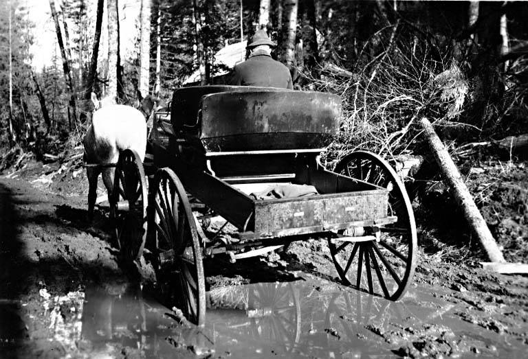
(Photo credit: Wikimedia Commons)
In 1849, to deal with the problem of poor roads, the Ontario government passed legislation allowing private companies to build toll roads.
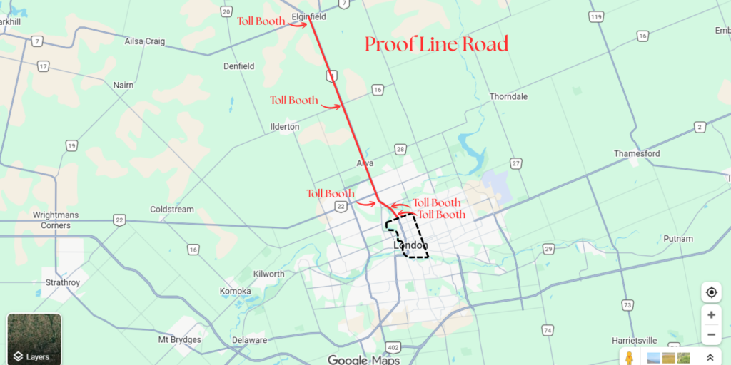
Immediately, a local group of London businessmen seized the opportunity, forming the “Proof Line Road Joint Stock Company” to grade, macadamize, and bridge the Proof Line Road north of London.
The road got its name from the early days when surveyors verified, or “proved,” the accuracy of the layout of the London District by comparing the various concession roads and lots they surveyed to the Proof Line Road running north.
The company completed a 10-mile stretch into the countryside, north from the V intersection at Richmond Street and Western Road, through Arva, Birr, and on to Elginfield (see map below). Later, they extended the Proof Line Road southwards to Huron Street, which at the time was the northern boundary of the City of London.
To pay for all these road improvements and to make a tidy profit for themselves, they put 5 toll booths along the route.
At first, locals considered the Proof Line Road well worth the tolls and ranked it the best-maintained route in the district. They also liked the reliable stagecoach service. Several hotels and taverns opened along the road, an indication of its heavy use.

However, 33 Years Later…
By 1882, roads everywhere had improved immensely. The province declared that all publicly owned county roads were toll-free, yet the Proof Line Road continued to collect its toll.
Resentful citizens would often take a detour for miles to avoid the toll gates on a road “run by profiteers,” as some of them put it.
25 Years After That…
Finally, in 1907, local councils and the province, spurred on by public petitions, bought the Proof Line Road for $11,000. The occasion was marked by a huge celebration in Arva, during which the toll gates were collected and burned in a large bonfire “as relics of barbarism.”
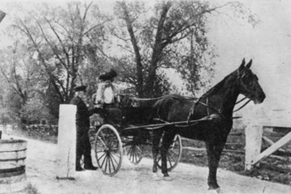
(Photo credit: Ivey Family London Room, London Public Library, London, Ontario, Canada)
Road Improvements Today
Today, people in the north end of the city are again asking for road improvements. And the city has responded… but with no tolls this time, of course.
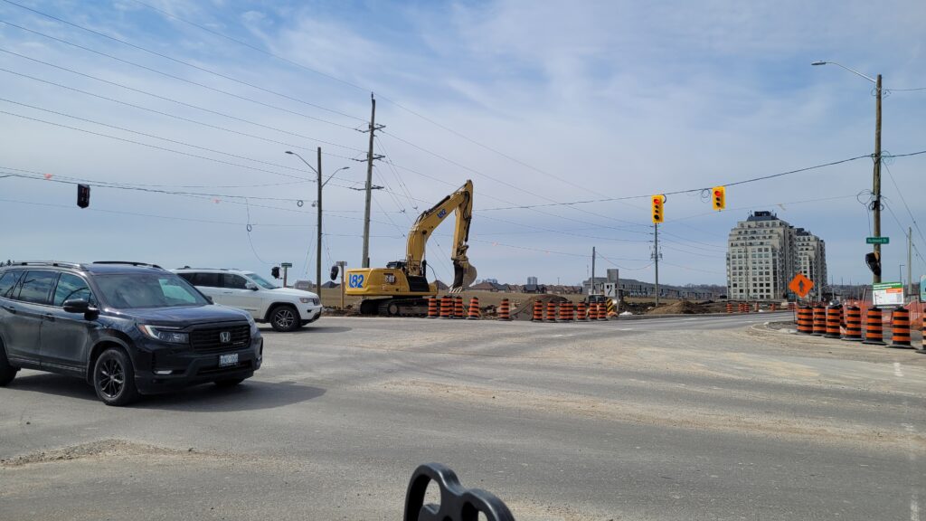
For example, in 2025, the intersection at Richmond Street and Fanshawe Park Road was reconstructed and improved.
(Photo credits: Unless otherwise indicated, the following photos are by the author)
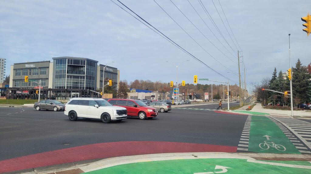
Further north, reconstruction of the next major intersection, Richmond Street at Sunningdale Road, will be completed in 2026 (see below).
The Difference in Road Design Now
The good thing about the road improvements nowadays is that the City of London is building road infrastructure that caters to all modes of transportation, not just cars.
Safer pedestrian crosswalks and crossrides for people on bicycles are being included whenever major roads and intersections are rebuilt.
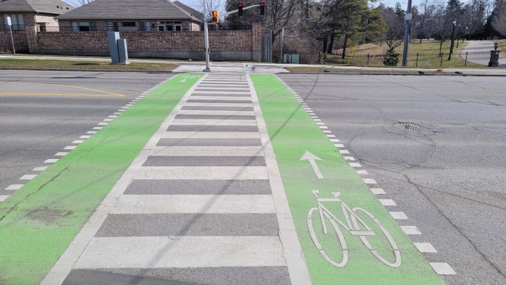
The new pedestrian crossover (PXO) design with bilateral bicycle crossrides and a crosswalk in between makes this crossing much safer for those using active transportation. Before this, there was no safe passage across Richmond Street for a 1 km stretch between North Centre Drive and Sunningdale Road.
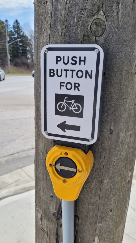
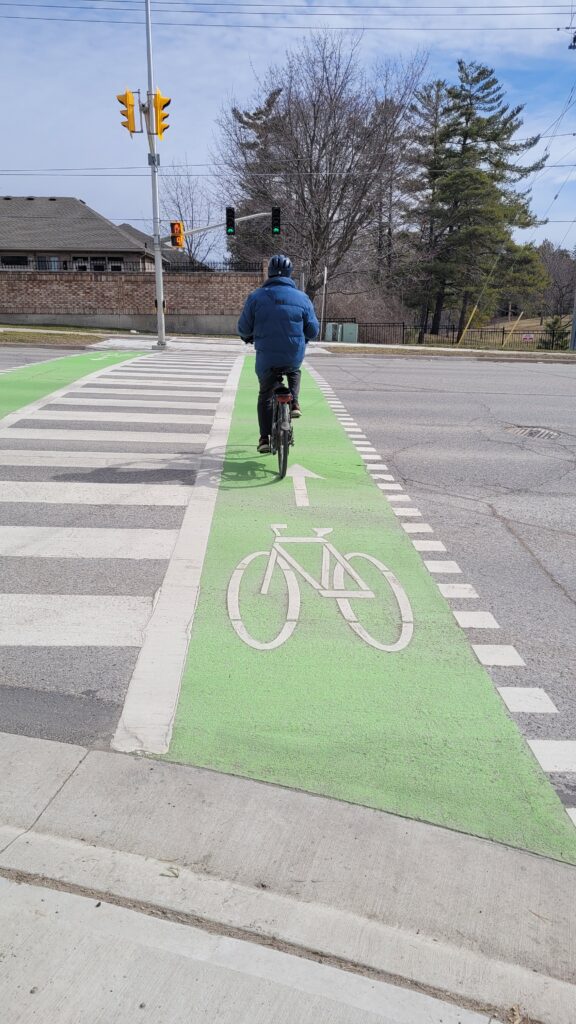
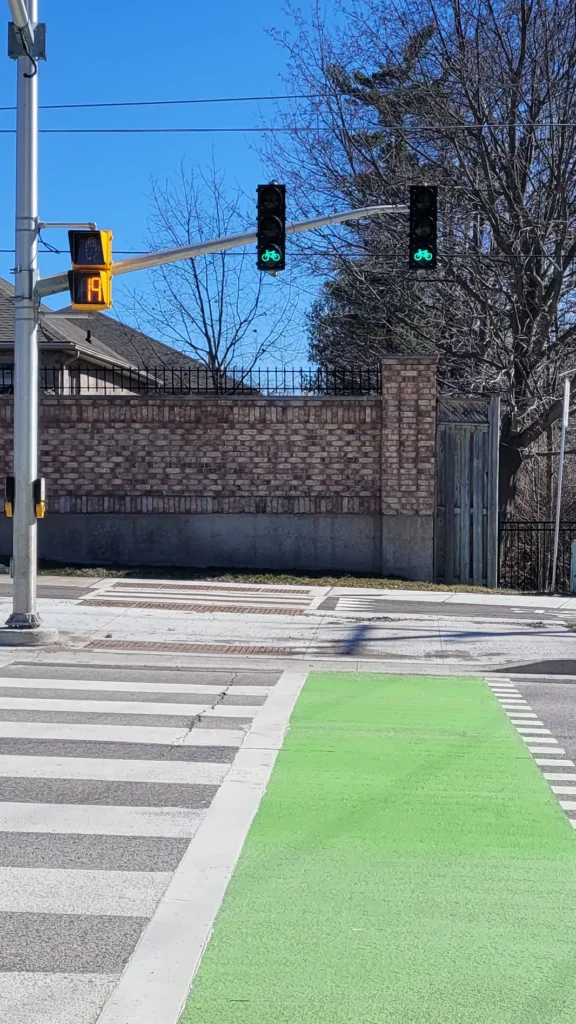
New dedicated push buttons for people on bicycles (left photo), a dedicated crossride (centre photo), and dedicated bicycle crossing signals (right photo) complement the crosswalk infrastructure to make this crossing much safer and accessible for people of all ages and abilities.
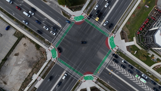
Notice the prominent painted crosswalks and crossrides in the intersection, and separate sidewalks and protected bicycle lanes leading to and from the intersection in all directions.
(Photo credit: City of London)
The plan is for sidewalks and bicycle lanes to eventually take people safely all the way from the city centre in the south to the city limits in the north, along parts of the route previously known as the Proof Line Road, the toll road that drove London drivers crazy all those years ago.
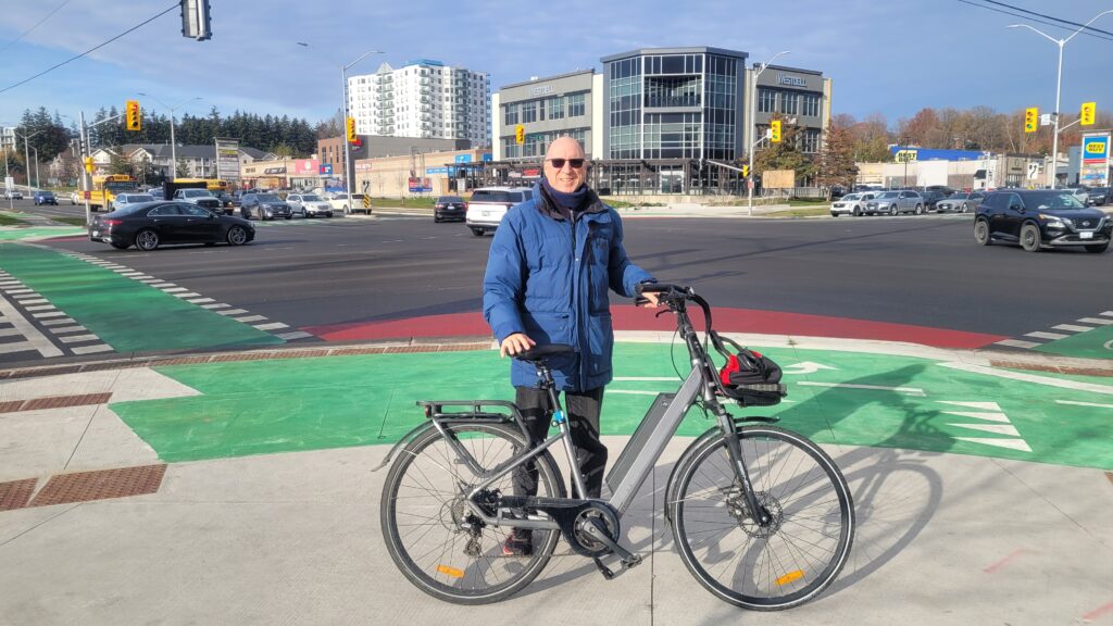
Hi, I’m Lawrence, storyteller and unofficial London cheerleader.
I’m a guy who loves telling tales about the early history of London and the new bicycle infrastructure the city is building. If reading stories like this makes you want to experience London’s charm (on our quieter streets and pathways, of course), I’d be thrilled to have you along on one of our bicycle tours.
Leave a Reply