Did you know that London is a launchpad for exploring the cosmos?
Tucked away on the campus of Western University is the Institute for Earth and Space Exploration, better known as Western Space.
On A Mission for Humanity
Western Space is the leading organization in Canada for Earth and Space Exploration, research, and training. Think of it as a mission control for brilliant minds, where astrophysicists, geologists, engineers, and even philosophers and artists come together to answer some of humanity’s biggest questions:
Founded on the principle that exploration is a fundamental human drive, the institute trains the next generation of explorers to tackle challenges from climate change monitoring to planning future missions to the Moon and Mars. They are, quite literally, building the future of space exploration right here in our city.
Western scientists are searching for ways for Canada, its cities, and its citizens to adapt to the recent record-high temperatures. (Photo credit: Julide Cakiroglu/Western Communications)A team of researchers at Western University studied which neighbourhoods in London were most at-risk during extreme heat events and, according to the creators, can be used by civic planners as an invaluable tool for building a cooler city in a warming world. (Photo credit: Karlos Lao/Western University)Researchers from Western Space are using drones, satellites, as well as stationary and hand-held devices to determine exactly how much methane is produced at London’s city landfill site on Manning Drive and whether any of it is escaping the collection system currently in place. The above photo shows where methane is collected and burned off. (Photo credit: City of London)A Western alumnus served as an engineer on the NASA science operations team that guided the Mars Rover once it landed on February 18, 2021. (Illustration by NASA/JPL-Caltech)Western space experts are currently field-testing new instruments that will eventually sit two metres above the Rover (as pictured above) when it is sent to Mars in 2028. (Photo credit: European Space Agency/Miabspace)Remarkable image near the heart of the Orion Nebula. As a partner, the CSA (Canadian Space Agency) receives a guaranteed share of the James Webb space telescope’s observation time, making Western scientists some of the first to study data collected by the most advanced space telescope ever built. (Photo credit: NASA/ESA/CSA, E. Dartois, E. Habart, PDRs4All ERS team)
Background
The Institute for Earth and Space Exploration (Western Space) was established in June 2019, building on the foundations of the former Centre for Planetary Science and Exploration.
Western Space hosts the only planetary science graduate collaborative specialization in Canada. Established in 2008, this program ranks among the top five worldwide in the number of students, many of whom are major scholarship recipients.
Western Space includes a Mission Control Facility, partners with international research collaborators, and regularly reaches out to the public to share its passion.
For instance, on public nights, you can view the stars through the 10-inch refractor telescope at the Hume Cronyn Memorial Observatory and pose your questions to the astronomers hosting the evening session.
(Photo credits: Lawrence Durham)
Your Next Adventure Awaits
London is a city of layers.
It’s a place where you can pedal along a serene river path in the morning and, by the afternoon, be contemplating the technology used to monitor our own changing Earth or the mysteries of a Martian landscape.
The story of Western Space is a powerful reminder that you don’t have to travel far to feel the thrill of exploration. Come see the hidden gems throughout London that showcase our unique blend of historical charm and bold, forward-thinking vision.
The author, in front of the Cronyn Observatory. (Photo credit: Lawrence Durham)
Hi. I’m Lawrence – bicycle tour guide, storyteller, and lover of London’s diversity.
I help curious folks like you discover the best parts of London, from its peaceful riverbanks to its sky-high ambitions. If you want to experience the energy of this great city, come along for a bicycle tour with me.
At one time, if you asked a Londoner for directions in the city’s north end, you’d likely hear a name, “Calamity Corners,” that sounds more like a wild west outpost than a modern intersection.
In the late 1800s, there were lots of stagecoach wrecks at the corner of Fanshawe Park Road and Richmond Street.
Way more trees. A narrow dirt road coming down a fairly steep hill. The stagecoach picks up speed. If the brakes overheat and fail, you’ve got a runaway stagecoach. If the stagecoach (or sleigh) overtakes the ability of the team of horses to hold it back, well, there you have it… a calamity.
The calamity begins with a steep hill and a narrow road. (Illustration credit: Canadiana)
By 1935, the London Free Press was calling it the most dangerous intersection in western Ontario.
In 1936, shortly after the new Masonville School was built near Calamity Corners, the principal reported that, “he had no other choice than to let students go briefly to the windows to assess the damage whenever they heard the unmistakable sounds of colliding vehicles.”
The Boom Years: When the Name Stuck
Car on car crash, 1965. Notice the “School Crossing” sign for the nearby school. (Photo credit: Archives & Special Collections, Western University, London Free Press collection of photographic negatives)Car and Truck crash, 1967. (Photo credit: Archives & Special Collections, Western University, London Free Press collection of photographic negatives)
As London expanded aggressively northward in the post-war era, so did Richmond Street. The road was widened, and what was once a rural route became a major arterial corridor.
Looking north along Richmond Street from the intersection with Fanshawe Park Road in 1966. (Photo credit: Archives & Special Collections, Western University, London Free Press collection of photographic negatives)
The intersection became a notorious hotspot for fender-benders and traffic snarls.
Even back then, the pace of development was outstripping the infrastructure needed to support it.
The Pressure Cooker: A Busy Intersection in a Growing City
Aerial view, looking southeast in 1950. The surrounding area was largely rural. (Photo credit: Masonville Secondary Plan, City of London)Aerial view, looking southeast in 2026 (76 years later). Notice the commercial and suburban buildup around the intersection. (Photo credit: Google Maps)
The intersection is currently surrounded by big-box retailers, restaurants, and services that draw traffic from all corners of the city. It’s a place of constant motion, a symbol of a city that is actively outgrowing its old skin.
The view from a building’s 3rd floor, looking southeast. (Photo credit: Lawrence Durham)A bird’s-eye view of the Fanshawe Park Road and Richmond Street intersection with mobility improvements. (Photo credit: City of London)
By 2021, London was ranked the fastest-growing city in Ontario and the fourth fastest-growing city in all of Canada.
The intersection at Richmond and Fanshawe Park Road is the 5th busiest in London, as ranked by TomTom. (Photo credit: Lawrence Durham)Even today, when you type in “Calamity Corners,” look where Google sends you. (Google Maps)
The Future: Densification and a Transit Village
Just when you might think the story peaks, a new chapter is being written.
This whole area, including nearby Masonville Mall, is slated for a monumental transformation into a “Transit Village.” This isn’t just a simple expansion; it’s a vision for a denser, more walkable, and transit-oriented urban hub, with high-density residential towers, commercial space, and improved public transit, all integrated into a single site.
Already, planning application signs are up. (Photo credit: Lawrence Durham)The map of the proposed Masonville Transit Village. (Photo credit: Masonville Secondary Plan, City of London)
This exciting development promises to densify the entire area, bringing more people, more life, and undoubtedly, more pressure to the already-busy intersection, which now stands at a new crossroads – not of streets, but of eras, between London’s car-centric 20th century and its denser, more sustainable 21st-century future.
The Masonville Secondary Plan includes “greenways,” active transportation routes for pedestrians and cyclists, as well as more shaded areas to rest. (Photo credit: Masonville Secondary Plan, City of London)
The challenge for our city will be to manage this growth, to re-engineer this legendary corner not as a point of calamity, but as a model of efficient, modern urban flow.
So, is Calamity Corners STILL the worst intersection in southwestern Ontario?
I’d say “No.”
Even though it’s still busy, the traffic engineers have gotten rid of most of the design flaws that made it so dangerous in the past.
The author, at the intersection of Fanshawe Park Road and Richmond Street. (Photo credit: Lawrence Durham)
Hi, I’m Lawrence—storyteller, unofficial London cheerleader, and a guy who believes the best stories are found when you’re not behind a windshield.
I started this blog as a way to share the wonderful, quirky, and hidden-in-plain-sight gems that make our city special. Uncovering the true tales behind places like Calamity Corners is exactly what I love to do.
If reading about all this busyness makes you want to experience the charm of London’s quiet pathways instead, I’d be thrilled to have you along on one of my relaxing bicycle tours.
PCBs (or Polychlorinated Biphenyls) were once viewed as a “miracle” substance. That’s because PCBs are non-flammable, chemically stable, and excellent insulators.
From the 1950s through the 1970s, the Westinghouse plant on Clarke Road in London manufactured essential electrical components like transformers and capacitors.
And the key to their success was PCBs.
Aerial Photo of the Westinghouse Plant on the south-east corner of Clark Road and Huron Street. c.1960s. (Photo credit: London Free Press, Collection of Photographic Negatives)
The Hidden Danger: Understanding the PCB Threat
In the early 70s, studies revealed the risks of using PCBs:
They are highly toxic and carcinogenic chemical compounds.
They bioaccumulate, traveling up the food chain, becoming more concentrated in animals (and humans) at the top.
They persist and can remain in the environment for decades.
An example of biomagnification of PCBs in the food chain. (Source: Enviroforensics)
By the late 1970s, production of PCBs was banned across North America.
PCB warning label on a power transformer known to contain PCBs. (Photo credit: Sturmovik)This transformer, dating from the 1930s, now has a warning label indicating that it contains PCBs. (Photo credit: Sturmovik)Labelling transformers containing PCBs (Photo credit: US Army Corps of Engineers)
Even though environmental agencies across North America enforced the 1970s ban, PCBs continue to pose health problems today due to their lingering presence in soil and sediment, and from products that were made before the ban.
Now back to Westinghouse
Like many sites across the continent, Westinghouse initially disposed of its PCB-laden materials (either knowingly or unknowingly) on the ground around its property.
Then PCBs from the contaminated soil leaked into the nearby Walker Drain and Pottersburg Creek, especially after heavy rains. From there, the PCBs found their way into the south branch of the Thames River.
In 1980, the discovery of elevated PCB concentrations in minnows collected from the Thames River near the mouth of Pottersburg Creek prompted an investigation, which eventually led to the Westinghouse Plant as the source of the contamination. (Photo credit: Bishnu Sarangi)You can follow the path the PCBs took as they made their way down Walker Drain and Pottersburg Creek to the South Branch of the Thames River. (Map by Nathalia Celeita)
How The Government Fixed the Problem (Temporarily)
The facility consisted of four containment cells lined with a non-permeable synthetic liner and about 24 inches of clay. The lined cells were surrounded by a sand/gravel leak detection zone contained within a secondary seal of clay.
The ministry monitored the site monthly, and thankfully, no leaks occurred.
In 1985, the MOE purchased the containment site to store MORE PCB-contaminated soil originating from OTHER industrial properties, as well as sediments cleaned up from Pottersburg Creek and Walker Drain.
And that’s how London came to have the LARGEST STOCKPILE OF TOXIC PCBs IN CANADA.
The Permanent Solution 24 Years Later (Excavation, Destruction, and Restoration)
In the 1980s, no technology or approved sites existed for the safe destruction of PCBs.
Secure storage was the only option available.
However, by the late 2000s, that all changed as cost-effective and safe methods for permanently destroying PCBs were developed.
Decommissioning of the Clarke Road site began in February 2009, and the first truckload of waste left the site in June. Numerous safety measures were in place to protect community health and safety throughout the project. Those precautions were backed up by constant monitoring of local air, dust, surface water, and groundwater.
Constant monitoring was done during the decommissioning of the Clarke Road site. (Photo credit: QM Environmental)
With the treated material gone, the site was backfilled with clean soil and re-vegetated for potential future use.
Total cost: $100 million.
A New Chapter: What This Cleanup Means for London
This story is more than an industrial report—it’s a narrative of renewal. It reveals a city that confronts its history with honesty and science, investing in a healthier future for its land and people.
The cleanup is an example of turning a challenge into a point of pride, demonstrating that environmental responsibility and community well-being are central to our identity.
The author, in front of the now vacant Westinghouse Plant. (Photo credit: Ben Durham)
Hi. I’m Lawrence, bicycle tour guide, storyteller, and lover of the environment.
This PCB story is just one example of the many unique things I’ve discovered while riding my bicycle around London.
It’s my personal mission to help curious folks like you discover all parts of London… from the pleasant to the not-so pleasant, all from the seat of my bicycle, of course. If you want to experience a city that’s actively shaping a brighter future for everyone, I invite you to come on a bicycle tour with me.
In 1885, an enthusiastic 80-member tobogganing club built the first engineered toboggan slide in London at the Military Grounds at the northeast corner of Wellington Street and Central Avenue.
It was wide enough to allow a couple of four-seater toboggans to descend the 45-degree slope at the same time, with a run of 200 to 250 feet on level ground.
A military band even serenaded the merrymakers who got refreshments at the nearby Gun Shed.
London’s initial toboggan slide was similar to this one built on Prince Edward Island, c. 1870. (Source: Canadiana)
1886
The next year, the starting platform was bigger and better, rising to a height of 38 feet. Its double chute was divided by foot-high boards and was 160 feet long. The course, which was lit by two rows of lanterns, went from the top of the ramp down to the end of the 279-foot-long run where a cushioning bank of snow was piled up against the street-side fence.
1887
The next season saw the construction of a 480-foot-long wooden slide starting on a vacant lot on Ridout Street near the west end of Albert Street.
Pairs of riders climbed sturdy wooden steps to the platform 15 feet above the river embankment, then launched themselves down the steep dual chutes, sliding a long distance before ending up down below on the river flats.
Three overhead electric lights, a novelty at the time, attracted crowds of people on a nightly basis.
1888
The next season saw two slides competing for patrons. The 800-member London Toboggan Club opened the new London North Slide further up the eastern bank of the Thames River.
The dual chute was higher and longer than the previous one, being 82 feet high and 780 feet long with a total run of 1,620 feet. It took 21 seconds for the descent, and then the riders faced a long walk back up the path, dragging their toboggans behind them. The contractors used nearly 60,000 feet of lumber in its construction.
Over 2,000 people watched the preliminary heats of the club’s first (and only) annual races on the evening of Tuesday, January 17th.
Not to be outdone, London South opened its own facility that January on Craig Street. From the brink of the hill overlooking what is now Thames Park, riders accelerated down the icy chutes, then flew through two dips on an open course across the flats, where they were challenged by a few trees for added excitement.
Sometimes toboggans ended their run by careening over the riverbank onto the ice. Since the Thames is quite shallow there, apparently drowning wasn’t a concern at the time.
1889
The next season saw the introduction of the London South Slide that started at the Hunt Dam and went straight down the frozen river, all while being lit by electric lights.
Another slide opened on what eventually became the campus of Western University.
In the rural areas outside London, people started setting up toboggan runs that took advantage of steep hillsides on their farms to get in on the action.
And of course, all of these sites charged admission to cover their costs at the very least, and to make a profit at best.
A two-lane tobogganing run in Montreal, c. 1890. (Photo credit: Canadiana)This ambitious toboggan slide in Montreal had 6 lanes, c.1906. (Photo credit: Libraries and Archives Canada)
1890 & 1891 (Two Years of Bad Weather)
The winter of 1890 was unusually warm in London. No snow fell until the second week of February, making for a very short season.
In 1891, the season started early with lots of snow, but also ended early, closing by the middle of January, when the snow melted.
1892 (The End of an Era)
By 1892, the exciting but brief era of engineered toboggan slides in London was over. Did fickle weather play a role in their demise, or did people simply decide that natural hills provided them with enough excitement?
After all, toboggan runs on natural hills might be shorter and less steep than the engineered slides, but hey, THEY WERE FREE!
Tobogganing In London in Modern Times
With so many hills throughout the city, Londoners of all ages have continued the winter tradition of tobogganing.
As a tip of the hat to the toboggan craze of the late 1800s, a local craft brewery on Richmond Street opened its doors in 2014.
Called the Toboggan Brewing Co., it is decorated with toboggans hanging from its ceilings and has period photos on its walls.
A view inside the Toboggan Brewpub. Can you spot the two wooden toboggans hanging from the ceiling? (Photo credit: Lawrence Durham)
So whether you’re the active type who slides down hills on a toboggan or the type who prefers instead to sip a cold brew with friends in The Toboggan, there is a place for you here in London.
The author, outside the Toboggan Brewery in downtown London. (Photo credit: Lawrence Durham)
Hi, I’m Lawrence – bicycle tour guide, storyteller, and enthusiastic cheerleader of all things London.
I love sharing stories about what makes our city so special (in all four seasons). Perhaps, when the weather turns warmer, I can show you around London… on a bicycle, of course.
When you think of world-changing tech hubs, you probably picture some glass-and-steel metropolis where everyone wears black turtlenecks and drinks $12 cold brew.
Well, it’s time to update your mental map because London, Ontario, just ranked fourth on North America’s 2025 list of next-generation tech markets.
That’s right, little ol’ London has quietly outpaced a bunch of flashier cities to become one of the continent’s most explosive tech stories. And the best part? It’s a scene built not on hype, but on things that actually matter, like stability, diversity, and a refusal to take itself too seriously.
By the Numbers: Why London’s Tech Boom is No Accident
Let’s break down the stats that should make every other city a little jealous.
Metric
The Verdict
Why It Matters
Sector Growth (3 yrs)
54.5% growth
The highest growth rate on the list, more than 10% above its peers. This isn’t a slow burn; it’s a rocket launch.
North American Ranking
#4 (North America’s “Next 25 Markets”)
A notable jump from its previous position (#10 in 2021), officially putting London on the map as a top-tier contender.
Tech Employment
20,700 jobs and climbing
That’s over 4,000 new jobs compared to the previous year, proving the growth is creating real opportunities.
Average Tech Wage
$77,347 USD (2024)
A whopping 33.8% wage growth since 2021. Talent isn’t just coming; it’s being valued and paid well to stay.
More Than Just Code: A Tech Scene with an Identity Crisis (But In the Best Way)
So, what’s the secret sauce? London’s tech scene refuses to be pigeonholed. While other hubs specialize in one thing, London’s innovation comes in so many forms that it’s hard to keep track. This isn’t a one-trick pony; it’s a whole ecosystem.
London is home to Digital Extremes, the studio behind the massively popular game Warframe. The company has been operating in London for 30 years now and draws thousands of fans to the city for its conventions. This isn’t a fledgling industry; it’s a deeply rooted part of the culture.
Fans attend TennoCon, a video game convention for Warframe and other games by Digital Extremes, at RBC Place in London, Ont., in July 2023. (Photo credit: Jonathan Ore/CBC)
Then there is the health care industry. With a robust network of hospitals and research institutions, London is a natural leader in medical technology.
Opened in 1986, Robarts Research Institute at Western University is a medical research facility with more than 600 people working to investigate some of the most debilitating diseases of our time. (Photo credit: Robarts Research Institute)In 2023, it took workers at Robarts 11 hours to carefully offload and deliver Canada’s most powerful MRI system – only the second of its kind in North America and sixth in the world. (Photo credit: Christopher Kindratsky/Western Communications)
But it doesn’t stop there. Agricultural technology, food innovation, and artificial intelligence are all thriving here as well. The city’s strength is its diversity, making it resilient and endlessly interesting.
Founded in London in 2015, Northern Commerce is the fastest-growing eCommerce agency in Canada. (Photo credit: Lawrence Durham)Founded in London in 2003, Voices.com, has become the largest provider of voice actors in the world. Founded in London in 2004, Big Blue Bubble has developed over a hundred computer games. (Photo credit: Lawrence Durham)With its Canadian headquarters located in London, Carfax is Canada’s definitive source of automotive information, enabling used vehicle buyers and sellers to make informed decisions by accessing billions of records. (Photo credit: Lawrence Durham)
Stability & Soul: The Un-Glamorous Keys to Success
What truly makes London attractive, especially for culture seekers, is its vibe. The city offers a combination of stability and beauty that’s a welcome antidote to the breakneck pace of traditional tech hubs.
Companies like Info-Tech Research Group, a global firm with over 1,500 employees worldwide, still call London home, viewing it as a “launch pad, not a boundary.”
Founded in London in 1997, Info-Tech Research Group is the fastest-growing information technology research and advisory company in the world. (Photo credit: Lawrence Durham)
What makes London particularly special is how these technological developments integrate with the city’s historic fabric. You’ll find startups operating in restored heritage buildings, tech workers enjoying lunch in Victorian-era parks, and innovation districts that maintain human scale rather than overwhelming glass towers (although we do that too).
The Info-Tech Research Group building is actually located at a historically significant site in the downtown area, as indicated by this plaque. (Photo credit: Lawrence Durham)
London isn’t a transient boomtown. It’s a community where businesses put down roots for the long haul, supported by a network of incubators, academic institutions like Western University, and organizations like TechAlliance that actively fuel growth. As the city’s mayor, Josh Morgan, notes, this achievement is a milestone for the “innovators who build and invest here.”
Incorporated in 2000 and located in downtown London, TechAlliance provides support to startups and high-potential firms through a range of programs and initiatives and is an important stakeholder in the region’s innovation ecosystem. (Photo credit: Lawrence Durham)
London’s Next Chapter
The Forest City’s tech story continues to evolve. Recent developments include:
Major investments in artificial intelligence and machine learning research
Expansion of the city’s cybersecurity sector
Growth in clean tech and sustainable innovation
Continued strength in digital creative industries
This isn’t a transient boom but the latest chapter in a long story of adaptation and growth. From a strategic settlement at the Forks of the Thames 200 years ago to a 21st-century innovation hub, London has maintained its character while embracing change.
The author, in front of the Info-Tech Research Building in downtown London. (Photo credit: Lawrence Durham)
Hi. I’m Lawrence – bicycle tour guide, storyteller, and proud Londoner.
I love shining a light on the hidden gems and incredible stories that make our city special. If you want to experience the charm of London and get a more intimate look at why the city is attracting all these tech firms, why not join me on a bicycle tour?
In early December 2010, a weather event of historic proportions settled over southwestern Ontario, a storm so significant it earned the dramatic name “Snowmageddon.”
For 102 hours between December 4th and 8th, an astonishing 177 centimetres of snow blanketed the region, falling steadily for 98 of those hours.
The snow was almost six feet deep in places. (Photo credit: Yahoo! News)
Snowmageddon was caused by the “lake-effect,” which is a term that describes the streamers that blow in from the open waters of Lake Huron.
This effect is common in winter when winds from the west blow over the still-warm waters of Lake Huron and collide with the cold air over land, dumping all their moisture as snow.
What made “Snowmageddon” unique was its persistence; the winds were “caught in a rut” with no other weather system to push them along, resulting in an unrelenting, multi-day snowfall.
Schools closed across the city and throughout surrounding counties on December 6th and 7th.
London’s public transit system halted operations that did not resume until December 9th.
‘Snowmageddon’ dumped a record snowfall in Lucan, Ontario, just north of London. (Photo credit: Yahoo! News)
On the treacherous highways to the east of London, high winds created dangerous whiteout conditions and massive drifts. A multi-vehicle accident involving several tractor-trailers closed Highway 401 near Ingersoll.
In Lambton County to the west, a separate but equally intense pulse of the storm on December 12th led to the county declaring a State of Emergency.
Over 1,500 motorists were stranded in deep snow along Highway 402 and other roadways. The situation grew so dire that the county requested the deployment of Canadian military helicopters to undertake rescue flights for those trapped in their vehicles.
A Sarnia police officer checks on stranded motorists on London Line, East of Sarnia, Ont., on Tuesday, Dec. 14, 2010. (Photo credit: Glenn Ogilvie / The Canadian Press)
Where History Meets Heart: Stories of Community Resilience
In the midst of the chaos on Highway 402, incredible scenes of generosity unfolded. Individuals opened their homes to complete strangers.
John Prins, a local manufacturer, saw a stranded tanker truck near his driveway and invited the driver in to warm up. He then learned of another stranded driver, and then another. “The next thing you know,” Prins recalled, “we basically pulled that whole group, maybe there was like… 35, 40 people”. His home became an impromptu shelter, with neighbours contributing food and another using farm equipment to dig out vehicles.
Archivist Nicole Aszalos, who was home during the storm, remembers the surreal quiet that followed: “You heard nothing but the howling of the wind and the sound of the snowmobiles very faintly in the distance”. Those snowmobiles became the lifelines of the community, ferrying supplies and helping with rescues where cars could not go.
These stories of neighbours helping neighbours, of communities rallying without a second thought, form the warm, human heart at the centre of this cold historical event.
Discovering London’s True Character
The legacy of Snowmageddon isn’t about preparing for the next great storm. It’s about the character of the people in the area, a character built on resilience, kindness, and a quiet determination to look out for one another.
This is the same welcoming spirit you’ll find all year round in London’s vibrant neighbourhoods, its charming cafés, and along the scenic Thames River pathways.
The author, riding his bicycle in a relatively “mild” snowstorm in December 2025. (Photo credit: Ben Durham)
Hi. I’m Lawrence – bicycle tour guide, storyteller, and all-weather cyclist.
I love sharing stories about what makes our city so special, regardless of the season we find ourselves in. As an optimist, I like to say, “There isn’t bad weather, only poor clothing choices.”
But seriously, though, when the weather does turn warmer in the spring, perhaps you’d like to join me as I show you around London… on a bicycle, of course.
Every city has its monuments. But in London, Canada, one of our most magnificent monuments isn’t made of brick or mortar—it’s a living, breathing giant.
Tucked away in the charming Blackfriars district, a majestic white oak stands as a silent onlooker to two centuries of history.
The heritage oak at the end of Argyle Street, July 2009. (Photo credit: Google Street View)
A Witness to London’s Earliest Days
This tree has seen the transformation of the landscape from dense forest to a thriving modern city. It’s a direct, living link to a precolonial London, a remnant of the vast Carolinian forests that once covered southwestern Ontario.
Looking south from Argyle Street, this photo from 1883 shows the oak tree (coloured green) was already two-storeys tall. (Photo credit: City of London)
The Dilemma
By 2025, the roots of the massive oak were growing into the foundation of the nearby house, with its five-foot-wide trunk being only inches away from the edge of the roof.
Notice just how close the tree trunk was to the house, Dec 2022. (Photo credit: Google Street View)
A decision had to be made. Does the city save the building or the tree? One had to go.
The problem was that the heritage house was protected. But so was the tree because the Heritage Act specifically includes landscape features as important elements.
According to one consultant, “We have two heritage attributes [where] one has essentially been destroying the other. The root system of the tree has been growing into the (house) structure for several years.”
The Decision
A few factors tipped the scales in favour of the tree:
The interior of the heritage house was destroyed by fire in 2022
An arborist’s report described the tree as “one of the nicest oak trees in the city,” and that, for “its age and structure, it is in impeccable condition.”
So it’s not surprising that city staff recommended permitting the house to be demolished while protecting the tree.
No mechanized equipment would be permitted near the tree during demolition or construction.
Part of the foundation must remain buried in the ground.
The new house had to be built near the centre of the property – a substantial distance from the oak tree.
The old house at 66 Blackfriars had to go, July 2023. (Photo credit: Google Street View)The new house is set back from the large oak tree, Nov 2025. (Photo credit: Lawrence Durham)
The Best Part
So, the next time you’re wandering around London, remember that some of our most fascinating history isn’t confined to plaques and museums—it’s growing right beside us.
And the best part? You can go and see this incredible tree for yourself.
The author, standing beside the Heritage Tree. (Photo credit: Lawrence Durham)
Hi. I’m Lawrence – bicycle tour guide, storyteller, and proud Londoner.
I love shining a light on the hidden gems and incredible stories that make our city special, like this heritage oak. If reading this makes you want to experience the charm of Blackfriars and other hidden corners of London up close and personal, why not join me for a guided bicycle tour?
When we think of London, Ontario, we picture the Thames River, beautiful parks, and a vibrant city.
But what if I told you that the ground beneath our feet holds a secret history of London that stretches back over 13,000 years?
Long before London was founded, this very landscape was a stage for epic natural dramas, Ice Age giants, and the first human footsteps.
The Great Thaw: London’s Icy Beginning
Our story starts at the end of the last Ice Age.
For millennia, a colossal mass of ice, the Laurentide Ice Sheet, smothered most of Canada. As the climate slowly warmed, this mighty glacier began its grand retreat, melting northward from what is now Southwestern Ontario.
The meltwater unleashed torrential rivers and carved out the basins of our Great Lakes. The land, once crushed by billions of tons of ice, began to rebound.
It was into this new, wet, and fertile world that the first life returned—a world of spruce forests, marshes, and giant creatures that now seem the stuff of legend.
The Giants of the Thames Watershed
Imagine cycling along the Thames River Parkway today, but instead of squirrels and geese, you spot a shaggy, elephant-like creature ambling through the trees. Meet the American Mastodon, the undisputed megastar of prehistoric London.
Restoration of an American mastodon without fur. (Illustration credit: Heinrich Harder)
These magnificent beasts were not woolly mammoths (their more famous, cold-adapted cousins). Mastodons were forest dwellers, with long, curved tusks and teeth perfectly designed for browsing on twigs and leaves.
They stood over three metres tall at the shoulder, a true testament to the richness of the post-glacial landscape. For thousands of years, herds of these gentle giants roamed the swamps and woodlands that would one day become London.
The First People: A Story Written in Stone
As the mastodons thrived, another chapter was beginning. The first Indigenous peoples to arrive in this region were the ancestors of the Anishinaabe, Haudenosaunee, and Lünaapéewak peoples. They were highly skilled and adaptable hunters, living in a world of immense natural abundance.
Painting of indigenous people on the hunt for foraging mastodons, found at The Museum of Ontario Archaeology in London. (Photo credit: Lawrence Durham)
Archeological dig at Red Hill Valley near Hamilton. (Photo credit: Dr. Ron Williamson)
Blood found on sharpened stone tools unearthed at the dig site was tested for DNA and showed conclusively that the Paleo Indigenous people at that time hunted and butchered mastodons living in the area – a discovery which the head archeologist, Ron Williamson, called “unprecedented.”
It likely would have taken a group of hunters to take down a mastodon. (Illustration by Ed Jackson, CC BY-NC)
Evidence for mastodons in Canada is abundant and includes widespread fossilized bones, teeth, tusks, and preserved dung.
Over 98 mastodon sites have been recorded in Southern Ontario alone, particularly along the north shore of Lake Erie, reflecting the forested habitat they preferred.
This map shows 133 locations where mastodon (and some mammoth) remains were found in southwestern Ontario. (Map credit: Earth Sciences Museum at the University of Waterloo)
The Highgate Mastodon had tusks 3 m (10 feet) long. (Photo credit: Chatham Daily News)
These stories remind us that London’s history doesn’t just live in museums. It’s woven into the very gravel of the Thames River and sleeps just beneath the soil of our parks and pathways. Every time we walk, cycle, or paddle through this city, we are moving through a landscape that had previously been home to giants.
Model of an archaeological dig site, located at The Museum of Ontario Archaeology in London. (Photo credit: Lawrence Durham)The author, looking at a mastodon jawbone (in a display case full of mastodon specimens) at The Museum of Ontario Archaeology. (Photo credit: Dr. Heather Hatch)The author, examining stone arrowheads like those that could have been used to hunt mastodons. (Photo credit: Dr. Heather Hatch)
Hi. I’m Lawrence – bicycle tour guide, storyteller, and a huge fan of our city’s incredible layers of history.
I love London and am constantly discovering hidden gems around every corner. If you’re the curious sort, I invite you to join me so we can explore this great city together.
London, Ontario, didn’t just randomly get its famous nickname, “The Forest City,” for nothing.
It is home to more than 4 million trees, 490 parks, and over 330 km of walking and biking trails.
Victoria Park, located in the centre of London, is an 18-acre oasis of trees and a hub for community events. (Photo credit: ReForest London)
However, before London became the lush city it is today, it first had to learn a painful lesson.
Conquering Nature (That Was A Mistake)
The Carolinian Forest was originally a dense canopy of oak, walnut, and chestnut trees that had stood for centuries. Early travellers to Southwestern Ontario regarded the vegetation as extraordinary. In particular, they remarked on the enormous size of the trees.
This 1840 painting, “Button Wood Tree,” by Philip John Bainbrigge depicts a tree eighteen feet in circumference in the bush near Chatham, Ontario. (Credit: Library and Archives Canada, Acc. No. 1983-47-97)
However, to pioneering settlers, the ancient forest was seen as an obstacle to progress.
With axe and saw, they energetically cleared the land, making way for farms, factories, and the grid of early streets. In fact, the first task for many settlers was removing tree stumps from roadways and their properties.
Looking west along Dundas Street from Wellington Street in 1842. At the time, London was a frontier community of tree stumps and mainly wooden buildings with a population of only 2,000. (From a painting by Lady Eveline-Marie Mitchell Alexander, courtesy of the 1999 Orr Collection at Museum London).
The founding of London in 1826 was an act of ambition, a declaration that a modern, industrial city would rise from the wilderness. In that earnest rush to conquer nature and build a robust economy, the very identity of the land changed.
This rapid transformation came at a cost. The relentless clearing of trees, essential for the city’s growth, slowly stripped away the natural canopy.
Looking north from the Thames River, you get a view of Labatt Brewery and City Mills (before 1874). Notice the lack of forest canopy, as clear-cutting forests to make way for industry was standard practice at that time. (Photo credit: Western Archives, Labatt Brewing Company Collection, AFC 101)
Modern Day Reconciliation With Our Forests
Today, we are on a collective journey to rewrite that story. The mission is no longer about conquering the landscape, but about reconciling with it. We are actively working to overcome that historical deforestation by getting back to our roots, literally and figuratively.
A child showing love for the tree she is about to plant. (Photo credit: ReForest London)
The spirit of the original forest is being coaxed back to life not with axes, but with shovels, through the dedicated work of community plantings and a renewed reverence for our natural environment.
We are weaving the canopy back into our urban fabric, learning from the mistakes of the past.
It’s a living, breathing mission being carried forward by an incredible organization: ReForest London.
Family tree planting. (Photo credit: ReForest London)
ReForest London is on a Mission
Founded 20 years ago, ReForest London emerged with a simple, but powerful goal: to ensure our city lives up to its nickname, the Forest City, for generations to come.
It operates on a beautiful, proactive principle: “The best time to plant a tree was 20 years ago. The next best time is today.”
What a difference a decade makes. (Photo credit: ReForest London)
This isn’t a small-scale effort. It’s a city-wide movement powered by thousands of volunteers, dedicated corporate partners, and the supportive framework of the City of London itself. As a registered charity, its work is multifaceted and deeply impactful, focusing on:
Planting for the Future: Through community plantings in parks, schoolyards, and naturalizations, they don’t just put trees in the ground; they cultivate a more vibrant urban forest.
The Million Tree Challenge: An ambitious, community-driven goal that has seen Londoners come together to add hundreds of thousands of new trees to the landscape.
Empowering Homeowners: With popular programs like their Native Plant Sale and Tree Giveaway, they put the power of reforestation directly into the hands of residents, encouraging the use of native species proven to thrive here.
Community engagement. (Photo credit: ReForest London)Education. (Photo credit: ReForest London)Showing trees some love. (Photo credit: ReForest London)Hi Ho, Hi Ho, it’s off to work we go! (Photo credit: ReForest London)Community tree planting in progress. (Photo credit: ReForest London)Time to show what we did today. (Photo credit: ReForest London)Educating our future leaders. (Photo credit: ReForest London)School trips. (Photo credit: ReForest London)Developing hands-on experience with nature. (Photo credit: ReForest London)One-on-one mentoring. (Photo credit: ReForest London)
All ages, races, and religions, working together for the common good.
(Photo credits: ReForest London)
Why a Canopy Matters: The Lungs of the City
This work is about so much more than beauty. A robust tree canopy is the lungs of a city. It cleans our air, filters our water, and provides crucial habitat for wildlife.
On a hot summer day, walking down a shaded street can definitely feel a lot cooler, a direct result of the “ambient temperature” lowering effect of trees.
The reforesting of London aligns perfectly with the City of London’s Climate Emergency Plan, which boldly aims for London to become the “greenest city in Canada” by 2050.
ReForest London Executive Director Roger Moran, celebrating the 20th anniversary of the organization with London City Councillor Corrine Rahman in 2025. (Photo credit: ReForest London)
Where to See the Story Grow
For a visitor, the work of ReForest London is something you can actually experience.
A wonderful example is their Mini-Forest, located in the Westminster Environmentally Significant Area (ESA)—the largest ESA in the city. This dense, fast-growing forest is a living laboratory and a beautiful, serene spot to witness urban reforestation in action.
(Photo credit: ReForest London)
You can also visit their Community Tree Nursery, where the next generation of London’s canopy is being carefully nurtured.
Ribbon-cutting ceremony at the opening of the Community Tree Nursery in 2025. (Photo credit: ReForest London)Native trees are nurtured here. (Photo credit: ReForest London)
This commitment to a green future creates the very landscapes that make London such a delightful place to explore. The shaded pathways, the lush riverbanks of the Thames, the vibrant parklands—they are all part of the story.
The author, riding along a bicycle path through the Carolinian Forest. (Photo credit: Lawrence Durham)
Hi, I’m Lawrence – bicycle tour guide, storyteller, and a proud champion of our beautiful Forest City.
I love sharing stories about what makes London so special. The cool, shaded trails and beautiful parks are the perfect settings for some amazing bicycle rides. If reading this makes you want to experience London’s green spaces, I’d be delighted to show you around.
The streets were bustling, industry was growing, and the city had established itself as a proud hub in Southwestern Ontario.
Market day in London in 1875. (Credit: Library and Archives Canada, Canadian Illustrated News, 1875-11-13, vol.XII, no. 20. 305)
But this promising city had a big problem, one that kept its citizens and council members awake at night.
The Constant Threat of Fire (1852 – 1875)
In an age where a single spark from a lantern or a stove could spell disaster, London had no reliable water supply to fight fires. And they had no fire hydrants!
Between 1852 and 1875, London experienced 484 fires, leading to a financial loss of over $1,000,000. Although many of the fires were minor, there was typically one major fire every single year in and around the downtown area.
When a blaze started, bucket brigades were often the only defence. It was a heartbreakingly futile effort against a roaring inferno.
Another fire. Another bucket brigade in action. (Photo credit: Wiktionary)
Time and again, valuable buildings, businesses, and homes were burnt to the ground.
Even the new pumper wagons manned by professional firefighters were largely useless without the ability to generate enough water pressure and without a plentiful water source to draw from.
London’s first paid, permanent fire department was established in 1873. Here, firefighters pose with their equipment and horses in front of the King Street firehall. (Photo credit: Western Archives and Special Collections, AFC49-S1-I60009)
This was more than an inconvenience; it was an existential crisis. As other Ontario cities like Toronto and Hamilton modernized their infrastructure with pressurized waterworks, London’s City Council grew increasingly concerned.
How could they attract new businesses and industries to London if they couldn’t guarantee the most basic municipal service – safety from fire?
A Modern Solution for a Growing City (1875)
The solution was clear: build a waterworks. The plan they came up with was a marvel of 19th-century engineering. They chose a site to the west of London where six natural springs flowed from the side of a big hill.
Their vision was to pump the clean, spring water up to the top of the 83-metre-high hill where a massive reservoir would be built. From there, gravity would do the rest, sending water through a six-kilometer pipeline to London to feed the fire hydrants soon to be positioned at nearly every street corner in the city.
Map showing the 1878 Waterworks Plan to get water from the reservoir to London via a pipeline. (Made with Google Maps)
The Great Debate: A Dream Delayed, But Not Denied (1875-1877)
It seemed like the perfect plan. But there was one major hurdle: the estimated $400,000 price tag.
City Council, understanding the critical need, put the issue to a public vote. Not once, not twice, but three times.
You can imagine the debates, the fear of rising taxes clashing with the vision for a secure, modern city.
Meanwhile, London continued to burn. For example, in the four months following the first vote, there were 34 fires.
Finally, perseverance paid off. On the third try, Londoners voted “yes” on December 14, 1877.
Shortly thereafter, a loan for the project was secured, with the promise that shovels would hit the ground in 1878.
The Legacy of a Watershed Moment (1879)
The completion of the Springbank Waterworks in January 1879 was a transformative moment for London.
It wasn’t just about the installation of those first, life-saving fire hydrants. It was about confidence. It was a signal to the world that London was open for business, ready to grow, and committed to the safety and prosperity of its citizens. The city could finally breathe a sigh of relief, no longer living in the shadow of the next great fire.
Incredibly, the natural springs supplied 18 billion litres of clean water daily. Here we see the holding ponds at the base of Reservoir Hill, in the area that would soon become Springbank Park. (Photo credit: London Post Card Album #2, Ivey Family London Room, London Public Library, London, Ontario, Canada)Looking south, you can see the crib dam to the left and the pumphouse to the right. (Photo credit: London Post Card Album #2, Ivey Family London Room, London Public Library, London, Ontario, Canada)Every 24 hours, the pumps could push up to 11 million litres of spring water from the holding ponds at the base of the hill to the reservoir at the top. (Photo credit: Public Utilities Commission 27th Annual Report to the City of London, 1905)When filled, the reservoir on the top of the hill could hold up to 2 trillion litres of water. After the first year, a fence was built around the reservoir to stop the complaints of cows swimming in the water. But, of course, it didn’t stop the ducks. (Photo credit: The Live Wire, July 1920)
In 1879, there were 180 fire hydrants in the city of London.
And today?
The latest figures from July 2019 show that, after 140 years of city expansion, the number of fire hydrants in London had grown to 7,614.
Discovering the Layers of Our City (Today)
This story is just one of the multifaceted aspects that make London such a fascinating place to explore.
The legacy of the 1877 waterworks decision is all around us: from the historic buildings in the downtown core that are still standing today because of the improved fire protection, to the continued beauty of Springbank Park, where it all began.
Historic Dundas Street, looking west from Richmond Street, c. 1900. (Photo credit: London Post Card Album #2, Ivey Family London Room, London Public Library, London, Ontario, Canada)The same scene today. (Photo credit: Lawrence Durham)People walking along the pathways in Springbank Park, autumn 2025. (Photo credit: Lawrence Durham)
History isn’t just in our museums; it’s written into the very fabric of our city, waiting for curious minds to discover.
The author, at the entrance to Springbank Park, December 2025. (Photo credit: Lawrence Durham)
Hi, I’m Lawrence – bicycle tour guide, teller of tales, and a huge fan of our city’s unique history. I love sharing hidden stories like this one that help you discover the best parts of London.
If you’d like to see where these events occurred, why not join me on a guided bicycle tour?
The Thames River, London’s liquid spine, may be a scenic backdrop for cyclists and kayakers today, but it does have a darker past.
For decades, we treated the Thames like a bottomless pit. Imagine a time when every toilet flush, every factory’s chemical byproduct, and every oily trickle from the street headed straight for the river. There was no “treatment.” There was only conveyance.
The river, once teeming with fish, became an open sewer. It was so polluted that by the mid-20th century, calling it “water” was generous; it was more of a biological hazard with a current.
Would you drink from this river?(Photo credit: 3bee)
The wake-up call was as pungent as you’d expect. The stench in summer was unbearable. The river was dying, and it was our fault. This environmental embarrassment sparked a revolution in thinking. We realized a fundamental truth: you cannot continue to use your river as a garbage dump and still somehow expect it to remain a resource.
The Great Separation: Where Things Started to Flow Correctly
The single most important fix was the separation of the sewage system from the stormwater system. We stopped piping our raw wastewater directly into the river. Instead, wastewater got sent to a treatment plant, while rainwater was managed separately.
On the left, with a combined system, sewage risks flowing into the river, especially during heavy rainfall events. On the right, the sewage system is separate from the stormwater system so that all sewage is treated properly before being discharged into the river. (Illustration Credit: EPH Publishing)
But that was just the first step.
Stormwater Management Ponds
We quickly learned that even rainwater running off streets and parking lots carries a nasty cocktail of oil, heavy metals, and debris. Sending that straight to the Thames was only marginally better than sending sewage into the river. So, London got smart. It started building stormwater management ponds.
Stormwater management pond with a small pedestrian bridge on Hyde Park Road. (Photo credit: Lawrence Durham)
These aren’t just decorative puddles. They’re the river’s kidney dialysis units. When rain falls, instead of gushing untreated into the Thames, it’s channeled into these ponds. The ponds slow the flow, allowing sediment and pollutants to settle out before the cleaner water is gradually released into the river. It’s a simple, brilliant mimicry of nature’s own filtering process.
Step 1: Stormwater (and pollutants) flow into the stormwater ponds. Step 2: Sediment and pollutants settle to the bottom. Step 3: Cleaner water leaves the stormwater pond and flows into the watercourse. (Illustration Credit: City of Hamilton)
But it’s only when you add rain gardens and permeable pavement that let water soak into the ground like a sponge instead of racing across concrete that you finally have a city learning to work with the water cycle, not against it.
The Downstream Domino Effect: It’s Not Just Our Problem
Here’s the kicker: a river doesn’t care about city limits. The problems we create in London don’t stay in London.
This map shows how pollutants entering the Thames River in London can affect everyone downstream. (Source: London Environmental Network)
When fertilizers from lawns in London, along with manure from farms along the river, packed with phosphorus and nitrogen, flow downstream, they feed massive algae blooms in Lake Erie. These blooms can create dead zones, suffocating aquatic life.
The health of our river is not a local vanity project; it’s a regional responsibility. Every stormwater management pond is a small act of apology and repair—a commitment to sending cleaner water to our downstream neighbours, including the Indigenous communities on the lower Thames River, who have lived alongside and depended on the river for millennia.
Residents of the First Nations to the southwest of London face significant drinking water challenges to this day and continue to have long-term boil-water advisories in effect. (Illustration Credit: Upper Thames River Conservation Authority)
The Thames River today
The Thames River today is a testament to what happens when a city decides to clean up its act. The fish are returning. The smell is gone. While you still shouldn’t drink from it, the river is on a remarkable journey back to health. Those unassuming stormwater management ponds dotting the city are the unsung heroes in this story, quietly filtering our mistakes and giving the Thames a fighting chance.
It’s a powerful lesson: even the most damaged relationships can be healed with a little effort… and a lot of filtration.
These stormwater management ponds in the Foxhollow neighbourhood have native plants, naturalized surroundings, and a bicycle path running between them. What’s not to like? (Photo credit: Lawrence Durham) This stormwater management pond just off Dyer Crescent in north-west London doubles as a park area and recreation trail.(Photo credit: Lawrence Durham) Author, on the path to the Hyde Park stormwater management pond. (Photo credit: Lawrence Durham)
Hi. I’m Lawrence – bicycle tour guide, storyteller, and lover of puns.
Reading about the Thames River comeback is one thing, but pedaling along its revitalized banks and seeing those stormwater management ponds in action is quite another. If you want to experience London’s environmental story, come explore with me. I help curious folks like you discover the best parts of London, from a bicycle seat, of course.
If you’re looking for the Swiss Alps, keep scrolling. But if you’re looking for something arguably more interesting – a community-built adventure on a dirt-pile – then welcome to Boler Mountain.
That’s right, London, Canada has a mountain. Or, as some might say, a “very ambitious hill.” We prefer “mountain,” thank you very much. Because what Boler lacks in height, it more than makes up for in personality.
The view from West Hill, overlooking downtown London. (Photo Credit: Tourism London)
The 34-Year Saga
Boler’s main slope, West Hill, is now the tallest point in London. How did it get that way? From 1978 to 2012, it was meticulously constructed from clean fill excavated from construction sites across the city. That’s right. The tallest point in London is essentially made from basement dig-outs and foundation pours. It’s the little hill that could, one truckload at a time.
This beloved 79-year-old non-profit ski hill stands as a monument to what a community can build when it has more attitude than altitude.
Winter is the Main Character, But Summer is the Plot Twist
Yes, winter is Boler’s blockbuster season. The skiing, snowboarding, and tubing are legendary, drawing crowds who know that you don’t need a six-hour drive north to Collingwood for a fun day on the slopes.
For skiers and snowboarders, Boler offers 15 runs, 3 quad chairlifts, equipment rentals, and professional lessons. (Photo Credit: Boler Mountain)Tube Park has 3 runs, is 10 stories high, and tubes can hit speeds up to 70 km/hr. (Photo Credit: Tourism London)
But the real genius move was making Boler a four-season attraction. When the snow melts each year, the place transforms into Southwestern Ontario’s most dynamic adventure park.
Here’s what it offers:
Treetop Adventure Park: A series of rope courses that lets you play up in the canopy, high above the forest floor. (Photo Credit: Tourism London)The Big Zip: A 1,100-foot tandem zipline that sends you flying over the trees. (Photo Credit: Tourism London)Mountain Biking & Fitness Trails: A network of trails for every level, from “leisurely roll” to “heart-pounding descent.” (Photo credit: Lawrence Durham)Beach Volleyball: organized leagues, private rentals, or Friday night drop-ins. (Photo credit: Lawrence Durham)
The New Chalet
At the base of the hill is a 16,000-square-foot chalet, a full-scale event hub that hosts everything from a quiet dinner to weddings, corporate shindigs, and special occasions.
The $6.1 million upgrade in 2017 doubled the size of the original chalet and included a banquet hall that can accommodate up to 200 people. (Photo Credit: Ginzel Photography)
Boler Mountain is a beautiful paradox.
It’s a non-profit that operates like a world-class resort.
It’s a “mountain” built by committee and construction waste.
It’s a place that is deeply local, yet it pulls people from all over to see what all the fuss is about.
It’s a testament to the fact that you don’t need epic geography to have an epic adventure; you just need vision, a little donated dirt, and a whole lot of heart.
The author, standing at the top of West Hill. (Photo Credit: Lawrence Durham)
Hi, I’m Lawrence, bicycle tour guide, storyteller, and champion for hidden gems in London.
If reading about Boler’s trails has you itching to explore more of London’s great outdoors, why not see it on two wheels? I help curious folks like you discover the best parts of our city, from the saddle of my bicycle, of course.
For the true culture seeker, the most compelling destinations are found where a city’s gritty past and its vibrant present collide.
If this speaks to your travel soul, then London’s rapidly evolving Smokestack District in Old East Village is your next must-see destination.
A welcoming mural on the wall of a building opposite 100 Kellogg Lane. (Photo credit: Lawrence Durham)
Factories That Built An Industrial Powerhouse
In the late 19th and early 20th centuries, this area of the city was the roaring engine of London. The skyline was defined by towering brick smokestacks billowing with the promise of progress.
The undisputed king of the hill was the Kellogg Factory.
Established in 1907, it was the largest and most modern cereal manufacturing plant in the country and became a London landmark for over a century.
Aerial View of the Kellogg Factory, 1941. (Photo credit: Ivey Family London Room, London Public Library, London, Ontario, Canada)
The nickname “Million Dollar Mile” on Dundas Street was a nod to the immense value the factory brought to the area through jobs and economic activity.
The Kellogg Factory was a “city within a city,” featuring its own power plant, fire department, and machine shop.
Built in 1931, the Powerhouse Building used steam turbines to generate all the electricity needed to run the Kellogg Factory.
(Photo credit: Lawrence Durham)
The factory complex was huge! Through a series of expansions, it soon covered 23 acres and had almost 1 million square feet of building space.
By 2011, the plant was producing 750,000 boxes of cereal a day!
The Decline of Manufacturing
However, like other North American manufacturing centres in the latter part of the 20th century, many factories in the Smokestack District faced challenges they couldn’t overcome and were forced to shut down.
By the end of 2014, after 107 years, the Kellogg factory also ceased operations, leaving a monumental void and an uncertain future for the iconic complex.
The Great Pivot: Weaving an Audacious New Dream
However, when new owners came onto the scene in 2018, they brought with them an audacious plan for redeveloping the area. Their bold vision became the driving force behind reimagining the entire Smokestack District.
Their goal wasn’t to erase its past, but to weave its industrial character into a new, community-focused tourist destination and entertainment hub, recreating a “city within a city.”
Today, the first phase of the project has been completed. The newly redeveloped 100 Kellogg Lane is a stunning example of adaptive reuse.
The original one-million-square-foot factory site now houses the largest indoor entertainment complex in Canada. (Photo credit: Lawrence Durham)
It is the home of a massive five-story ropes course, a 20,000 square foot trampoline park, four 145-foot zip-lines, an arcade, a local craft brewery, restaurants, a distillery, a 28,000 square foot sports bar, retail shops, a mini-golf and indoor sports centre, office space, a convention centre that can accommodate up to 1,000 guests, the largest virtual reality facility in Canada, warehouses, the Canadian Medical Hall of Fame, the London Children’s Museum, the first Hard Rock Hotel in Canada, and much, much more.
The highest ropes course in North America. (Photo credit: The Factory)The 20,000-square-foot trampoline park includes a glow dodgeball court, basketball nets, a battle beam, tumble tracks, stunt performance bags, and more. (Photo credit: Lawrence Durham)There are over 50 arcade games. (Photo credit: Lawrence Durham)The Next Level was one of the earliest attractions at 100 Kellogg Lane and is the largest Virtual Reality facility in Canada. (Photo credit: The Next Level)The London Children’s Museum was the first children’s museum established in Canada. It moved to the fourth floor of 100 Kellogg Lane in 2025. (Photo credit: Lawrence Durham)Illuminated electric guitar in front of the Hard Rock Hotel London, the first Hard Rock Hotel in Canada. (Photo credit: Hard Rock Hotel London)This indoor/outdoor pool at the Hard Rock Hotel London comes equipped with underwater surround sound and retracting glass walls, and is the only one of its kind in the city. (Photo credit: Hard Rock Hotel London)
The entire complex has essentially become an urban resort where people can stay for days at a time without ever needing to set foot outside the building if they don’t want to.
Its interior courtyard is a large central flex space that can be used for large performances, events, and community gatherings.
The interior Courtyard, as seen from a balcony. (Photo credit: Lawrence Durham)
The careful redevelopment work, guided by the Heritage Impact Assessment’s mandate to preserve the site’s “mass, scale, and industrial materials,” ensures that the soul of the old factory remains ever-present. The result is a clever blend of modern chic with the exposed bones of the industrial building showing through.
Notice the exposed overhead pipes and large brewing tanks, clearly visible behind a modern bar in the Beer Kitchen, giving it a more industrial vibe. (Photo credit: Lawrence Durham)Likewise, notice that the old cement floors that were once part of the cereal factory remain, contrasting with the high-end bar and dining room in the Hard Rock Hotel. (Photo credit: Lawrence Durham)The decommissioned steam power plant. Notice that the twin smokestacks and pipes leading to the old factory remain even after it had been converted into a state-of-the-art brewery called the Powerhouse Brewery, naturally. (Photo credit: Lawrence Durham)
The Modern Smokestack District: Where Heritage Meets High Design
In addition to the recently completed Kellogg’s Block (marked as #1 in the above photo), the Kellogg District Master Plan calls for 8 adjacent properties to be organized into 3 additional Blocks that will feature offices, residences, and commercial space.
To bring cohesion to this sprawling community, several of the taller buildings will be connected by elevated pedestrian bridges, and a landscaped walking trail will wind along the old Spur Rail Line, linking three new urban parks.
The new Spur Line Trail will run alongside this old rail line, and a new pedestrian sky bridge will link the Hard Rock Hotel (on the left) to the Pillsbury Building (on the right). (Photo credit: Lawrence Durham)
To preserve the industrial character of the Smokestack District, much attention has been paid to adaptive reuse, conservation methodologies, and heritage guidelines.
Factors such as protecting important views and sightlines, maintaining signage from the industrial era, and preserving the vertical elements of older buildings are all important, but so is mitigating the effects of shadowing from the new towers and allowing for a smooth transition from the new taller buildings in the centre of the District to the lower height of existing homes in the surrounding neighbourhood.
This redevelopment project will take years to finish, but when all is said and done, the transformation from a gritty working-class neighbourhood to a high-end entertainment district will be complete.
Experience the Transformation on Two Wheels
The best way to absorb the scale and spirit of the Smokestack District is from the seat of a bicycle. The wide, flat streets of the surrounding neighbourhoods, once filled with workers heading to the factory, are perfect for cycling.
These small working-class houses are just steps away from the Kellogg Factory, shown at the end of King Street. (Photo credit: Lawrence Durham)Notice the overhead sign indicating bicycles can safely travel in the wide bus lane, which just so happens to pass right in front of 100 Kellogg Lane (which is on the red brick building on the right-hand side, in the distance). (Photo credit: Lawrence Durham)
On a bicycle, you can appreciate the architectural details that were preserved and feel the palpable energy of a neighbourhood being written anew.
The author, standing in front of 100 Kellogg Lane. (Photo credit: Lawrence Durham)
Hi. I’m Lawrence – bicycle tour guide, storyteller, and lover of heritage buildings.
This Industrial Renaissance is just one of the many things I’ve discovered while exploring London on my bicycle. But there’s sooo much more. Come and see for yourself.
Small groups, big laughs, and a chance to see visions becoming a reality, up close and personal. I help inquisitive folks like you discover the best parts of London, from the seat of my bicycle, of course.
If you’ve traveled through downtown London for any length of time, you’ve probably already had the experience of being stuck in traffic while slow-moving freight trains took forever to clear the tracks.
And wouldn’t you know it. It’s always when you’re running late.
(Photo credit: Lawrence Durham)
So, there you are, fuming and cursing the flashing lights and the long freight trains cutting the city in half. But what if I told you that the trains are what helped make London a prosperous city in the first place?
The 1853 Game Changer: From Mud Paths to Iron Tracks
Long before London was a city with rail crossings that annoyed you, it was a town with muddy streets and boardwalks; really just a hopeful grid on a map. Then, in 1853, the Great Western Railway steamed in, and London went from being a provincial outpost to a booming city.
The trains didn’t just bring in goods; they brought people, money, and a reason for everyone else to show up. London became a strategic hub, with tracks stretching out in all directions.
An early photo of a group of railway officials posing with Great Western Railway’s locomotive #82. (Photo credit: Toronto Railway Historical Association)
The Anatomy of a Railway City: By the Numbers
55 Level Crossings: That’s 55 official opportunities to sit in your car, sigh deeply, and contemplate your life choices. Consider it a city-wide, mandatory mindfulness exercise.
21 Bridges Over Railroads & 12 Under Them: Let’s talk about two recent improvements, since they are both near large urban train yards, each with many slow-moving freight trains.
The Adelaide Street underpass project eliminated 25 to 43 instances of train delays per day. It may have cost the city a cool $88 million, $29 million higher than expected, but who doesn’t love a good budget surprise, right?
The Hale/Trafalgar elevated roundabout reduced significant delays for the 15,000 vehicles that previously lined up to cross the tracks daily.
A “Before image” of the complicated rail crossing at Hale Street and Trafalgar Street. Up to 47 freight and passenger trains passed along these tracks every day, blocking traffic in all directions. (Photo credit: Delcan Corporation)An “After Image” showing an artist rendering of the innovative solution. More than five decades after residents initially complained about the busy rail crossing, the Hale/Trafalgar raised roundabout opened to traffic in 2010 to positive reviews from the community. Of note, this unique design was the first of its kind in North America and won engineering awards and garnered international attention. (Source: Canadian Consulting Engineers Awards 2011)
CN, CPKC, and the Art of the Inconvenient Pause
Today, railways in Canada are run by two giants: CN (Canadian National Railway Company) and CPKC (Canadian Pacific Kansas City). Even though their freight trains are the lifeline of our national economy, the level crossings constantly disrupt our daily routines.
The traffic delays? Think of them not as annoyances, but as a chance to put on your favourite podcast, check your messages, and appreciate the raw, industrial power rumbling past your windshield. It’s a free, unscheduled spectacle of commerce!
Your Ticket to Adventure
But here’s the secret for the culture seeker: this railway network is your best friend. The VIA train is your stress-free ticket to an amazing weekend.
Hop on a train in Toronto or Windsor, and a couple of relaxing hours later, without any white-knuckle traffic on Highway 401 (the busiest highway in North America), you’ll be deposited right in the heart of London, ready to discover our breweries, trails, and vibrant neighbourhoods.
London’s VIA Rail train station, mere steps away from downtown. (Photo credit: Balcer)
Opportunities Galore for Cyclists
Interestingly, because the railways intersect numerous roads and pathways in London, they offer train-loving cyclists many opportunities to pass over and under the train tracks. Here is but a sampling:
A cyclist exits the Greg Curnoe tunnel that passes under the CN rail tracks at Springbank Road. (Photo credit: Lawrence Durham)The Thames Valley Parkway Cyclists and pedestrians pass under the Thames-Oxford Rail Bridge (in the foreground) and the Thames-Oxford Vehicle Bridge (in the distance). (Photo credit: Lawrence Durham)The historic arched Thames Street railway bridge. (Photo credit: Lawrence Durham)Amazing view of a freight train crossing the Thames River (visible from a multi-use path south of Riverside Drive). (Photo credit: Lawrence Durham)Cyclists and cars have to wait for the green light to pass under the Platts Lane bridge, while to the left in the photo, pedestrians have a separate tunnel. (Photo credit: Lawrence Durham)You might have to zoom in a bit to see the cyclists crossing over the CN rail tracks at the Kiwanis Park Bridge in south-east London. (Photo credit: Lawrence Durham)The author, standing atop the recently refurbished Harry Geris Park bridge. This bridge over the CPKC rail line in north-west London links Sarnia Road to Sandbar Street. (Photo credit: Lawrence Durham)
Hi. I’m Lawrence – bicycle tour guide, storyteller, and lover of puns.
If you’re all done reading about our rail history and want to experience London, why don’t you come on a bicycle tour with me? Small groups, big laughs, and zero train-related delays (I promise). I help curious folks like you discover the best parts of our city (from the saddle of my bicycle, of course).
In the middle of a suburban neighbourhood is a place that has spent 10,000 years resisting human attempts to civilize it. Welcome to Sifton Bog, a floating, acidic, peat-based reality check that refuses to be conquered.
Notice how Sifton Bog in north-west London is now completely surrounded by housing developments. (Photo credit: Lawrence Durham)
Sifton Bog isn’t just a patch of green. This is one of the most southerly acidic bogs in all of Canada, a 41.6-hectare time capsule where plants eat meat, the ground literally floats, and a ten-minute walk can transport you through botanical zones that are usually found far apart. And it’s right in our backyard.
A Hole with a Soul: How a Glacier’s Misstep Created a Masterpiece
So, how did such an oddity come to be?
The story begins back when much of Ontario was covered by a massive ice sheet. As it retreated, it left behind a giant chunk of ice buried in the Ingersoll Glacial Moraine. When this ice chunk finally melted, it left a massive, water-filled depression with no natural drainage—a kettle lake.
Interpretative panel at the entrance to Sifton Bog. (Photo credit: Lawrence Durham)
Over the next ten millennia, nature got to work. Plants grew and died in the water, but because the conditions were too cool and oxygen-poor for them to fully decompose, they did the next best thing: they turned into peat. Layer upon layer of this partially decayed matter built up, eventually forming a semi-floating mat that now surrounds the open water of Redmond’s Pond. This peat layer isn’t just a few inches thick; it’s a staggering 18 metres (60 feet) deep in places. The bog is essentially a giant, waterlogged sponge.
Where North Meets South
What makes Sifton Bog truly bizarre, and a magnet for botanists, is its unique location. It’s where two great forest empires come together.
The Boreal Forest: The centre of the bog is a little piece of the far north. It’s dominated by sphagnum moss, leatherleaf, and stunted trees like black spruce and tamarack that are typically found in the vast boreal forest that covers 75% of Canada.
The Northern Boreal Forest. (Photo credit: Lawrence Durham)
The Carolinian Forest: Surrounding the bog is a deciduous swamp and upland forest characteristic of the Carolinian zone. This forest region, found only in southern Ontario, is home to a much greater diversity of species than can be found anywhere else in the country.
The Southern Carolinian forest. (Photo credit: Lawrence Durham)
Visiting Sifton Bog means that in one short stroll, you can experience a change in vegetation so drastic it would normally require a road trip of several hundred kilometres. It’s like climate change, but in reverse, and far more pleasant.
The Meat-Eating Residents (No, Not What You Think)
The bog is also home to some of the plant kingdom’s most cunning predators. That’s right, Sifton Bog is home to four types of carnivorous plants that have evolved to thrive in the nutrient-poor, acidic soil by supplementing their diet with a little bug protein.
Purple Pitcher Plant with some unfortunate insects trapped inside (soon to be dinner). (Photo credit: jggrz)
You can find the delicate, dewy-leaved sundews (Drosera intermedia and Drosera rotundifolia) and the iconic purple pitcher plant (Sarracenia purpurea). These plants are passive-aggressive assassins. The sundews trap insects on their sticky, glandular leaves, while the pitcher plants drown them in a cocktail of digestive enzymes. It’s a brutal, but highly efficient system. They’re a testament to the fact that in the bog, you adapt or you become lunch.
Humanity’s Failed Attempts to Tame the Bog
Of course, humans being humans, we looked at this unique, fragile ecosystem and thought, “I bet we can make a buck off it.”
And we tried. Oh, how we tried.
Sphagnum Moss for War: During the First World War, the bog’s sphagnum moss was harvested as an alternative to cotton gauze for bandages, supporting the war effort and local hospitals.
Gunpowder from Buckthorn: In the Second World War, the Alder Buckthorn plant native to the bog was harvested to produce gunpowder.
A view from the platform at Redmond’s Pond. (Photo credit: Lawrence Durham)
But the bog, in its quiet, soggy way, resisted full-scale exploitation. The commercial ventures failed to conquer it, and the city eventually grew around it. Today, instead of being drained for a subdivision, it’s a proudly preserved Environmentally Significant Area (ESA). It stands as a beautiful, mossy island of wilderness, completely surrounded by suburban homes, a daily reminder that the most interesting things are often the ones we couldn’t change.
Yet another reminder to prevent people from unwittingly introducing invasive species to Redmond Pond. (Photo credit: Lawrence Durham)
Your Adventure Awaits
Today, experiencing this natural anomaly is incredibly easy. A well-maintained trail, including a meandering boardwalk, lets you safely traverse the floating mat and leads you out to a platform extending over Redmond’s Pond. It’s a 3.7-kilometre round trip that feels worlds away from the city, even though you’re just steps from it.
A young family walking along the boardwalk. (Photo credit: Lawrence Durham)
As you walk, keep your eyes peeled for painted turtles sunning themselves, dragonflies skimming the water, and, if you’re lucky, even deer wandering through the surrounding woods. The boardwalk is the bog’s greatest gift to visitors. It protects delicate plants from being trampled while letting you become fully immersed in this otherworldly landscape without sinking into 60 feet of peat.
A win-win, really.
The author, in front of interpretive displays at the entrance to Sifton Bog. (Photo credit: Lawrence Durham)
Hi. I’m Lawrence – bicycle tour guide, storyteller, and lover of puns.
This ancient peat bog is just one of the many things I’ve discovered while exploring London on my bicycle. But there’s sooo much more. Come and see for yourself. Small groups, big laughs, and zero chance of being eaten by a purple pitcher plant (I promise). I help inquisitive folks like you discover the best parts of London – from the seat of my bicycle, of course.
Not a juicy gossip-column scandal, but the kind that shakes the very foundations of what’s right and wrong. Our story today involves a secret oath, a grossly unfair trial, and a deportation that would make headlines today.
It’s the story of the Tolpuddle Martyrs and their connection to London, Canada.
“Transportation” in the 1800s meant a treacherous journey by ship to a distant penal colony. (Photo credit: HistoryPod)
First, the 19th-century drama.
In the English village of Tolpuddle, six agricultural laborers faced a simple, brutal truth: their wages were being cut to starvation levels. So, they did what sensible people do: they formed a friendly society to support each other.
Their tool? A secret oath.
Their crime? According to the authorities, “administering unlawful oaths.”
The punishment? A one-way ticket to a penal colony in Australia.
The trip to penal colonies was horrific, and the treatment when they got there was equally brutal.
These men weren’t violent. They weren’t plotting a revolution. They were asking for a fair day’s pay for a fair day’s work. And for that, they were gathered up and shipped off to a foreign land without due process. It was a legal travesty so shocking that it sparked mass protests in England in 1834 that ultimately led to their pardon in 1836 and the birth of the modern trade union movement.
So, what does this have to do with London?
In 1844, George Loveless, along with four of his fellow martyrs and their families, emigrated to Canada and settled on farms in the London District. George’s final resting place is in the serene Siloam Cemetery in north-east London, marked by a provincial plaque that tells the story of the Tolpuddle Martyrs.
Historical plaque outside the Siloam cemetery on Fanshawe Park Road East. (Photo credit: Lawrence Durham)
But our city’s tribute doesn’t end in a quiet cemetery.
Downtown, at the corner of York and Thames streets, you’ll find a sculpture simply entitled “Good Hands.”
The “Good Hands” Sculpture in Ivy Park in downtown London. (Photo credit: Lawrence Durham)
It’s a quiet but unmistakable nod to the dignity of labor and the courage of those six men from Tolpuddle. It’s a monument not to a general or a politician, but to the idea that fairness is worth fighting for.
(Photo credit: Lawrence Durham)Dedication plaque at the base of the “Good Hands” sculpture. (Photo credit: Lawrence Durham)
From Tolpuddle to Today: An Unfinished Story
It’s tempting to put this story neatly in the “history” box. But the mechanism of rounding people up under dubious legal pretenses and deporting them isn’t just a relic of the 1830s.
I.C.E. agents tackling a suspected illegal immigrant in 2025. (Photo credit: The Majority Report)
Consider modern-day I.C.E. agents in the United States, who have similarly detained and deported individuals, often separating families and bypassing due process. The details are different, but the theme of using state power to punish the vulnerable is a chilling echo across the centuries.
The US has sent hundreds of mostly Venezuelan migrants to El Salvador to be held without trial in a controversial mega-prison. (Photo credit: Reuters)
London’s connection to the Tolpuddle Martyrs isn’t just a quaint historical footnote. It’s a poignant reminder that the fight for justice is an ongoing journey. It’s a testament to the fact that our city, in its own small way, became a sanctuary for a concept: the right to organize, the right to dissent, and the right to be treated with dignity.
We Can’t Forget Their Stand
So, the next time you walk past the downtown sculpture or drive past the historical plaque on Fanshawe Park Road, remember the martyrs who landed in our backyard. It’s a story that proves history isn’t always about famous battles; sometimes, it’s about six brave farmhands whose legacy of resilience is woven right into the fabric of our city.
The author, standing in front of the Tolpuddle Martyrs sign at Siloam Cemetery. (Photo credit: Esha Shakya)
Hi. I’m Lawrence – bicycle tour guide, storyteller, and lover of puns.
Reading about a historical plaque is one thing, but standing before it and feeling the connection to a global story of injustice, that’s a different kind of journey.
If you want to experience some of these hidden gems, come on a bicycle tour with me. I help inquisitive folks like you discover the best parts of London – from a bicycle seat, of course.
If you’ve ever driven through a typical suburban neighborhood, you’ve seen streetscapes dominated by rows upon rows of garage doors.
Homes designed for cars, not for people. It’s a world of concrete driveways and heat-baked asphalt, where the garage is the palace and the front porch is an afterthought.
Well, a quiet revolution is brewing in London, Ontario, and it’s turning that conventional wisdom on its head. Welcome to EVE Park, a net-zero community so innovative it was lauded by CNN as one of the “10 architectural projects set to shape the world in 2024.”
The circular courtyard supports native plants and is a cozy communal space for neighbours to meet. (Photo credit: s2e Technologies)
The Vertical Parking Tower
Imagine this: instead of a sprawling parking lot, you drive up to what looks like a sleek, modern garage. You park your car in a ground-level stall, get out, and push a button.
In less than 80 seconds, your car is whisked away to a vertical storage system. No more scraping ice off your windshield in February. No more hunting for a spot. Your vehicle is tucked away, safe and sound.
View of one of the vertical parking towers in the distance, from inside a nearby courtyard. (Photo Credit: Lawrence Durham)
By ditching the traditional sea of asphalt, the designers at EVE (Electric Vehicle Enclave) have created space for the environment to flourish.
The land that would have been wasted on driveways and parking spots is now home to meadows of native plants, walking trails, and communal courtyards. The development’s ethos is literally to be “living in a park, not a parking lot.”
Drone shot showing Riverbend Park in the background, steps from EVE Park. Note the green wall growing up the front of the parking garage, nourished by recycled rainwater. (Photo credit: Ben Durham)
Table: Traditional Parking vs EVE Park’s Smart Tower
Feature
Traditional Suburban Parking
EVE Park’s Smart Tower
Land Use
Expansive asphalt lots that contribute to urban heat islands
Compact towers freeing up space for gardens and walking trails
User Experience
You have to deal with rain or snow, and cleaning snow off your car in the winter
Your vehicle is delivered in ~80 seconds and is protected from the elements
Environmental Impact
High, because of impermeable surfaces and stormwater runoff
Low, due to permeable surfaces that reduce your carbon footprint
Community Effect
Separates the space between houses with pavement
Creates central pedestrian courtyards that connect neighbours
Beyond the Parking Spot: The Art of Net-Zero Living
But the genius of EVE Park isn’t just where it puts your car. It’s how it powers your life. This is an all-electric community powered by the sun.
A massive array of solar panels feeds a community micro-grid, making the entire project net-zero energy, meaning it generates as much power as it uses over a year.
Solar panels completely cover the roofs of each energy-efficient building. (Photo credit: s2e Technologies)
Step inside one of the bright, airy units, and you’ll find a suite of technical innovations:
Tight Building Envelopes: Super-insulated walls and triple-pane, ENERGY STAR-rated windows keep the perfect temperature in and the weather noise out.
Fresh Air Machines: Formally known as Energy Recovery Ventilators (ERVs), these systems constantly swap stale indoor air for fresh, filtered outdoor air, all while recapturing heat to save energy.
Top-of-the-Line Everything: From Panasonic induction cooktops to heat pump dryers, every appliance is chosen for maximum efficiency without sacrificing an ounce of quality.
First floor of a two-floor condominium model. (Photo Credit: s2e Technologies)
They’ve even thought of the air you breathe, using low-VOC (Volatile Organic Compound) paints and finishes to ensure you’re not inhaling nasty chemicals. It’s healthy living, baked right into the drywall.
Second floor, showing open concept living and great views. (Photo credit: s2e Technologies)
From Forest City to Future City: A Nod to London’s Legacy
Now, you might be thinking, “This is all very futuristic, but what’s it doing in London, Ontario?” The beautiful part is that it makes perfect sense.
London didn’t get its “Forest City” nickname by accident. There’s a deep-seated respect for nature here, even if decades of conventional development tried to pave over it.
Young folks going for a stroll in nearby Riverbend Park, a recreational hub for the community. (Photo Credit: Lawrence Durham)
EVE Park, nestled within the greater West 5 community and connected to the Thames River park area, is like the 21st-century expression of that Forest City soul. It’s a return to the ideal of living with nature, just with the benefit of 80-second parking retrieval.
It’s a project that required navigating outdated building codes and regulatory hurdles, a testament to the stubborn optimism of its developers, s2e Technologies, and designers like Gensler. They fought for this future, and London is now on the global architectural map for it.
Come See for Yourself
Exterior view of the stacked townhouses with balconies and ground-floor walkouts. (Photo Credit: Lawrence Durham)A young cyclist passes EVE Park on a quiet neighbourhood street. (Photo Credit: Lawrence Durham)The author, in front of the EVE Park complex in northwest London. (Photo Credit: Lawrence Durham)
Hi. I’m Lawrence – bicycle tour guide, storyteller, and lover of sustainable innovation.
EVE Park is just one of the many things I’ve discovered while exploring London on my bicycle. But there’s sooo much more. Come and see for yourself.
I’ve made it my mission to help inquisitive folks like you discover the best parts of London – from my bicycle seat, of course.
Any city can build a neighbourhood on nice, stable, dry land.
But then there’s London’s Blackfriars District, a heritage neighborhood erected almost two centuries ago on a low-lying flood plain.
Defiantly, it sits beside a river that regularly threatens to devour it.
Cyclists riding atop the West London Dike, with the Blackfriars neighbourhood in the background. (Photo Credit: Ben Durham)
The Great Floods
The Thames River can be very unpredictable.
Sometimes it slows to a trickle, but when heavy rains fall upstream, it becomes a swollen torrent.
The Thames River when the water level is low. (Photo credit: Lawrence Durham)The Thames River: after a bad storm upstream. (Photo credit: Lawrence Durham)
In July 1883, a catastrophic flood swept through London, killing 17 people.
In April 1937, another devastating flood poured river water into the Blackfriars neighbourhood, a reminder that you can’t just wish a river away.
In the 1937 flood, roads became rivers, and boats came in handy.
In the 1950s, in response to the continued risk of flooding, the newly formed Upper Thames River Conservation Authority (UTRCA) built a series of dams upstream and dikes downstream.
They reinforced the West London Dike, a 2,374-meter-long, sloped mound of compacted earth and concrete walls to protect the low-lying Blackfriars District.
By 2030, further upgrades by the UTRCA will ensure that the dikes can withstand a 1-in-250-year flood.
With dams controlling the level of the river upstream and dikes holding back the water downstream, the residents of Blackfriars can finally feel safe. (Photo Credit: Ben Durham)
The Bridge That Refused to Quit
During the 1800s, a combination of floodwaters and winter ice systematically destroyed each wooden bridge that was erected to cross the river.
Finally, in 1875, the city decided to build for the long run and constructed a bridge made of iron.
(Photo Credit: Lawrence Durham)
The Blackfriars Bridge is an iron bowstring truss bridge that looks delicate, but is deceptively strong. Some say it’s a miracle that something that looks so intricate has lasted so long.
It is now the oldest wrought-iron bridge in North America still used for vehicular traffic.
The much-photographed Blackfriars Bridge has become a symbol of the city. (Photo Credit: Lawrence Durham)
Yet a century and a half of high floodwater and vehicle wear-and-tear took its toll. By 2017, the bridge was in such poor repair that it was closed for a year, painstakingly restored, and then reopened in 2018.
Its latest comeback proves that in Blackfriars, they don’t discard their history; they polish it up and send it back into battle.
Blackfriars Bistro: A Taste of the Modern Harvest
Just a couple of blocks west of Blackfriars Bridge sits Blackfriars Bistro, the district’s culinary crown jewel.
Housed in a heritage building that was once a hotel and broom factory, this celebrated farm-to-table, chef-inspired restaurant offers seasonal menus, catering, and pastries baked from scratch.
Exterior of the historic Blackfriars Bistro. (Photo credit: Lawrence Durham)Inside Blackfriars Bistro, you’ll find delectable food. (Photo credit: Blackfriars Bistro)
Labatt Memorial Park
Also behind the dike is Labatt Memorial Park, the “World’s Oldest Continually Operating Baseball Grounds,” as proclaimed by Guinness World Records in 2008.
Labatt Park was established in 1877. (Photo credit: Lawrence Durham)Labatt Park is protected on its eastern and southern flanks by the West London Dike. (Photo credit: UTRCA)
Over time, this park has hosted legends such as Ty Cobb, Satchel Page, and Fergie Jenkins.
It has hosted a wide variety of events, including bicycle racing, soccer, football, boxing, wrestling, winter skating, political rallies, show jumping for horses, civic receptions, the Royal Canadian Mounted Police Musical Ride, and even a 21-gun salute to Queen Elizabeth in 1997.
Your Invitation to a District That Earned Its Place
The Blackfriars District is one of London’s best comeback stories. It’s a lesson in grit… and proof that the most interesting places are often the ones that had to fight the hardest to survive.
The author, standing in front of Blackfriars Bridge. (Photo Credit: Lawrence Durham)
Hi. I’m Lawrence – bicycle tour guide, storyteller, and lover of puns.
The Blackfriars District, with its elevated bicycle path, is just one of the many amazing things I’ve found while exploring London on my bicycle. But there’s sooo much more to discover.
Come see for yourself.
Small groups, big laughs, and zero chance of being swallowed in a flood. I help curious folks like you discover the best parts of London – from the seat of my bicycle, of course.
You normally wouldn’t expect to find a noted archaeological site at the end of a quiet suburban street, but that’s exactly what you’ll find in London, Canada.
In the north end of the city are two significant historical treasures: The Museum of Ontario Archaeology, along with the adjacent Lawson Site.
Here you will find the remains of a bustling, fortified 16th-century village, a place where nearly 2,000 people once lived, 500 years ago.
Author, just outside the Museum’s front entrance. (Photo credit: Mishkin Berteig)The Museum of Ontario Archaeology and The Lawson Site (inside the pink lines). Notice how close The Lawson Site is to the suburban development next door. No doubt, this ancient site would have eventually been overtaken by developers and destroyed if it hadn’t been proactively protected. (Photo credit: Google Maps)
From Pre-European Contact to Subdivision
Imagine it’s the year 1500.
Well over a century before Europeans ever made it this far into the North American wilderness, the Attawandaron (Neutral Iroquoian) people had already built a thriving settlement on a plateau overlooking the confluence of the Medway River and Snake Creek.
Interpretive sign located inside the palisade walls of The Lawson Site. (Photo credit: Lawrence Durham)
And this was no temporary camp. It was a heavily fortified settlement, a pre-European contact masterpiece of urban planning and defense.
It was surrounded by a series of palisade walls, earthworks, and maze-like entrances designed to keep enemies out.
Inside, the remains of at least 39 longhouses were discovered, each a home to multiple families.
Map of The Lawson Village site excavations by W.J. Wintemberg, 1921, 1922, 1923. (Illustration credit: Ontario Museum of Archaeology)
The inhabitants were master farmers, who cultivated the “Three Sisters” – corn, beans, and squash – in the fertile fields outside their walls.
But they were also sophisticated traders, craftspeople, and hunters. Over 500,000 artifacts have been recovered from the site, telling a vivid story of daily life.
Carbonized corn, beans, and squash seeds; evidence of cultivated fields.
Hunting & Tools
Projectile points for arrows/darts; stone drill bits for crafting.
Art & Craftsmanship
Intricately carved pipes; beads made of bone, shell, and stone; bone needles for sewing.
Trade & Connection
Materials sourced from as far as the Atlantic seaboard and Lake Superior.
Home & Defense
Post molds from 39+ longhouses; evidence of complex palisade walls and earthworks.
The Museum now has Virtual Reality
The Museum of Ontario Archaeology is dedicated to the study and interpretation of over 11,000 years of human history in Ontario.
In addition to traditional exhibits, you can now step into their VRchaeology lab, where you will be immersed in a reconstructed 16th-century longhouse through virtual reality, a truly cutting-edge way to walk in the footsteps of the past.
Interpretive panel on the grounds of the Lawson Site. (Photo credit: Lawrence Durham)
But how did this all come to be?
In the late 1960s, local archaeologist Wilfrid Jury convinced property owner Colonel Tom Lawson to donate a portion of his property (on which this archaeological site was located) to the University of Western Ontario, ensuring it was saved from development and preserved for generations to come.
Wilfred (left) and Amos Jury, the father and son team who conducted early archeological digs at the Lawson Site. (Photo credit: Ontario Museum of Archaeology)
The Lawson Site was the first archaeological site in Ontario to be placed on the Canadian Register of Historic Places.
So, the next time you’re in North London, come in for a closer look.
The Lawson Site is a powerful reminder that you don’t have to travel far to find world-class history. Sometimes, the greatest adventures are buried right in your own backyard.
The author, standing just outside the palisade wall that originally protected the inhabitants from their enemies. (Photo credit: Lawrence Durham)
Hi. I’m Lawrence – bicycle tour guide, storyteller, and lover of puns.
This 500-year-old village is just one of the many things I’ve come across while exploring London on my bicycle. But there’s sooo much more to see.
Why not come along for a ride? I help inquisitive folks learn about the best parts of London – from my bicycle seat, of course.


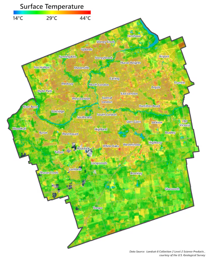
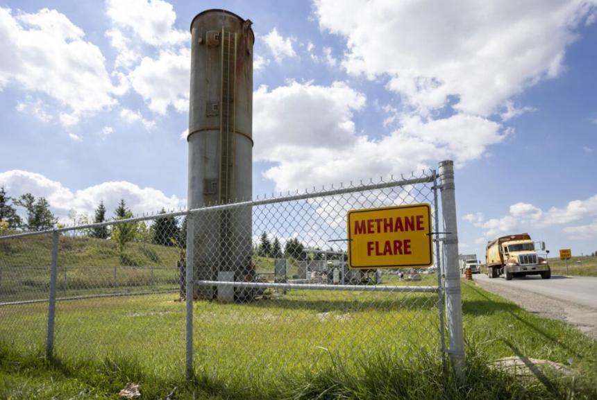


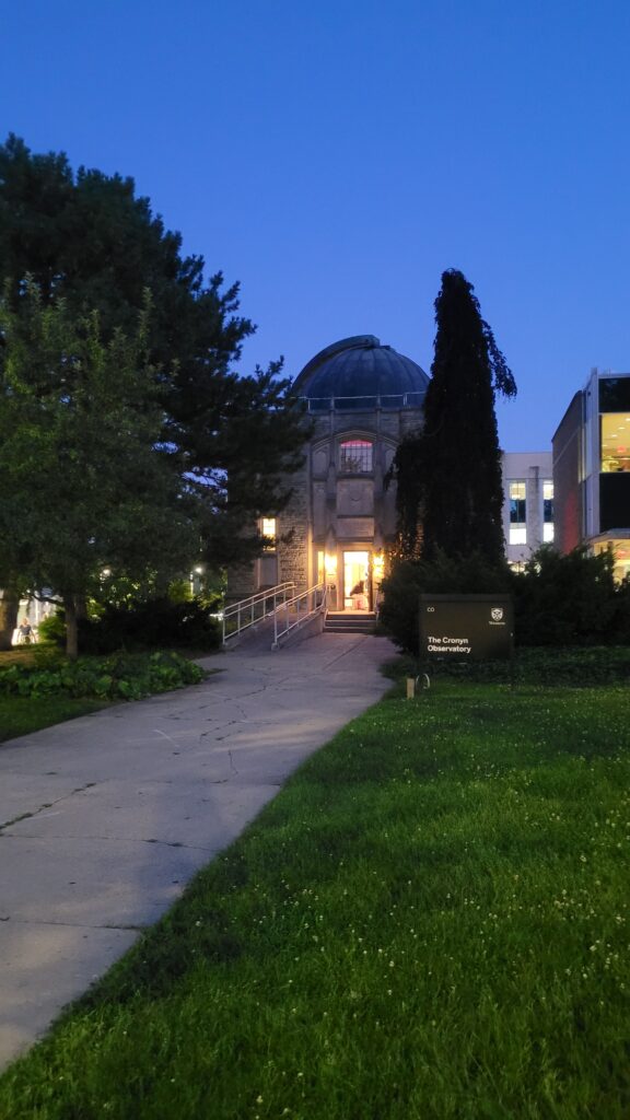
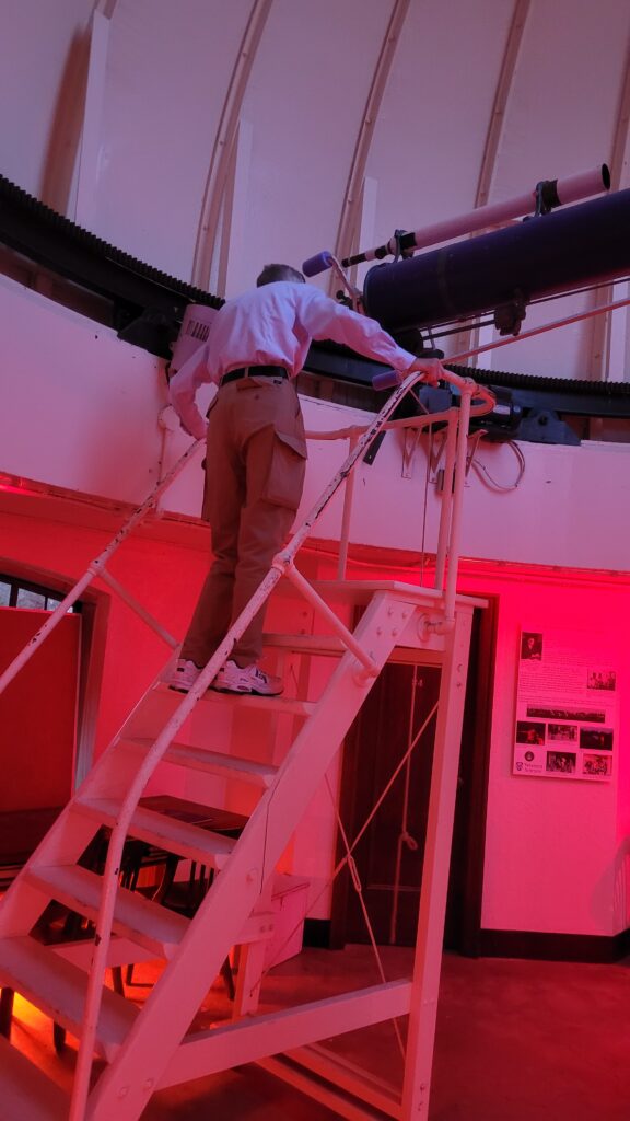
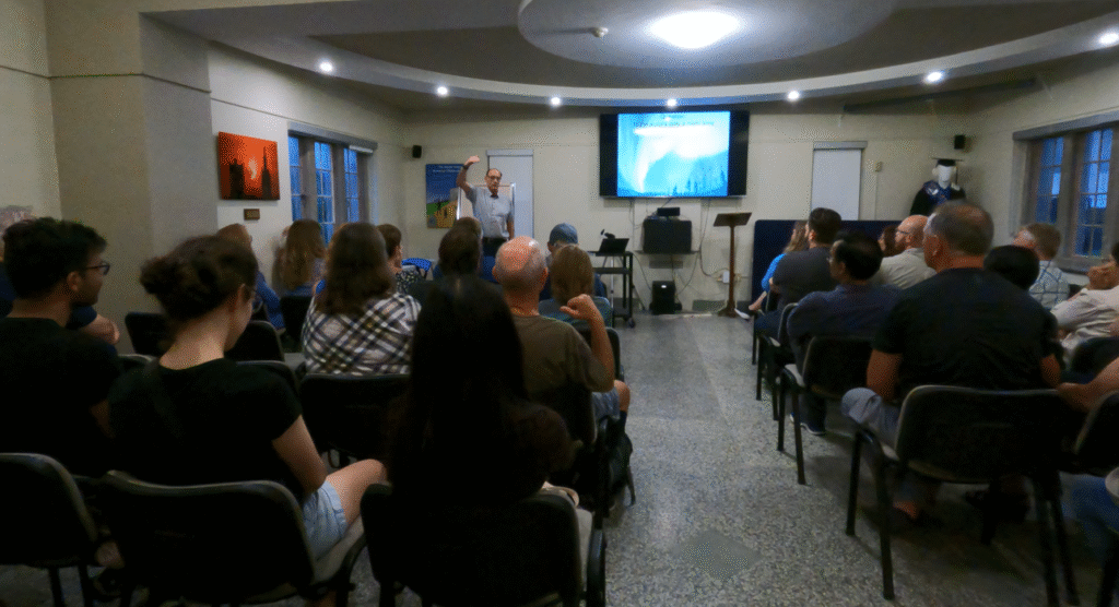
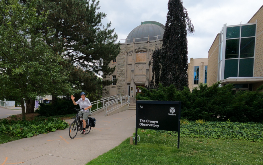
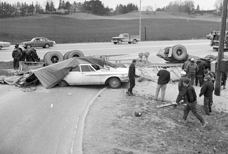

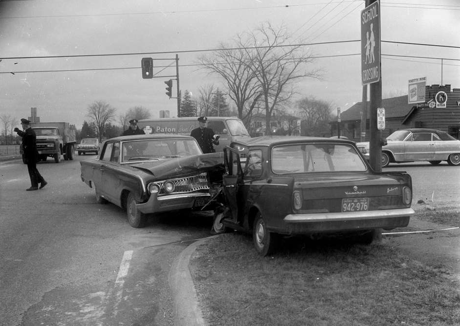
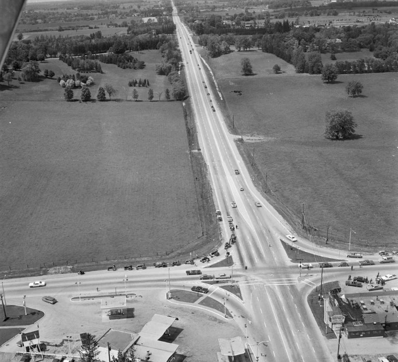
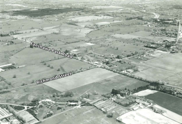
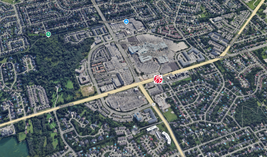
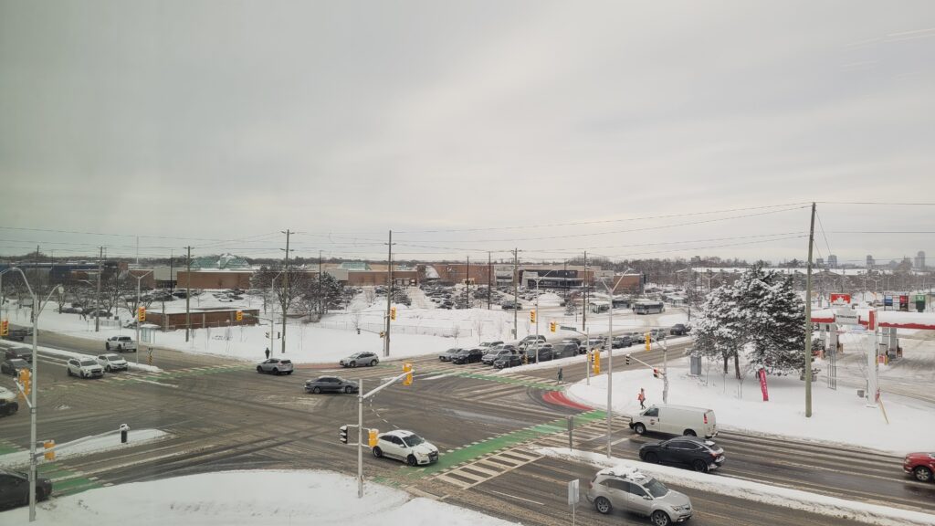
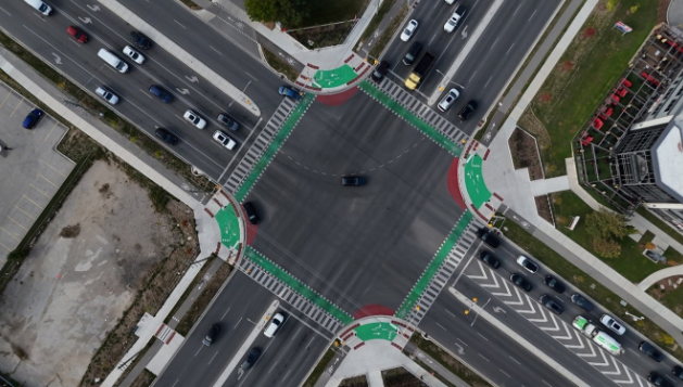
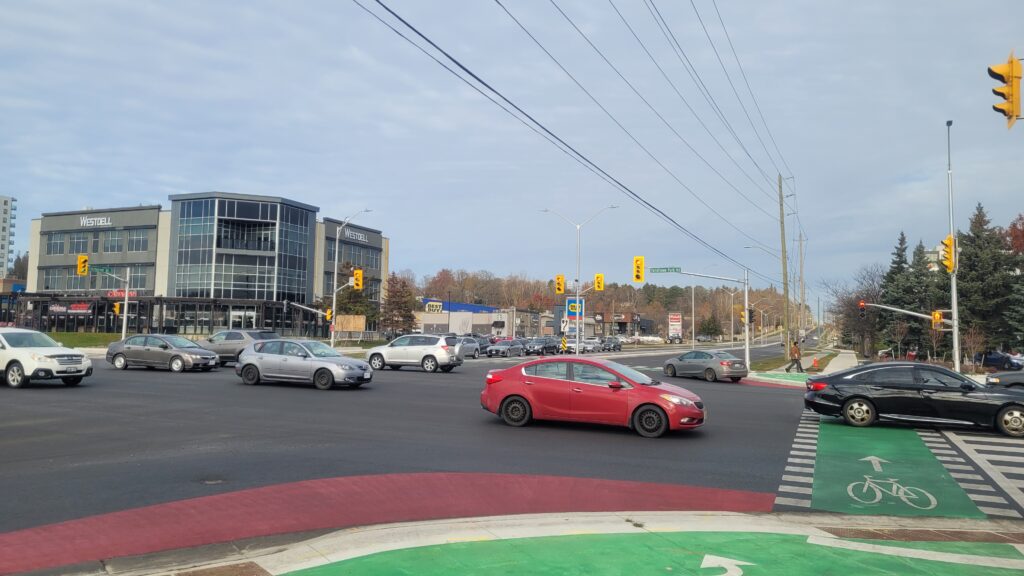
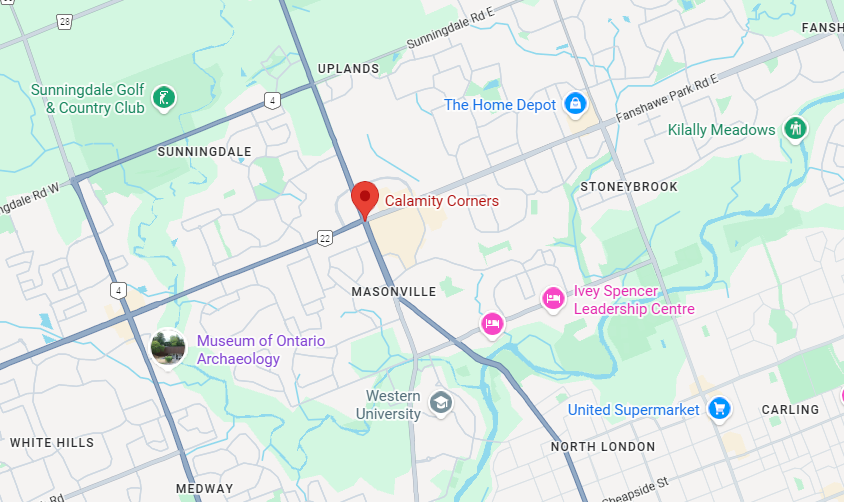
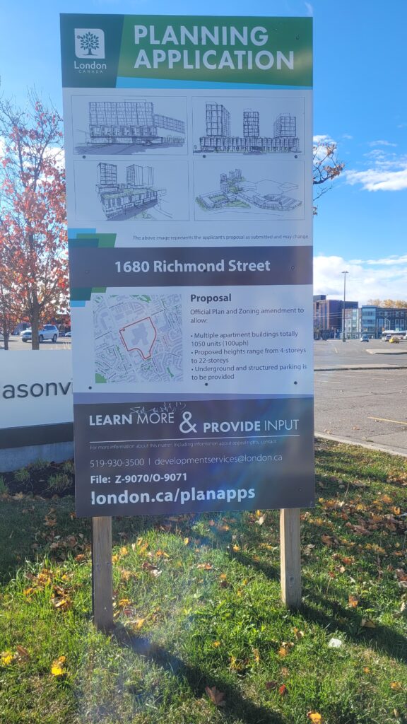
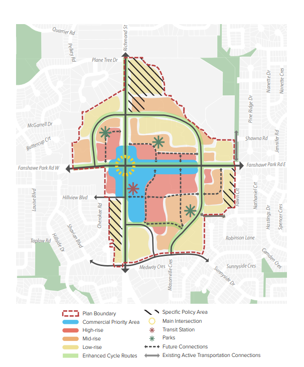
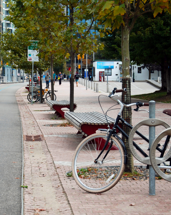
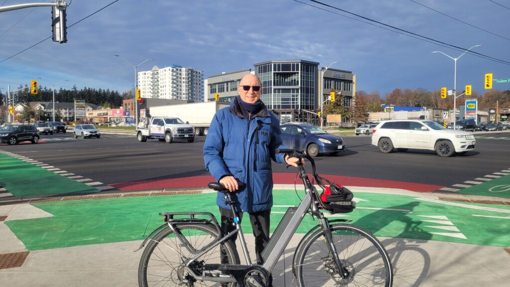

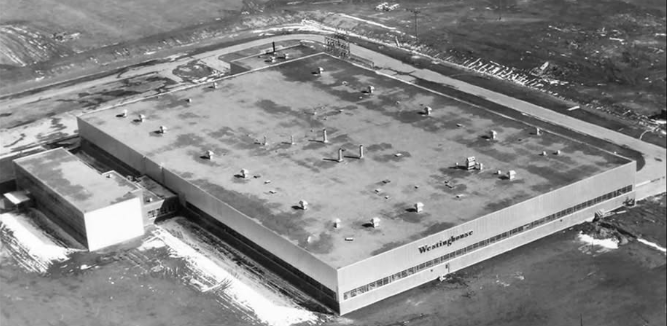
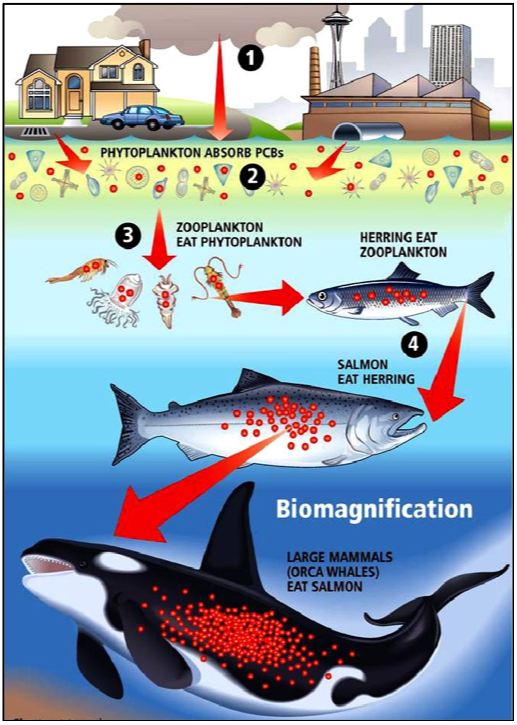
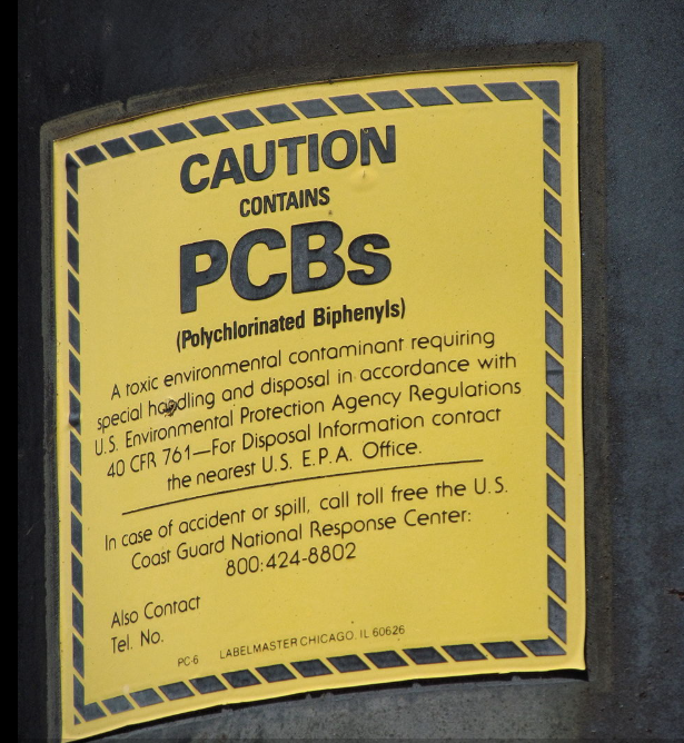
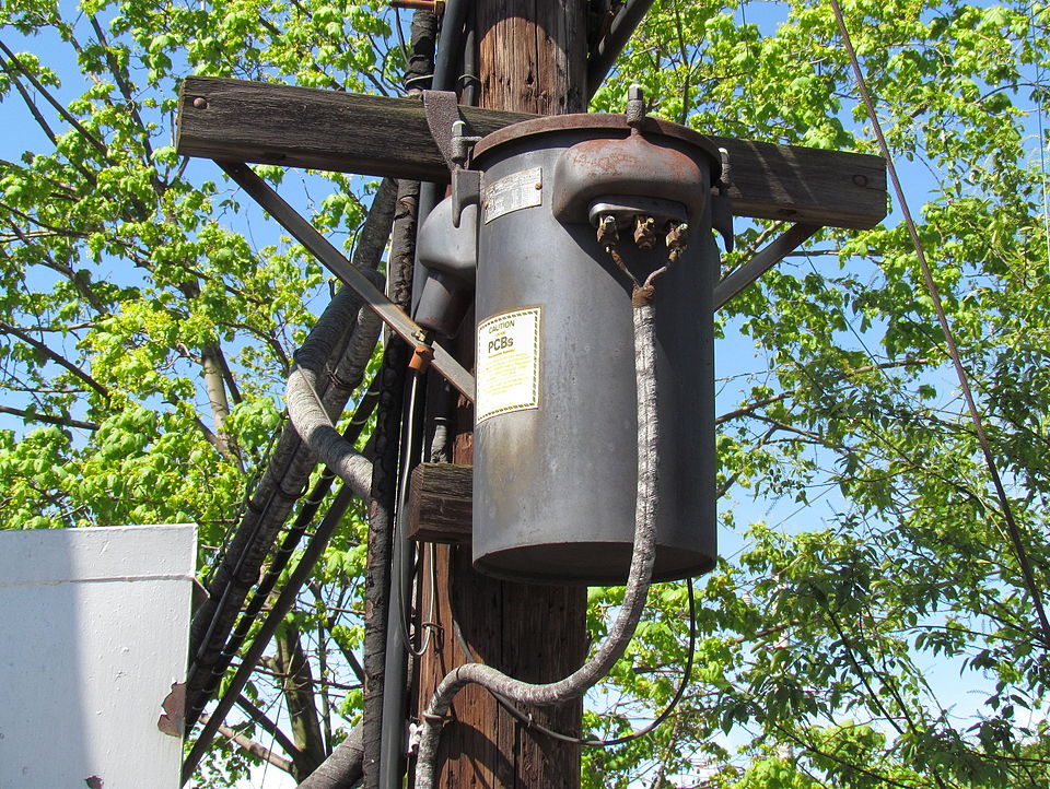


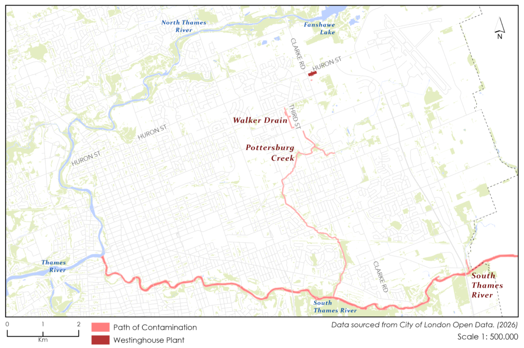
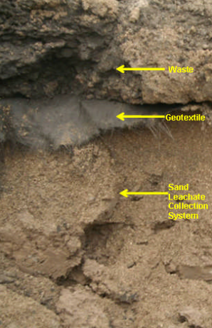
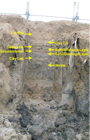

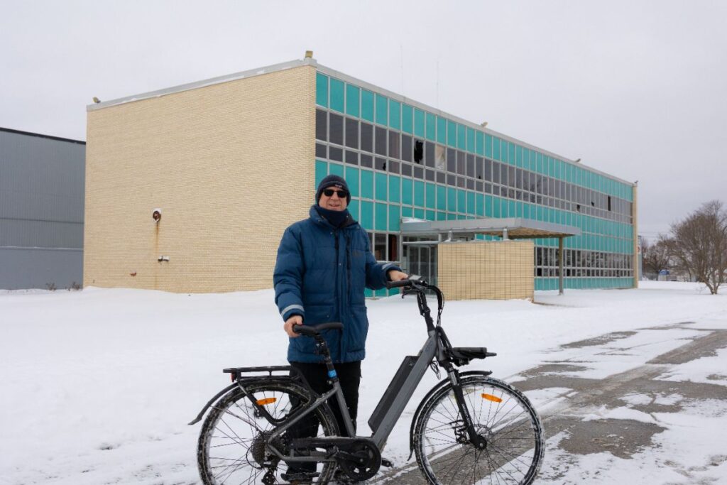

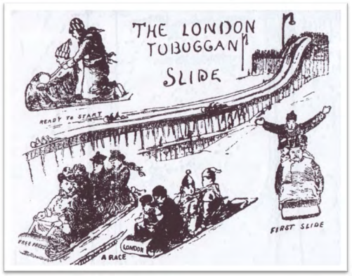
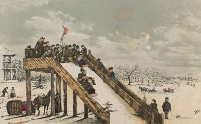
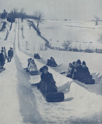
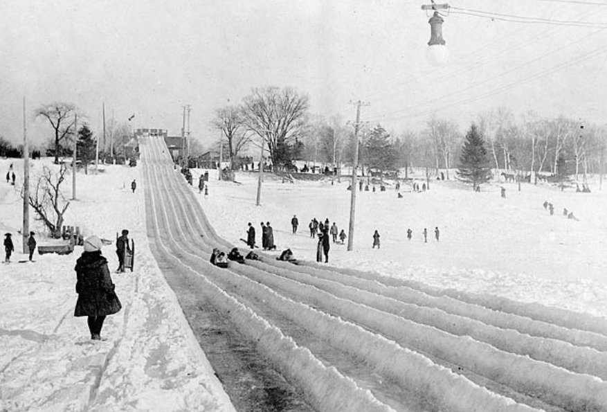

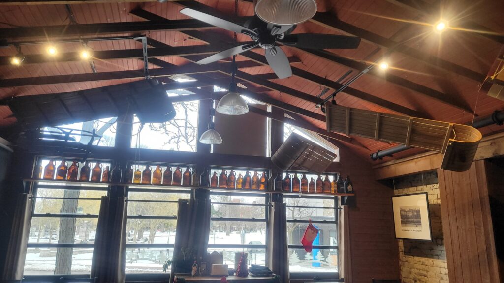
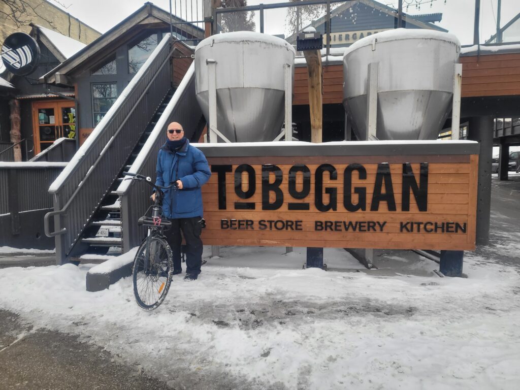


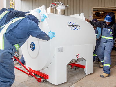
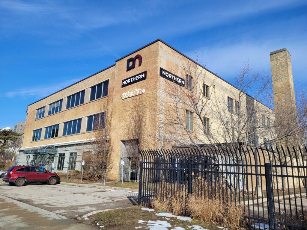
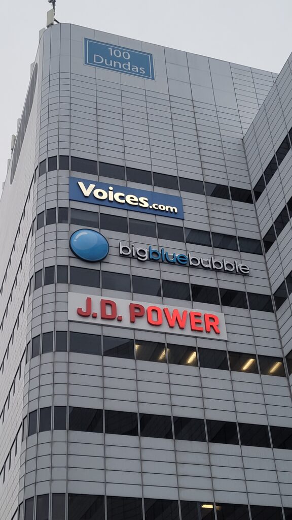
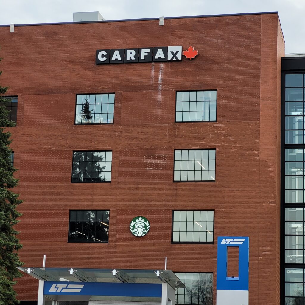
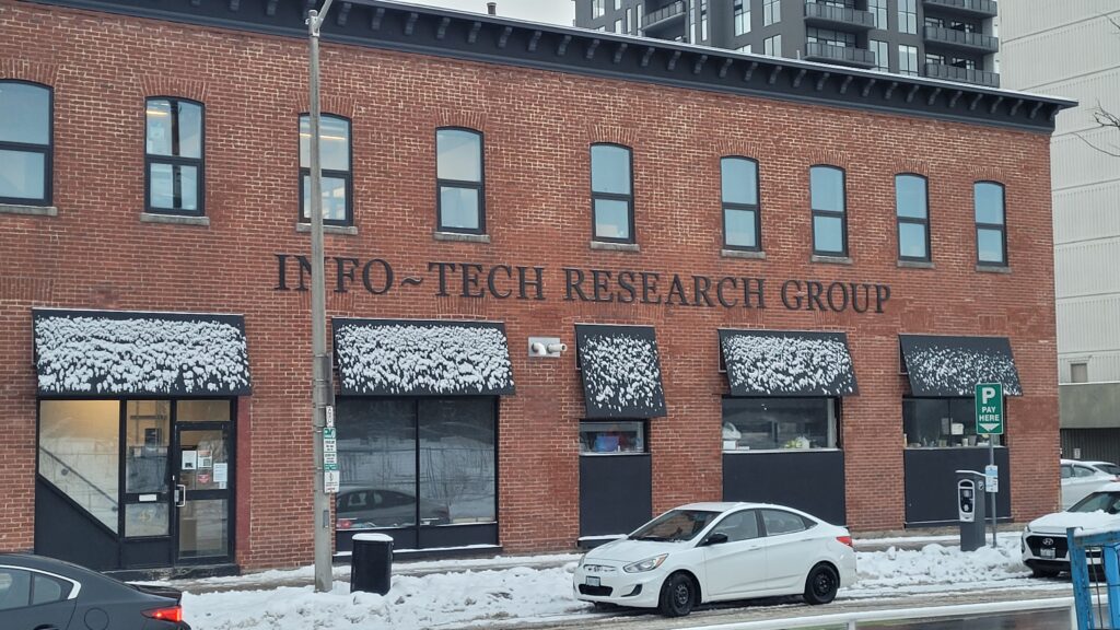
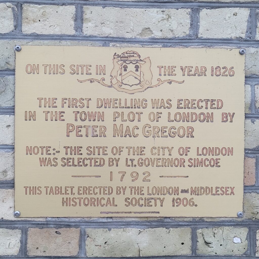
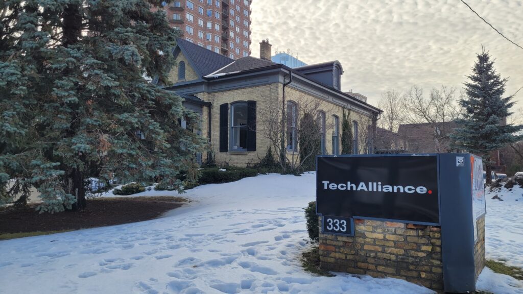
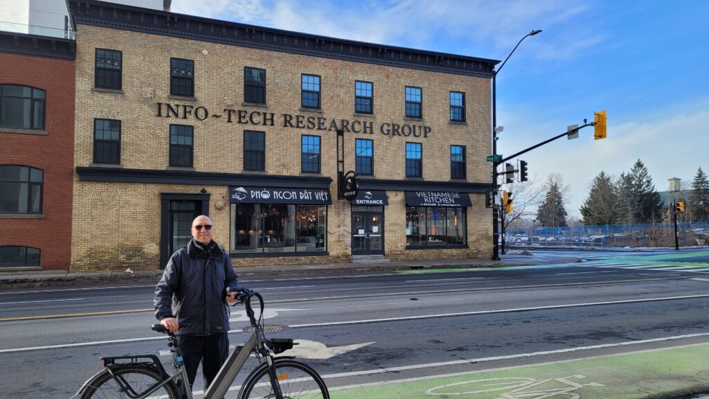


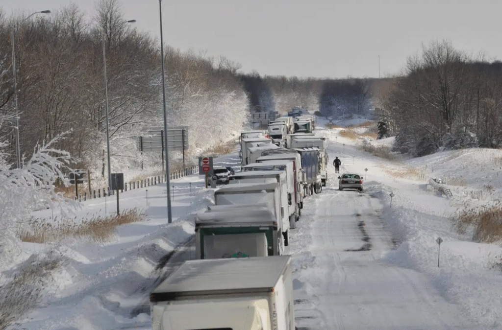

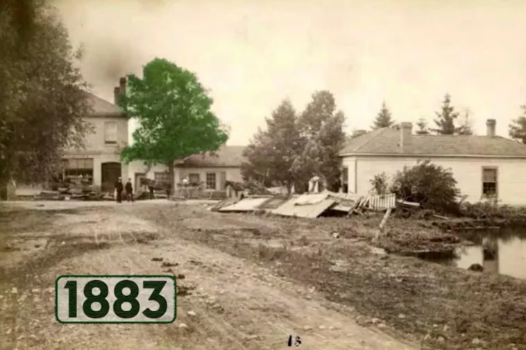
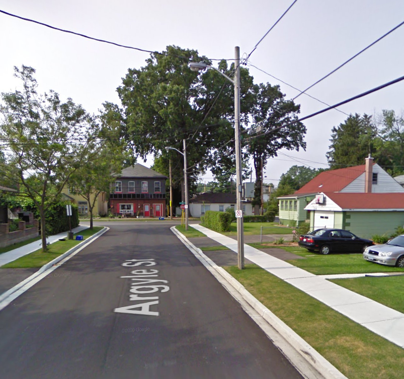
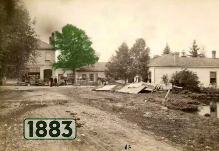
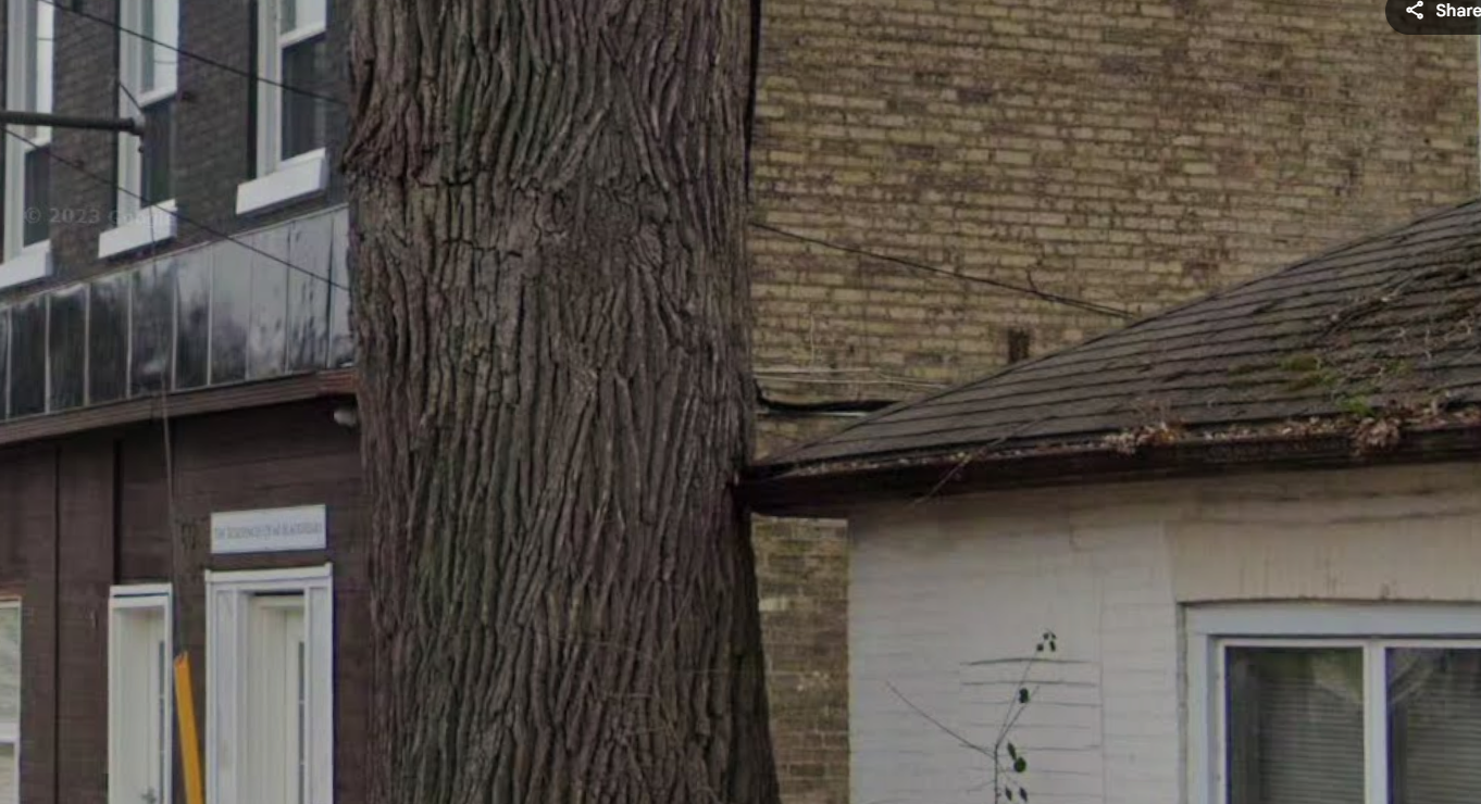
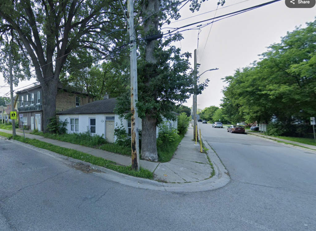
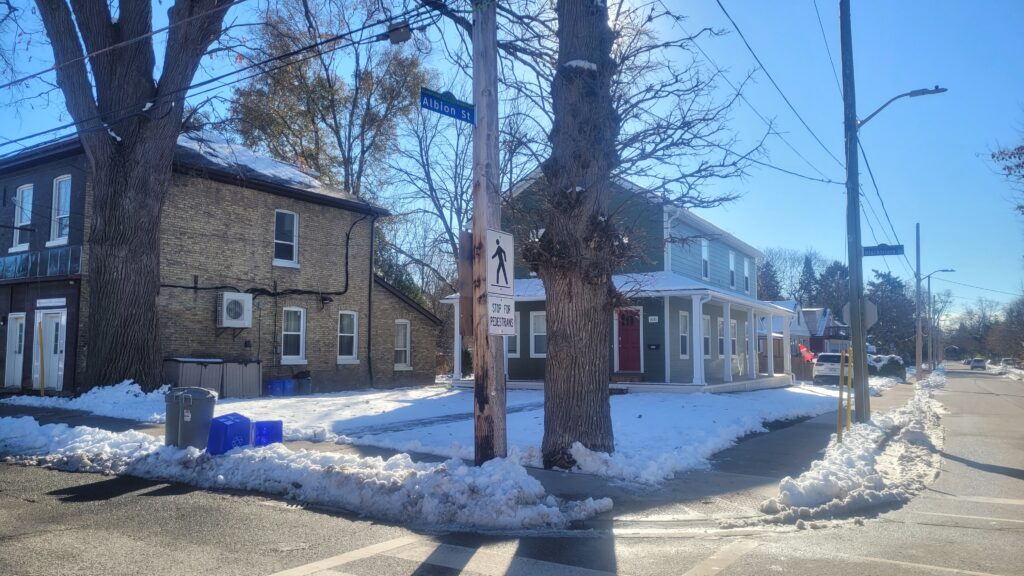
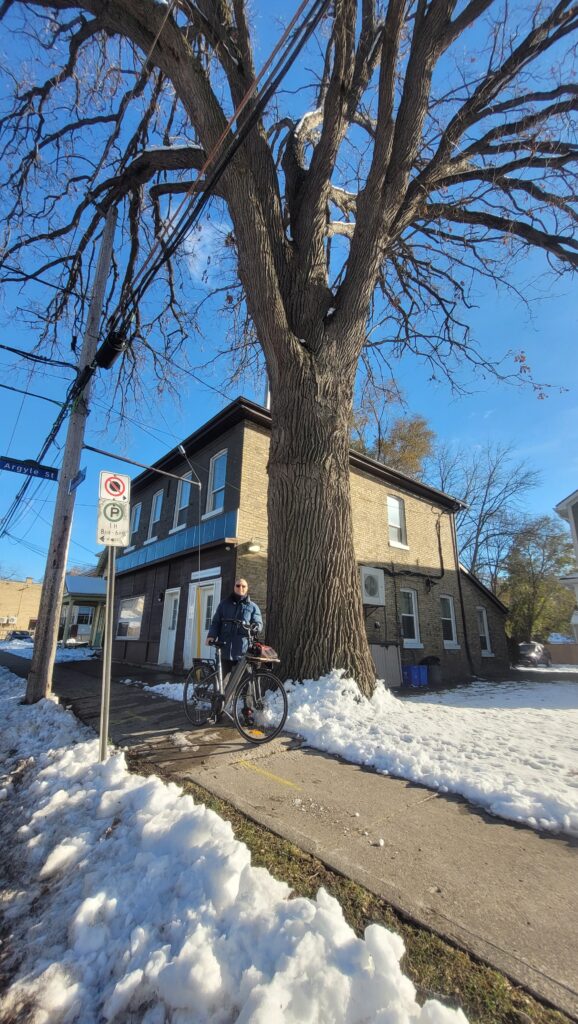


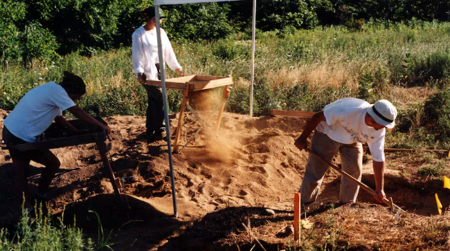

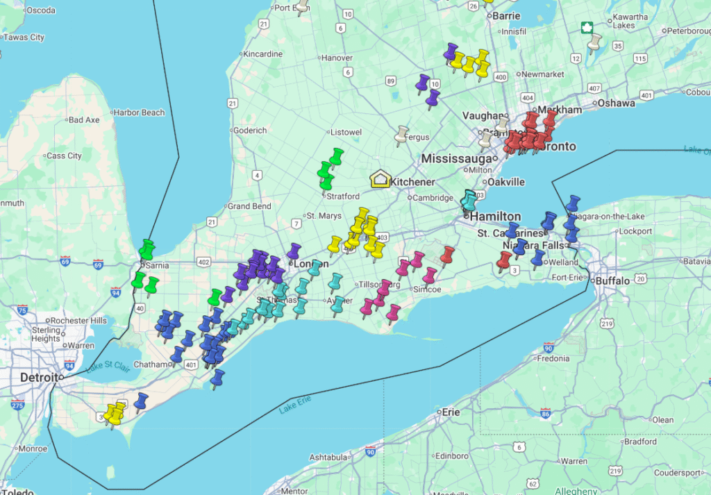
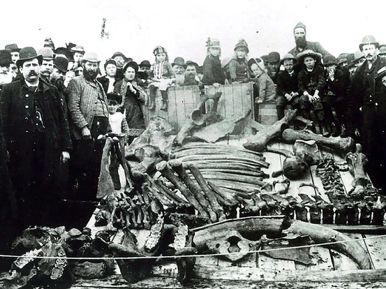
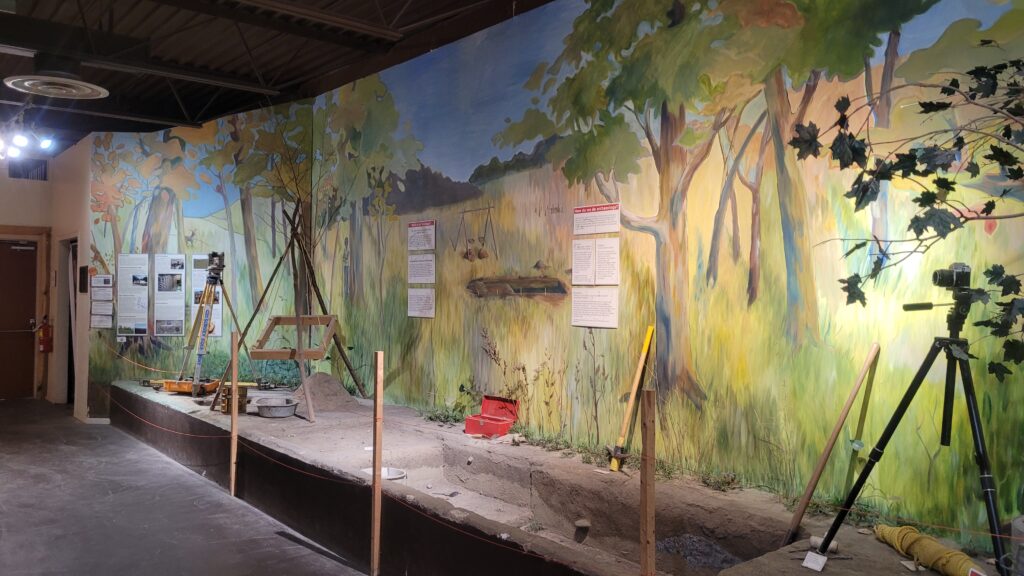
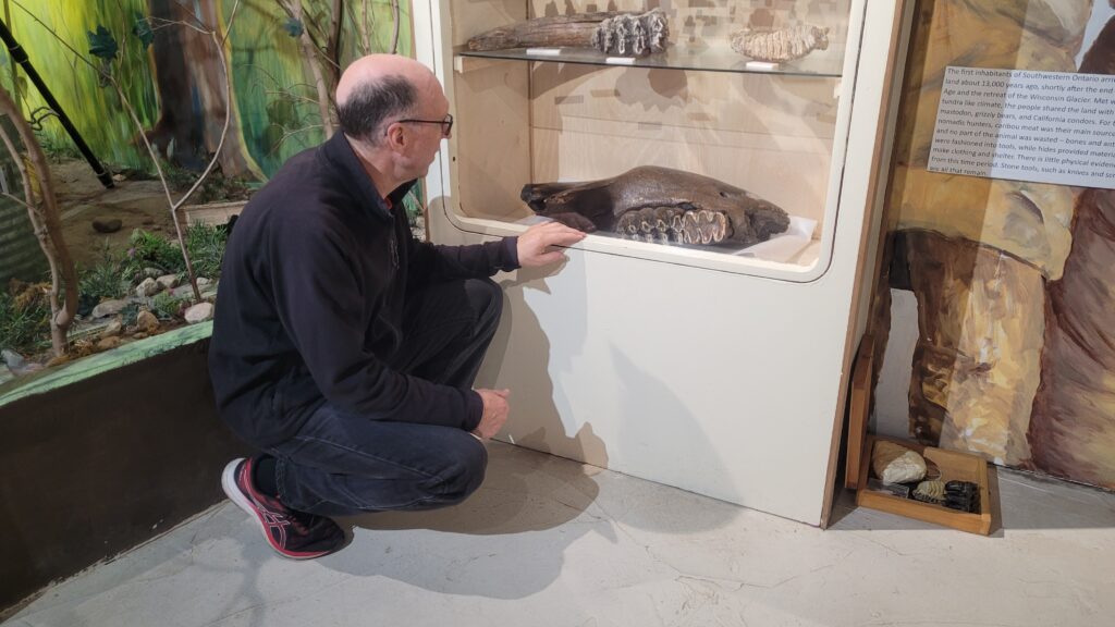
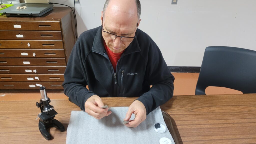
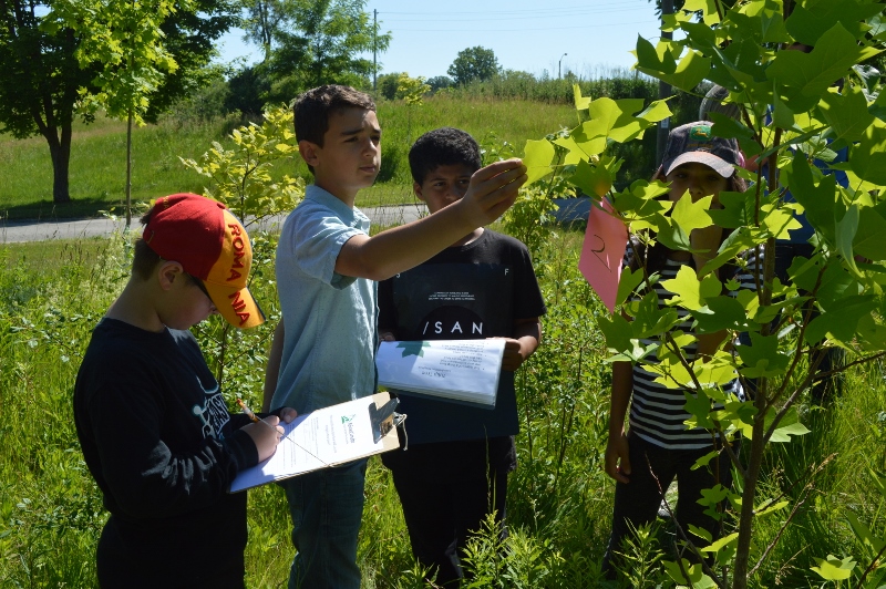
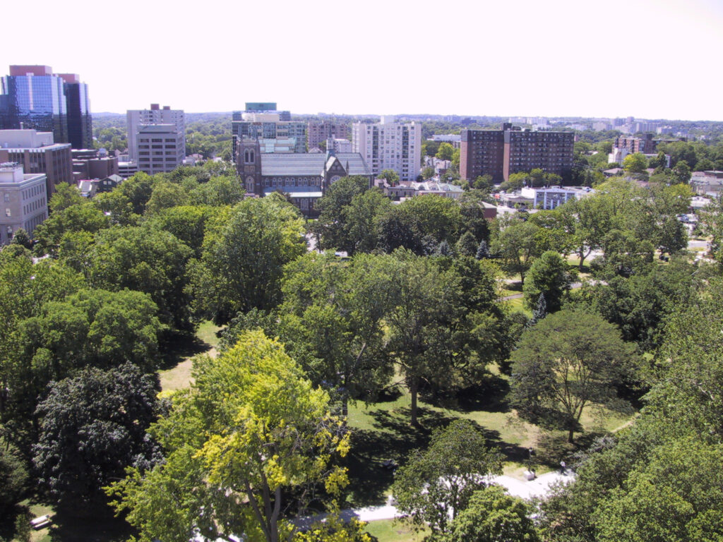
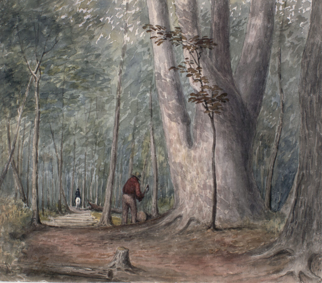
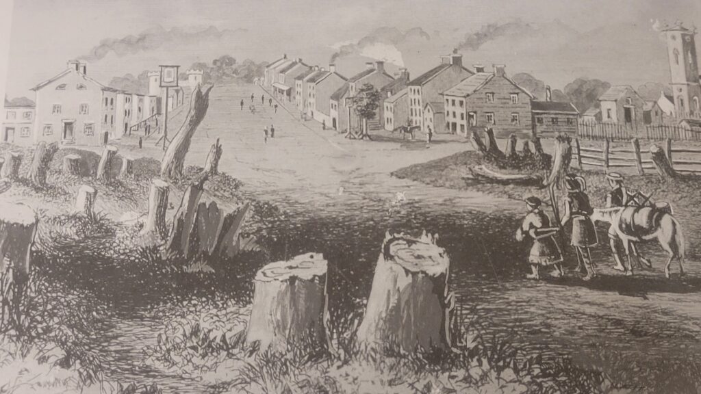
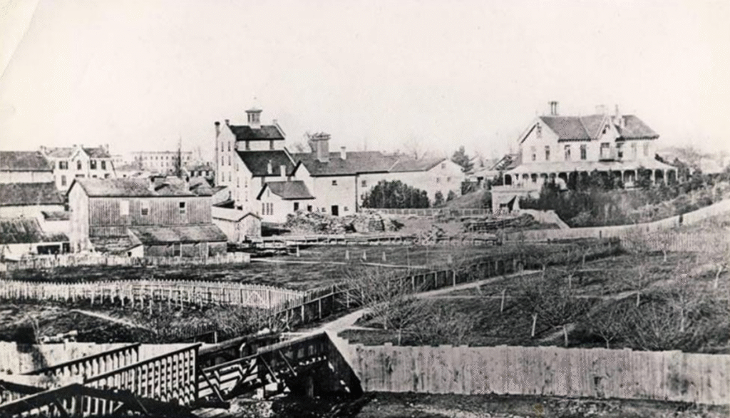

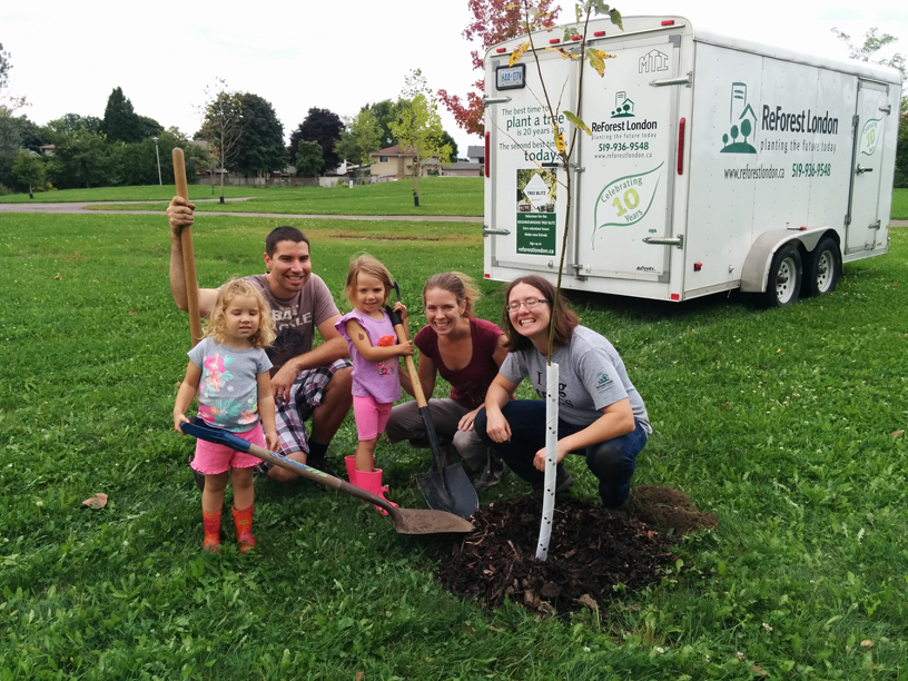
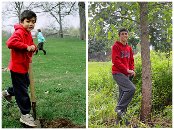
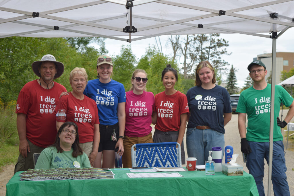
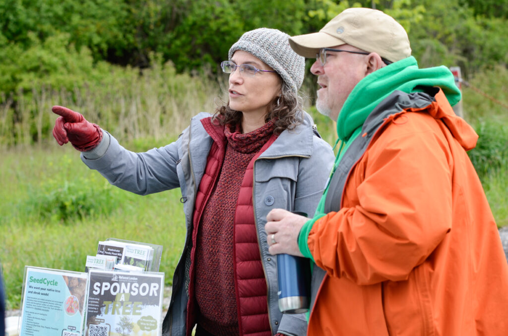

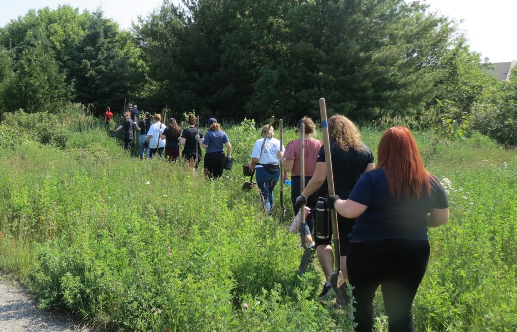
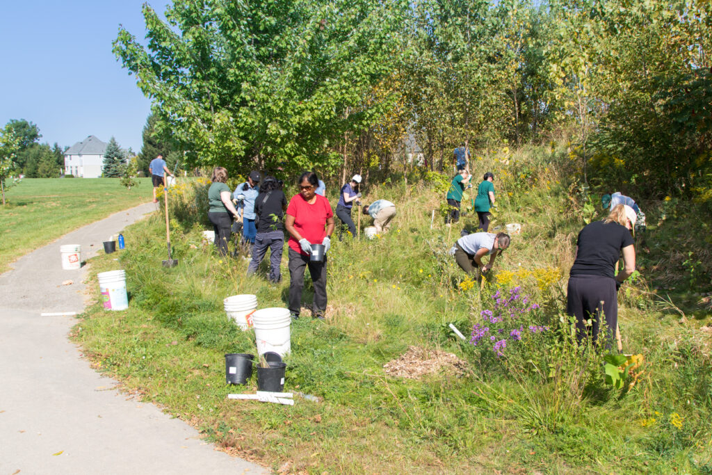
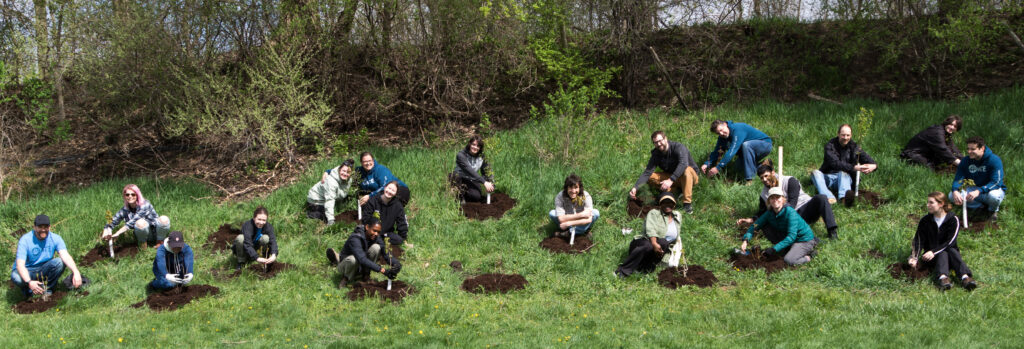


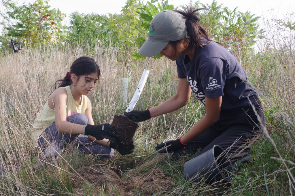

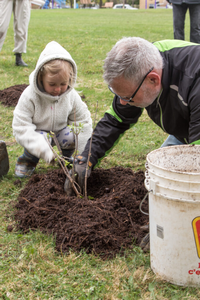

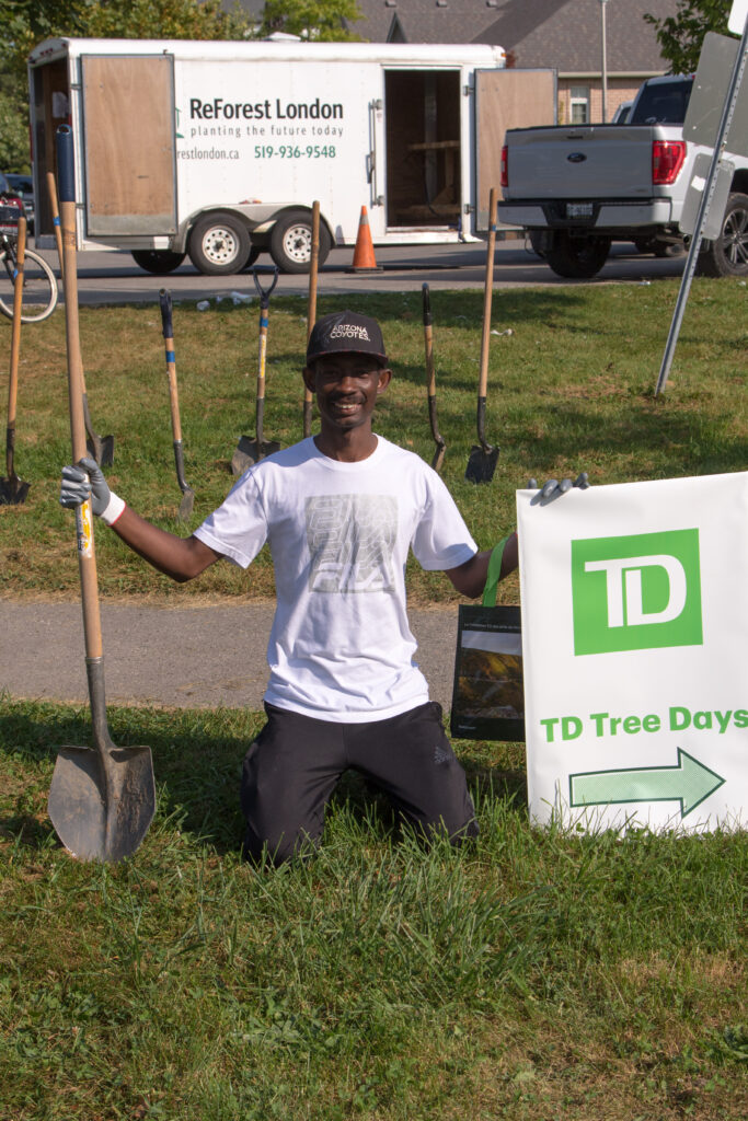
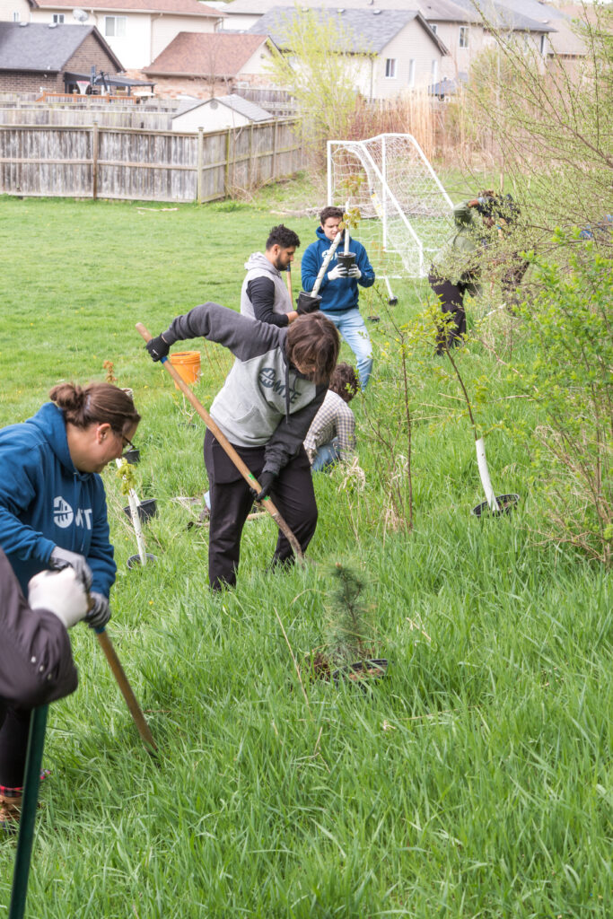


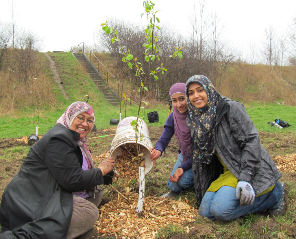


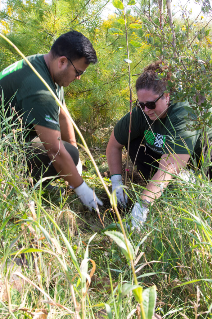
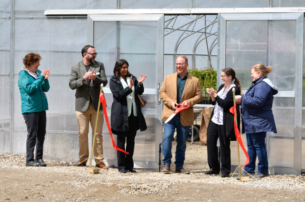
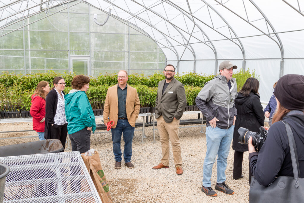

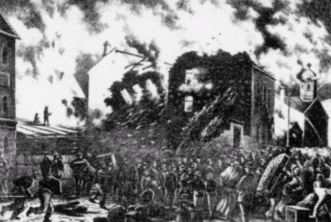
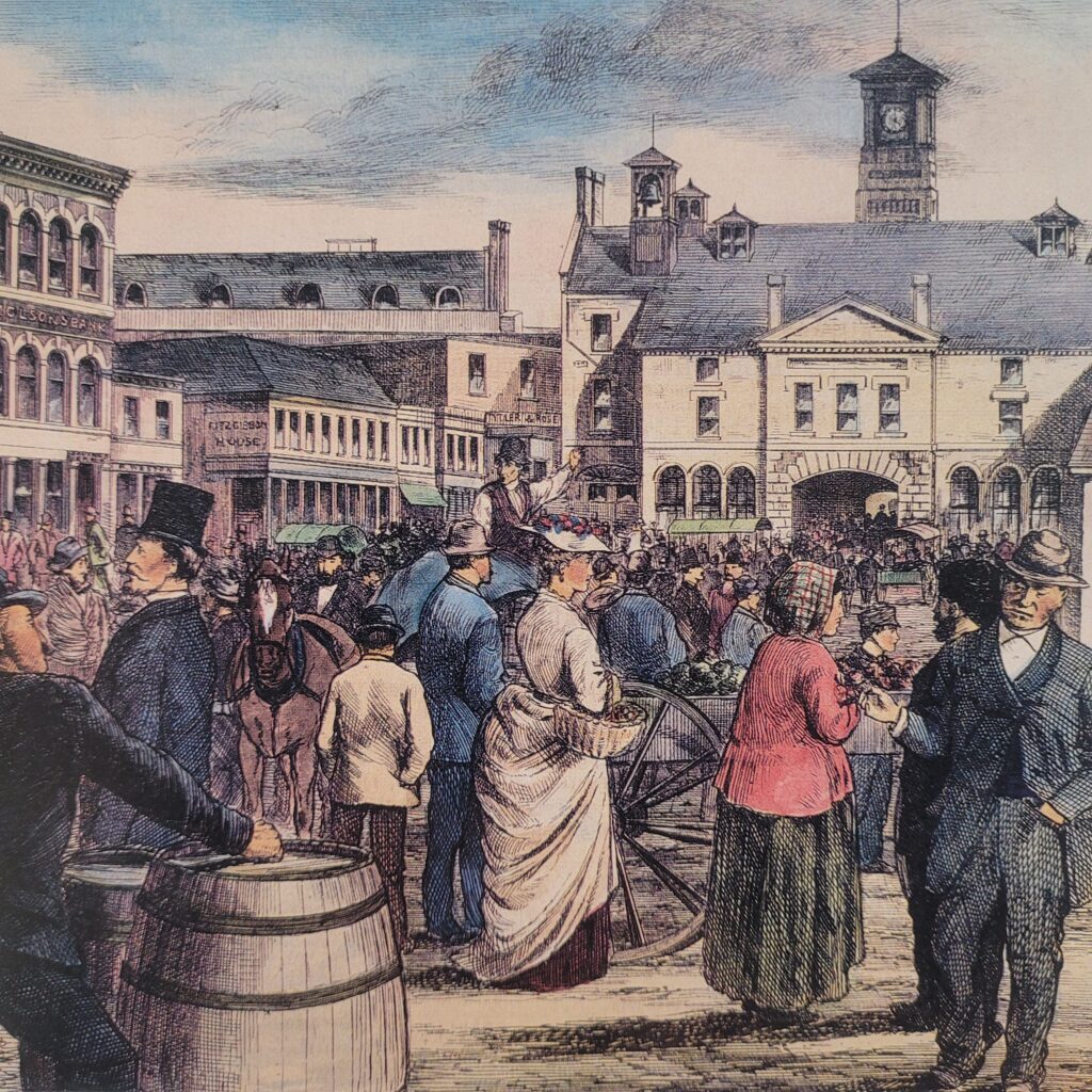
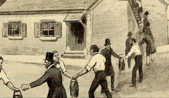
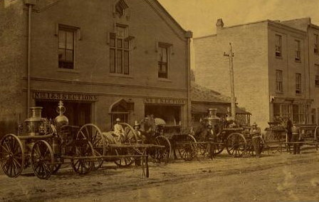
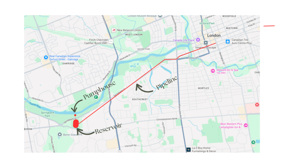
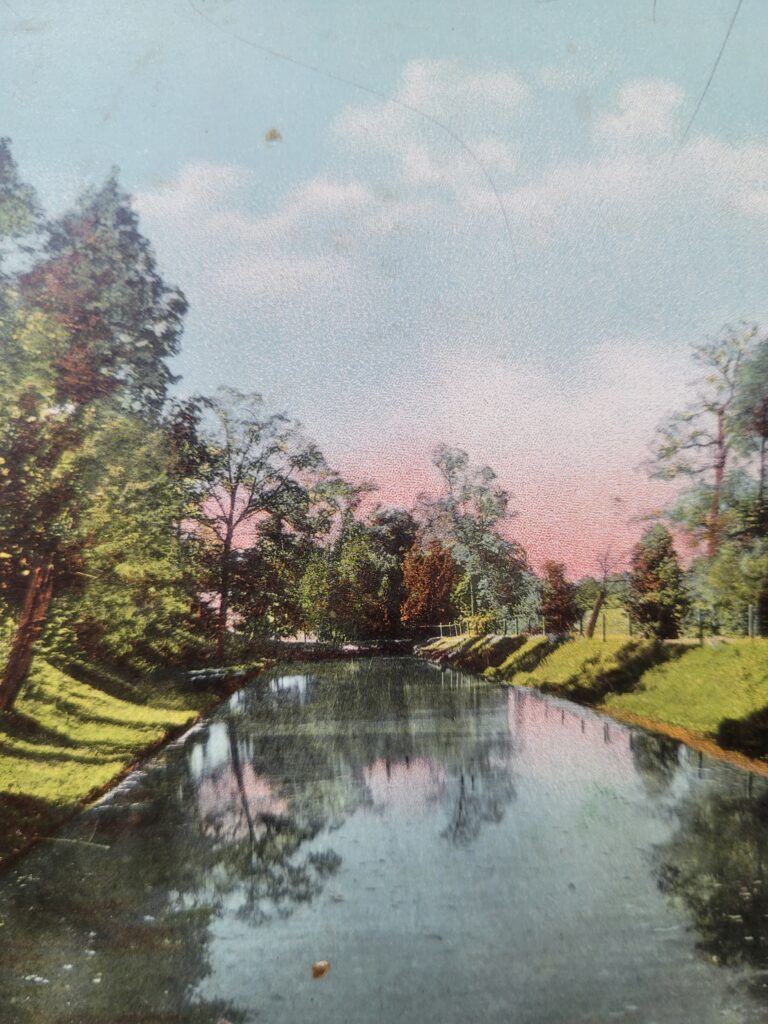
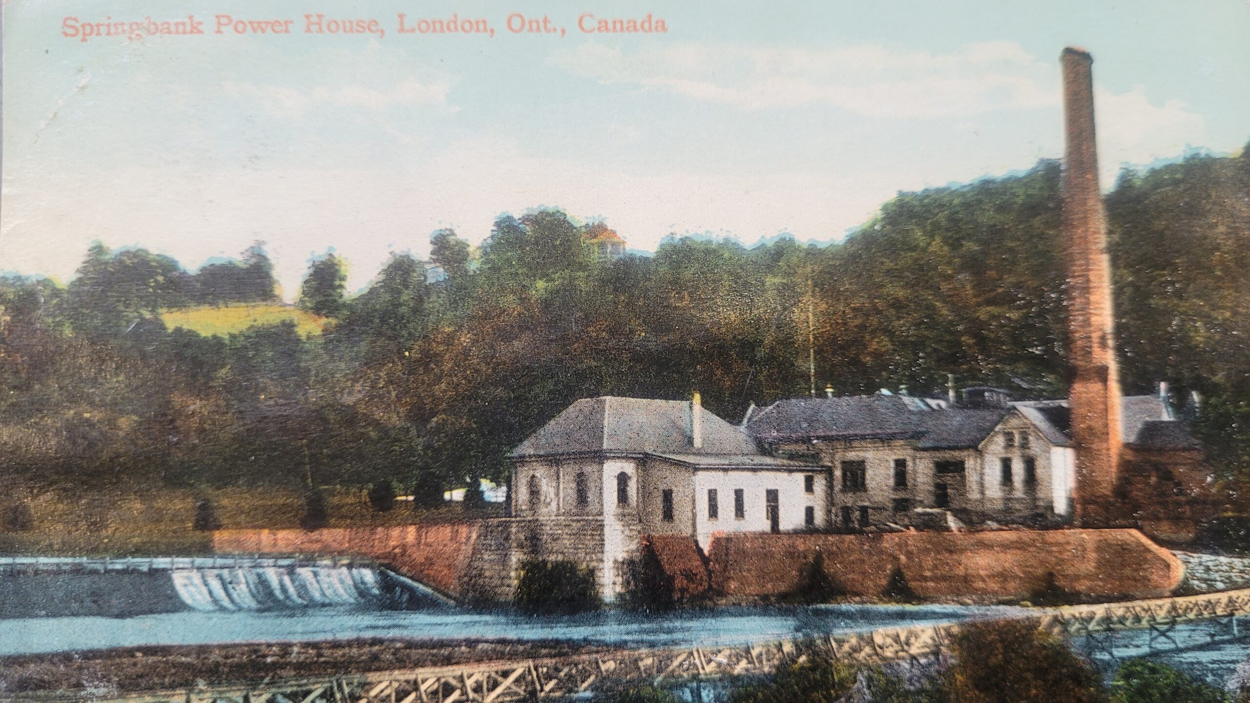
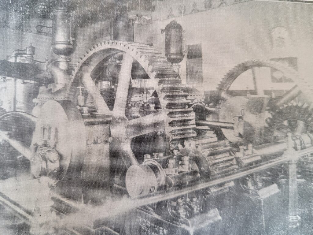
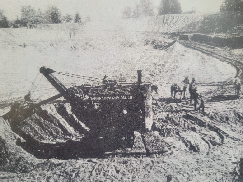
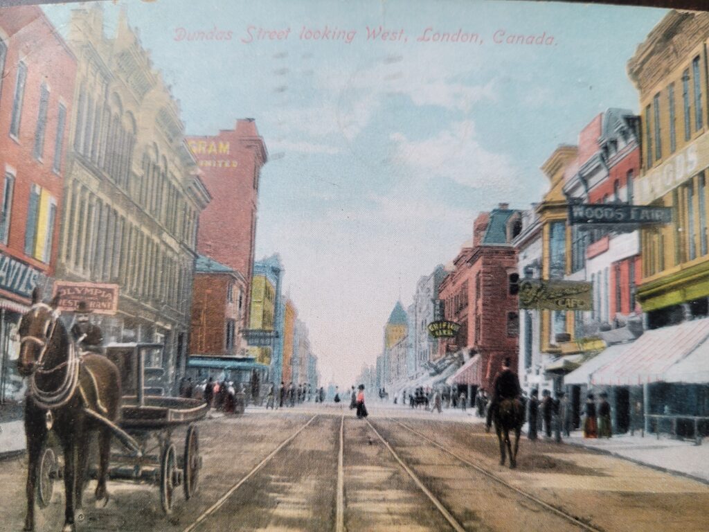
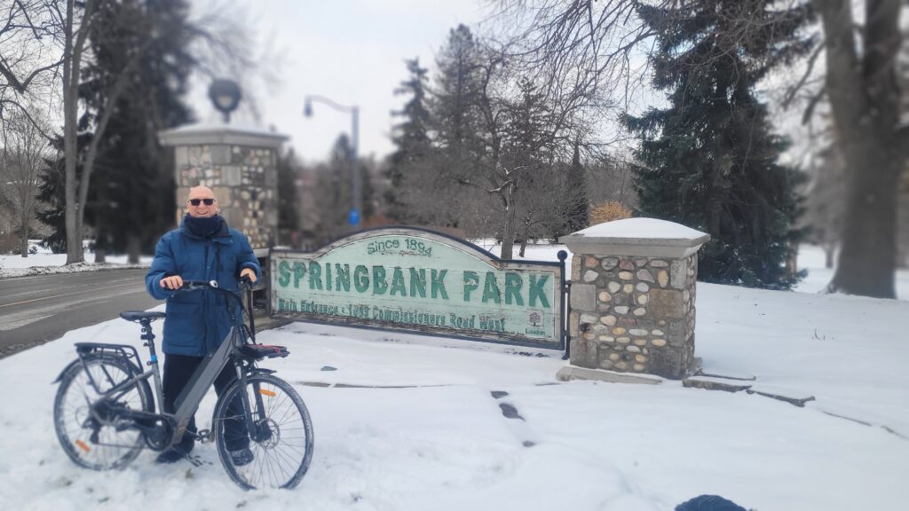
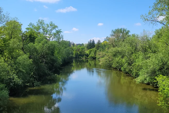


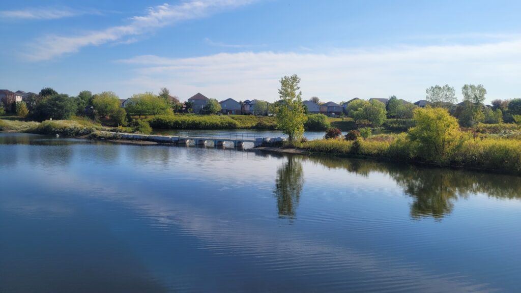

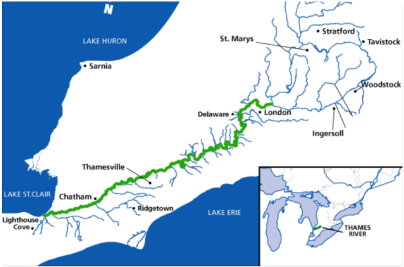

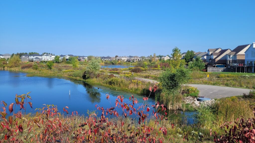
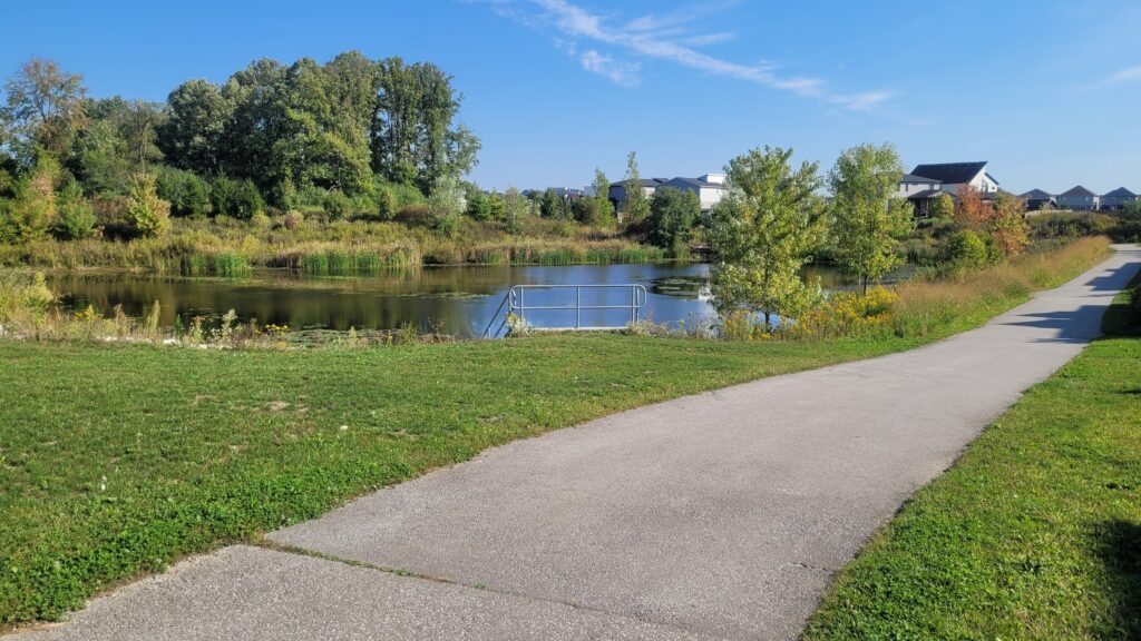
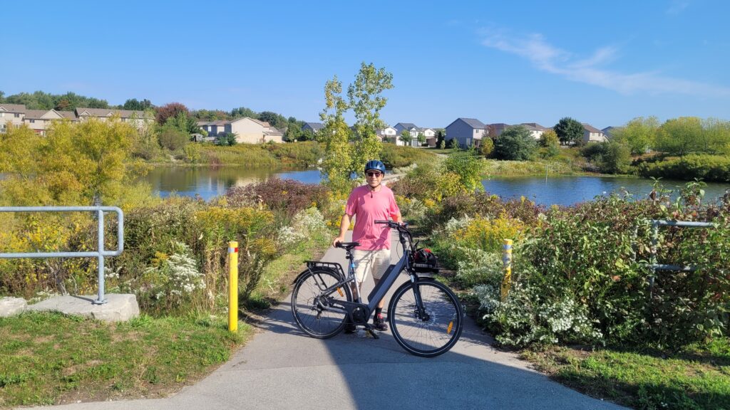
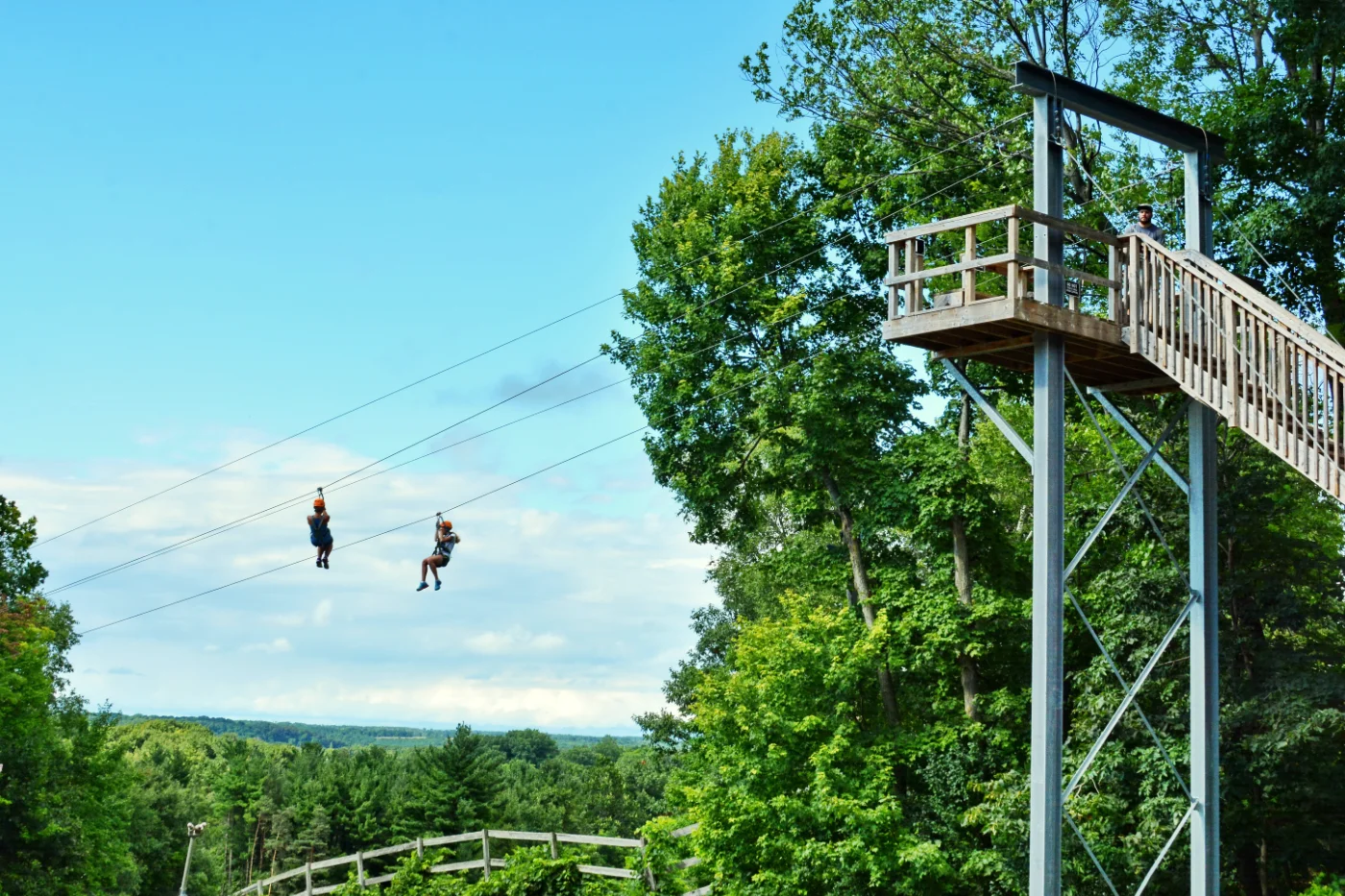
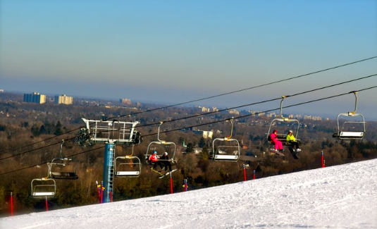
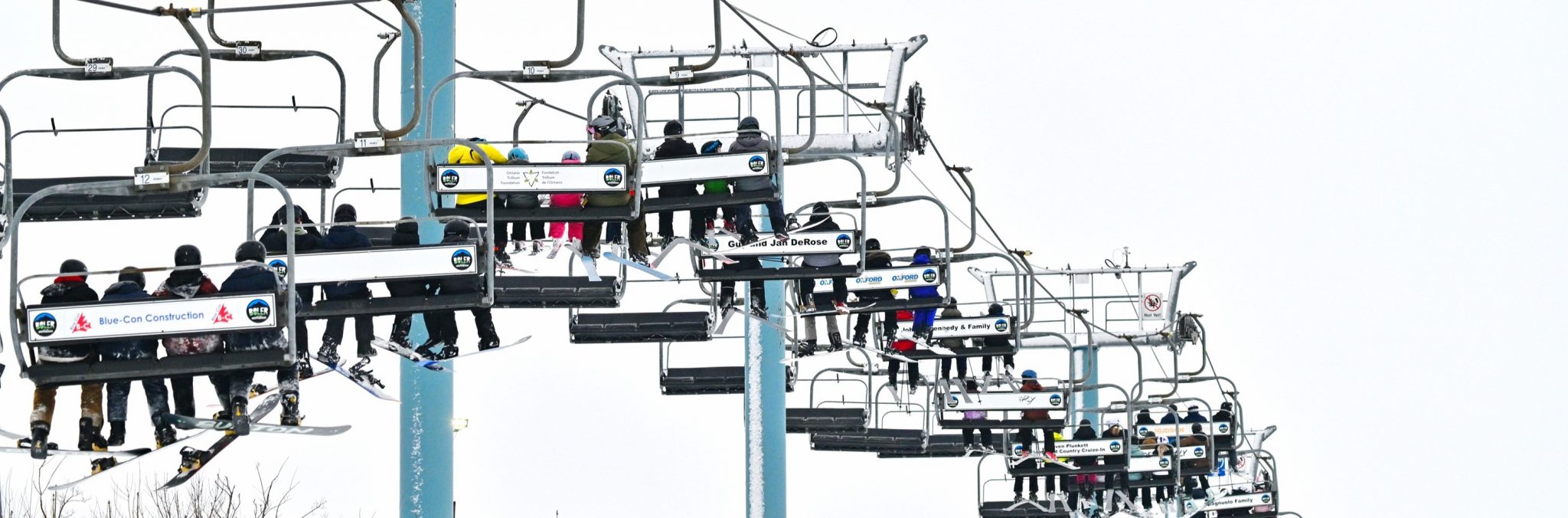

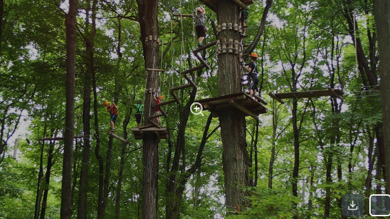
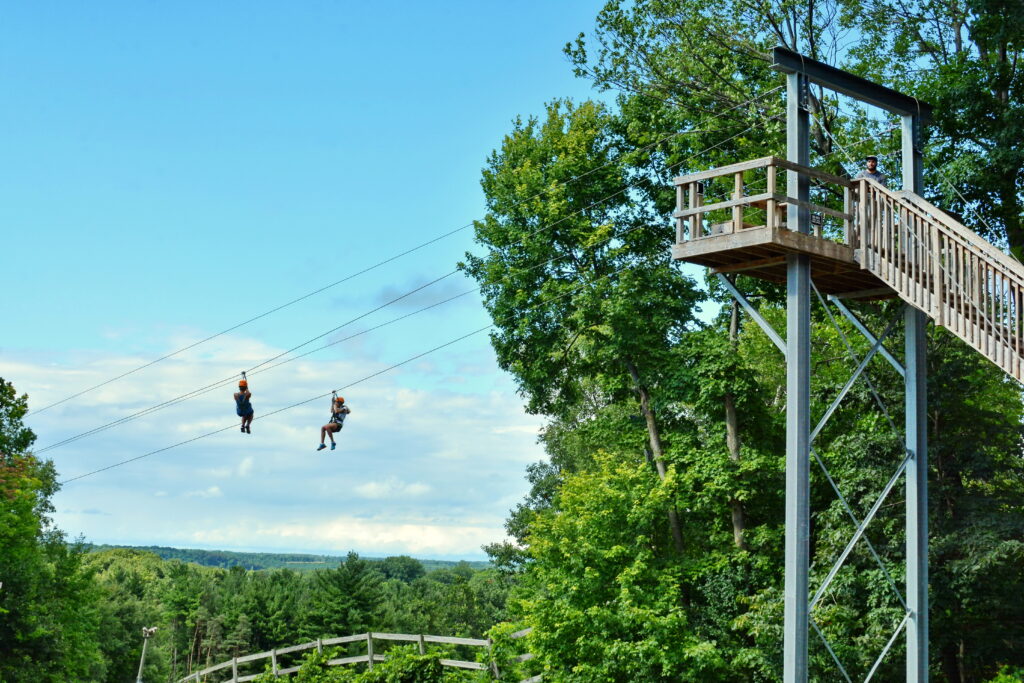
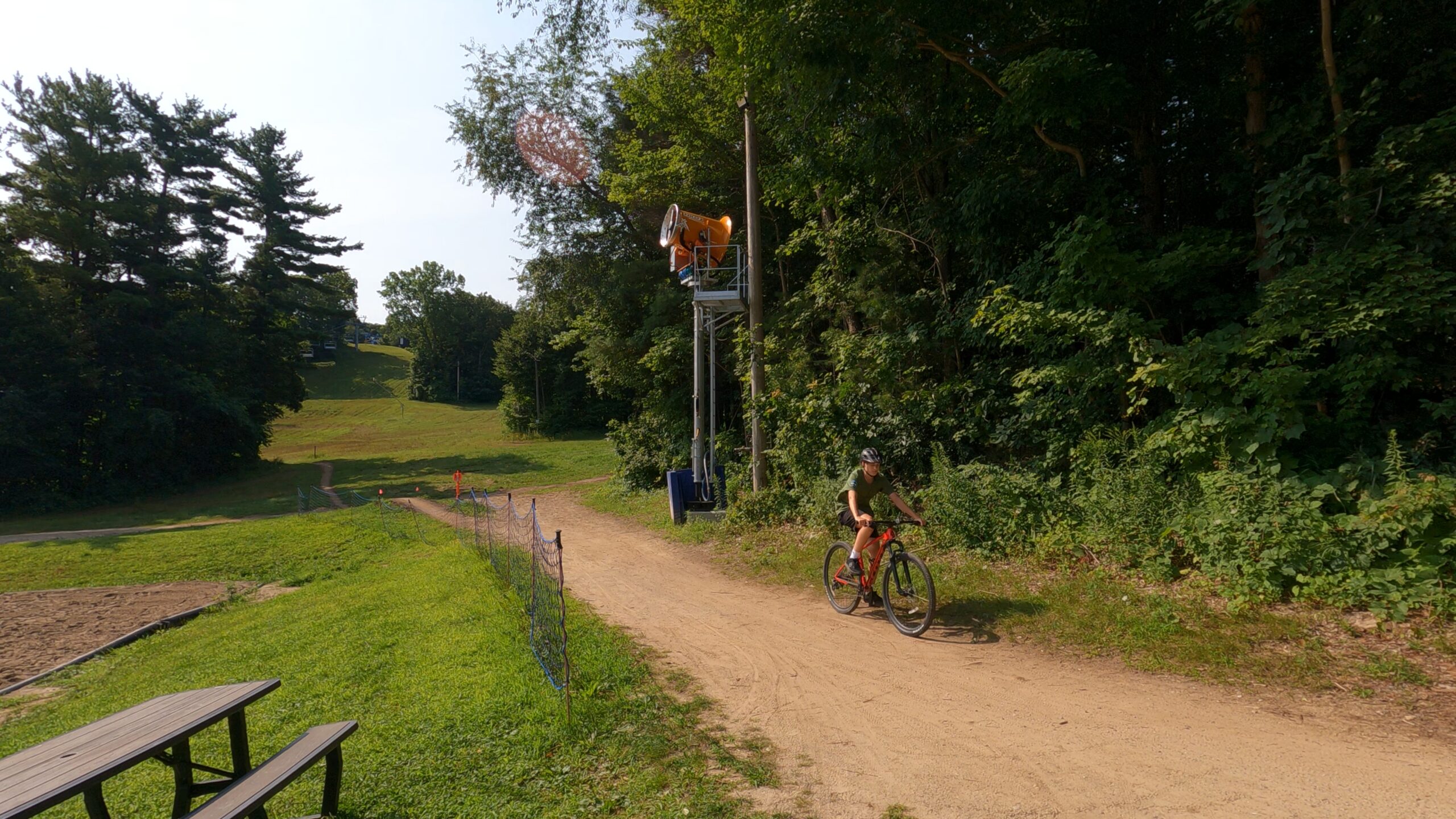
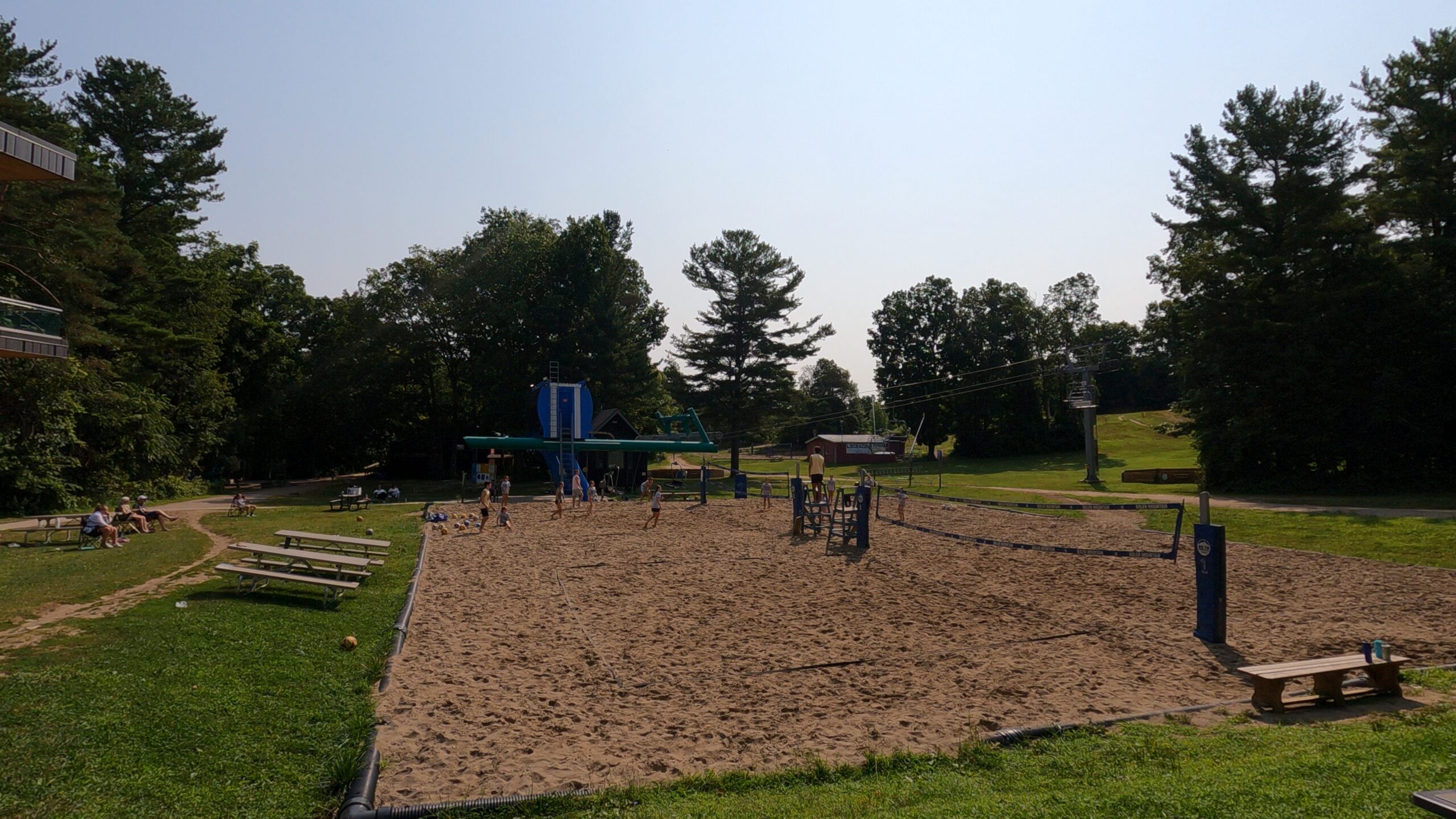
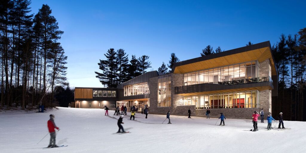
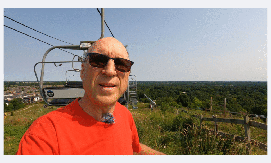
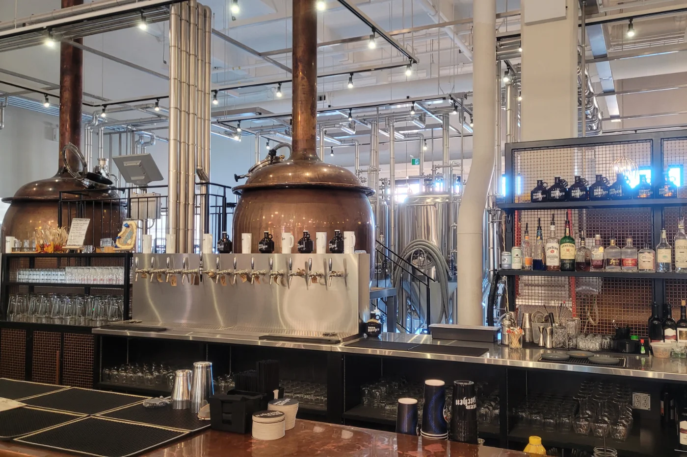


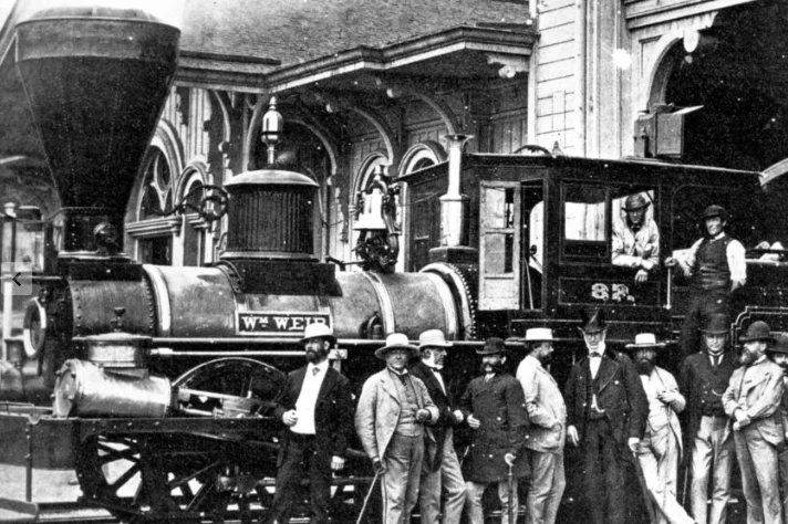


